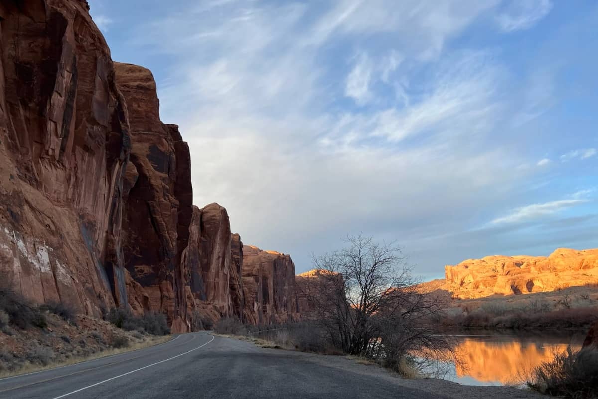
Potash Road in Moab, Utah, offers travelers a journey through some of the most breathtaking landscapes in the American Southwest. This scenic byway, officially known as Utah State Route 279, meanders alongside the Colorado River, presenting a tapestry of towering sandstone cliffs, ancient petroglyphs, and natural arches. While the allure of this route is undeniable, it’s imperative to recognize and prepare for certain hidden dangers to ensure a safe and enjoyable experience.
Understanding Potash Road
Potash Road begins approximately 4 miles north of Moab, branching off from U.S. Highway 191. The initial 17 miles are paved, offering easy access to various attractions such as Wall Street—a renowned rock climbing area—and the trailheads for Corona and Bowtie Arches. Beyond the pavement, the road transitions into a dirt track that leads adventurers deeper into the rugged terrain, eventually connecting with the Shafer Trail and providing access to Canyonlands National Park.
Hidden Dangers Along Potash Road
- Narrow and Steep Sections: As Potash Road merges into the Shafer Trail, drivers encounter narrow pathways with steep drop-offs. These sections demand heightened attention and caution, especially for those unfamiliar with off-road driving. The road’s width often accommodates only a single vehicle, making passing challenging and increasing the risk of accidents.
- Unpaved and Rough Terrain: The transition from paved to unpaved surfaces introduces travelers to rough and uneven terrain. High-clearance, four-wheel-drive vehicles are recommended to navigate these conditions safely. Standard vehicles may struggle, leading to potential mechanical issues or becoming stuck in challenging sections.
- Limited Passing Opportunities: The narrowness of the road, combined with blind curves and steep inclines, limits opportunities for vehicles to pass one another. This situation can lead to congestion and requires drivers to communicate effectively and use designated pullouts to allow others to pass safely.
- Exposure to Weather Conditions: The region is susceptible to sudden weather changes. Rain can render the dirt sections muddy and slippery, making them potentially impassable. Snow or ice during colder months can further exacerbate these hazards. It’s crucial to check weather forecasts and road conditions before embarking on the journey.
- Falling Rocks and Debris: The towering sandstone cliffs along Potash Road are prone to rockfalls, especially after heavy rainfall or during freeze-thaw cycles. Falling rocks pose a significant danger to travelers, making it essential to remain vigilant and avoid stopping near cliff bases.
- Remote Location with Limited Services: Once past the paved sections, amenities become scarce. Cellular reception is often unreliable, and there are no fuel stations or repair services. In the event of a breakdown or emergency, assistance may be hours away. Travelers should ensure their vehicles are in optimal condition, carry extra supplies, and inform someone of their travel plans.
Safety Precautions and Recommendations
- Vehicle Preparation: Ensure your vehicle is suitable for off-road conditions. A high-clearance, four-wheel-drive vehicle is ideal. Check tire pressure, fluid levels, and carry a spare tire, jack, and basic repair tools.
- Supplies: Carry ample water, food, and emergency supplies, including a first-aid kit, flashlight, and blankets. Given the remote nature of the area, it’s wise to be prepared for unexpected delays.
- Communication: Inform someone of your itinerary, including expected departure and arrival times. Consider carrying a satellite phone or personal locator beacon, as cell service is unreliable.
- Weather Awareness: Monitor weather conditions leading up to and during your trip. Avoid traveling during or immediately after adverse weather to reduce the risk of encountering hazardous road conditions.
- Driving Caution: Maintain a slow and steady speed, especially on unpaved sections. Be prepared to yield to oncoming traffic, and use pullouts to allow others to pass safely.
- Stay Informed: Before embarking, check with local authorities or the National Park Service for current road conditions, closures, or advisories.
Experiencing Potash Road Responsibly
Despite the potential hazards, Potash Road offers an unparalleled adventure through Utah’s iconic red rock country. The route provides access to numerous attractions:
- Wall Street: A popular climbing area where enthusiasts scale the sheer sandstone cliffs. Even if you’re not climbing, it’s fascinating to watch and appreciate the skill involved.
- Petroglyphs: Ancient rock art panels are visible along the route, offering a glimpse into the region’s rich cultural history. Marked pullouts provide parking to view these panels up close.
- Corona and Bowtie Arches: Accessible via a moderate hike, these natural arches are stunning examples of the area’s unique geology. The trailhead is located approximately 10 miles from the junction with Highway 191.
- Jug Handle Arch: Located about 13.5 miles along Potash Road, this arch is adjacent to the highway and offers a short walk to its base.
By acknowledging and preparing for the hidden dangers along Potash Road, travelers can safely enjoy the myriad attractions and natural beauty this route offers. Respecting the environment, adhering to safety guidelines, and being well-prepared will ensure a memorable and safe adventure through one of Utah’s most scenic byways.


