Arizona road trips can look peaceful from the window: red-rock canyons, desert highways, pine forests, mountain switchbacks, and long empty miles that feel made for a camera roll. But some of the state’s most memorable drives also come with a serious warning. The danger is not always obvious at the start of the trip.
A road can seem simple on a map and still become risky because of sudden dust storms, steep grades, narrow lanes, sharp curves, rockfall, heat, wildlife, or long distances between services. That is why locals often warn travelers to respect these routes instead of treating them like ordinary scenic drives.
This guide is not meant to scare people away from Arizona. It is meant to help drivers understand which routes require extra attention, slower speeds, better planning, and a real look at road conditions before leaving.
Why Arizona Road Trips Can Turn Dangerous Fast
Arizona is built for long drives, but its landscape can change quickly. A route may begin in a metro area and reach open desert, canyon country, or mountain weather in the same day. That creates a mix of hazards that many visitors do not expect.
Heat can strain vehicles. Dust can cut visibility with little warning. Desert highways invite speeding because they feel open and empty. Mountain roads can punish distracted driving with tight turns and steep drop-offs. In canyon areas, rain and fire-scar runoff can damage roads or trigger debris problems.
Another issue is distance. On some Arizona routes, help, gas, cell service, and safe turnouts may be farther apart than travelers expect. A small mistake can become more serious when the next town is miles away.
1. Interstate 17: Phoenix to Flagstaff
I-17 is one of the busiest travel routes in Arizona, carrying people between Phoenix, Sedona, Flagstaff, and northern Arizona. Many visitors think of it as a normal interstate, but the drive changes dramatically as it climbs from desert heat into high country.
The stretch between the north Valley, Black Canyon City, Sunset Point, and beyond can bring heavy traffic, steep grades, construction zones, sudden slowdowns, and weather changes.
A major issue is speed combined with congestion. Drivers may move quickly through open areas, then suddenly meet stop-and-go traffic near grades, curves, work zones, or weekend bottlenecks. That mix can create rear-end crashes and long delays.
The route also sees heavy travel during holidays, winter snow trips, Sedona weekends, and summer escapes from Phoenix heat. A road that feels routine to locals can catch visitors off guard.
Check traffic before leaving. Avoid peak Sunday southbound return traffic when possible. Keep distance from the vehicle ahead, especially near hills and work zones. If weather is changing near Flagstaff, do not assume Phoenix conditions tell the whole story.

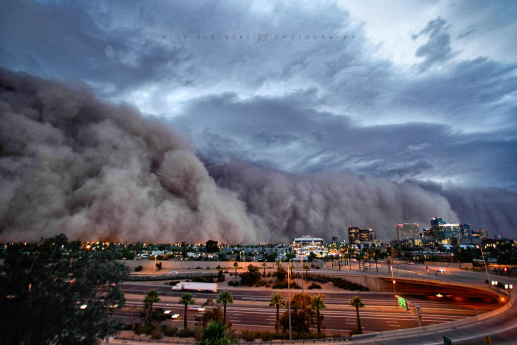
2. Interstate 10 Near Eloy and Picacho: The Dust Storm Corridor
Few road hazards in Arizona are as sudden as a dust storm. On I-10 between Phoenix and Tucson, the area near Eloy and Picacho has a long history of blowing dust and storm-related crashes. The road is straight, fast, and busy, which makes sudden visibility loss especially dangerous.
A driver can see clear pavement one minute and a wall of dust the next. That is why this corridor gets repeated warnings during monsoon season.
Dust storms can reduce visibility to nearly nothing. When that happens on a high-speed interstate, drivers may brake suddenly, drift, stop in a travel lane, or follow lights without realizing they are still in danger.
Arizona has added dust-detection technology along a section of I-10, including warning signs and variable speed tools, but technology does not replace driver judgment.
Do not drive into blowing dust. If dust is already crossing the highway, slow safely, leave the roadway if possible, turn off lights once fully stopped away from travel lanes, set the parking brake, and wait with your seatbelt on. The smartest move is to delay travel if storms are building.
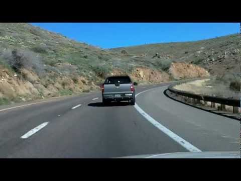
3. State Route 89A: Sedona to Flagstaff Through Oak Creek Canyon
SR 89A through Oak Creek Canyon is one of the most famous scenic drives in Arizona. It is paved and popular, but it is not a casual cruise. The route includes canyon curves, switchbacks, narrow sections, heavy tourist traffic, cyclists, pedestrians near recreation areas, and rockfall-prone slopes.
Many visitors are focused on the red rocks, creek stops, and viewpoints. That attention shift is part of the problem.
The biggest concerns are tight curves, sudden braking, vehicles entering and leaving roadside areas, and rockfall-related work or closures. During busy seasons, drivers may crawl through traffic and then speed up too quickly in open sections.
Weather can also change the road’s feel. Rain, ice in colder months, or debris after storms can make the canyon more stressful than expected.
Start early and give yourself more time than the map suggests. Avoid tailgating, be patient near tourist pullouts, and watch for flaggers or lane restrictions. If you want photos, stop only where it is legal and safe.
4. State Route 88: Apache Trail
The Apache Trail, also known as SR 88, is one of Arizona’s legendary scenic routes. It passes desert cliffs, lakes, narrow sections, and rugged terrain east of the Phoenix area. But this road has also faced major damage from flooding, rock debris, and unstable conditions in past years.
That history is why travelers should never assume the entire route is open or suitable just because a map shows a line across the terrain.
Some sections are narrow, steep, winding, or unpaved. Road damage, rockfall, washouts, and limited access can make conditions more complicated than a normal scenic drive.
The route may be manageable in one section and restricted or difficult in another. That is especially true after storms or during repair work.
Check official road conditions before planning the full drive. Do not rely only on old travel blogs, social media clips, or GPS routing. Carry water, avoid the route during heavy rain risk, and turn around if conditions feel beyond your vehicle or comfort level.

5. State Route 87: Phoenix to Payson and the Mogollon Rim Area
SR 87, often called the Beeline Highway, is a major escape route from the Phoenix area to Payson, the Mogollon Rim, and northern recreation spots. On weekends, it can fill with campers, trailers, off-road vehicles, boats, and drivers heading for cooler weather.
The road can feel open, but traffic waves and speed changes make it risky.
Expect fast-moving vehicles, sudden slowdowns, wildlife, changing weather, and long climbs. During winter or storms, conditions can shift quickly as elevation rises.
The road also gets heavy return traffic at the end of weekends, when tired drivers are coming back to the Valley.
Leave outside peak times, secure anything being towed, and avoid impatient passing. If traffic is heavy, accept the slower pace instead of weaving or tailgating.
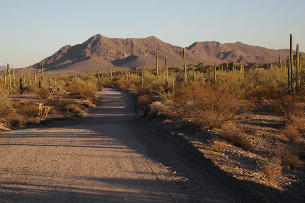
6. Interstate 8 and Desert Routes Near Yuma and Gila Bend
Some southwestern Arizona road trips feel quiet and open, especially around I-8, Gila Bend, Yuma, and desert side roads. The danger here is not always curves or traffic. It is heat, distance, fatigue, tire trouble, and limited shade.
In summer, a breakdown can become serious faster than travelers expect.
High temperatures strain vehicles and tires. Long straight stretches can make drivers sleepy. Services may be far apart, and cell coverage can vary once you leave major highways.
Dust, crosswinds, and sudden storms can also affect open desert roads.
Carry more water than you think you need. Check tires before leaving. Keep fuel above half a tank in remote areas. Tell someone your route if you are leaving the interstate for desert roads.
7. State Route 260 and High Country Roads Near Show Low, Heber, and Payson
Arizona is not all desert. Routes around Payson, Heber-Overgaard, Show Low, and the White Mountains can bring snow, ice, fog, elk, deer, and sudden weather changes.
Visitors coming from Phoenix or Tucson may not expect winter-style road conditions in Arizona.
The danger often comes from drivers carrying desert habits into mountain country. Speeding, following too closely, or driving without checking weather can become a problem on curves, grades, and shaded icy patches.
Wildlife is another concern, especially around dawn and dusk.
Check weather and road conditions before the trip. Bring layers, extra water, and a charged phone. In winter, do not assume a small car with worn tires can handle every mountain road safely.

The Most Common Warning Signs On Arizona Road Trips
Sudden Visibility Loss
Dust, rain, fog, or smoke can make a road dangerous within seconds. If visibility drops, reduce speed safely and do not keep driving blindly.
Drivers Going Too Fast For Conditions
A posted speed limit is not a promise that the road is safe at that speed in every situation. Curves, storms, traffic, and darkness may require much slower driving.
Remote Stretches With Few Services
A route can be paved and still remote. Always plan fuel, water, and rest stops before entering desert or mountain areas.
Rockfall, Washouts, And Fire-Scar Damage
Arizona storms can damage roads quickly, especially in canyon areas and burn scars. A route that was fine last season may have restrictions now.
Before You Take Any Risky Arizona Road Trip
Check AZ 511 before leaving. Look for closures, crashes, weather alerts, restrictions, and construction zones. Do not trust old screenshots or outdated route videos.
Build extra time into the trip. Many dangerous decisions happen when drivers feel late, rushed, or pressured to reach the next stop before dark.
Pack water, a phone charger, basic supplies, and a paper backup or offline map for remote areas. Avoid driving unfamiliar canyon or mountain roads at night when possible.
Most of all, treat Arizona’s scenery with respect. The same cliffs, desert flats, canyons, and high-country roads that make the state unforgettable can also punish careless driving.
Final Thoughts
The most dangerous Arizona road trips are not always marked by warning signs at the start. Sometimes they begin as famous scenic drives, quick weekend routes, or empty desert highways that seem harmless until weather, traffic, speed, or terrain changes the situation.
US 93, I-17, I-10 near Picacho, US 60 through Salt River Canyon, SR 89A, SR 88, US 191, SR 87, I-8, and high-country routes all deserve extra planning.
You do not have to avoid these roads completely. But you should drive them with patience, current road information, and a clear understanding that Arizona’s wild beauty comes with real road risks.