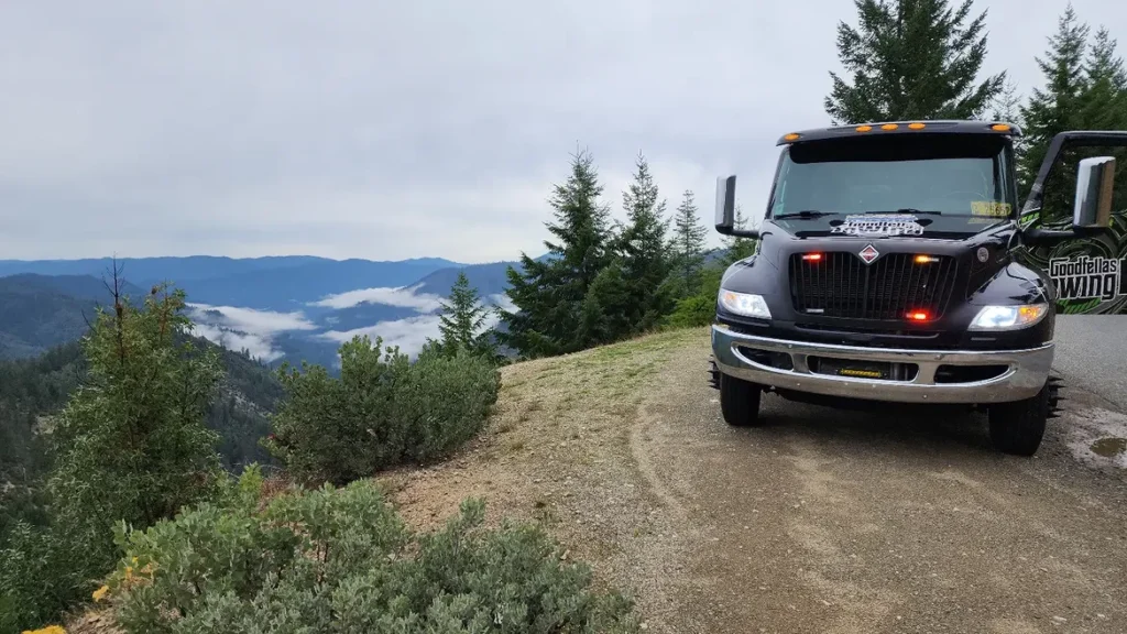
Oregon has a way of making dangerous roads look harmless at first. A forest lane can feel peaceful for twenty miles, then suddenly turn into a narrow climb with no cell signal, no shoulder, and snow sitting where your map app promised clear pavement. That is what catches visitors off guard.
The roads locals warn about are not always the famous ones. Some are scenic shortcuts. Some are old mountain passes. Some connect small towns, rivers, lakes, and coast roads that look simple on a screen. The problem is that Oregon’s backroads can change fast. Rain, ice, fog, wildfire closures, rockfall, sharp curves, and long gaps without fuel can turn a casual road trip into a serious mistake.
This is not a scare story. It is the part of Oregon that many glossy guides skip. The state has some of the most dramatic drives in the country, but a few routes demand more respect than excitement.
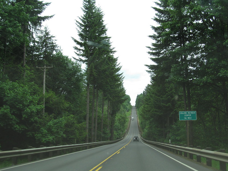
Bear Camp Road
Bear Camp Road has one of the strongest warning reputations in Oregon. The road cuts through remote southwest Oregon between the Rogue River area and Agness, and it has long been treated as a route where GPS confidence can get drivers into trouble.
On a map, it can look like an adventurous back way to the coast. On the ground, it is a different story. The road crosses steep forested terrain, has limited services, and can be affected by snow, wildfire closures, fallen trees, and poor visibility. Side roads can confuse drivers who are already tired, low on fuel, or relying too heavily on navigation apps.
Locals often warn visitors not to treat Bear Camp Road like a casual detour. It is the kind of place where a wrong turn matters. In dry, open-season conditions, prepared drivers may be fine. In bad weather or during fire season, this road can become a trap for people who thought they were taking the scenic route.
McKenzie Pass Highway
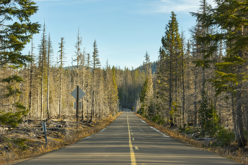
McKenzie Pass Highway, also known as Oregon Route 242, proves that a road can be stunning and risky at the same time. The route winds through lava fields, mountain views, tight curves, and high-elevation terrain. It feels like a dream drive until weather or road width becomes part of the trip.
This highway closes seasonally, usually from late fall into early summer, because snow and mountain conditions make it unsafe. That closure is not a small detail. It is a warning about how serious the pass can become once winter settles in.
Even during the open season, McKenzie Pass asks for patience. Drivers face narrow lanes, sharp bends, exposed stretches, cyclists, and slow-moving tourist traffic. Anyone rushing through it misses the point and increases the risk. This road rewards calm driving, not speed.
Forest Road 39
Forest Road 39 near Hells Canyon is one of those Oregon routes that sounds perfect for people who love quiet places. It has big views, mountain air, and access to one of the wildest corners of the state. That same isolation is exactly why locals warn road trippers to think twice before going unprepared.
The Hells Canyon Scenic Byway includes stretches with few services, long distances between fuel stops, and narrow winding roads. Snow closes portions of the route for part of the year, and early-season conditions can still include rough surfaces, debris, potholes, or unexpected hazards.
This drive is not dangerous because it is busy. It is dangerous because it can feel empty. A mechanical issue, wrong fuel estimate, or late start can become a real problem. The smartest drivers check road status before leaving, fill the tank early, and avoid acting like remote country is just another photo stop.
Wilson River Highway
Oregon Route 6, often called the Wilson River Highway, is a familiar road for people heading between the Portland area and Tillamook. Because it is so common, many drivers underestimate it. That is part of the problem.
The road runs through forested terrain with curves, shade, rain-slick pavement, and heavy coast-bound traffic at busy times. Add impatient passing, weekend crowds, and wet weather, and the drive can become tense fast.
Locals know this highway is no place for aggressive driving. The scenery can distract visitors, but the road demands attention. It may look like a normal route to the coast, yet its crash reputation has made it one of Oregon’s more serious drives.
Salmon River Highway
Oregon Route 18 carries travelers between the Willamette Valley and the Lincoln City area. It is a practical road, a beach road, and a route many people use without much thought. That casual attitude is exactly what makes it risky.
The highway has stretches where traffic bunches up, drivers get impatient, and wet coastal weather changes the feel of the road. Curves, limited passing judgment, and sudden slowdowns can create dangerous moments, especially during weekends and holiday travel.
This is not the kind of road that announces danger with dramatic cliffs at every turn. Its risk is quieter. A driver relaxes too much, follows too close, pushes a pass, or ignores rain. That is why locals often treat it with more caution than visitors expect.
Lake of the Woods Highway
Oregon Route 140 near Lake of the Woods is popular with travelers heading through southern Oregon mountain country. It connects scenic areas, forests, lakes, and routes that lead near Crater Lake travel plans. Yet it also includes a section recognized for serious crash risk.
The Lake of the Woods area has mountain conditions that can shift quickly. Snow, ice, wildlife, darkness, curves, and elevation changes can turn the drive from peaceful to stressful. A dry road in one section does not guarantee safe pavement farther ahead.
This road is a reminder that Oregon’s mountain highways deserve respect even when they are open. Visitors sometimes plan around distance alone. Locals think about weather, daylight, road surface, and how quickly help could arrive if something goes wrong.
Oregon Route 211
Oregon Route 211 does not have the famous-name drama of a mountain pass or remote canyon drive. That is why it can surprise people. The road runs through rural Clackamas County areas near Estacada and Molalla, with curves, local traffic, farm access, and sections where drivers can become too comfortable.
The risk here comes from normal-looking danger. A rural two-lane road can feel simple until speed, turning vehicles, limited shoulders, and blind curves meet in the wrong place. This is the kind of route where the landscape feels open, but reaction time can shrink fast.
Local warnings around roads like this are often practical rather than dramatic. Slow down before curves. Watch for driveways and farm vehicles. Do not assume a quiet road is a safe road.
Dead Indian Memorial Road
Dead Indian Memorial Road connects the Ashland side of southern Oregon with higher country leading across the Cascades. It has history, forest, mountain air, and the kind of quiet that can make a road trip feel far removed from the interstate.
That remoteness has a cost. Snow, ice, darkness, wildlife, and limited services can make the route difficult, especially outside fair-weather daylight hours. The summit area is closely watched during winter because conditions can become serious.
Drivers who know the area tend to treat this road with caution. It is not a place to test tires, rush a schedule, or assume a mild day in town means mild pavement higher up. The road may be scenic, but it is still a mountain route with real consequences for careless travel.
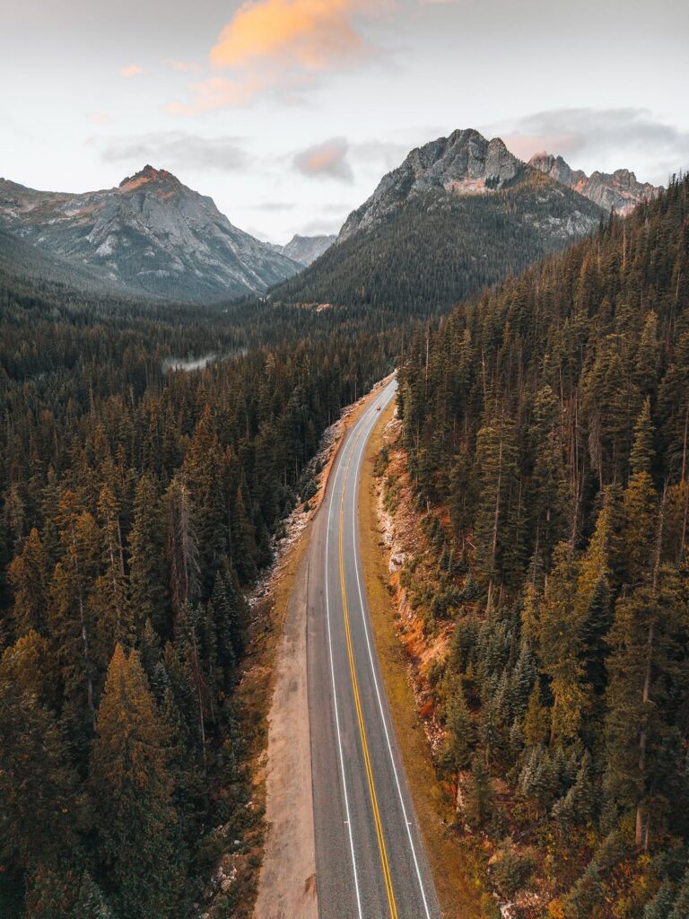
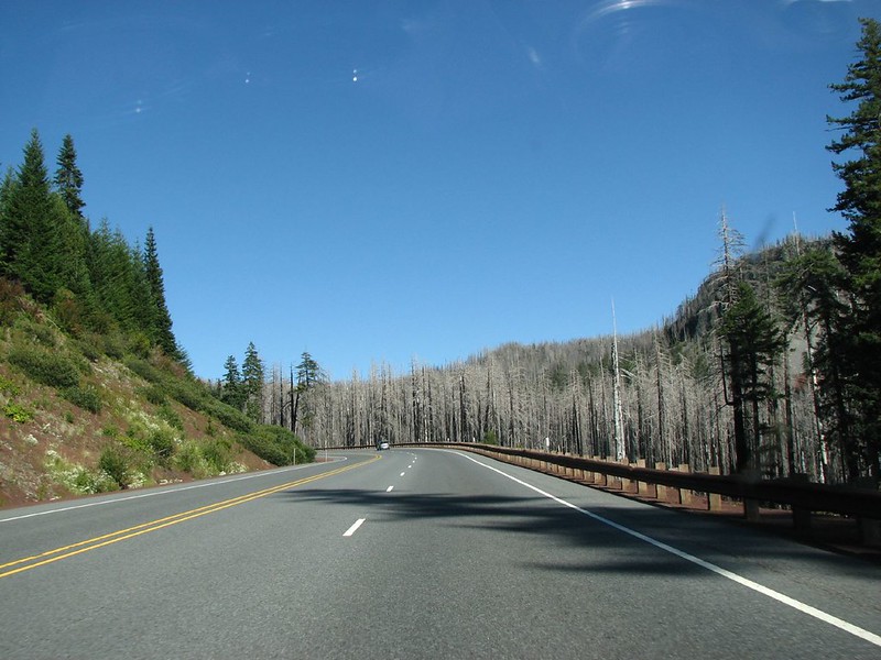
Cascade Lakes Highway
Cascade Lakes Highway is one of central Oregon’s great drives, linking Bend with lakes, forest, and mountain views. In summer, it can feel like the perfect outdoor road trip. In shoulder season, it can be far less forgiving.
High-elevation snow controls the story here. Seasonal closures happen because the road sits in mountain country where snow, ice, and blocked access can linger long after town streets look clear. Even after reopening, shaded corners and lake areas can hold slick patches.
The mistake many visitors make is assuming Bend weather tells the whole truth. It does not. This highway asks drivers to check conditions before leaving, carry extra layers, and avoid late-day gambles when temperatures drop.
Santiam Pass
Santiam Pass is not hidden in the usual sense, but its danger often hides behind routine. Many Oregonians cross it often. Travelers use it for trips between the Willamette Valley and central Oregon. That familiarity can make the pass feel safer than it is.
Winter storms, chain requirements, fog, heavy trucks, ski traffic, and sudden slowdowns can all shape the drive. Conditions can change from manageable to tense within a short distance, especially near higher elevations.
The contrarian truth is simple: a road does not need to be obscure to be underestimated. Santiam Pass proves that even a well-known Oregon route can become hazardous when drivers ignore weather, timing, or road reports.
Why Locals Warn About These Oregon Roads
The common thread is not that these roads are impossible to drive. Many people travel them safely every year. The issue is that each route has a habit of punishing casual planning.
Oregon road trips often involve distance, elevation, forest shade, rain, snow, fog, wildlife, or long service gaps. Those factors do not always appear clearly on a phone map. A route can look short while still being slow, remote, seasonal, or risky.
Locals warn about these roads because they know the pattern. Visitors see scenery. Locals see timing, weather, road closures, fuel range, and the possibility of getting stuck far from easy help.
Final Thoughts
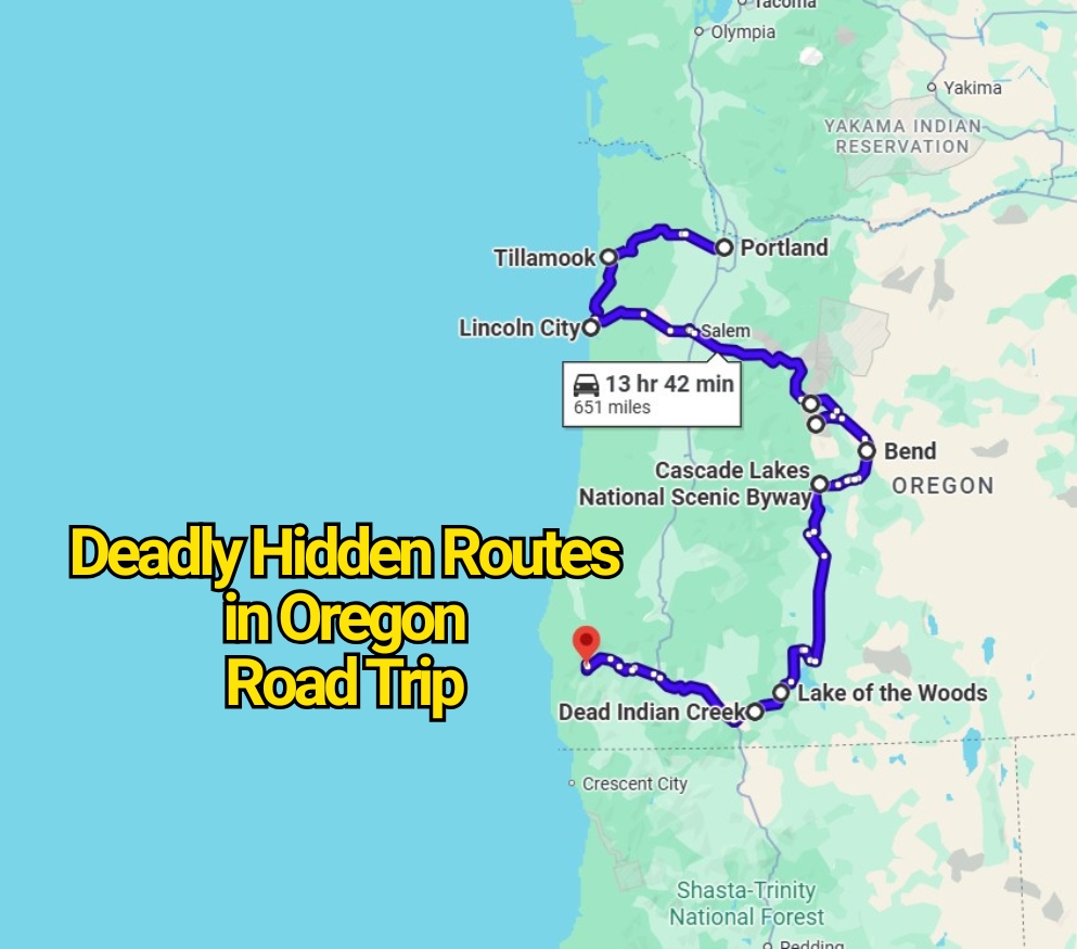
Oregon’s hidden and semi-hidden road trip routes can be unforgettable, but they are not all easy drives. Bear Camp Road, McKenzie Pass, Forest Road 39, Route 6, Route 18, Route 140, Route 211, Dead Indian Memorial Road, Cascade Lakes Highway, and Santiam Pass all carry real reasons for caution.
The best approach is simple. Check current road conditions before leaving. Do not rely blindly on GPS. Fill up before remote stretches. Avoid closed roads. Respect winter gates, wildfire notices, and mountain weather. Drive slower than your schedule wants you to.
That is how Oregon should be traveled: curious, prepared, and humble enough to listen when locals say a road deserves caution.