Illinois may be famous for Chicago’s skyline, Route 66, and endless stretches of farmland, but the state also hides a surprising collection of waterfalls. From rocky canyons and forest trails to quiet parks far from the usual tourist crowds, these scenic stops reveal a completely different side of the Prairie State. Some falls rush after heavy rain, while others flow gently across layered cliffs and moss-covered rocks.
This Illinois waterfall road trip brings several of the state’s most beautiful cascades together in one memorable route. Along the way, you can wander through shaded trails, pause beside dramatic sandstone formations, and enjoy peaceful picnic areas surrounded by nature. Each stop has its own character, giving you plenty of reasons to slow down, take photos, and appreciate the changing landscape.
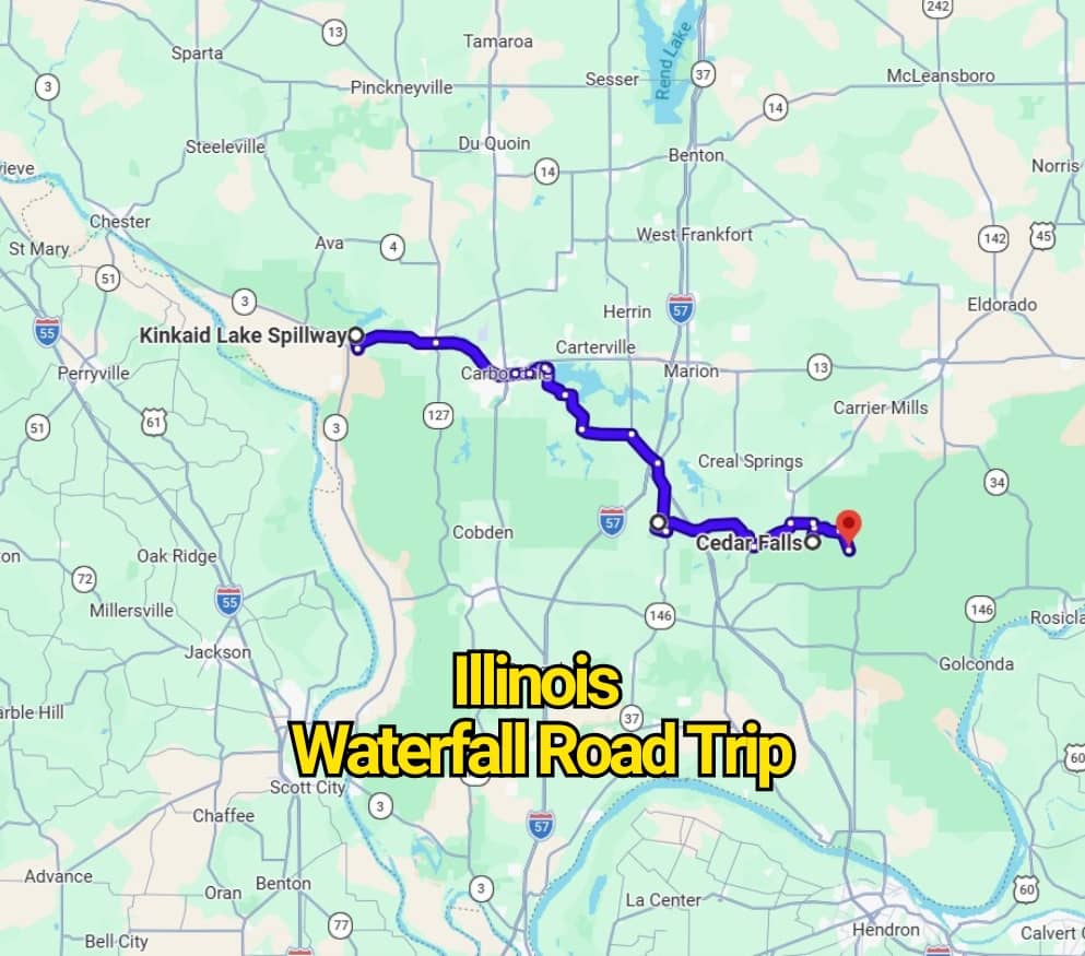
The map makes it easier to organize your drive while helping you reach waterfalls that many travelers overlook. Whether you plan a weekend getaway or break the route into shorter day trips, this journey offers a fresh reason to hit the road. Pack comfortable shoes, check recent rainfall conditions, and get ready to see Illinois from an entirely new perspective.
1. Ferne Clyffe Waterfall Trail: Begin Beneath Shawnee’s Sandstone Cliffs
- Location: Goreville, Illinois
- Known For: A moderate 1.1-mile forest trail leading to a seasonal waterfall surrounded by rocky bluffs
- Best Time to See the Falls: Spring or early summer after steady rainfall
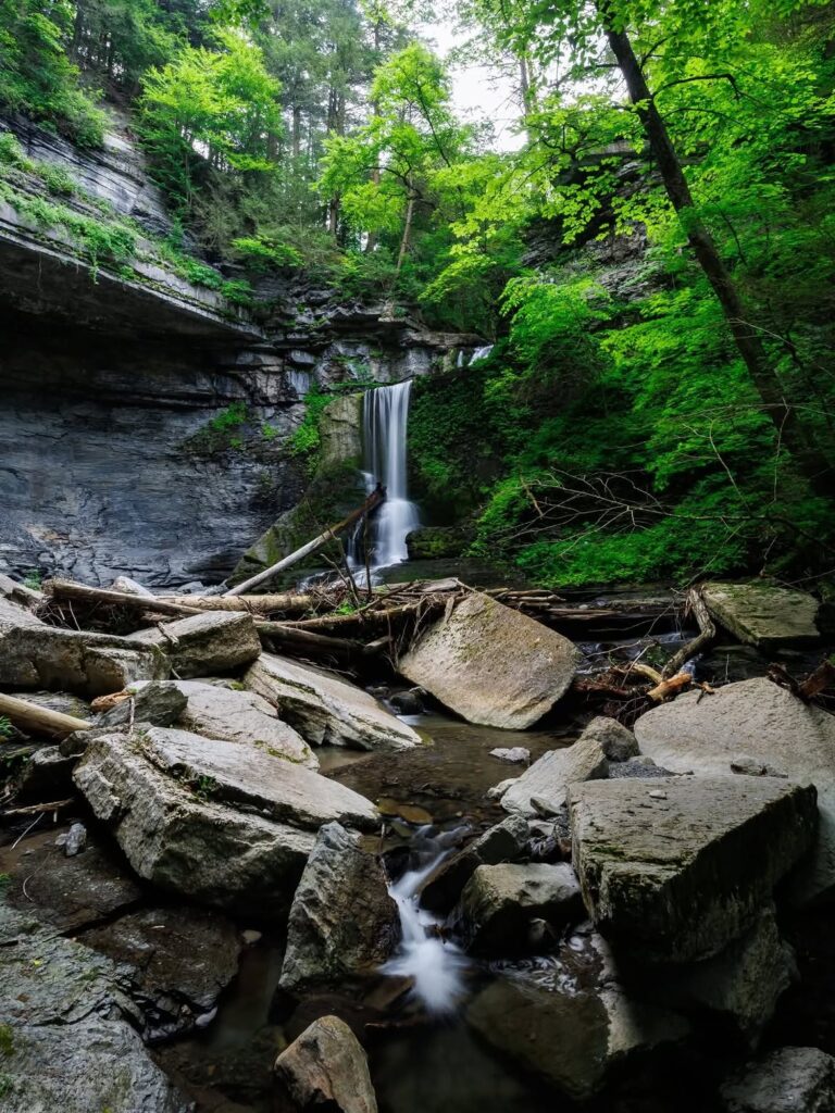
Begin your Illinois waterfall road trip at Ferne Clyffe State Park near Goreville, where wooded paths and towering sandstone walls create a striking first stop. The 1.1-mile trail winds through dense forest before reaching a narrow waterfall that drops from a high rock ledge into a shallow basin. Water levels rely heavily on recent rain, so the cascade may appear faint or completely dry during warmer stretches.
Although the hike is fairly short, several rocky and muddy sections can make the route moderately challenging. Wet weather often leaves the stones slippery, so sturdy hiking shoes with good traction are helpful. Stay on the marked path because smaller side trails can become confusing and may lead away from the main waterfall area.
Parking is available near Deer Ridge Campground, where visitors will find restrooms, signs, and an accessible trailhead. Allow a few hours to enjoy the walk without rushing, especially if you plan to stop for photographs or admire the surrounding cliffs. The shaded forest and dramatic rock formations make this stop worthwhile even when the waterfall is flowing lightly.
2. Kinkaid Lake Spillway: Cool Off Beside a Tiered Cascade
- Location: Gorham, Illinois
- Known For: A multi-level cascade flowing into a popular Southern Illinois swimming area
- Best Time to See the Falls: Spring for stronger flow and summer for wading
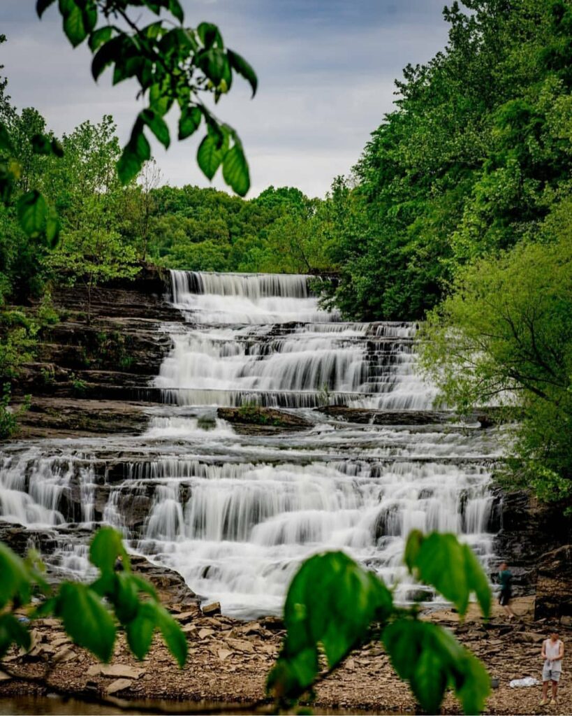
Roughly an hour northeast of Ferne Clyffe, Kinkaid Lake Spillway offers a refreshing change from the wooded hiking trails. Water tumbles over several rocky tiers before entering the lake below, creating one of the most inviting roadside waterfall stops in Southern Illinois. Kinkaid Lake is a man-made reservoir where visitors often spend time fishing, swimming, and relaxing near the water.
Reaching the spillway requires very little walking, making it a convenient addition to the road trip. A spacious parking area sits near the waterfall along Spillway Road, with restrooms and picnic tables available close by. You may hear the rushing water before leaving your vehicle, and the short approach means you can enjoy the scenery without committing to a lengthy hike.
Some visitors carefully climb across the lower rock levels or wade near the base, though wet surfaces can become extremely slick. Water shoes or sturdy sandals with dependable grip are a smart choice. Spring usually brings the loudest and fullest cascade, while summer offers warmer conditions for cooling off in one of the region’s best-known swimming spots.
3. Cedar Falls: Follow a Quiet Forest Trail to an 80-Foot Drop
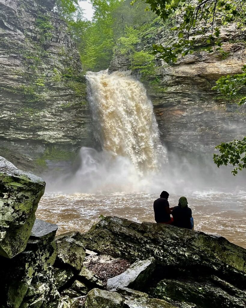
- Location: Ozark, Illinois
- Known For: An 80-foot seasonal waterfall with a clear pool beneath the rocky ledge
- Best Time to See the Falls: Late winter or spring
About an hour southwest of Kinkaid Lake Spillway, Cedar Falls offers a quieter stop on this Illinois waterfall route. The 80-foot cascade is considered one of the state’s tallest, sending water over a rugged cliff into a glassy pool below. Its flow depends heavily on recent rain, making late winter and spring the strongest seasons for seeing the falls at their best.
Access begins near Camp Ondessonk, reached by following IL-13 West into the Ozark area. Since the waterfall sits on privately managed property, visitors should request permission and confirm current access rules before entering. From the camp, the Cedar Falls Trail covers roughly two miles and is generally considered manageable for most hikers.
The route passes beneath thick tree cover and across sections of uneven, rocky ground before arriving at the waterfall. Spring brings patches of wildflowers and fresh greenery along the path, adding extra color to the walk. Wear supportive shoes, carry water, and allow enough time to enjoy the pool and towering rock wall without rushing back.
4. Little Packentuck Waterfall: Take the Long Forest Route to a Hidden Cascade
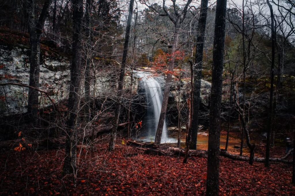
- Location: Ozark, Illinois
- Known For: A small waterfall system along the East Trigg Loop Trail, with streams, rock formations, and horseback-riding paths
- Best Time to See the Falls: Late winter or spring
Little Packentuck Waterfall sits along the East Trigg Loop Trail, making it one of the more remote stops on this Illinois waterfall road trip. The moderate 8.5-mile loop begins near Trigg Tower Road and travels through a quieter section of Shawnee National Forest. Several small cascades and flowing creeks appear along the route, especially after seasonal rain.
The trail passes beneath broad tree canopies and beside rugged rock formations, a concrete archway, and shallow streams. Hiking is the most common way to reach the falls, though the path is also used for horseback riding. Follow the marked route carefully because a few side paths are difficult to trace and may cross onto private land.
Mud, loose stones, and wet stream crossings can make the journey harder than its mileage suggests. Wear sturdy footwear and carry enough water for several hours on the trail. Cell service is often unreliable in this area, so save an offline map before leaving. The long approach takes patience, but the quiet surroundings and scattered waterfalls make the effort rewarding.
5. Jackson Falls: Pair a Seasonal Cascade With Rugged Canyon Trails
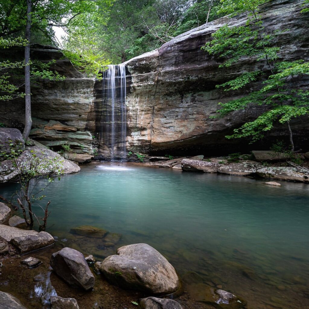
- Location: Simpson, Illinois
- Known For: A seasonal waterfall surrounded by hiking routes, sandstone cliffs, and established rock-climbing areas
- Best Time to See the Falls: Spring or summer following steady rainfall
Jackson Falls lies only a short distance from Little Packentuck, making it a convenient fifth stop on this Illinois waterfall drive. It can be reached from the East Trigg Loop Trail, where several smaller cascades appear between wooded ridges and rocky passages. The main waterfall often runs as a narrow ribbon, so its appearance is far more impressive after a stretch of spring or summer rain.
For a more direct outing, follow the moderate 4.4-mile Jackson Falls Trail, which begins near a marked parking area and trailhead. The loop winds through thick forest before dropping into a sandstone canyon filled with ledges, boulders, and steep rock walls. Some sections require careful footing, particularly when wet leaves, mud, or loose stones cover the path.
Jackson Falls is also known for its climbing areas, though those routes are better suited to experienced climbers with proper equipment. Regular hikers can still enjoy the canyon floor and waterfall without attempting the cliffs. Save an offline map because signs may become unclear in places, and pack water and snacks for the longer walk through this rugged corner of Shawnee National Forest.
You may also like :