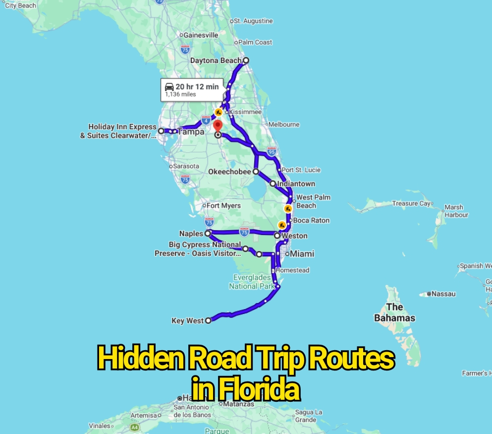
Florida road trips are usually sold through palm trees, Gulf Coast sunsets, ocean bridges, and miles of open highway. That postcard version is real, but it leaves out something experienced Florida drivers already know: a road does not need sharp mountain curves or icy pavement to become dangerous.
Some of the state’s hardest routes appear almost harmless. They are flat, straight, and easy to underestimate. That false sense of comfort can lead to higher speeds, distracted driving, fatigue, or risky passing. Add sudden rain, heavy tourist traffic, wildlife, narrow shoulders, and long distances between services, and a relaxing drive can change without much warning.
There is no official government ranking called “Florida’s deadliest hidden road-trip routes.” The roads below were selected because of documented crashes, repeated public safety concerns, difficult driving conditions, or unusual roadside hazards. Florida’s crash totals also change as new reports are filed, so the state’s official crash dashboard remains the strongest place to check updated figures.
U.S. Route 19 Through Pinellas and Pasco Counties
U.S. 19 does not look like a secret backroad. It runs beside shopping centers, restaurants, neighborhoods, and everyday businesses. That ordinary setting is part of the problem. Drivers may treat it like a familiar commercial street even though large sections function more like a fast-moving highway.
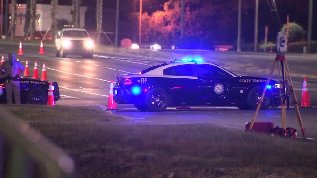
A 2024 analysis reported more than 150 deaths along U.S. 19 in Pinellas and Pasco counties since 2020. The Pinellas County portion accounted for 94 fatalities, while the Pasco County section recorded 68. Local transportation officials pointed to high traffic volume, speed, and busy intersections as major concerns.
The risk is not limited to people inside cars. Pedestrians and cyclists may need to cross broad sections of roadway where vehicles are moving quickly. This mixture of highway speeds and street-level activity makes U.S. 19 one of Florida’s clearest examples of a road that can feel routine while carrying serious danger.
Interstate 4 From Tampa to Daytona Beach
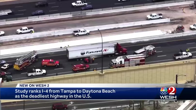
Interstate 4 connects Tampa, Lakeland, Orlando, and Daytona Beach, placing it directly through one of Florida’s busiest travel corridors. Families heading to theme parks, commuters, trucks, airport traffic, and long-distance travelers all share the same roadway. The trip may appear simple on a map, but traffic can change from flowing freely to nearly stopped within a short distance.
An analysis based on federal data counted more than 165 deaths along the 132-mile interstate between 2011 and 2015. The Orlando portion was identified as the deadliest section during that study period. Another transportation analysis calculated a fatality rate of more than one death per mile, though rankings vary according to the years and methods used.
The larger lesson is more useful than the dramatic ranking. I-4 demands attention because drivers face sudden braking, lane changes, construction activity, visitors unfamiliar with exits, and congestion that appears with little notice. The road is rarely hidden, yet its danger can be hidden beneath the assumption that an interstate drive will be predictable.
Overseas Highway From Key Largo to Key West
The Overseas Highway is one of Florida’s most famous drives. It crosses long bridges, passes blue water, and links the islands of the Florida Keys. Those views can make the journey feel like part of the vacation rather than a demanding highway trip.
The physical layout tells another story. U.S. 1 serves as the primary road through much of the island chain, leaving few practical alternatives when a serious crash, fire, or emergency closes a section. During a South Florida brush fire in March 2025, authorities briefly closed U.S. 1, and travelers faced lengthy delays while crews worked near the roadway.
Available crash data reported 1,732 crashes on Monroe County roads in 2024, with at least six deaths and more than 1,200 injuries. Those countywide figures are not limited entirely to the Overseas Highway, but U.S. 1 carries a large share of Keys traffic and remains central to almost every island road trip.
A driver distracted by water views may miss stopped traffic, a turning vehicle, or a changing speed zone. Bridges also offer limited space for avoiding trouble. The Overseas Highway deserves its scenic reputation, but the scenery should never be mistaken for an easy driving environment.
State Road 710 Near Indiantown
State Road 710 is the sort of rural highway many visitors barely notice. It runs through parts of Okeechobee, Martin, and Palm Beach counties, carrying local drivers, agricultural vehicles, and commercial trucks. Long, open sections may encourage motorists to maintain high speeds for extended periods.
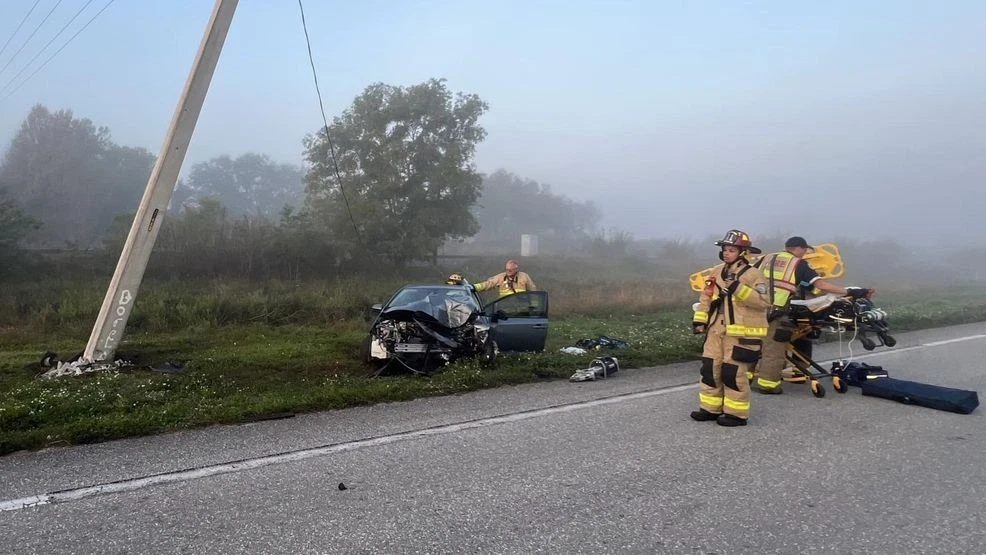
The road gained wider attention after repeated serious crashes. Following a fatal collision in January 2026, the Martin County sheriff publicly described the route as a “death trap” and called for quicker safety improvements. By early July 2026, Martin County Fire Rescue had reportedly responded to 42 vehicle-related calls on SR 710 during the year. Another head-on collision killed a driver on July 6, 2026.
That history does not mean every mile is equally hazardous or that a crash is unavoidable. It means the road’s plain appearance should not lower a driver’s guard. Speed differences, passing decisions, trucks, dark nighttime sections, and limited recovery space can make a minor mistake far more serious.
State Road 60 East of Lake Wales
State Road 60 changes character as it crosses Florida. Near developed areas, it behaves like a busy regional highway. Farther east, the road opens into longer rural sections passing ranchland, small communities, and lightly developed country.
That emptiness can feel calming after urban traffic, but it may also encourage speeding and impatience. Drivers can become trapped behind slower vehicles and attempt passes without enough distance. After sunset, limited lighting makes it harder to judge speed, identify roadside hazards, or notice a vehicle entering from a side road.
The route has experienced severe crashes, including fatal head-on and multi-vehicle collisions near Lake Wales and River Ranch. Those incidents alone do not create a complete statistical ranking, but they show why the rural section deserves more respect than its uncomplicated map line suggests.
The smarter approach is to treat SR 60 as a working cross-state highway rather than an empty country road. Trucks, local traffic, wildlife, rain, and drivers making long journeys can all occupy the same stretch at the same time.
State Road 70 Across Central Florida
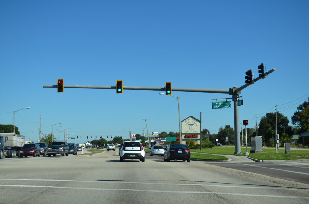
State Road 70 cuts across broad areas of inland Florida, linking communities near Bradenton, Arcadia, Lake Placid, Okeechobee, and the Treasure Coast. Much of the route sits far from the state’s resort districts, which is exactly why travelers may underestimate it.
In December 2025, a fatal collision occurred on SR 70 during dense fog and limited visibility in Highlands County. In June 2026, another fatal crash near the Highlands–Okeechobee county line forced a lengthy closure and caused backups on surrounding roads.
Fog is especially deceptive on flat roads. Drivers may see a clear stretch ahead and maintain speed just before entering a dense patch. Rural darkness can create a similar problem, making distances harder to judge and slower vehicles more difficult to spot.
SR 70 also illustrates a disadvantage of remote road travel: one major crash can close the highway for hours. Nearby roads may not provide a fast detour, and emergency crews can require more time to reach isolated locations.
Tamiami Trail Through Big Cypress
The Tamiami Trail section of U.S. 41 between Naples and Miami offers an entirely different Florida road trip. Instead of beaches and high-rise hotels, the route passes wetlands, canals, sawgrass, and protected habitat. The drive can feel wonderfully removed from urban South Florida.
That isolation carries its own risks. Long dark stretches, wildlife movement, standing water, and limited services create conditions many visitors are not accustomed to handling. A driver who is watching the roadside for animals may drift from the lane, while a motorist staring only ahead may fail to notice wildlife entering the pavement.
Federal wildlife research has identified vehicle collisions as a serious threat to Florida panthers. A section near the Turner River was studied as a collision hotspot, leading to the use of roadside animal-detection technology intended to warn motorists when large wildlife approached the highway.
The contrarian truth about Tamiami Trail is that its low traffic can work against drivers. Fewer cars may reduce congestion, but they can also create boredom, fatigue, and excessive speed. The route should be driven as a wildlife corridor and remote highway, not as an empty shortcut between Florida’s coasts.
Alligator Alley Between Naples and Weston
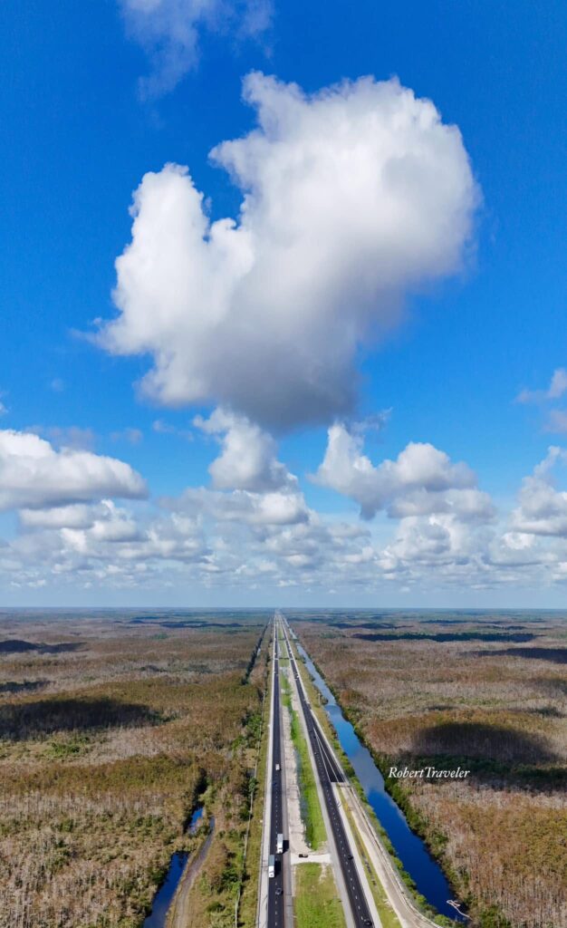
Alligator Alley is broad, straight, and separated from most towns. For many drivers, it appears easier than almost any urban highway in Florida. Set the cruise control, remain in the lane, and wait for the Everglades to pass—that is how the journey can feel.
The old danger of Alligator Alley was more complicated. Canals run beside substantial portions of the interstate, creating a severe secondary hazard when vehicles leave the pavement. A transportation study found that cable safety barriers installed along I-75 in Collier County sharply reduced the number of vehicles reaching those canals and lowered vehicle-immersion fatalities.
Those improvements matter and should not be ignored. Calling the road unchanged would be misleading. Still, barriers cannot remove every problem. Fatigue, intense rain, reduced visibility, high speeds, disabled vehicles, and long gaps between exits remain part of the trip.
Alligator Alley may be safer than it once was, yet its appearance continues to fool drivers. A straight road is not automatically a forgiving road, particularly when water, wildlife, and remote surroundings leave little room for careless decisions.
Why Florida’s Flat Roads Can Be So Deceptive
Florida lacks the cliffs, snow, and mountain switchbacks that instantly make drivers nervous. Its danger often comes from the opposite direction: roads look easy enough to ignore. Long straightaways can encourage speed. Wide commercial highways may place pedestrians beside fast traffic. Scenic bridges can pull attention from the lane. Remote corridors can bring fatigue before a driver realizes concentration has faded.
Statewide crash data also shows why personal behavior matters. FLHSMV reported that a crash occurred about every 44 seconds in Florida based on preliminary 2023 numbers, while nearly 300 people died in crashes involving distracted driving that year.
The roads in this article should not be treated as forbidden routes. They are major transportation corridors used safely by thousands of people. The better takeaway is that familiarity, straight pavement, and good weather do not cancel risk.
The Real Warning Locals Want Visitors to Hear
The strongest warning is not “never drive these roads.” It is “stop treating them like background scenery.” Check weather and traffic conditions before leaving, take breaks on long inland routes, avoid rushing to make up lost time, and keep full attention on the road through the Keys, Everglades, and busy metropolitan corridors.
Florida’s most troubling road-trip routes rarely announce themselves with dramatic warning signs. Many look ordinary until traffic stops suddenly, fog covers the pavement, an animal enters the lane, or a vehicle crosses the center line. That is why locals respect these highways—and why visitors should do the same.