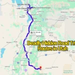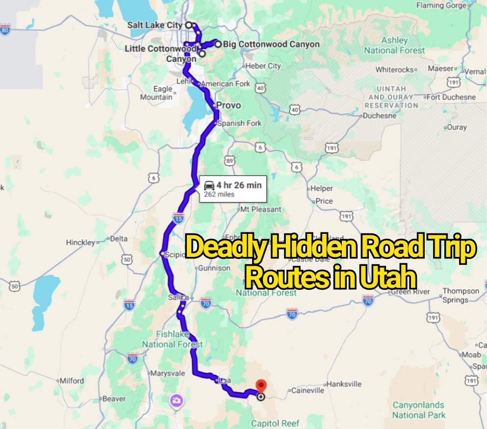
Utah road trips are often sold as effortless drives through red-rock country, alpine forests, and wide-open desert. That polished image leaves out an uncomfortable truth. Some of the state’s most memorable routes also pass through places where cell service disappears, weather changes without much warning, and one poor decision can turn a scenic detour into a serious problem.
Still, calling every steep or remote road “deadly” would be misleading. There is no official ranking that labels the following routes as Utah’s deadliest hidden drives. Their danger comes from documented conditions such as exposed switchbacks, avalanche zones, flash flooding, deep sand, winter ice, rough surfaces, and long distances from emergency help.
These roads are not necessarily places to avoid. They are routes that punish overconfidence. Drivers who arrive with the wrong vehicle, too little water, or no knowledge of current conditions may learn why local warnings deserve attention.
Moki Dugway Turns a Scenic Shortcut Into a White-Knuckle Climb
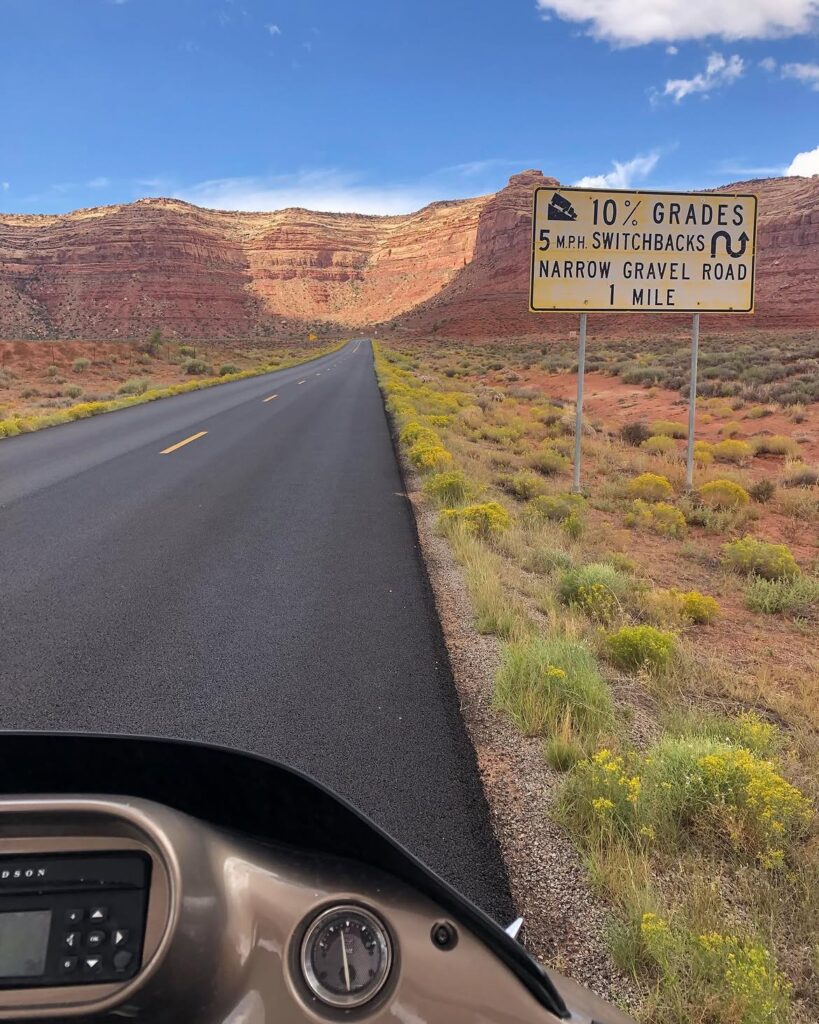
Moki Dugway looks almost impossible from below. The gravel road rises around 1,200 feet in roughly three miles, cutting back and forth across the face of Cedar Mesa. Its tight turns and steep grade create a driving experience that feels far removed from the smooth highways found elsewhere in Utah.
The route is generally passable in dry weather, yet that does not make it suitable for every driver. Large recreational vehicles and vehicles towing trailers can struggle with the bends and limited roadside space. Rain can soften the surface, while loose gravel may reduce traction near the sharper corners.
Many travelers expect a brief scenic detour. Instead, they meet a slow climb requiring patience, steady braking, and full attention. The greatest risk may be assuming the road is easy simply because it appears on a map.
Shafer Trail Is More Serious Than Its Famous Photos Suggest
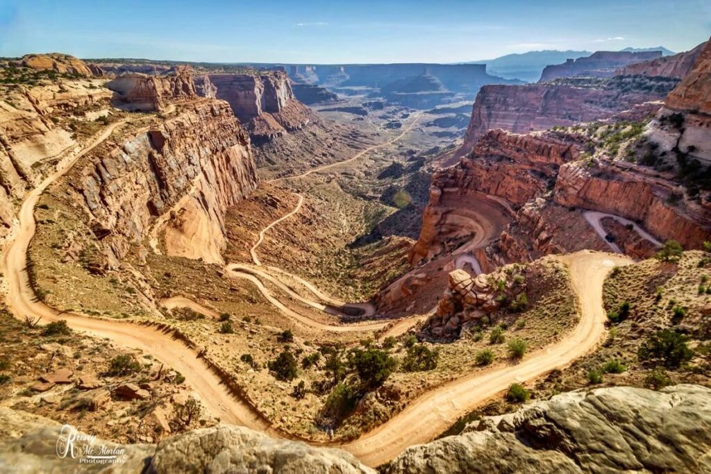
Shafer Trail is one of the most photographed backcountry roads near Moab. Images of its stacked switchbacks often make the route appear like an exciting side trip for anyone visiting Canyonlands National Park. Those photographs rarely communicate how narrow, exposed, and uneven the road can feel from the driver’s seat.
The trail descends about 1,500 feet from the Island in the Sky district. Loose gravel, deep ruts, washboarding, ice, and storm damage may change the route from manageable to hazardous. High-clearance vehicles are strongly favored, and four-wheel drive can become important after poor weather.
This is not a road for staring at the scenery while moving. Drivers must watch the surface, judge approaching traffic, and control speed through every turn. The canyon views are dramatic, but the margin for careless driving can be thin.
White Rim Road Demands Far More Than a Full Tank of Gas
White Rim Road circles through one of the most isolated areas of Canyonlands National Park. The roughly 100-mile journey is sometimes described as an epic scenic drive, yet that phrase hides the physical demands of the route. Rocky climbs, deep sand, steep ledges, and rough switchbacks can test both the vehicle and the person behind the wheel.
A high-clearance, low-range four-wheel-drive vehicle is required, along with a permit. Even experienced drivers may spend ten to twelve hours completing the route in one day. Others break the journey into several days and camp along the road.
There is no drinking water along the loop, and help may be many miles away. A mechanical problem in a city is inconvenient. The same problem on White Rim Road can become a backcountry emergency.
Little Cottonwood Canyon Becomes a Different Road During Winter
Little Cottonwood Canyon Road serves major ski areas near Salt Lake City, so some visitors assume it functions like an ordinary mountain highway. During calm weather, the paved route may feel straightforward. Winter storms reveal its harsher character.
The canyon contains dozens of mapped avalanche paths, with a large portion of State Route 210 exposed to avalanche danger. UDOT may close the road for control work, cleanup, or severe conditions. Traction rules can also require approved winter tires, chains, or other permitted equipment.
The danger is not limited to snow sliding onto the roadway. Ice, heavy traffic, poor visibility, and stopped vehicles can create long delays inside a narrow canyon. Turning around may not be simple, especially when hundreds of other drivers have made the same mistake.
Big Cottonwood Canyon Can Trap Unprepared Drivers in Gridlock
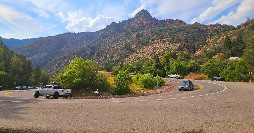
Big Cottonwood Canyon does not have the same intimidating reputation as some desert backroads, yet winter conditions can make it one of Utah’s most stressful drives. Snowfall, sharp curves, crowded parking areas, and slow-moving traffic often combine during peak ski periods.
Traction restrictions may be activated during storms. Drivers without suitable tires or equipment can lose control on icy grades, block traffic, or become stranded. Limited parking adds another problem, since vehicles sometimes continue up the canyon long after popular areas are full.
This road shows why danger does not always come from isolation. Sometimes it comes from too many people entering a confined mountain corridor at the same time, many of them expecting normal highway conditions.
Burr Trail Switchbacks Can Become Impassable After Rain
The Burr Trail crosses some of southern Utah’s most striking desert terrain before reaching a steep series of switchbacks in Capitol Reef National Park. The switchback section climbs about 800 feet in half a mile, creating a sudden change from open canyon driving to a tight ascent.
The road surface inside the park is graded dirt. Recreational vehicles and trailers are poor matches for this section, particularly after rain. Wet clay can become slick and may stop even capable four-wheel-drive vehicles.
The route’s appearance can fool drivers. Dry conditions may make it seem firm and harmless, while one storm can alter the surface within minutes. Desert roads do not need deep water to become impassable. A thin layer of wet soil may be enough.
Cathedral Valley Loop Leaves Little Room for Mechanical Trouble
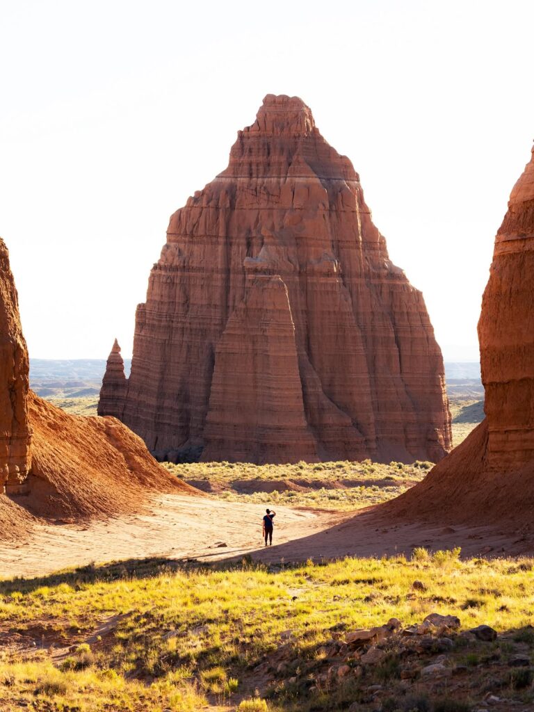
Cathedral Valley offers massive rock formations, open desert, and a level of isolation that draws travelers away from Capitol Reef’s busier areas. The same remoteness that makes the loop appealing also raises the stakes of every decision.
The roads are unpaved and may suffer from mud, washouts, erosion, or deep ruts. Rain and melting snow can make certain sections difficult for high-clearance vehicles. River crossings and changing surfaces add further uncertainty.
Cell coverage is unreliable, services are distant, and traffic may be sparse. Drivers who enter without water, a spare tire, basic recovery supplies, and current road information are gambling on perfect conditions. Cathedral Valley often rewards preparation, but it rarely forgives the absence of it.
Hole-in-the-Rock Road Is Longer and Rougher Than Many Expect
Hole-in-the-Rock Road begins near Escalante and stretches deep into remote desert country. At first, the wide dirt road may appear relatively tame. Conditions usually become rougher farther from town, where washboarding, ruts, rocks, sand, and storm damage can slow travel considerably.
The road receives irregular maintenance, and its clay surface may become nearly impossible after rain. Drivers can cover many miles before realizing that returning will be harder than continuing. Fuel use also rises on rough roads, especially when speed drops and traction worsens.
A map may show a direct line through the desert. The road itself tells another story. Distance, poor surfaces, and limited communication make this route far more serious than a casual afternoon drive.
Cottonwood Canyon Road Can Change Before the Forecast Does
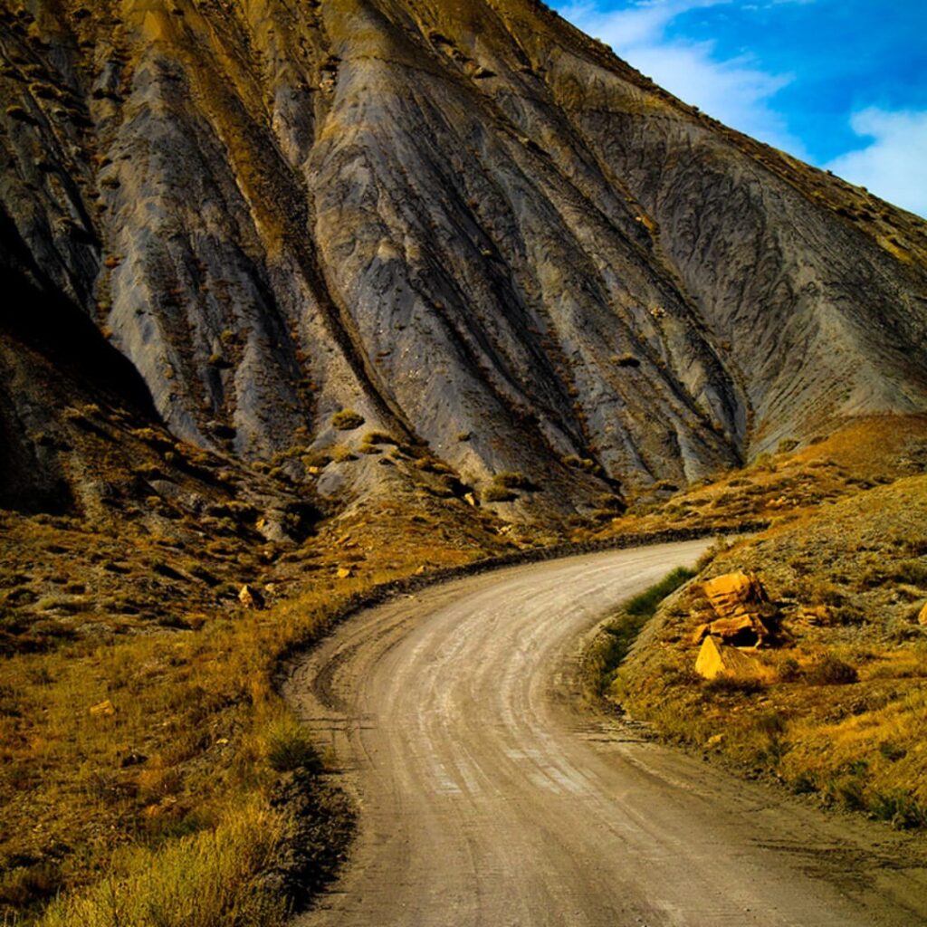
Cottonwood Canyon Road cuts through Grand Staircase-Escalante country between the Cannonville area and U.S. Route 89. The scenery attracts travelers looking for a quieter alternative to Utah’s crowded park roads, but the unpaved route is highly dependent on weather.
Rain can create mud, washed-out sections, flooded crossings, and roadside damage. Clay-heavy surfaces may remain unusable after the storm has passed and blue sky has returned. That delay catches visitors who assume dry weather overhead means dry ground below.
The road is especially risky for standard passenger cars after poor weather. Local conditions should matter more than a phone’s route suggestion. A navigation app can calculate distance, but it cannot judge fresh mud around the next bend.
South Draw Road Is a Shortcut That Can Cost Hours
Digital maps sometimes send drivers onto South Draw Road near Capitol Reef as though it were a convenient alternative route. The National Park Service warns travelers against relying on it as an ordinary shortcut.
South Draw is an unmaintained road intended for high-clearance four-wheel-drive vehicles. Passenger cars, trailers, recreational vehicles, and drivers without backcountry experience may face rough terrain that becomes progressively harder.
The problem often begins with misplaced trust. Travelers assume that a route displayed by a popular app must be reasonably passable. In remote Utah, that assumption can lead to vehicle damage, delays, or a difficult recovery far from paved roads.
Hells Backbone Road Tests Drivers With Height and Isolation
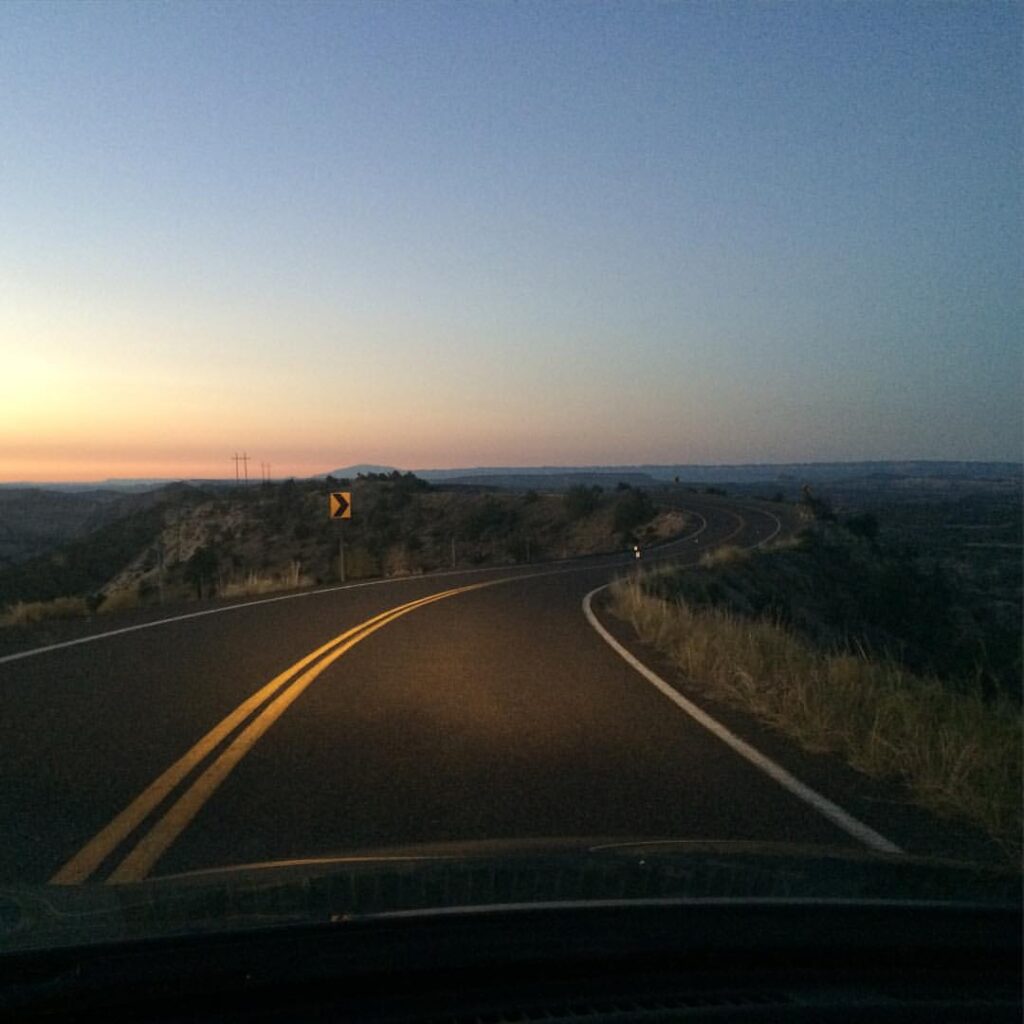
Hells Backbone Road runs through high country between Escalante and Boulder. The route crosses forested terrain before reaching narrow sections above deep canyons. Its best-known feature is Hells Backbone Bridge, where the landscape drops sharply on both sides.
Part of the road is gravel, and winter snow can close or severely limit access. Storms may leave fallen rocks, mud, or damaged sections behind. The high elevation also means conditions can differ greatly from the warmer desert below.
Its name sounds like marketing, but the road’s isolation is real. Drivers should not treat it as a quick loop simply because the mileage appears manageable. In mountain country, a short distance can still require a slow and careful journey.
Scenic Byway 12 Over Boulder Mountain Hides Its Risk Behind Pavement
Scenic Byway 12 is one of Utah’s most celebrated paved roads. That status can create false confidence. The Boulder Mountain section rises to around 9,600 feet, where snow, wind, ice, fog, and sudden temperature changes may affect the highway.
Pavement removes some backcountry concerns, but it does not cancel mountain weather. Shaded corners may hold ice after sunny stretches have dried. Strong wind and reduced visibility can also make driving harder, especially for larger vehicles.
The route can be beautiful and comfortable in good conditions. During a fast-moving storm, it becomes a high-elevation road with limited services and little tolerance for speeding.
Utah’s Most Dangerous Roads Are Often the Ones Drivers Underestimate
The common thread between these Utah road trip routes is not a high official death count. It is the gap between how easy they look online and how demanding they may become in person.
A paved mountain highway can close because of avalanche danger. A dry desert road can turn to mud after a short storm. A famous scenic trail can require specialized equipment, permits, water, and hours of slow driving. Even navigation apps may direct travelers onto roads that are unsuitable for standard vehicles.
The smartest response is not fear. It is skepticism. Check current conditions, match the vehicle to the route, carry water and emergency supplies, and turn back before a difficult section becomes a crisis. Utah’s remote roads offer unforgettable views, but none of those views are worth treating local warnings as an exaggeration.
You may also like :