Alabama features a wide range of natural spots, including several striking waterfalls spread across different parts of the state. Some are located in quiet forested areas, while others are easier to reach and often visited by travelers passing through. A full loop connecting several of these falls makes it possible to experience a variety of landscapes in one continuous drive.
This journey idea brings together multiple waterfall stops into a single route that can be completed in a day. Each location offers its own character, from wide cascading drops to smaller, hidden streams flowing through rocky terrain. The drive between stops also adds variety, moving through rural highways, wooded sections, and open countryside.
Seven waterfalls have been chosen for this route based on accessibility and natural appeal. Together, they form a well-paced itinerary for travelers who want to explore different parts of Alabama without extending the trip over several days. A simple mapped guide can help visitors follow the sequence and plan stop durations along the way.
1. Moss Rock Preserve in Hoover, Alabama
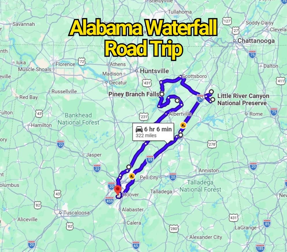
Moss Rock Preserve is a 349-acre natural area known for its forest trails, sandstone formations, and flowing water features that appear after rainfall. The landscape shifts between rocky terrain and wooded sections, offering several small waterfall spots that can be viewed along walking paths.
This location also supports a variety of plant and animal life, making each visit slightly different depending on season and weather conditions. The combination of stone outcrops and moving water creates a striking natural setting that draws hikers and casual visitors throughout the year.
Visitors often use this stop as a short hike rather than a full-day trek, since the trail network is easy to follow and offers multiple viewing points close together. After rainfall, small streams can form across the rock surfaces, creating temporary cascades that make the area feel especially active and dynamic. It is a good place for relaxed walking, photography, and spending a brief time surrounded by natural scenery without needing a long or difficult route.

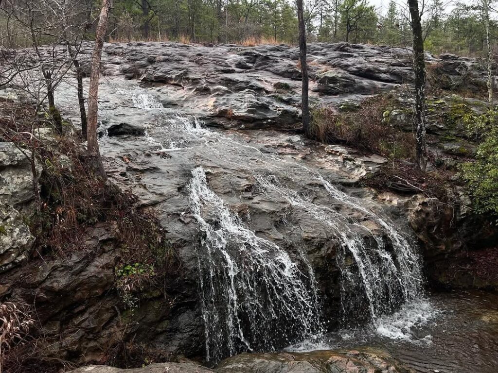
2. Noccalula Falls in Gadsden, Alabama
Noccalula Falls Park features one of Alabama’s most striking natural water drops, where water plunges about 90 feet from a Lookout Mountain cliff into a deep, green valley below. The setting combines rugged rock edges with dense greenery, creating a strong contrast that makes the fall stand out in every season.
The waterfall acts as the central highlight of the park, drawing visitors who come to view the powerful descent and surrounding scenery. Walking paths and viewing areas give different angles of the drop, allowing visitors to take in the full height and flow of the water from multiple positions.
This location is especially popular for short visits and relaxed exploration, as the main viewing points are easy to access and close together. After rainfall, the water volume increases, making the cascade even more dramatic and visually intense as it rushes over the cliff edge.

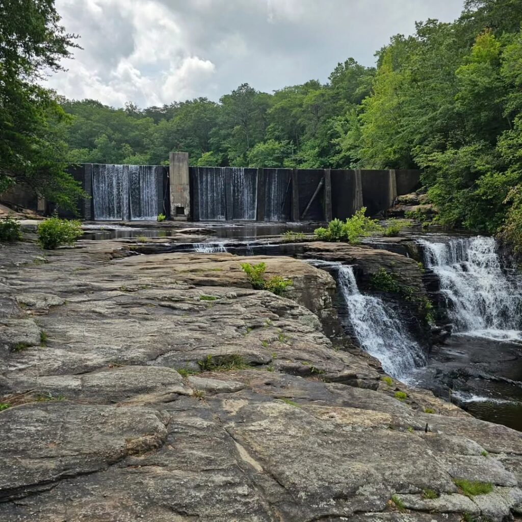
3. Little River Falls in Fort Payne, Alabama
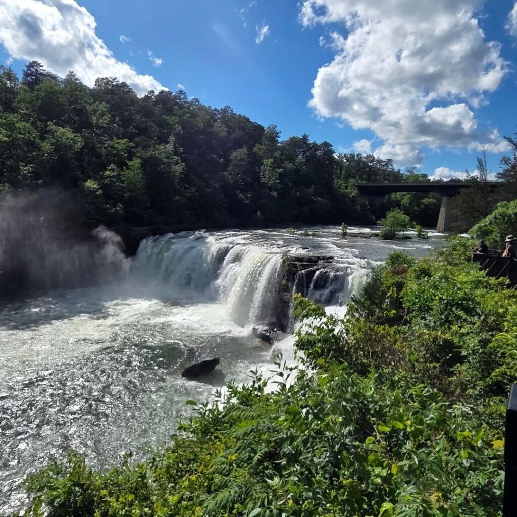
Little River Canyon National Preserve is home to the striking Little River Falls, where water drops roughly 45 feet as it begins its journey through the canyon system. This point marks the start of one of the deepest canyon landscapes in the eastern United States, shaped over time by continuous river flow.
The waterfall is known for its steady flow and rocky surroundings, which change character depending on rainfall levels and seasonal shifts. Visitors often stop at designated viewpoints along the edge to observe the water as it spreads across wide rock ledges before descending into the canyon below.
Access is managed through clearly marked entry points, with information provided by park authorities about visiting hours, parking areas, and seasonal conditions. The area is suitable for short stops along a longer canyon drive, offering quick but memorable views of moving water cutting into ancient stone formations.
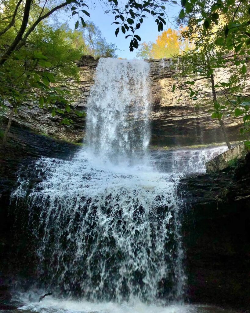
4. DeSoto Falls in Mentone, Alabama
DeSoto Falls is a powerful 104-foot cascade formed as the West Fork of the Little River drops from a steep Lookout Mountain cliff. The fall is split into multiple sections, creating a layered flow that spreads across the rock face before reaching the pool below.
Surrounding the waterfall is a rugged mountain environment with forested slopes and rocky overlooks. Visitors can view the drop from designated points that sit above and beside the falls, giving different perspectives of the water as it descends through the gorge.
The site is often included in North Alabama waterfall routes due to its dramatic height and easy roadside access. After periods of heavy rain, the water flow becomes stronger, turning the cascade into a wider and more forceful sheet moving over the cliff edge.
5. Piney Branch Falls in Marshall County, Alabama
Piney Branch Falls is a striking waterfall located near the outskirts of the Columbus City area, known for its seasonal flow and quiet natural setting. The water moves over rock formations in a gentle but steady drop, creating a scenic stop for those passing through the region.
This site is on private land, and access depends on permission from the property owners who live nearby. Visitors should respect boundaries and follow local guidance before approaching the area to view the falls.
Because it is not a public park, the experience here is more limited compared to other waterfall locations on the route. Still, those who are allowed entry can see the cascade up close, especially after rainfall when the water flow becomes stronger and more defined.

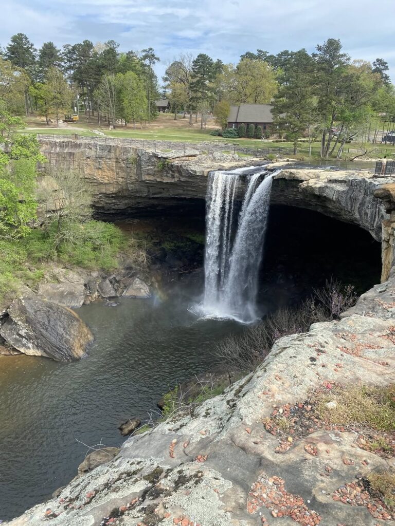
6. High Falls in Oak Grove, Alabama
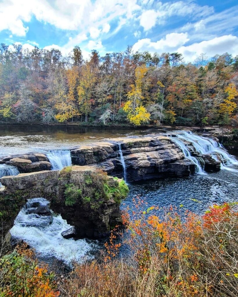
High Falls is a broad and powerful waterfall created by Town Creek as it moves over the Sand Mountain landscape. At around 35 feet in height, the water spreads widely across the rock face, and during periods of strong flow it can stretch over 300 feet from side to side.
The surrounding area feels remote and less developed, with forested land and rocky terrain shaping the approach to the falls. The wide flow pattern changes with rainfall, sometimes appearing as a thin curtain and other times as a strong rushing sheet.
This stop is often included in waterfall driving routes across northern Alabama due to its scale and natural setting. Short walking paths lead to viewing areas where visitors can observe the full width of the cascade as it moves over the edge and into the pool below.
7. Turkey Creek Falls in Pinson, Alabama
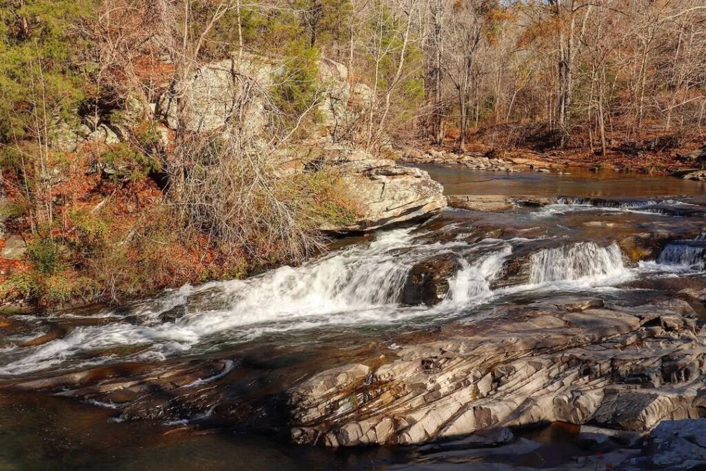
Turkey Creek Falls sits inside the larger Turkey Creek Nature Preserve, a 466-acre protected area known for its forest trails, clear streams, and rocky water features. The waterfall is one of the key highlights of the preserve, formed as Turkey Creek moves through uneven stone terrain and drops into natural pools.
The surrounding environment features mixed woodland and creek-side paths that shift in character with rainfall and seasonal changes. Water levels can vary, sometimes creating a light flow over the rocks and other times producing a stronger cascade that spreads across the ledges.
This location is commonly included in Alabama waterfall routes due to its accessibility and natural appeal. Visitors often rely on official preserve information for entry details, trail updates, and safety guidance before planning a visit, since conditions can change depending on weather and creek flow.
You may also like :