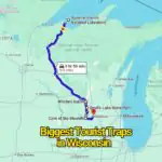
Wisconsin offers a wide mix of travel routes, from big cities and small towns to lakes, forests, and river corridors. With so many options across the state, planning a trip can feel like a lot at first. These ten road trip ideas help you pick simple, flexible routes you can enjoy in any season.
You can explore Milwaukee and Madison for city stops, drive through Door County for shoreline views, or head north to the Northwoods for forest landscapes. The Apostle Islands and Lake Superior routes bring cooler coastal scenery, while the Mississippi River drive and Driftless Area offer rolling hills and quiet backroads. Small towns like Bayfield, Cedarburg, and Eau Claire add easy breaks along the way.
Before heading out, plan your route, check road conditions, and pack basic travel items like snacks, water, and fuel stops. Weather can shift quickly in Wisconsin, especially during winter, so a flexible schedule helps keep the trip smooth.
With a mix of lake views, forest roads, and small-town stops, these routes work well for both short drives and longer trips. Each season changes the experience, giving you fresh reasons to return and explore different parts of the state.
1. Wisconsin 1-Day Road Loop Adventure
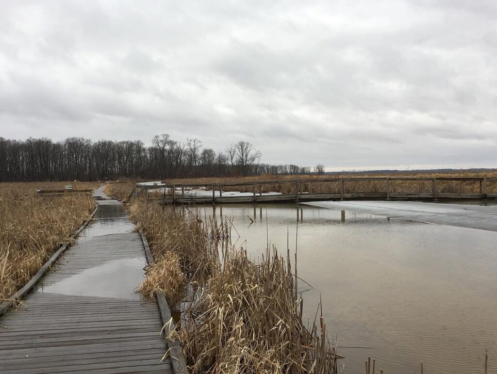
- Travel Path: Lion’s Den Gorge Nature Preserve → Kettle Moraine State Forest (Pike Lake Unit) → Dodge County Ledge Park → Horicon Marsh Education and Visitor Center → Edgewater Park
- Total Mileage:: 63 miles
- Drive Duration: About 1.5 hours total
This compact Wisconsin driving loop fits easily into a single day, yet still brings a wide mix of landscapes. From lakefront cliffs to wooded trails and broad wetland views, each stop adds a different layer to the journey. Even though the drive time is short, the experience can be extended by spending extra time at each location.
Along the way, you’ll pass Lake Michigan shoreline scenery, forest paths, limestone ledges, and the vast Horicon Marsh wetland system. This area is also known for strong bird activity, making it a great stop for wildlife viewing. Quiet walking areas and open water views offer space to slow down between destinations without feeling rushed.
You can shape the trip based on your pace—some may prefer short walks at each stop, while others may stay longer at the marsh or lakeside parks. The variety of environments keeps the route interesting even over a short distance.
This one-day drive works well for a quick escape into nature, combining water views, forest sections, and open wetlands into a single, easy-to-follow Wisconsin route.
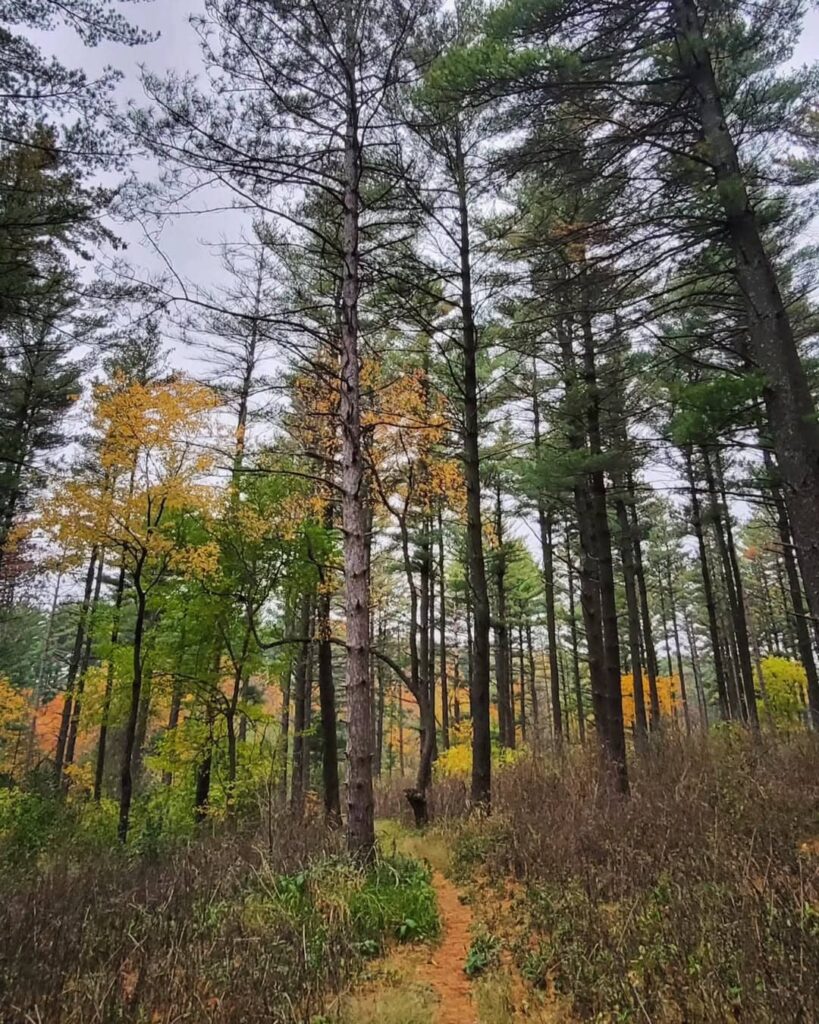
2. Wisconsin 3-Day Weekend Driving Route Through Forest Lands
- Travel Path: Kettle Moraine State Forest (Northern Unit) → Governor Earl Peshtigo River State Forest → Northern Highland–American Legion State Forest
- Total Mileage: 270 miles
- Drive Duration: About 5 hours total
This three-day Wisconsin driving plan links together three major forest regions, each with its own landscape style and outdoor character. The route is built for a relaxed pace, allowing time to move between forest zones without rushing the experience.
Kettle Moraine’s northern section brings rolling hills and mixed woodland areas, while Peshtigo River State Forest adds river corridors and quieter backcountry settings. Farther north, the Northern Highland–American Legion State Forest expands the journey with large lakes, deep forest stretches, and wide open outdoor space. Each stop feels different, giving the full route steady variety across the three days.
Although structured as a weekend plan, the timing can be adjusted depending on how long you prefer to stay in each forest area. Some travelers focus on hiking and lake time, while others keep it simple with short drives and frequent breaks.
This multi-day route works well for anyone looking to spend extended time outdoors across Wisconsin’s forest regions, combining longer driving segments with slower, nature-focused stops.
3. Door County Scenic Driving Route
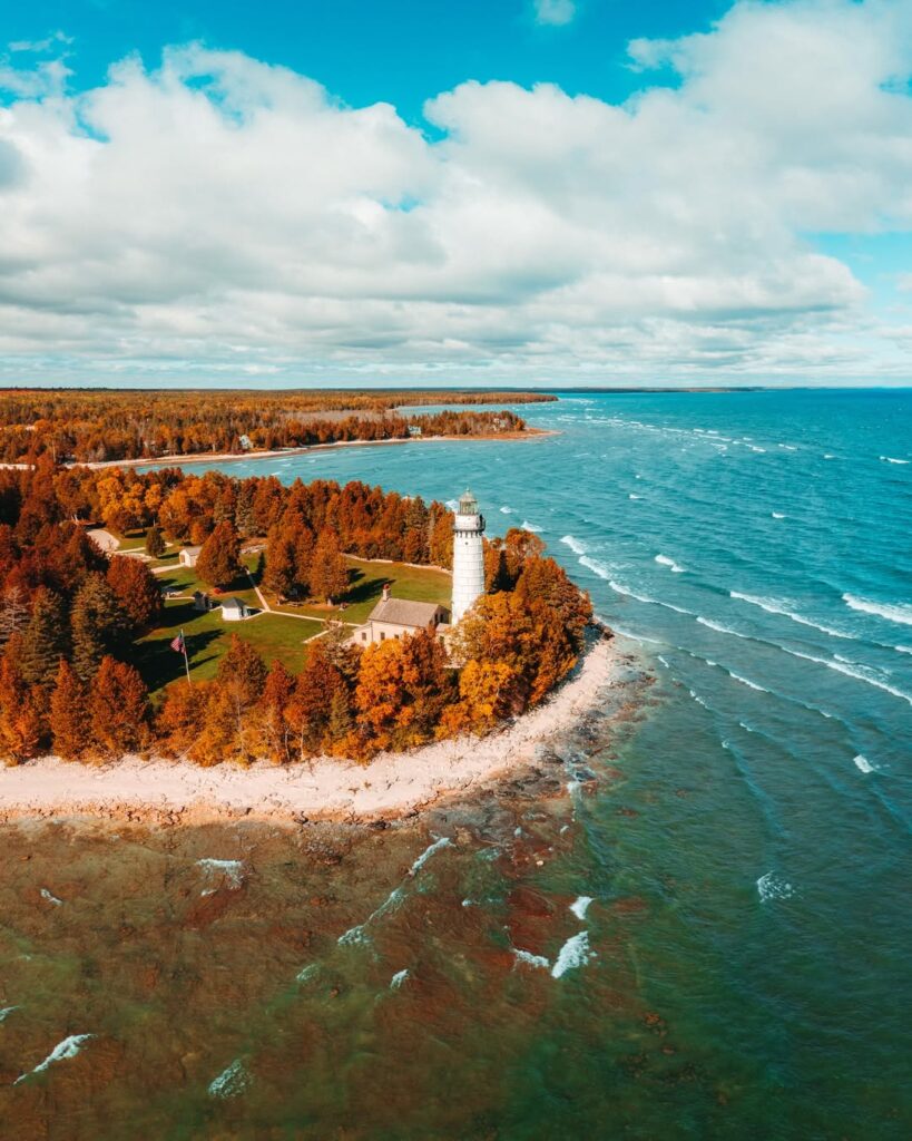
- Travel Path: Newport State Park → Peninsula State Park → Cave Point–Clay Banks State Natural Area → Whitefish Dunes State Park → Potawatomi State Park
- Total Mileage: 56 miles
- Drive Duration: Around 1.5 hours total
This Door County Wisconsin route connects five well-known parks in a single loop, making it easy to experience shoreline views and outdoor stops in one trip. The drive stays short, so most time can be spent at each location instead of on the road.
Newport State Park offers quiet forest trails and Lake Michigan access, while Peninsula State Park adds cliffs, wooded paths, and lighthouse viewpoints. Cave Point–Clay Banks brings rocky shoreline scenery, followed by Whitefish Dunes with sandy beach areas. Potawatomi State Park completes the loop with elevated views over Green Bay.
The region blends outdoor areas with small-town food spots, shops, and seasonal activities. Summer and fall are especially popular due to warm-weather access and color changes in the trees.
This compact loop works well for a relaxed day or weekend trip, offering variety without long driving stretches between stops.
4. Lake Winnebago Scenic Driving Loop
- Travel Path: Lakeside Park → The Little Farmer → Heritage Orchard → High Cliff State Park → Waverly Beach Bar and Grille → Dockside Tavern
- Total Mileage: 83 miles
- Drive Duration: Around 2 hours total
This central Wisconsin route circles Lake Winnebago, starting from Fond du Lac and moving in a counterclockwise direction around the shoreline. The drive connects small towns, open lake views, and natural stops, making it a steady mix of rural charm and waterfront scenery.
Along the way, you pass through Appleton and Oshkosh, where lakefront access, local eateries, and relaxed town centers add variety to the journey. High Cliff State Park brings elevated views over limestone cliffs and the lake, while orchards and farm stops offer seasonal fruit and local products that break up the drive.
The route also includes casual dining spots and lakefront taverns where travelers can pause and enjoy the water views. Short stops between driving segments keep the trip light and flexible without requiring long detours.
This loop works especially well for a summer weekend, combining open water scenery, small-town stops, and easy driving segments into a single connected Wisconsin experience.
5. Spring Waterfall Driving Route in Wisconsin
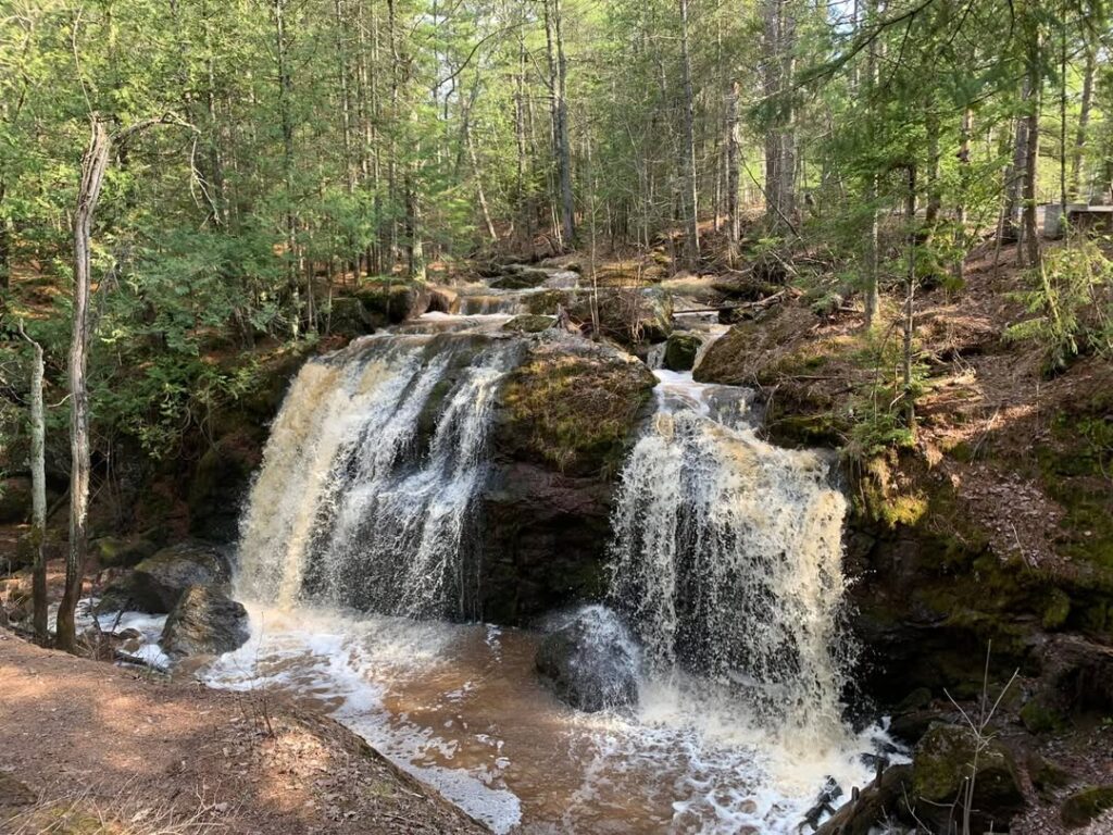
- Travel Path: Big Manitou Falls → Little Manitou Falls → Amnicon Falls State Park → Morgan Falls → Brownstone Falls → Potato River Falls → Superior Falls → Saxon Falls → Long Slide Falls County Park
- Total Mileage: 292 miles
- Drive Duration: Around 6 hours total
This northern Wisconsin spring route follows a long chain of waterfalls, beginning in the northeastern corner of the state and moving through forested Northwoods terrain. As winter snow melts, rivers rise and create stronger water flow, making each stop more active and visually striking during this season.
The journey starts near Wisconsin’s tallest waterfalls and continues through a series of natural parks and river areas. Each location offers a different setting, from wide falls with heavy flow to quieter forest streams surrounded by rocky edges and wooded paths.
Driving between stops takes you through rural roads and forest stretches, where scenery shifts gradually from river valleys to deeper woodland regions. The spacing between waterfalls allows time to pause, walk short trails, and view each site at a relaxed pace.
This spring-focused route is ideal for travelers who enjoy long scenic drives mixed with multiple outdoor stops, especially during the season when water levels bring extra energy to northern Wisconsin’s waterfall system.
6. Summer Driving Route Across Wisconsin
- Travel Path: Veterans Park (Milwaukee) → Waukesha → Madison → Mt. Horeb → Governor Dodge State Park → Prairie du Chien
- Total Mileage: 195 miles
- Drive Duration: About 3.75 hours total
This Wisconsin summer driving path runs from Lake Michigan all the way to the Mississippi River, linking urban areas, small towns, and major natural stops in one continuous journey. The route also passes through Madison, where the state capitol adds a strong cultural and historic pause point in the middle of the trip.
After Madison, the drive moves into rolling countryside before reaching Governor Dodge State Park near Spring Green. This area is closely connected with Frank Lloyd Wright’s legacy, and travelers often extend the trip with optional stops at nearby architectural sites such as Taliesin. Farther along, Prairie du Chien brings riverfront views along the Mississippi.
Between these main stops, the road passes through farmland, hills, and small communities that shift the pace of the journey from city movement to open-road stretches. The spacing of destinations allows flexible breaks without forcing a strict schedule.
For those extending the drive north from Prairie du Chien, the Great River Road continues along the Mississippi River bluffs, passing river towns and scenic overlooks until reaching Prescott and the meeting point with the St. Croix River near the Minnesota border.
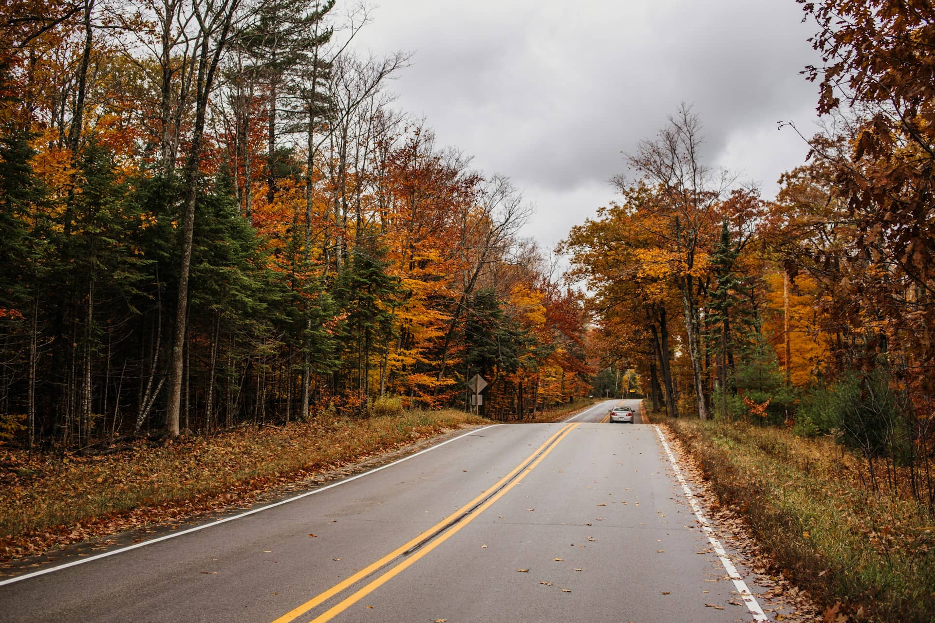
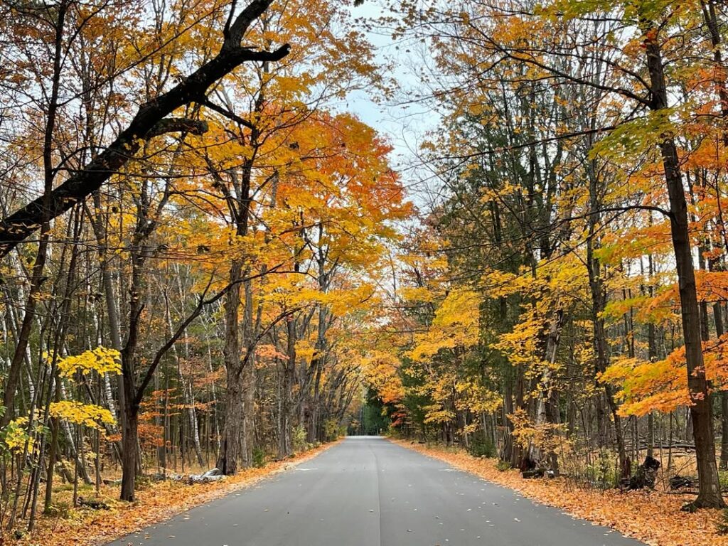
7. Autumn Driving Route Across Wisconsin
- Travel Path: High Cliff State Park → Peninsula State Park → Kettle Moraine State Forest → Devil’s Lake State Park → Blue Mounds → Wyalusing State Park → Wildcat Mountain State Park → Mill Bluff State Park
- Total Mileage: 597 miles
- Drive Duration: Around 11.5 hours total
This fall-focused Wisconsin driving route stretches across much of the state, linking lake regions, forest zones, and river valleys into one extended seasonal journey. It begins in Door County, then moves through central landscapes before reaching the Mississippi River region, offering steady shifts in scenery along the way.
The route includes several well-known natural areas such as Peninsula State Park, Devil’s Lake State Park, and Kettle Moraine, followed by Driftless Area highlights like Blue Mounds and Wildcat Mountain. Each stop brings different autumn color patterns, from wooded hillsides to open bluffs and river views.
As the drive continues westward, the landscape gradually changes from lakeshore environments to deep valleys and elevated overlooks. The spacing between parks allows time for short hikes, photo stops, and relaxed breaks without rushing through each location.
This long seasonal loop works best when divided into multiple days or a full weekend plan, giving enough time to experience Wisconsin’s fall color transitions across forests, cliffs, and river country.
8. Winter Driving Route Across Wisconsin
- Travel Path: Lake Geneva → Cambridge → Madison → Wisconsin Dells → Tomah → Sparta → La Crosse → Chippewa Falls → Hayward
- Total Mileage: 468 miles
- Drive Duration: Around 8.75 hours total
This winter Wisconsin driving route connects several towns and cities known for seasonal decorations, festive lights, and cold-weather charm. The journey begins in Lake Geneva, a well-known holiday stop, and continues through central Wisconsin before reaching the northern regions.
Madison and Wisconsin Dells add variety to the route, combining city stops with entertainment areas and indoor attractions that work well during colder months. The Dells, in particular, offers a mix of holiday displays and year-round recreation, making it a flexible midpoint on the drive.
As the route moves farther north and west, towns like La Crosse, Chippewa Falls, and Hayward introduce quieter winter settings with river views, small-town streets, and snow-covered landscapes. Driving segments between stops allow time to rest and adjust travel pace depending on road conditions.
This seasonal loop is best enjoyed with flexible timing, giving room for weather changes and longer breaks while moving through Wisconsin’s winter scenery and holiday-focused destinations.
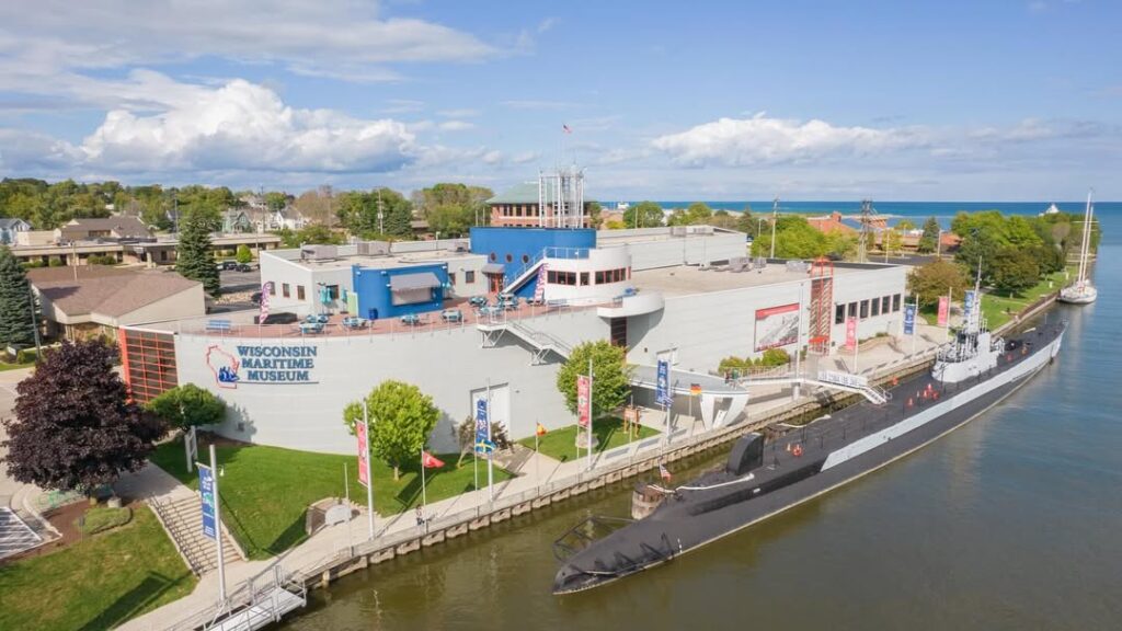
9. Family-Friendly Wisconsin Driving Route
- Travel Path: Choo-Choo Charlie’s Shriner Diner → SafeHouse → Bronze Fonz → Cedar Park → Bobrowitz Sculpture → Wisconsin Maritime Museum
- Total Mileage: 159 miles
- Drive Duration: Around 3 hours total
This Wisconsin family-focused driving route is built for short travel time with plenty of stops along the way. The total drive stays under three hours, which helps keep the journey comfortable for children while still covering multiple interesting locations.
The route mixes playful city landmarks, casual dining spots, and outdoor breaks. Milwaukee highlights like the Bronze Fonz and SafeHouse bring lighthearted urban stops, while Cedar Park offers open space for stretching and quick breaks. The Wisconsin Maritime Museum adds an interactive learning stop with hands-on exhibits and local history.
Food stops such as Choo-Choo Charlie’s Shriner Diner help break up the drive, giving families a chance to rest and reset between destinations. Short driving segments between attractions make the route easy to follow without long stretches on the road.
This loop works well for a relaxed day out, combining light sightseeing, simple travel flow, and frequent stop options that keep the experience easy for all ages.
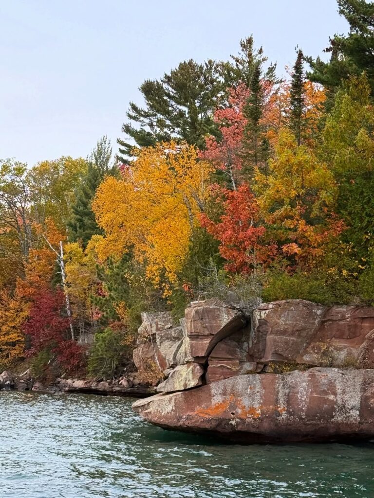
10. Wisconsin Landmarks and Natural Wonders Driving Route
- Travel Path: Cave Point County Park → Barkhausen Waterfowl Preserve → Athelstane → Long Slide Falls → Chequamegon-Nicolet National Forest → Minocqua → Copper Falls State Park → Apostle Islands National Lakeshore → Amnicon Falls State Park → Big Manitou Falls
- Total Mileage: 489 miles
- Drive Duration: Around 9.75 hours total
This long Wisconsin driving route links shoreline landscapes, forest regions, and major waterfall sites into one extended journey. It begins along Lake Michigan’s rocky edge in Door County and gradually shifts north and west through wooded terrain and river valleys.
Early stops include Cave Point County Park and Barkhausen Waterfowl Preserve, where lake views and wetland areas set a calm opening tone. Moving inland, the route passes through Athelstane and Long Slide Falls, where forest roads and smaller waterfall sites add a more remote feel to the drive.
Farther north, Chequamegon-Nicolet National Forest and Minocqua introduce long stretches of woodland and lake country. Copper Falls State Park and Amnicon Falls bring stronger waterfall scenery, while the Apostle Islands National Lakeshore adds dramatic shoreline cliffs and open water views on Lake Superior.
The route finishes near Big Manitou Falls, rounding out the journey with one of Wisconsin’s most powerful waterfall sites. This extended loop works best as a multi-day trip, giving enough time for hiking, paddling, and slow exploration across northern Wisconsin’s varied landscapes.
These Wisconsin road trip ideas are just a small sample of the many possible routes you can plan across the state, but they should help you get started while planning your next visit to the Badger State.
Do you think these rank among the top road trips in Wisconsin? What routes would you add to the list? Share your ideas—we’re interested to hear your recommendations.
You may also like :