Idaho’s most threatening roads are rarely abandoned dirt tracks with warning signs nailed to trees. Many are paved scenic highways promoted for mountain views, river access, hot springs, and small-town stops. That pleasant appearance is precisely what catches unfamiliar drivers off guard.
A clear summer morning can make a canyon highway feel harmless. Then the road enters a shaded curve, the shoulder disappears, a truck crosses the centerline, or loose stone reaches the pavement. Winter brings another set of concerns, including black ice, drifting snow, avalanche closures, and poor visibility at high passes.
The phrase “deadliest hidden roads” is not an official Idaho Transportation Department classification. There is no state table ranking these particular routes from first to worst. Still, the broader crash record supports taking rural Idaho highways seriously. During 2024, 79% of fatal single-vehicle crashes and 70% of fatal multiple-vehicle crashes happened on rural roadways. Speed, animals in the roadway, lane departure, distraction, and failure to yield were major contributing factors.
The routes below earned their place because of documented avalanche exposure, active landslides, rockfall history, sharp mountain geometry, isolation, wildlife conflicts, or repeated safety work. They are not roads to fear. They are roads that punish casual driving.
State Highway 21 From Lowman to Stanley
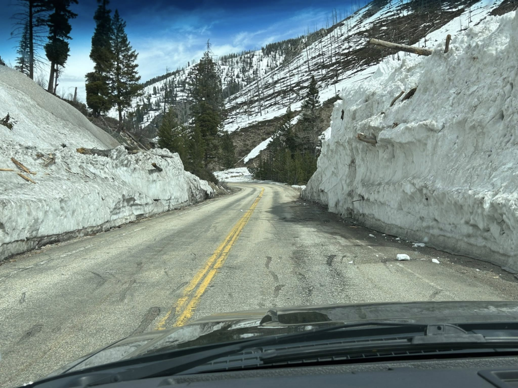
State Highway 21 between Lowman and Stanley looks like an ideal central Idaho road trip. The road passes forested mountains, hot springs, campgrounds, and the broad scenery surrounding Stanley. Yet this corridor has one of the strongest hazard records of any recreational highway in the state.
The most serious portion passes through a section widely called Avalanche Alley. Idaho transportation records place avalanche gates near milepoints 93.85 and 105.44, with Banner Creek Summit sitting between them at an elevation of about 7,046 feet. The roughly 11-mile controlled zone contains numerous slide paths capable of placing deep snow and debris across the highway.
Winter is not the only concern. Heavy rain can loosen burned soil, rocks, logs, and mud above the roadway. On July 23, 2026, ITD reported that a mudslide had closed SH-21 from Grandjean to Banner Summit between mileposts 94 and 105. Crews warned that additional rain could keep the road closed for as long as a week.
That recent closure challenges the common belief that this road becomes predictable after the snow melts. Summer thunderstorms, wildfire damage, and unstable slopes can create a fresh hazard within minutes. There are also long areas without easy detours. A closure near Banner Summit can force travelers into a much longer trip through another part of central Idaho.
The road demands patience even during clear weather. Curves tighten beside steep slopes, wildlife may enter the pavement, and cell reception can fade. Drivers should check Idaho 511 before leaving Lowman or Stanley rather than assuming the road remains open because the sky looks clear.
U.S. Highway 12 From Kooskia to Lolo Pass
U.S. Highway 12 east of Kooskia is beautiful enough to lower a driver’s guard. It follows the Clearwater and Lochsa river corridors through dense forest, rocky canyon walls, and distant mountain country. The lane markings are clear, the road is paved, and traffic may appear light. None of that makes it forgiving.
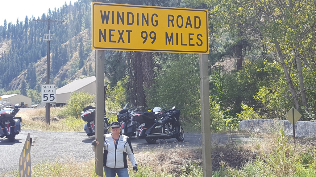
A roadside warning famously announces a winding road for the next 99 miles. That is not playful tourism marketing. The highway bends repeatedly while following the river through a remote mountain corridor. Idaho transportation records and planning documents acknowledge both the sign and the long sequence of curves.
The danger is less about one dramatic cliff and more about accumulated fatigue. A driver may handle the first 20 miles comfortably, then begin cutting curves, following too closely, or watching the river rather than the pavement. Motorcycles, recreational vehicles, commercial trucks, and passenger cars must share a road where passing opportunities can be scarce.
The river adds another psychological trap. People often treat waterside roads as relaxed scenic drives, yet many curves allow little time to correct a lane-position mistake. Rocks may fall from the uphill side, while the downhill edge may offer little recovery space. Wet leaves, frost, smoke, or rain can make the corridor far more serious than it appears in travel photos.
Fuel, food, and dependable phone service become less available farther east of Kooskia. Drivers should begin the canyon section with a full tank and allow far more time than a mileage estimate suggests. Trying to race daylight or reach Lolo Pass before a deadline can turn an enjoyable drive into an exhausting one.
State Highway 55 Through the Payette River Canyon
State Highway 55 carries heavy recreational traffic between the Boise area, Cascade, and McCall. Because thousands of vacationers use it, some visitors assume it must be an easy mountain highway. The Payette River Canyon quickly disproves that idea.
Near Smiths Ferry, the highway is pressed between steep rock slopes and the North Fork Payette River. A major rockslide struck the corridor in March 2021 and forced a closure while crews assessed the unstable hillside.
Construction has improved sections of the route, yet the road’s physical setting cannot be removed. Traffic still encounters curving canyon pavement, changing speed zones, slow vehicles, rockfall exposure, and limited space during congestion. Weekend traffic can create long lines in which impatient drivers attempt risky passes or follow the vehicle ahead too closely.
Rainbow Bridge adds another concern farther north. ITD reports that the existing bridge has narrow lanes and shoulders, tight curves on both approaches, and limited driver sight distance. Maintenance was completed to keep it operating, while a replacement bridge remains in development and could begin construction as early as 2028, depending on funding.
The strongest warning about Highway 55 is that familiarity does not remove danger. A driver who has used the route many times may become more aggressive during slow traffic. A first-time visitor may become distracted by the river. Both can make the same lane-position error.
Travel outside peak weekend hours where possible. Leave extra braking distance, accept the speed of traffic, and wait for a clearly legal passing area rather than forcing a move on a canyon bend.
U.S. Highway 95 Through Riggins and White Bird Canyon
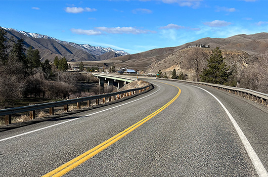
U.S. Highway 95 is Idaho’s primary north-to-south road, yet the section between Riggins, White Bird, and Grangeville feels closer to an old mountain passage than a major statewide artery.
Near Riggins, the highway follows the Salmon and Little Salmon river country beneath steep slopes. North of White Bird, it climbs sharply out of the canyon before reaching higher ground near Grangeville. Drivers face major elevation changes, truck traffic, long grades, and weather that can differ greatly between the canyon floor and the top.
Rockfall is a documented concern on White Bird Grade. In May 2022, persistent rain caused rocks to fall across lanes near the top of the grade. Later that year, ITD conducted rock scaling to remove unstable debris from the hillside before it could fall unexpectedly onto traffic.
The newer U.S. 95 alignment should not be confused with Old White Bird Grade. The historic road has numerous tight switchbacks and is far narrower. Travelers searching for dramatic viewpoints can accidentally select the older road through a map application. It offers historical interest, but it should not be treated as a quick shortcut.
Large trucks need more room on grades, and downhill vehicles can build speed quickly. A driver who becomes impatient behind a truck may accept a passing gap that is too small. The route also creates false confidence because some straighter areas appear immediately after demanding curves.
Rain deserves special caution here. Water can loosen hillside material, reduce tire grip, and hide small rocks on dark pavement. During winter, higher sections can hold ice even when Riggins is relatively mild.
U.S. Highway 20 Through Island Park and Henrys Lake
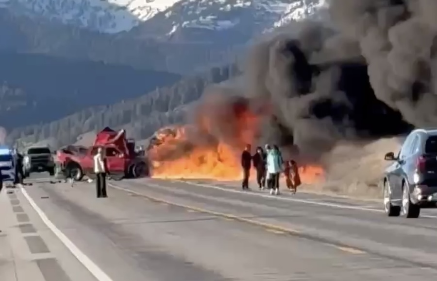
The road from Ashton through Island Park to West Yellowstone does not look as intimidating as Idaho’s deepest canyon routes. Long straight stretches, broad forest openings, and popular tourist stops can make U.S. Highway 20 appear simple.
That appearance creates its own risk. Traffic often moves at highway speed through a region used by residents, tourists, recreational vehicles, buses, motorcycles, and wildlife. Drivers may become impatient behind slower vehicles or drift mentally during long stretches before entering a busier junction.
Safety concerns along this corridor have been serious enough for ITD to pursue improvements across roughly 43 miles through Island Park. Work has included centerline safety rumble strips intended to alert drivers drifting across the middle of the road.
Wildlife is another central issue. A recent Idaho transportation study used the Henrys Lake area along U.S. 20 and State Highway 87 as a case study while examining wildlife-vehicle conflict locations.
Deer, elk, moose, and smaller animals may enter the highway, particularly near dawn, dusk, and darker forest sections. Swerving sharply can create a second emergency, especially if another vehicle is approaching or following closely.
Summer tourism also changes the rhythm of the road. Vehicles may slow suddenly for lodging entrances, trail access, gas stations, or side roads. Winter replaces congestion with blowing snow, ice, and reduced contrast between the pavement and shoulder.
The contrarian lesson is simple: the straightest road in this article may tempt drivers into the worst attention. Speed control and active scanning matter just as much here as they do on a cliffside highway.
State Highway 75 Over Galena Summit
State Highway 75 between Ketchum and Stanley is frequently marketed as one of Idaho’s finest scenic drives. The road passes the Sawtooth country, mountain valleys, forest land, and Galena Summit. The scenery is real, but so is the slope movement beneath part of the highway.
ITD identifies an active landslide on the southern side of Galena Summit at approximately milepost 156.7. The unstable area measures roughly 300 to 400 feet wide and about the same distance in length. It has damaged the highway repeatedly, shifted the road alignment, and required costly repair work.
Transportation officials warn that leaving the slope untreated could eventually allow a larger slide to block the highway for an indefinite period. That wording matters. This is not simply a rough patch of asphalt or a short construction inconvenience. It is a moving section of mountain that continues to affect the road.
Winter adds avalanche exposure, heavy snow, and ice around the summit. The Idaho avalanche team also advises on terrain at Galena Summit, reflecting the seriousness of seasonal conditions there.
During summer, drivers often stop at overlooks or watch the surrounding peaks. That distraction combines badly with mountain curves, cyclists, construction activity, and changing pavement near the slide area.
The road is worth driving, but it should not be rushed. Check for lane restrictions before leaving Ketchum or Stanley, keep attention on the pavement, and do not assume summer weather removes geologic risk.
State Highway 14 From Grangeville to Elk City
State Highway 14 is one of the less familiar roads in this article. It leaves the agricultural country near Grangeville and runs east through forested, mountainous terrain to Elk City. The route feels secluded because it is.
Isolation is part of the appeal, but it also increases the consequences of mechanical trouble, weather, rockfall, or a closure. Alternate roads may be long, seasonal, unpaved, or unsuitable for ordinary passenger vehicles.
A large slope failure on SH-14 previously cut Elk City off for several weeks. Idaho’s rock-slope research also identifies landslide and rockfall locations west of Elk City, confirming that the corridor’s problems are tied to its geology rather than one random event.
The road follows river and canyon terrain where loose rock can reach the pavement after rain, snowmelt, or repeated freezing and thawing. Fallen trees and wildfire activity can also affect access.
SH-14 feels hidden because traffic is light and communities are sparse. Yet quiet roads can create slow emergency response times. A flat tire, dead battery, or blocked lane becomes a larger problem when phone service is weak and few vehicles pass.
Travelers should begin in Grangeville with enough fuel and basic roadside supplies. More importantly, someone outside the vehicle should know the expected route and arrival time. This is not because disaster is certain. It is because minor problems last longer in remote country.

U.S. Highway 93 From Salmon to Lost Trail Pass
North of Salmon, U.S. Highway 93 enters a narrow mountain corridor before climbing to Lost Trail Pass on the Montana line. The route is a vital connection, but it contains a difficult mix of curves, grades, rock slopes, winter weather, and limited passing room.
Official Idaho transportation discussions have described Lost Trail Pass as steeper and narrower than other alternatives, with sharp curves and fewer passing lanes.
Rockfall is also a measured concern. A recent ITD geotechnical study specifically assessed the U.S. 93 corridor from Salmon to Lost Trail Pass as part of a statewide review of rock slopes and vehicle exposure.
Winter can change conditions quickly. Snow may collect at higher elevations while Salmon remains dry. Shaded bends can preserve ice long after exposed pavement has cleared. The Idaho avalanche team also provides advice for conditions around Lost Trail Pass.
Long-distance drivers are often most vulnerable here. Someone arriving after hours of travel may underestimate the mental effort required for the final climb. Fatigue reduces lane control and delays reactions to animals, rocks, or a slow vehicle beyond a curve.
A daylight crossing is usually less stressful than reaching the pass late at night. Drivers should also watch fuel levels because services thin out between communities.
Why These Idaho Roads Feel More Dangerous Than They Look
The defining threat on Idaho’s remote highways is not always a dramatic drop beside the pavement. It is the combination of several smaller pressures.
A curve becomes more serious when the shoulder is narrow. Wildlife becomes harder to avoid when the driver is tired. A harmless-looking rainstorm becomes significant when it loosens a rock slope. Congestion becomes dangerous when a driver attempts a hurried pass.
Idaho’s 2024 crash analysis found that speed was the leading recorded contributing circumstance in single-vehicle crashes. Animals in the roadway and failure to maintain a lane followed closely. Those findings match the character of these rural corridors, where high speeds, wildlife, curves, and limited recovery space frequently meet.
The common advice to “drive carefully” is too vague. A stronger approach is to lower speed before curves, increase following distance, avoid rushed passing decisions, and stop before fatigue becomes heavy. Weather and closure checks should happen before entering the remote section, not after traffic reaches a locked gate.
Road-trip schedules should also remain flexible. Idaho’s mountains do not follow hotel check-in times. A closure, thunderstorm, wildfire restriction, or snow squall may add hours to the drive. Building spare time into the day reduces the urge to speed.
The Final Reality About Idaho’s Hidden Dangerous Routes
These roads are not forbidden routes, and thousands of people travel them without incident. Calling them deadly should never imply that the pavement itself causes every crash. Driver choices remain a major part of the record.
Still, it would be equally misleading to present these corridors as ordinary scenic drives. Avalanche gates, slope-stabilization projects, rock scaling, rumble-strip programs, bridge replacement work, and recurring closures exist because the hazards are real.
The safest Idaho road trip is not the one with the strongest vehicle or the boldest driver. It is the one that respects changing conditions, accepts delays, and treats mountain roads as active environments rather than fixed attractions.
Before leaving, check Idaho 511 for cameras, weather, construction, closures, and traffic alerts. ITD specifically recommends using the service to prepare for current road conditions.