
Hawaii sells the dream of effortless island driving. Open windows, warm air, coastal views, and roadside waterfalls seem to promise a relaxed day behind the wheel. Yet some island roads tell a harsher story.
The most hazardous routes are rarely high-speed freeways. They are narrow mountain roads, cliffside lanes, rough coastal tracks, and remote volcanic drives. A wrong turn may lead to an unpaved section with no fuel, weak phone service, or few safe places to turn around.
There is no official government ranking of Hawaii’s “deadliest hidden roads.” Still, transportation agencies, park officials, police reports, and local authorities document real hazards across these routes. The danger usually comes from road width, sharp bends, falling rocks, flooding, altitude, driver inexperience, or distance from emergency help.
Kahekili Highway on West Maui
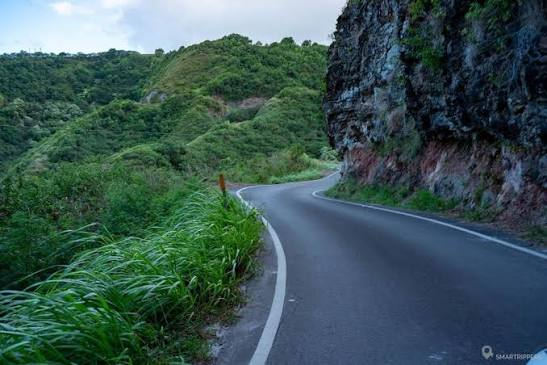
Kahekili Highway, also called Route 340, follows the northern edge of West Maui between the Waiheʻe area and the Kapalua side of the island. It receives far less attention than the Road to Hāna, which may be exactly why unprepared travelers end up here.
A transportation study describes the remote connection between Kahekili Highway and Honoapiʻilani Highway as a winding, single-lane country road that does not meet current roadway standards. Drivers may face blind corners where two vehicles cannot pass comfortably. Rock walls rise beside the pavement, while other sections sit beside steep coastal slopes.
The road can feel manageable at first. That changes near Kahakuloa, where the lane narrows and traffic must negotiate bends without clear sightlines. A driver may need to stop or reverse until an approaching vehicle reaches a wider section.
Weather creates another problem. Maui County has repeatedly closed parts of Kahekili Highway during flooding and hazardous road conditions. Closures recorded during March 2026 show how quickly access can change after severe weather.
This is not the route for a rushed airport transfer or a nervous driver testing an unfamiliar rental car. It is best treated as a remote local road rather than a shortcut around West Maui.
Hāna Highway through East Maui
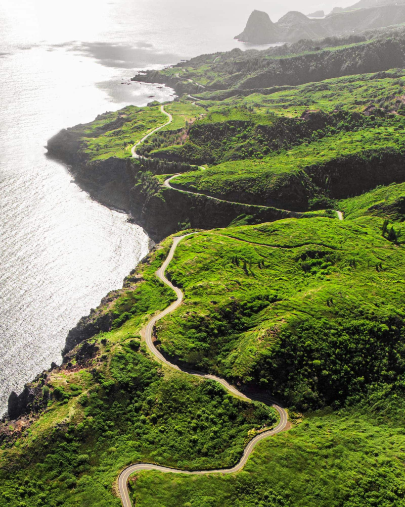
Hāna Highway looks harmless on a map. Hāna sits roughly 52 miles from Kahului, yet the drive may require two to four hours without lengthy stops. Route 360 contains about 620 curves and 59 bridges, including many narrow bridge crossings.
The major threat is not one terrifying section. It is the steady accumulation of small risks. Drivers face wet pavement, repeated blind turns, one-lane bridges, roadside pedestrians, slow sightseeing traffic, and vehicles stopping near waterfalls.
Rain can turn an ordinary drive into a road-closure situation. Maui County warnings have reported flooding near Hāna and stated that heavy rain may trigger rockslides and mudslides in steep terrain.
Visitor behavior adds to the pressure. Sudden braking near roadside attractions can surprise following traffic. Poorly parked vehicles may partly block the lane. Local residents also use this highway for work, medical appointments, school travel, and basic errands.
The safer approach is not to race the clock. Begin early, stay within marked parking areas, yield where required, and turn back when conditions worsen. The road may be famous, but fame has not made it forgiving.
Piʻilani Highway and the Back Road Beyond Hāna
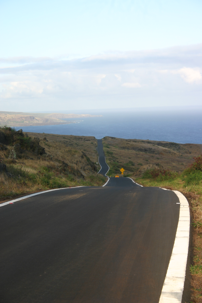
The southeastern road beyond Hāna is often called the Back Road to Hāna. It follows portions of Piʻilani Highway and Hāna Highway through Kīpahulu, Kālepa, Kaupō, and ʻUlupalakua.
Many visitors assume the route offers an easy loop back to central Maui. That assumption can collapse once the road becomes narrower, rougher, and more isolated. Some sections pass dry coastal slopes, unstable rock faces, and areas far from fuel or dependable phone reception.
Rockfall is a documented concern. Maui County began a rockfall-netting replacement project near Kālepa Point between mile markers 38 and 39 in June 2026. Weekday daytime closures were expected to continue for about five months.
Earlier closures near Kīpahulu were also linked to unstable cliffs and rockfall hazards. These incidents show that the problem is not travel-blog exaggeration. The landscape can physically block the road.
Rental agreements deserve close attention here. A road may appear on a digital map while still falling outside the permitted driving area in a rental contract. Roadside assistance may also be limited if the driver enters a prohibited section.
This route should never be treated as an automatic return road from Hāna. Current closures, weather, rental terms, fuel level, and remaining daylight must all support the decision.
Maunakea Summit Access Road
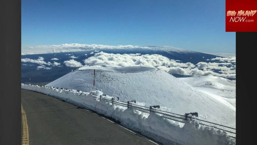
Maunakea Summit Access Road replaces tropical scenery with a high-altitude volcanic landscape. The real danger is not a cliffside photo opportunity. It is the long, steep descent after reaching nearly 14,000 feet above sea level.
The eight-mile summit road rises almost 5,000 feet above the Visitor Information Station. Parts of it are unpaved, rough, steep, and narrow enough for single-lane traffic. Four-wheel-drive vehicles are required above the visitor station.
Brake overheating is the central driving risk. Officials instruct motorists to use four-wheel-drive low range and lower gearing during the descent. Holding the brake pedal continuously can create dangerous heat and reduce braking performance.
Altitude also affects passengers and drivers. The Visitor Information Station sits at about 9,200 feet, and the summit stands much higher. Officials warn that certain visitors, including children under 13 and people with some health concerns, should not continue above the station.
The road may close because of ice, snow, strong wind, poor visibility, or other hazards. A standard all-wheel-drive crossover may not meet the four-wheel-drive low-range requirement. Vehicle capability must be confirmed before the climb begins.
Chain of Craters Road on Hawaiʻi Island
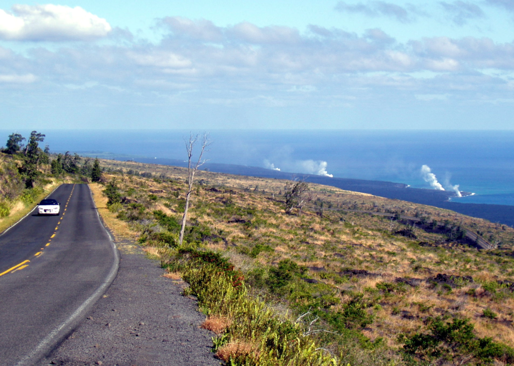
Chain of Craters Road runs about 18.8 miles from the Kīlauea summit area down through Hawaiʻi Volcanoes National Park. It is paved and accessible to normal two-wheel-drive vehicles, which makes it appear less threatening than the roads above.
The danger comes from isolation, changing volcanic ground, wildlife, weather, and visual distraction. The National Park Service states that driving may be the most hazardous activity visitors undertake in the park because of narrow roads, sharp curves, and attention-grabbing scenery.
There is no food, fuel, or drinking water available along the route. Phone reception can be limited, and an emergency phone is located at the Puʻuloa Petroglyphs trailhead.
Volcanic activity can also damage the pavement. In 2024, earthquakes created cracks and ground faults that forced temporary closures. Officials later reopened the road with warnings about bumps, rough surfaces, and damaged areas.
Wildlife deserves attention as well. The National Park Service reports that vehicles are a leading cause of adult nēnē deaths within the park. Drivers should slow down near birds, pedestrians, parking areas, and pavement cracks.
Maunaloa Road in Hawaiʻi Volcanoes National Park
Maunaloa Road branches away from the busier areas of Hawaiʻi Volcanoes National Park and climbs through forested volcanic terrain. It does not carry the dramatic reputation of Maunakea, yet its quiet setting can create false confidence.
The National Park Service includes Maunaloa Road in its driving-safety guidance alongside Chain of Craters Road, Crater Rim Drive, and Hilina Pali Road. Officials warn about narrow lanes, sharp curves, limited phone service, fast-changing weather, fog, and distracting views.
The road can feel empty, especially outside peak visitor periods. That emptiness means help may not arrive quickly after a breakdown. Fog may reduce the visible road distance, while rain can make bends and shaded pavement slick.
Drivers should carry water, food, basic emergency supplies, and suitable clothing. The lack of crowds does not make the road harmless. It simply means fewer people may witness a problem.
Waimea Canyon Drive and Kōkeʻe Road
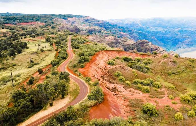
Waimea Canyon Drive and Kōkeʻe Road climb from western Kauaʻi into the highlands of Waimea Canyon and Kōkeʻe State Parks. The ascent passes canyon overlooks, forest roads, and mountain viewpoints.
The roads are paved, but the combination of steep grades, repeated curves, rain, low clouds, roadside parking, and sudden stopping creates a difficult driving environment. Drivers often pay more attention to the canyon than the lane ahead.
Road repairs and damaged sections are recurring issues. State park notices have warned visitors about roadwork, delays, limited parking, and storm-damaged roads in the Kōkeʻe area.
Conditions near the upper lookouts may differ sharply from conditions near the coast. A clear morning in Waimea can become foggy or wet at higher elevation. Limited visibility makes roadside pedestrians and parked cars harder to see.
The return drive deserves equal caution. Long downhill sections encourage drivers to carry too much speed into bends. Lower gearing can reduce constant pressure on the brakes during the descent.
Polihale State Park Access Road
Polihale State Park sits beyond the paved western highways of Kauaʻi. Reaching it requires driving roughly five miles on an unimproved dirt access road.
The state warns that this road may flood during rain and become impassable. Deep sand can appear in other sections, and four-wheel drive is recommended. Some rental companies prohibit their vehicles from using the access road.
This warning matters because the road has a history of severe mud and flood problems. During wet periods, officials have described it as a river of mud, with potholes and further damage forming as the ground begins to dry.
A sunny forecast elsewhere on Kauaʻi does not prove this road is ready. Recent rainfall, standing water, soft sand, and vehicle clearance may decide whether the trip ends at the beach or beside a stuck car.
Drivers should also remember that the beach itself has strong offshore currents. The access challenge does not end when the vehicle reaches the park.
North Lānaʻi Dirt Roads
Lānaʻi creates a different type of road-trip risk. Only about 30 of the island’s 400 road miles are paved. Many northern attractions require four-wheel drive on rocky, uneven, or sandy tracks.
Routes to Kaiolohia, Keahiakawelo, and other remote areas may look short on a map. Travel times grow quickly on rutted ground, especially after rain. A full tank of fuel is important because services outside Lānaʻi City are scarce.
The lack of stoplights and traffic can make the island feel easy to cross. In reality, the quiet roads demand patient driving. Dust may hide potholes or reduce another driver’s visibility. Narrow tracks may also leave little room for passing.
This is off-pavement travel rather than a normal sightseeing loop. Visitors should use an approved four-wheel-drive vehicle, follow local access rules, and return before darkness makes road conditions harder to read.

Tantalus Drive and Round Top Drive on Oʻahu
Tantalus Drive and Round Top Drive form a wooded mountain loop above Honolulu. The route sits close to the city, yet its tight bends and shaded slopes feel far removed from urban streets.
Drivers share the road with cyclists, runners, walkers, and local residents. Blind curves can hide vulnerable road users until the final moment. Leaves, rain, darkness, and downhill speed can further reduce reaction time.
The risk is supported by police reports. In February 2025, a cyclist died after a collision at Tantalus Drive and Moreira Street. In August 2025, a motorist was critically injured after losing control at high speed and striking a tree on Tantalus Drive.
These cases do not mean every drive on Tantalus ends badly. They show why the route should not be treated as a private mountain racetrack. Speed that seems moderate on a straight road may be excessive before a blind bend.
Daylight offers better visibility, but drivers must still expect cyclists or pedestrians around any corner. Passing should occur only where the view ahead is clear and enough space exists.
Why Hawaii’s Hidden Roads Become Dangerous So Quickly
Hawaii’s road hazards rarely come from one factor. Narrow pavement becomes worse when rain arrives. A steep descent becomes more serious when a driver uses the brakes incorrectly. An isolated dirt track becomes risky when a rental car lacks proper clearance.
Digital maps can also create overconfidence. A route shown as connected may include unpaved sections, temporary closures, damaged pavement, or roads barred under a rental agreement. Estimated driving times may fail to account for one-lane bridges, fog, flooding, or local traffic.
The smarter choice is sometimes turning around. That decision may feel disappointing after driving for an hour, but a road trip is not improved by pushing through deep water, unstable rockfall zones, heavy fog, or prohibited terrain.
Check official transportation notices, park alerts, weather warnings, and rental terms before departure. Repeat the check on the morning of the drive because island conditions can change overnight. Hawaii rewards patience far more than bravado.