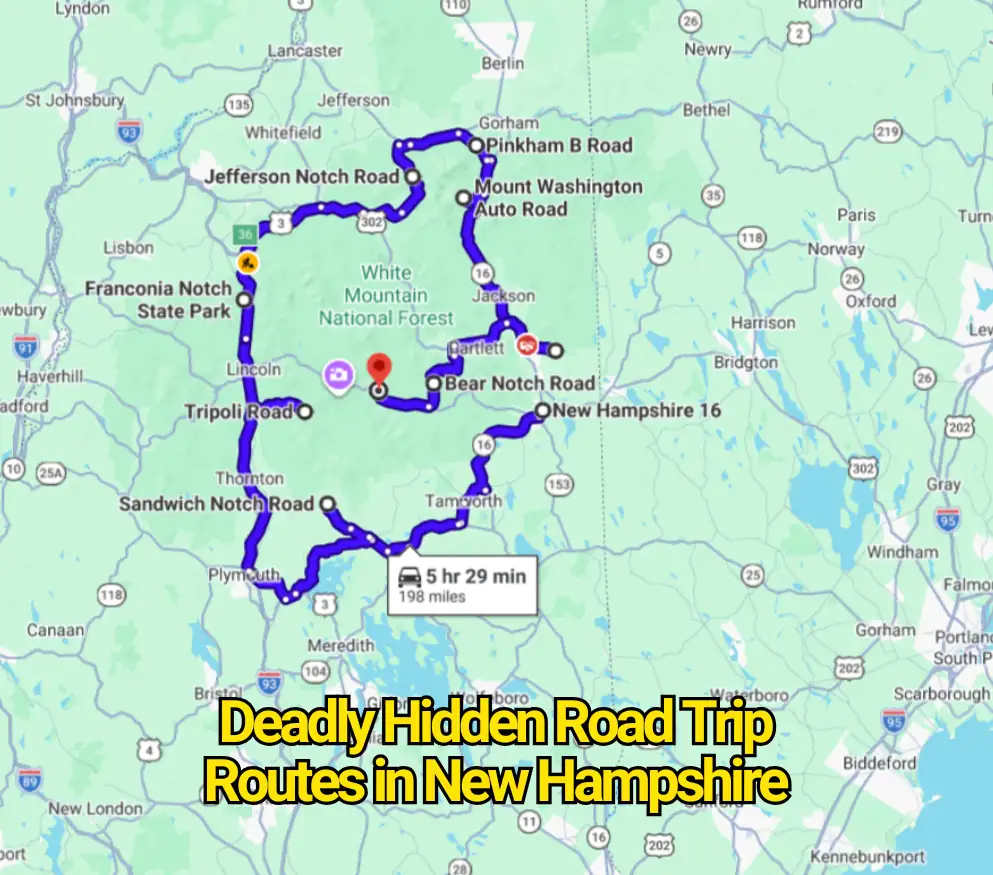
New Hampshire road trips sell themselves with mountain ridges, covered bridges, fall color, and quiet forest pavement. That polished image hides the part many visitors learn too late: some of the state’s prettiest roads demand more judgment than their mileage suggests.
The phrase “most deadly” sounds like an official ranking, but no state agency publishes a list under that name. The honest story is sharper. New Hampshire has steep private mountain roads, seasonal dirt corridors, crowded scenic highways, and remote forest crossings where weather, weak phone service, rough surfaces, and driver error can pile up quickly.
These routes are not automatic death traps. They become dangerous when visitors treat them like ordinary sightseeing roads.
Mount Washington Auto Road
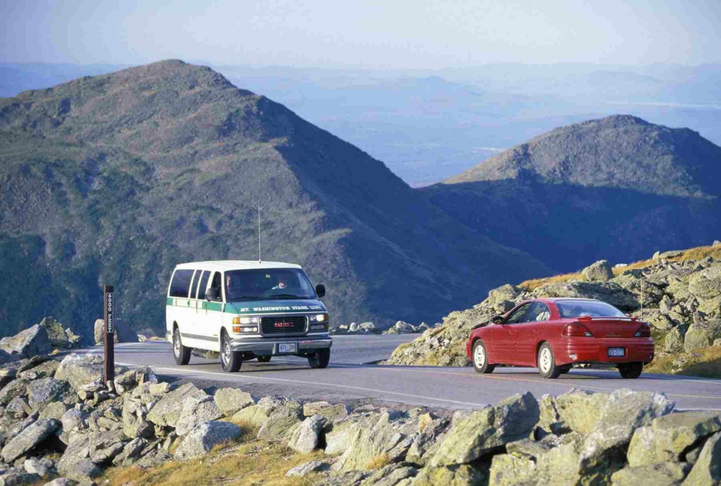
Mount Washington Auto Road is the clearest example of a road that looks theatrical but carries real mechanical demands. The route climbs 7.6 miles, averages a 12 percent grade, and runs along narrow sections without guardrails. The operator tells drivers to use the lowest gear on the descent, avoid riding the brakes, and stop at turnouts if the brakes become too hot. Certain vehicles are restricted because size, weight, and braking performance matter on this climb.
The contrarian point is that the road’s reputation can be more frightening than its record. The Auto Road says three fatalities have occurred during more than 150 years of operation. That does not make the drive harmless, but it shows why the bigger problem is often poor preparation rather than the road acting like a random killer. Weather can also close the route, and motorcycles may be stopped during high winds or wet conditions.
A careful driver should arrive with a suitable vehicle, follow staff directions, leave space ahead, and resist the urge to rush downhill. The most stressful moment often comes after the summit, when repeated braking can build heat. The mountain view is the attraction; brake management is the part that deserves full attention.
Kancamagus Highway
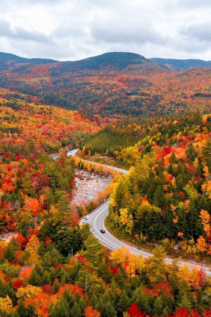
The Kancamagus Highway is hardly hidden, yet its risk is easy to underestimate because it is promoted as one of New Hampshire’s signature scenic drives. The main mountain section covers 34.5 miles between Lincoln and Conway. There are no gas stations along that stretch, and official tourism guidance warns that cell service can be minimal or absent. During peak foliage traffic, a drive that might take about 45 minutes without congestion can stretch to two or three hours.
That combination changes the character of the road. Drivers may brake suddenly for overlooks, trailheads, wildlife, pedestrians, or vehicles waiting for parking. Long dark sections can feel emptier after sunset, while rain, fog, early snow, and wet leaves can reduce grip. The highway is paved and maintained, but the forest setting can create a false sense that traffic will stay light.
The sensible approach is to fuel up before entering, download directions, and expect delays during foliage season. A scenic highway becomes risky when one driver watches the trees instead of the centerline and another stops unexpectedly for a photo.
Hurricane Mountain Road
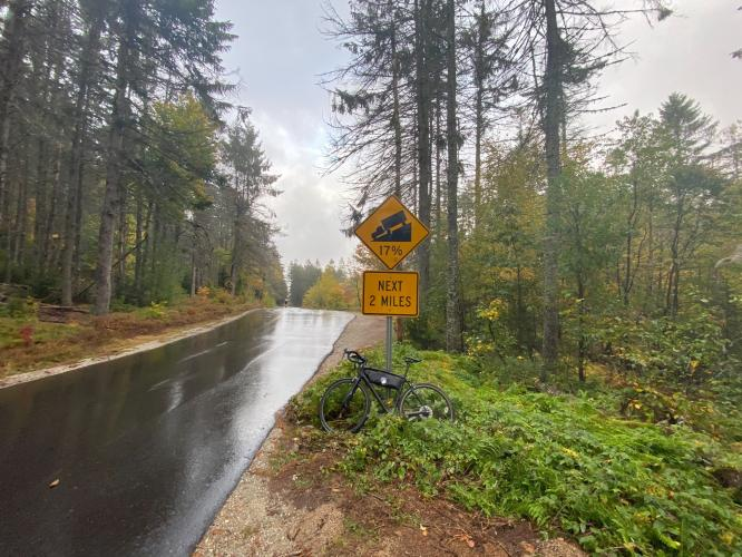
Hurricane Mountain Road crosses between the North Conway side and Chatham. It is a seasonal mountain road known for steep pitches, tight bends, limited sight distance, and rapid elevation changes. New Hampshire’s Department of Transportation closes it for winter and reopens it after spring thaw restrictions are lifted and storm debris has been cleared.
This is the sort of road that exposes weak habits. A driver can enter from a busy tourist area and suddenly face a narrow mountain crossing where oncoming traffic appears around a bend. Wet pavement and fallen leaves can make downhill braking less predictable, while frost may linger in shaded sections.
The road’s danger is not based on great distance. It comes from compression: steep grades, curves, seasonal conditions, and little time to correct a bad line. Large vehicles and nervous drivers may find it far less comfortable than the map suggests.
Sandwich Notch Road
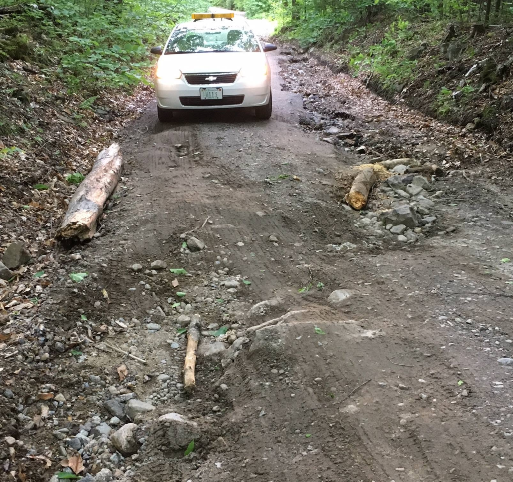
Sandwich Notch Road runs between the Sandwich area and Thornton through forest and old hill-country terrain. It is a seasonal dirt road with short steep grades, rough surfaces, drainage channels, stones, ruts, and sections where two vehicles may need to pass carefully. Regional travel guidance recommends a high-clearance four-wheel-drive vehicle, while other local references describe it as open to vehicles outside winter.
Calling it a shortcut misses the point. A paved route may take longer on paper yet save time once slow speeds, potholes, mud, and careful passing are considered. Ordinary low-clearance cars may scrape underneath or struggle after heavy rain. A road that was manageable last week can change after one storm.
Drivers should treat the route as a backroad excursion, not a time-saving cut-through. Turning around early is a sensible decision when washouts, deep ruts, standing water, or a closed gate appear. Google Maps cannot judge ground clearance or fresh storm damage.
Jefferson Notch Road
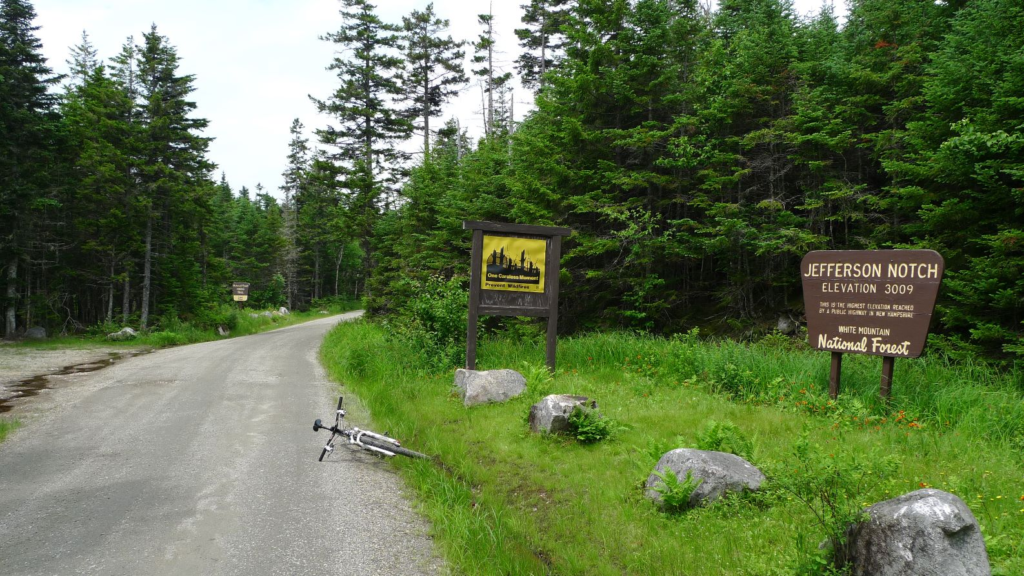
Jefferson Notch Road reaches the Caps Ridge trailhead area at roughly 3,008 feet, described by local outdoor guidance as the highest-elevation trailhead on a public road in the White Mountains. The road is seasonal, and Forest Service maps mark seasonal motor-vehicle designations in this part of the national forest.
Elevation is only part of the issue. The route includes gravel, loose edges, ruts, narrow travel space, and long stretches with limited roadside help. Rain can soften the surface, while early or late-season cold can leave ice in places that receive little sun. Visitors headed for a hike may arrive focused on the trail and give too little thought to the drive.
The road deserves slower speeds than its open stretches appear to allow. Meeting another vehicle on a narrow section may require patience and backing to a wider point. A closed gate should end the attempt immediately; bypassing it risks entering a road closed for safety or surface protection.
Bear Notch Road
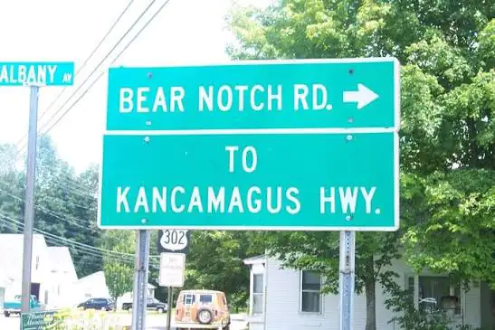
Bear Notch Road links the Bartlett area with the Kancamagus Highway. It passes through the White Mountain National Forest and is part of a network where seasonal road closures are common. The Forest Service says roads may close because snow, drifts, and ice make them impassable or because traffic would damage the roadbed.
In summer and fall, the road may feel calm compared with nearby tourist corridors. That calm can encourage faster driving, even though wooded curves, cyclists, hikers, wildlife, damp pavement, and narrow shoulders can appear with little warning. Leaf cover can also hide broken pavement or gravel near the edge.
The hidden risk is confidence. Drivers often relax because the road seems empty, then reach a bend carrying too much speed. Bear Notch Road rewards a steady pace and becomes a poor choice after storms or near the seasonal closing period.
Tripoli Road
Tripoli Road is an 11-mile connection between Route 49 in Waterville Valley and Interstate 93 near Thornton. A Forest Service assessment describes it as partly paved and mostly gravel, with eight miles passing through national forest land. It generally serves through traffic and recreation access from about mid-May through November.
The route also serves camp areas, trailheads, and roadside recreation. That means drivers can encounter parked vehicles, people near the roadway, turning traffic, dust, gravel, and cars entering from small access points. The Forest Service has carried out planning tied to campsite relocation and roadside hazard-tree removal, showing that safety concerns extend beyond the driving surface itself.
Tripoli Road is less intimidating than Mount Washington, but that can make it more deceptive. A driver may travel faster because the road appears broad and manageable. Loose gravel lengthens stopping distance, dust can hide an approaching vehicle, and weekend recreation traffic can create sudden conflicts.
Pinkham B Road
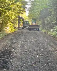
Pinkham B Road, also called Dolly Copp Road, runs through the northern White Mountains between the Route 2 area near Randolph and the Route 16 side near Pinkham Notch. Forest Service material identifies Dolly Copp roads within the motor-vehicle network and marks seasonal use in the Presidential Range area.
The route is quieter and rougher than the major highways around it. Dirt surfaces, mud, potholes, fallen branches, and weak phone reception can turn a simple drive into a slow retreat. The road also serves trail access, so parked cars and hikers may appear near narrow sections.
This is a route where backup matters. A downloaded map, enough fuel, daylight, and a vehicle suited to rough roads reduce the chance that a minor problem becomes a long wait. Seasonal gates and posted closures must be treated as final.
NH Route 16
NH Route 16 does not fit the usual image of a hidden mountain road. It is a major north-south corridor carrying local traffic, trucks, vacationers, and visitors headed for Conway and the White Mountains. That traffic mix is exactly why it belongs in the conversation.
A corridor safety assessment covering about 27 miles from the Ossipee-Wakefield town line to the Conway-Bartlett town line recorded 957 reported crashes during 2008 through 2012. The report counted 11 fatalities, 21 incapacitating injuries, and 194 possible or non-incapacitating injuries during that study period. Those numbers are historical rather than a description of present-day conditions, but they show that this road’s risk has been studied as a serious transportation issue.
The threat here is less about dirt or cliffs and more about speed differences, intersections, turning vehicles, congestion, and impatience. A driver leaving a slow tourist district may accelerate just as another vehicle turns across traffic. Route 16 proves that the road with the most dramatic mountain view is not always the road with the strongest crash evidence.
Franconia Notch Parkway
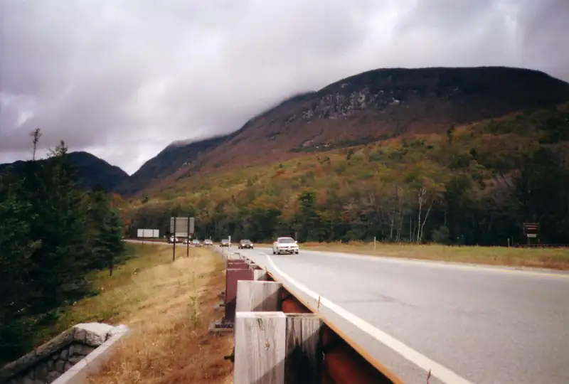
Franconia Notch Parkway carries Interstate 93 through one of New Hampshire’s best-known mountain corridors. Its interstate number can create the wrong expectation. Drivers may assume wide, forgiving highway conditions even as snow, fog, freezing temperatures, heavy recreation traffic, and narrow mountain geography affect the trip.
New Hampshire DOT warns that parking is prohibited along Interstate highways, including I-93 through Franconia Notch. The agency says vehicles that interfere with winter maintenance may be towed, and roadside parking puts motorists and plow operators at risk.
The greatest trouble often appears during popular hiking days or winter storms, when legal parking fills and drivers look for improvised spaces. Stopping on an interstate shoulder for recreation is not a harmless convenience. It reduces room for emergency response, snow removal, and drivers recovering from slippery conditions.
Why These Roads Feel Safer Than They Are
New Hampshire’s mountain roads rarely announce danger with one dramatic feature. The risk usually arrives as a stack of ordinary problems. A curve follows a wet shaded section. A driver is watching foliage. Cell service disappears. A fuel gauge drops. A dirt road becomes rougher after a storm. A parking area is full, and someone makes a rushed decision.
That is why the phrase “locals warn about” should be understood as road respect, not folklore. Experienced drivers do not need every route to be terrifying. They check the season, weather, vehicle limits, fuel level, daylight, and closure status before leaving pavement.
The most hazardous decision may be continuing because the trip was already planned. Gates, washouts, ice, brake heat, poor visibility, or an unsuitable vehicle are valid reasons to turn back.

How to Check Conditions Before the Drive
Forest roads can close seasonally because of snow, ice, storm damage, or the need to protect soft roadbeds. The White Mountain National Forest posts alerts and closure information, while New England 511 combines official information reported by NHDOT, MaineDOT, and VTrans with additional traffic data.
A Google Maps route should be treated as a planning sketch rather than proof that every segment is open or suitable. Check official status on the day of travel, obey gates and signs, and choose a paved alternative when conditions or vehicle clearance are uncertain.