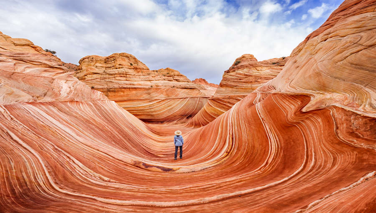
Stunning lunar-like landscape of the Wave in Vermilion Cliffs National Monument, straddling the border of Utah and Arizona. Story and photography by Jerry Ginsberg. While the Southwest’s four states—New Mexico, Arizona, Colorado, and Utah—boast 13 national parks, the region’s breathtaking natural beauty extends far beyond park boundaries.
Much of the precious wilderness beyond national park boundaries is also protected, primarily as federal lands and, in some cases, state parks. Among the most notable is Vermilion Cliffs National Monument. Encompassing the former Paria Wilderness, this 294,000-acre expanse along Arizona’s northern edge surpasses the size of several national parks. While the lengthy Paria Canyon hike is a highlight, the Wirepass Trailhead offers access to two distinct hikes, each with unique photographic opportunities. One standout feature is the Coyote Buttes, known for their striking, sensuously rounded red rock formations.
Hiking in the Paria
To reach the Wirepass Trailhead, drive west from Page, AZ, or east from Kanab, UT, along Route 89. Turn south onto House Rock Road and continue for 8 to 8.5 miles until you reach the parking area on the right. From there, cross the small road, descend into the dry wash, and turn left.
Following the wash leads to a ‘T’ intersection at a tall rock wall. Turning right takes you into the renowned Buckskin Gulch, a stunning but narrow slot canyon. Be cautious of flash flood risks by checking the weather forecast, as rain anywhere in the region can make this route dangerous. Ideally, visit on a bright, sunny day—not only for safety but also for the best photography conditions. Cloudy days won’t provide the light needed for striking slot canyon images.
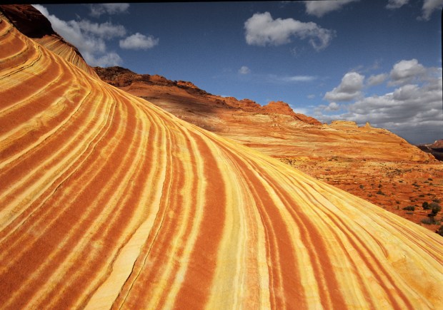
Wave Pool Reflection
As you enter the Wave area, you’ll encounter a shallow rock depression known as the Wave Pool. Though it rarely holds water, it can collect rain, creating a perfect reflection. To guarantee this view, consider carrying an extra liter of water to fill the pool yourself.
Slot Canyon Photography
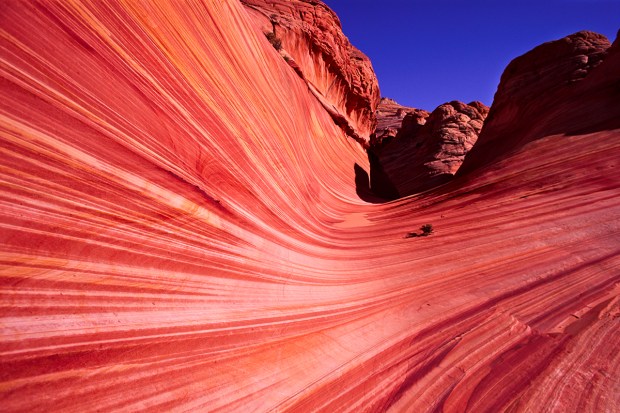
Unlike traditional landscape photography, slot canyons shine brightest under clear, sunny skies, especially when the sun is directly overhead or near its peak. As sunlight filters through the narrow canyon openings, it illuminates one wall, casting a warm glow that reflects onto the opposite side. This reflected—and sometimes re-reflected—light creates stunning images, highlighting the rich, multi-hued rock surfaces.
To capture the best shots, focus on contrasts in color and light while experimenting with compositions. Excluding the sky from your frame often enhances the final result, drawing attention to the intricate details and textures within the canyon.
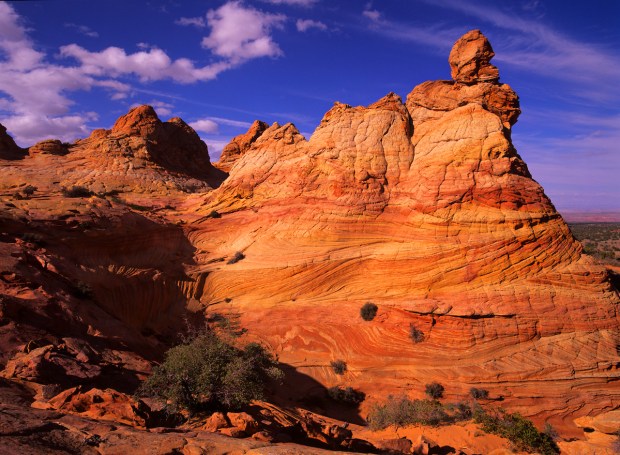
South Coyote Buttes
One of the most iconic formations in the region lies in the South Coyote Buttes. Reaching this remote area requires a challenging drive, best tackled with a four-wheel-drive vehicle and high ground clearance. The effort, however, rewards visitors with extraordinary landscapes perfect for adventurous photographers.
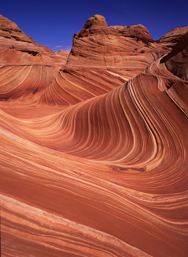
Coyote Buttes
From the same Wirepass Trailhead, another path leads to the North Coyote Buttes, home to the iconic Wave. Accessing this area requires a permit from the Bureau of Land Management (BLM). Permits are distributed through an online lottery held 4 to 6 months in advance, with a limited number also available 1 to 2 days prior at the BLM/Interagency Ranger Station along Route 89, just east of Kanab, Utah.
However, securing a permit is just the first step—reaching the Buttes requires navigating rugged terrain, making preparation and route knowledge essential for a successful visit.
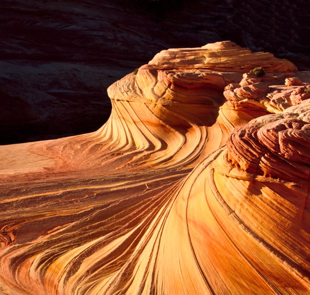
Swirls
The Swirls, a striking sandstone formation, lies about 150 yards above the Wave. The best time to capture its intricate patterns is just before the sun dips behind the western rock wall. Once the light fades, it’s time to start your return hike.
For photography, pack a range of wide-angle and short telephoto lenses, ideally covering 20 to 100 mm (full-frame equivalent), along with a sturdy tripod. Equally important is hydration—carry at least two liters of water per person. Keep in mind that while more gear improves your shots, it also means a heavier pack for the long trek back, aside from the water you’ll have already used.
South Coyote Buttes
The South Coyote Buttes, a lesser-known gem, can be tricky to reach. Accessing the area from the opposite side involves navigating sandy stretches and exposed rock, requiring a high-clearance, four-wheel-drive vehicle. Off-road tires are also highly recommended.
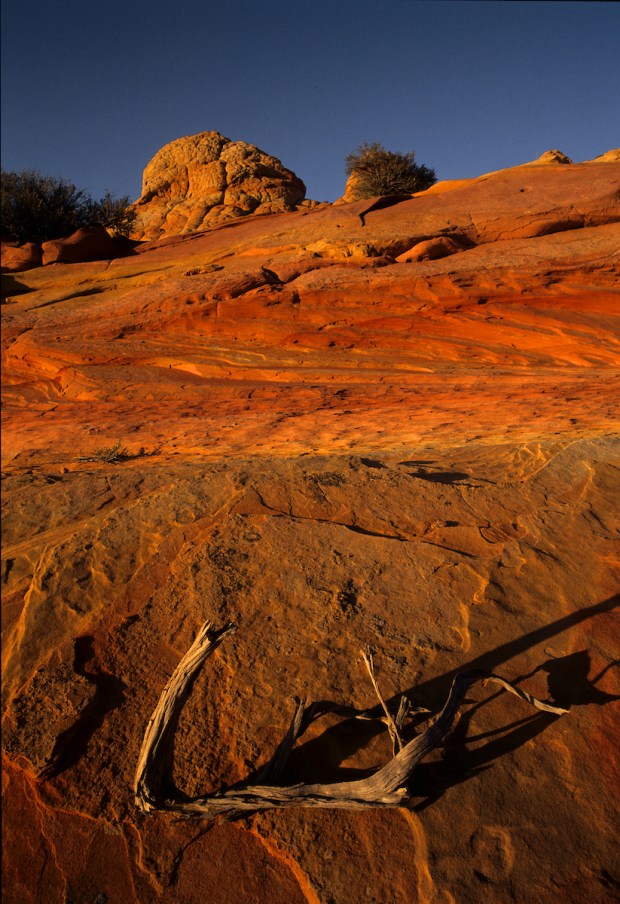
Both the North and South Coyote Buttes feature remarkable cone-shaped formations known as “teepees.” When I first explored this breathtaking landscape years ago, it was nearly untouched. Unfortunately, decades of heavy foot traffic have taken a toll on the fragile sandstone. To help preserve this special place, it’s essential to follow the Leave No Trace principles.
Though often overlooked, the South Buttes offer stunning compositions and unique photographic opportunities for those willing to make the journey.
Lake Powell & Gunsight Butte
For another stunning photo opportunity nearby, head to Gunsight Butte on the edge of Lake Powell. When water levels are high, the butte appears as an island, creating a striking panoramic scene under the right light.
To reach a viewpoint overlooking this unique formation, drive north through the small town of Big Water, UT. From there, follow the network of unpaved roads leading toward the lakeshore. A GPS is highly recommended for navigating these backroads.
While the unpaved roads (except for those leading to South Coyote Buttes) are typically well-maintained and suitable for standard passenger vehicles, opting for one with higher clearance adds extra peace of mind. Four-wheel drive is generally unnecessary.
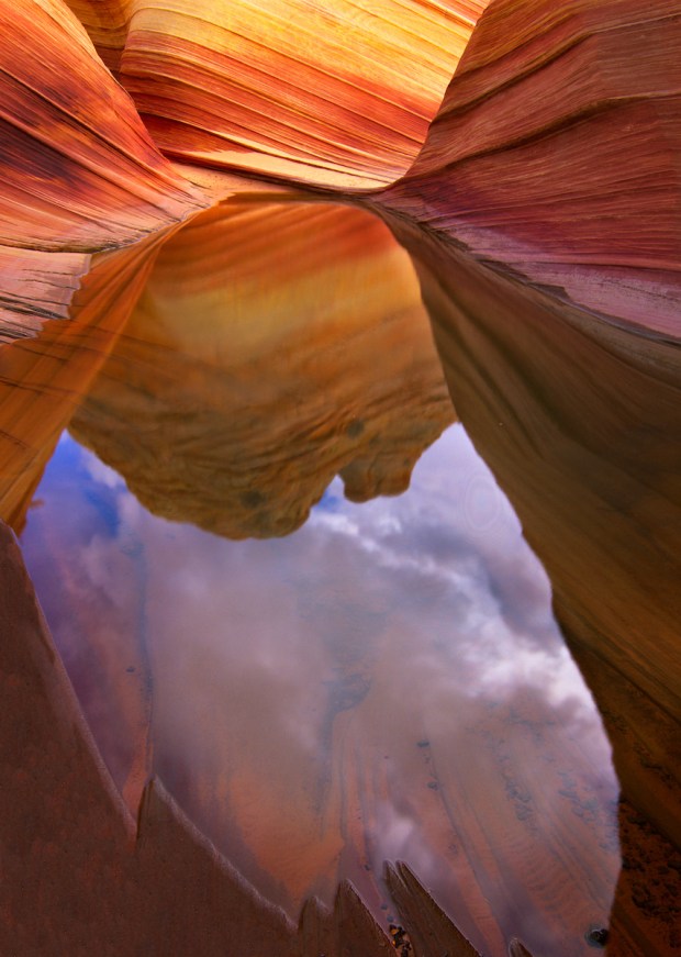
Entrance to the Wave
Once you reach the inviting entrance to the Wave, it’s just a few more steps before you find yourself standing at the heart of this breathtaking natural wonder.
For convenient lodging, consider staying in either Page, AZ, or Kanab, UT. Both towns cater to tourists, offering a variety of motels, restaurants, and casual dining options. While Kanab provides easy access to Zion National Park, Page is often the better choice for photographers, thanks to its proximity to several other scenic spots right on the town’s outskirts.
Though Vermilion Cliffs National Monument is officially located in Arizona, some trails occasionally cross the state line into Utah, adding a touch of border-hopping to your adventure.

Jerry Ginsberg is an accomplished nature and travel photographer whose stunning landscape images have appeared on hundreds of book covers, magazines, and travel catalogs. Notably, he is the only photographer to have captured every U.S. National Park using medium-format cameras.
His work has been exhibited nationwide, earning numerous awards and recognition. Jerry has also been honored with Artist Residencies in several National Parks, further solidifying his legacy as a leading voice in landscape photography.