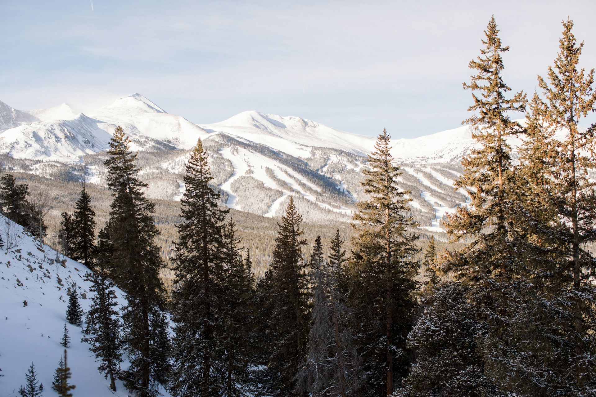
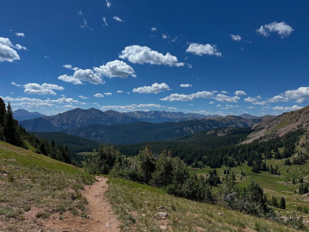
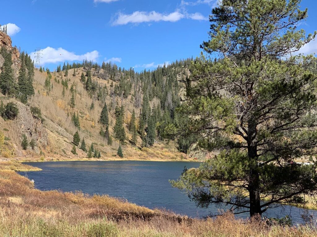
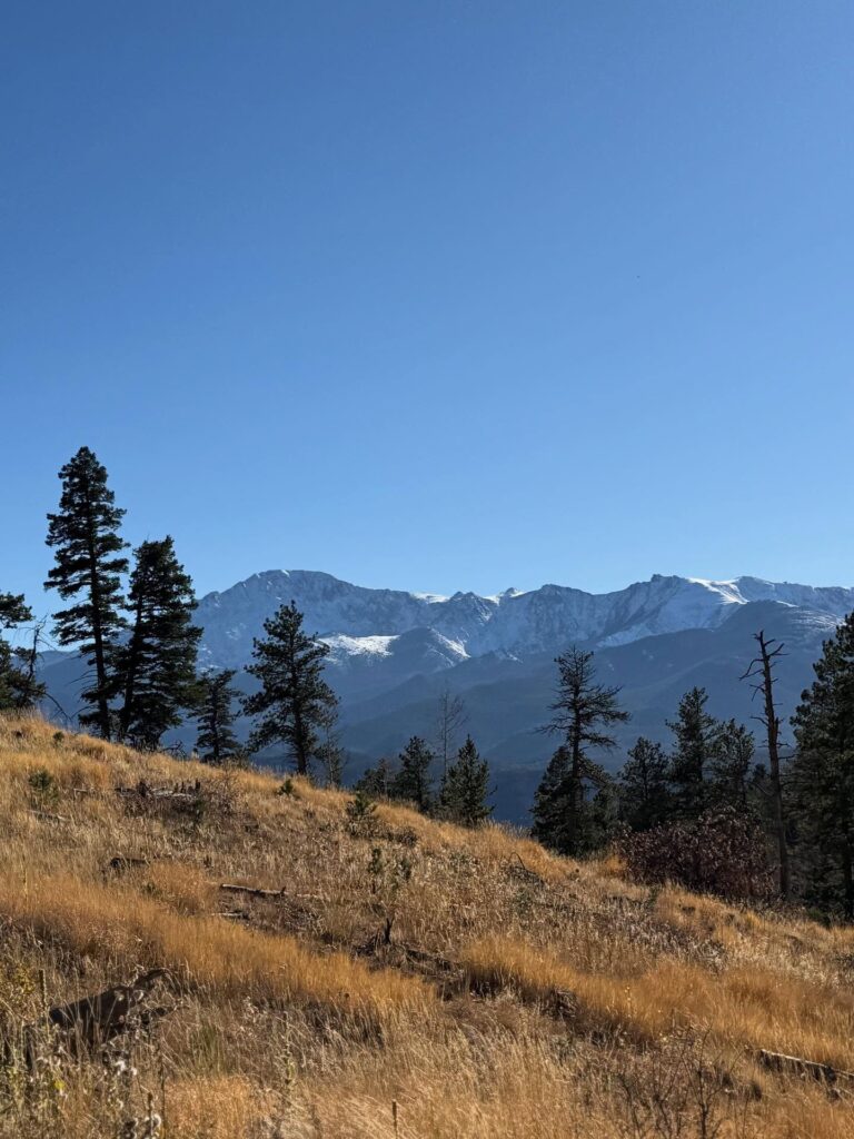
Breckenridge, Colorado, offers a variety of hiking experiences that range from easy family trails to the challenging 14ers. Located just 90 minutes from Denver, it’s a haven for outdoor enthusiasts year-round. Summer in Breckenridge draws locals and tourists alike with wildflower hikes, alpine treks, and numerous mountain biking paths. You can enjoy fly fishing on the Blue River or water sports on nearby Dillon Reservoir. For those seeking even more adventure, the area offers ATV rides, horseback riding, and off-road jeep tours through the White River National Forest. Just a short drive from Denver, Breckenridge serves as an ideal base for your Colorado summer getaway.
For families like Melody’s, Breckenridge has become synonymous with summer fun. Every year, they explore the area’s best trails, taking on the high elevation hikes and checking off new adventures. Over time, they’ve created a vault of favorite hikes in this charming mountain town, ensuring that there’s always something new to discover. Whether you’re hiking the alpine routes or simply enjoying the local activities, Breckenridge offers a perfect mix of exploration and relaxation.
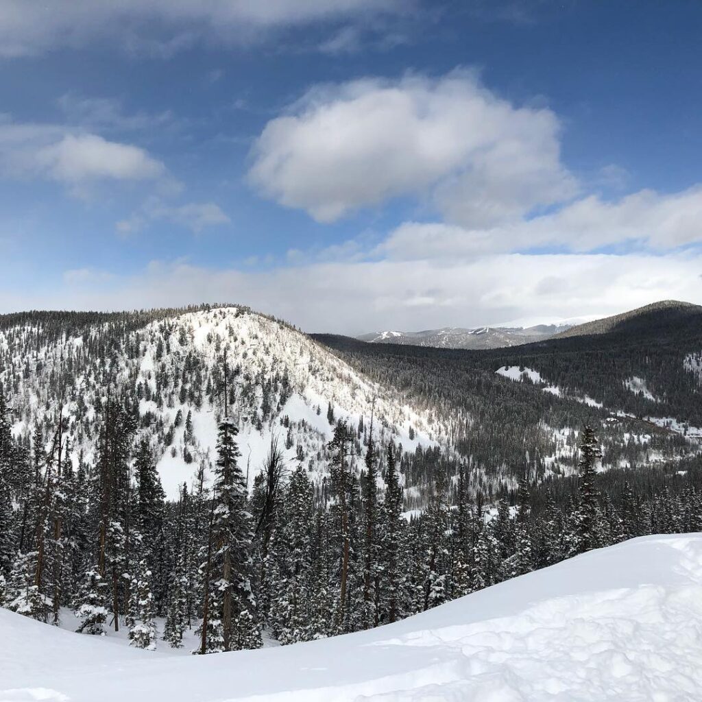
Don’t limit your hiking to just the summer months. Breckenridge is a year-round destination with fantastic fall hikes that transform into snowshoe paths during winter. With an elevation of 9,600 feet, it’s essential to prepare properly for hiking in the area. Load up on electrolytes, wear layers, and take the time to rest to make your Breckenridge experience unforgettable. With proper planning, you’ll enjoy some of the best hikes and activities this beautiful mountain town has to offer.
The Ideal Time for Hiking in Breckenridge
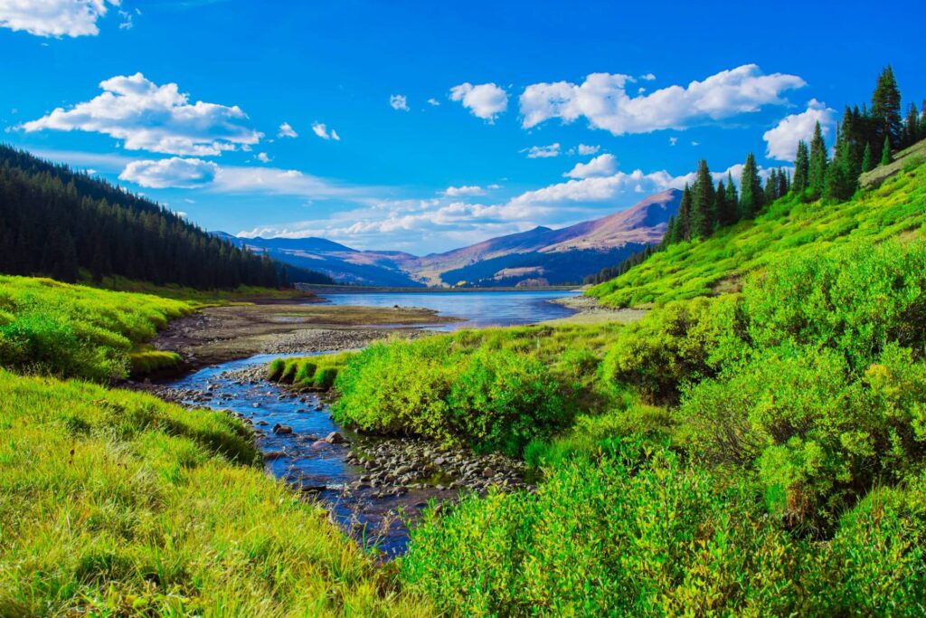
Breckenridge, Colorado, offers stunning views year-round, but for the best hiking conditions, the ideal time to visit is from June to mid-September. July and early August are the peak months for Colorado’s wildflower season, with trails covered in an array of colorful blooms. While these months tend to be the busiest for hiking in Summit County, they also present the opportunity to experience the most vibrant floral displays along nearly every trail. If you prefer a quieter experience, weekdays in the fall offer a more peaceful hike, with the added bonus of colorful foliage painting the landscape.
During the summer, trails are lined with purple Columbines, Colorado’s state flower, while red Indian Painted Brush and Claret Cup Cactus add vibrant splashes of color. These wildflowers create a stunning backdrop for your hike, so make sure to bring your camera to capture the beauty. However, it’s important to leave the flowers undisturbed, allowing the next hiker to enjoy the same breathtaking sights.
One insider tip for hiking in Breckenridge is to start your trail early. Locals and out-of-state visitors alike flock to these trails, making them crowded during peak hours. To avoid the crowds and experience the tranquility of the mountains, try heading out between 5:00 and 5:30 AM. While it may take an extra cup of coffee to get moving, the reward of peaceful trails, available parking, and the chance to spot wildlife makes it worthwhile.
Read More : 25 Activities to Enjoy in Breckenridge, Colorado: Scenic Drives, Skiing, and More Adventure
Easy Hikes in Breckenridge
The term “easy” takes on a different meaning when hiking at high altitudes. With Breckenridge sitting at 9,600 feet, most trails begin at even higher elevations. These hikes are short in distance, have minimal elevation gain, and are easily accessible from main roads, making them perfect for families and hikers of all skill levels.
If you’re coming from sea level, it’s important to adjust to the higher altitude. Make sure to check out some beginner hiking tips before you go. Staying hydrated and using sunscreen will be key to making your hike more comfortable and enjoyable.
PRO TIP : We always carry a hydration pack on our hikes. It helps keep your hands free for trekking poles and provides easy access to water throughout your journey.
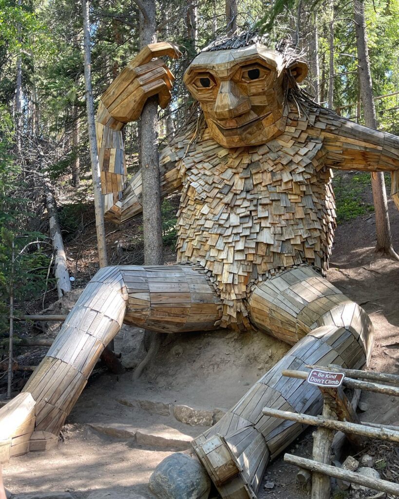
1. Trollstigen Trail: Visit to Isak Heartstone
Mileage: 1 mile | Elevation Gain: 121’ | Route: Loop
The Trollstigen Trail offers a pleasant stroll rather than a challenging hike, making it perfect for families and anyone adjusting to the high altitude of Breckenridge. The highlight of this trail is the 15-foot-tall Isak Heartstone, a magnificent troll created by Danish artist Thomas Dambo. Made entirely from recycled materials, Isak has become a beloved piece of art, attracting visitors from around the world who come to take pictures with this unique sculpture.
For a truly memorable start to your Breckenridge trip, plan to visit Isak on the first day of your adventure. Since he’s a popular attraction, be sure to arrive early if you’d like to experience the troll without a crowd. The trail is well-marked, making it an easy and enjoyable walk for hikers of all levels.
How to Get There: The trailhead is located in the southeast corner of the Stephen C. West Ice Arena parking lot, next to the Illinois Gulch Trailhead.
Pro Tip: If you’re feeling adventurous, there are several other marked and unmarked trails around Isak. Feel free to explore a little off the main route—you’ll find your way back to the parking lot easily, as it’s still within city limits.
Exciting Update! Isak Has a New Friend
In the summer of 2023, Thomas Dambo introduced a new troll sculpture named Rita the Rock Planter, located near Victor, Colorado. Standing just as tall and impressive as Isak, Rita calls an old mine property home.
To visit Rita, take a 75-minute drive from Colorado Springs. Follow CO-67S towards Cripple Creek, and take a sharp right onto CO Rd 87. From there, a short 1/2 mile hike leads you to Rita, or you can extend your hike by parking further down the road and walking uphill for an additional 3/4 mile.
2. Sallie Barber Mine Trail: A Glimpse into Breckenridge’s Mining History
Length: 2.8 miles | Elevation Gain: 393’ | Route: Out and Back
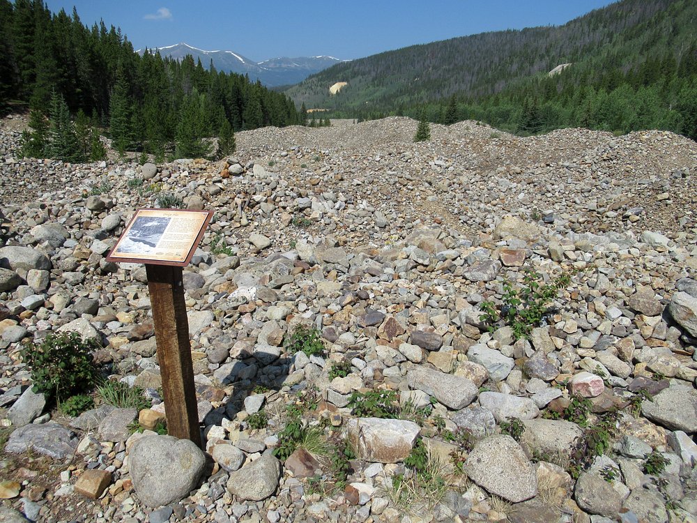
The Sallie Barber Mine Trail offers an easy and scenic hike, perfect for families or anyone with a love for history. At 2.8 miles, this relatively flat trail takes you along a wide gravel road with a few steeper stretches. Most of the path is shaded, providing a comfortable walk as you approach the mine ruins at the end. This hike provides a blend of natural beauty and historical significance, making it a worthwhile adventure.
If you’re looking for hikes near Breckenridge that combine scenic views with history, this trail is a must. While you’ll be captivated by the breathtaking mountain landscapes, don’t forget to stop and read the informational placards around the mine ruins to learn more about its past.
Founded in 1880 by miners from Bald Mountain, this site holds a fascinating history. The largest shaft at the mine is 365 feet deep, a testament to the extensive work that went into its operation. The ruins are among the few well-preserved mining sites in the area, making it safe to explore without worry—no risk of stumbling into an old shaft!
The trail itself is an easy out-and-back, but if you’re in the mood for a longer hike, consider extending your journey by taking one of the backcountry trails that connect to Sallie Barber Mine. A sign at the ruins provides directions to these trails—snap a picture and head out for an all-day adventure!
Insider Tip for Hiking in Breckenridge: A popular extended route from Sallie Barber is Sallie Barber -> Nightmare on Baldy -> True Romance, covering nearly 6 miles roundtrip.
How to Get There: From Breckenridge, take Wellington Road east toward Hwy 2/French Gulch Road. About 3 miles in, you’ll find the Sallie Barber Mine Trailhead on your right.
Note: You’ll need to walk a short distance down the road to reach the actual trailhead.
This trail also makes for a fantastic winter excursion, perfect for snowshoeing and cross-country skiing.
3. Baker’s Tank Trail: A Historical and Scenic Hike
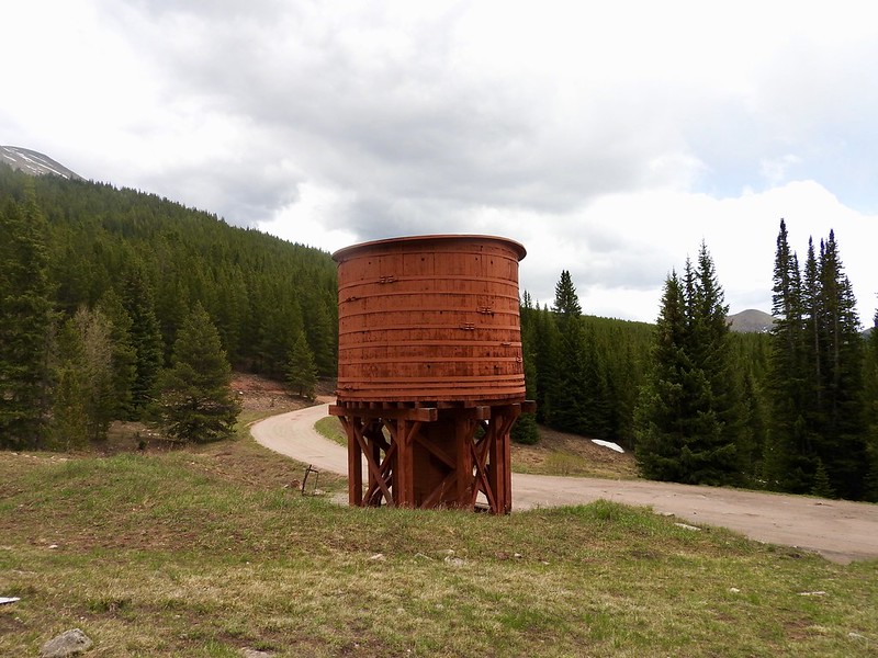
Mileage: 6 miles | Elevation Gain: 880’ | Route: Out and Back
MARK THIS TRAIL FOR FALL.
The Baker’s Tank Trail is a delightful 6-mile hike, particularly stunning in autumn when the aspen trees turn golden. The trail is mostly shaded, offering a cool escape during the summer months. The path is a single track through the forest, making for a peaceful walk in the woods.
The initial mile is a bit steeper and rockier, with a steady climb that could be tough for those not used to high altitudes. It’s important to pace yourself, especially if you’re coming from sea level.
Pro Tip: Altitude can affect even the most seasoned hikers. Slow down, hydrate, and take regular breaks. Sweet and salty snacks like gummy bears and pretzels can help maintain your energy as you go.
The final stretch is along a dirt road exposed to the sun, so it can feel warmer. Keep going—you’re almost there! To make the hike more enjoyable, aim to start early or in the late afternoon, especially during the summer, to avoid the heat.
While you’ll encounter stunning wildflowers and scenic views of the Tenmile Range and Quandary Peak, the highlight of this trail is the historic Baker’s Tank. This red tank was once used by steam locomotives in the late 19th and early 20th centuries to refill their water supply before heading up the steep mountain grades.
Note: Mountain bikers often use this trail, so be aware of them while you’re walking. To avoid the crowds, it’s best to hike early or during weekdays.
How to Get There: The trailhead is located near a small pullout on the uphill side of Boreas Pass Road, right on the edge of a residential area.
Keep Exploring: For an extended adventure, begin at the South Illinois Creek Trail near the Breckenridge skating rink, then head to Aspen Alley Trail before connecting with the Baker’s Tank Trail.
4. Burro Trail: A Scenic and Accessible Hike
Length: 6.1 miles | Elevation Gain: 918’ | Route: Out and Back
GREAT WINTER HIKE OPTION.
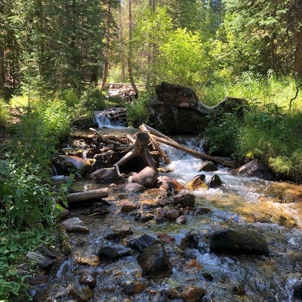
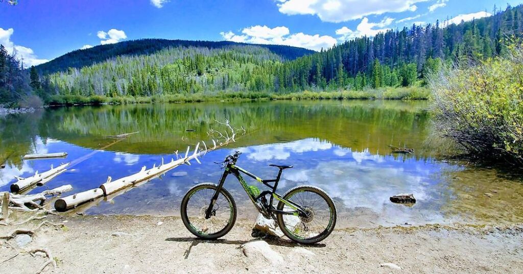
Burro Trail offers an easy and enjoyable hike starting right from lodging areas along Village Road in Breckenridge. It begins at the base of Peak 9, near the Quicksilver chairlift. The trail follows a creek, which provides a refreshing breeze and ample shade, making it a pleasant walk in warmer months. It’s also a great spot for kids, with plenty of places along the way to dip their toes in the cool waters.
This trail holds sentimental value for Melody’s family, as it was their first hike in Breckenridge when her daughter was just a baby. Located so close to town, it’s perfect for a post-dinner stroll to enjoy the cool mountain air.
About half a mile from the trail’s end, you’ll encounter large rock piles and interesting cairns created by hikers and bikers along the way. It’s a great spot for a quick break and a bit of exploration. The trail concludes at Spruce Creek Road, offering a peaceful endpoint to the journey.
Local Hiking Tip for Breckenridge: Burro Trail connects to Lower Crystal Lake Trail, allowing you to extend your hike if you have time. Be sure to pack enough supplies, layers, and plan for a longer adventure if you’re heading to Crystal Lake.
How to Get There: Parking is available near Beaver Run Resort and Conference Center. The trailhead is located at the foot of the chairlift, to the left. Look for a wooden sign marking the start of the trail. You’ll cross a small stream and enter the forest shortly after beginning your walk (it’s about a 5-minute walk from the parking area).e trailhead quickly becomes apparent and you ford a small stream before entering the forest within minutes of leaving the base of the lift.
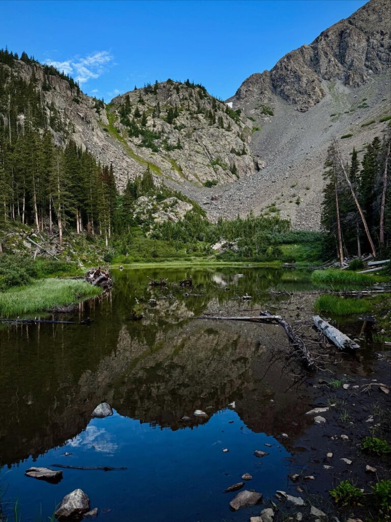
5. Lily Pad Lake via Meadow Creek Trail: A Peaceful Journey Through Nature
Mileage: 3.1 miles | Elevation Gain: 757’ | Route: Out and Back
A few years ago, we hosted our relatives from Texas for a week in Breckenridge. As we hiked through the pine forest with wildflowers surrounding us, there was no fuss. However, when goldfish appeared and chipmunks showed up, things took a wild turn. We learned an important lesson that day—when hiking with little ones, it’s best to keep snack time organized with an adult close by.
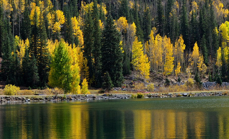
The trail is closely associated with beavers, who have done a remarkable job building dams and ponds along the way. Much of the hike meanders through aspen groves, which transforms this trail into one of the most memorable autumn hikes in Breckenridge. The fall colors turn the landscape into a stunning display of yellows and oranges.
While both ponds on the trail are beautiful, we recommend the first pond for a more serene experience. As for the second pond, its lily pads are in full bloom, offering an ideal setting for nature lovers—though you might find yourself swatting a few bugs if you didn’t use enough insect repellent.
The area bursts into vivid colors during the fall, making it one of the most popular trails for autumn hikes around Breckenridge. For a more challenging route, consider starting at an alternate trailhead. This longer, more demanding hike will reward you with sweeping mountain views as you make your way toward the pond.
Hiking Tip for Breckenridge Trails: Don’t miss the far side of the pond and the view just below the beaver dam. The scenery over the lake, framed by the mountains, is worth the extra effort.
For a more extended hike, take the Colorado Trail and turn right at the dirt road. This will lead you to the original trail, creating a pleasant 6-mile loop. Along the way, enjoy scenic views and the sight of Mount Elbert rising behind you.
How to Get There: From Highway 6, head toward Silverthorne, then take the exit onto Stephens Way. Turn left onto Wildernest Road, followed by another left onto Ryan Gulch Road. Continue along Ryan Gulch Road to the trailhead Creek.
6. Lower Sawmill and Snowflake Trailhead: Add This For a Longer Hike
Mileage: 1.5 miles | Elevation Gain: 246’ | Route: Loop
MAKE IT A LONGER HIKE.
When our kids were young, this trail was a family favorite for evening hikes. After dinner, we’d pack some dessert snacks and coat ourselves in bug spray (because yes, even at 10,000 feet, the bugs are still around, especially near water). The trail takes you on a short and easy walk to an alpine lake blanketed with lily pads, offering a perfect spot to relax and take in the scenery.
For those coming from sea level, consider adding the Sawmill Trail as part of your early days of altitude acclimation. The first half of the trail is a moderate uphill climb, mostly shaded, making it a comfortable yet invigorating hike. Depending on the time of year, you might encounter a small swamp crossing, so be on the lookout for branches that could help you navigate through it.
How to Get There: From South Park Avenue (Hwy 9), head south toward Four O’clock Road. Turn right onto Four O’clock Road, and the trailhead will be on your left. Look for the Snowflake chairlift at the intersection of Four O’clock Road and Kings Crown Road.
Moderate Hiking in Breckenridge: Prepare for Varying Elevation
When you talk about moderate hikes in Breckenridge, you’re often referring to trails with varying elevation gains. Some hikes begin at around 12,000 feet, while others start lower but quickly climb in elevation. These hikes can challenge both beginners and experienced hikers, so it’s important to be prepared.
Breckenridge trails can be rocky, so sturdy hiking shoes are essential. If this is your first time hiking in Colorado, take some time to research the best footwear for the trails. Consider the type of terrain you’ll be covering and pick the right shoes, boots, or runners for the job.
It’s not just about breaking in your shoes, but about getting your feet used to them. Before you set off on the trail, try a few test walks to make sure they fit comfortably.
And don’t forget the socks! You’d be surprised how something as small as socks can make or break your hike. Trust us—we’ve learned this the hard way.
After much trial and error, we swear by Smartwool socks. Whether you need thicker or thinner pairs, Smartwool has options for every preference. For moderate to challenging hikes on Colorado trails, consider getting a pair that covers your ankles. They won’t necessarily keep your feet dry, but they’ll certainly keep them warm, even if you end up soaked from streams or storms.
7. Little French Gulch Trail: A Beautiful Wildflower Hike
Mileage: 4.6 miles | Elevation Gain: 482’ | Route: Out and Back
The Little French Gulch Trail begins at the end of French Gulch Road in Lincoln and leads toward Mount Guyot. A peaceful creek flows alongside the path, offering a refreshing breeze and cooling you off as you hike.
The first couple of miles follow a wide gravel road, giving you easy access to the surrounding landscape. As the trail narrows, it enters the gulch and reveals stunning wildflower meadows. This hike is one of our favorite Breckenridge summer trails, with vibrant reds, yellows, purples, and pinks scattered throughout the meadow, filling the air with a fragrant floral scent.
Continue on the trail through French Pass and head toward Black Powder Pass for even more beautiful views of the area.
Insider Tip for Hiking in Breckenridge:
For a different perspective, turn left onto viewpoint trail #970A after about one mile. This extra 400 feet of elevation will reward you with breathtaking views, including Applegate Lake.
When we hiked this trail, it was extremely windy, making it hard to find some of the trail markers. We ended up adding about 600 feet to our climb after losing the trail, but in this case, getting lost wasn’t a problem. The area is so beautiful that you won’t mind a little extra exploration.
A Quick Note: The All Trails map for this trail isn’t entirely accurate. Little French Gulch branches off the French Creek Trail after about a mile. The French Creek Trail starts as a road, passing houses, a mine, and crossing a creek before narrowing and climbing steeply into the forest.
How to Get There and Where to Park:
To reach the trailhead, park at the Sallie Barber Trailhead. You’ll need to hike about a mile along the road before reaching the start of Little French Gulch Trail. To get there, take US 24W and CO 9 to Boreas Pass Road, then follow it to French Gulch Road.
8. Mount Royal + Mount Victoria and Peak 1: A Challenging Adventure with Stunning Views
Mileage: 3.9 miles | Elevation Gain: 1,374 feet | Route: Out and Back
We discovered this hike in the summer of 2020 when we were craving new scenery and ready for steep hills and breathtaking views. This trail delivers on both. One of the best parts of the hike is the ample parking available at the trailhead, which is a rarity for many popular Breckenridge hikes.
Prepare yourself for a steady uphill climb over rocky terrain. Trail runners will likely pass you—yes, it’s humbling! Make sure to give them a shout-out for their amazing endurance. Good hiking shoes and trekking poles are essential for anyone tackling this trail. The final push to the summit is particularly steep, but it’s a well-marked path lined with aspen trees. We’re already looking forward to returning in the fall to enjoy the stunning golden aspen leaves.
Add-On: Mount Victoria and Peak 1
Mileage: 8.7 miles | Elevation Gain: 3,996 feet | Route: Out & Back with Loop
If you’re craving a challenge, then hiking Mount Victoria and Peak 1 is a perfect option. This route offers a demanding workout and rewards you with jaw-dropping views at every turn.
Start at the trailhead (located just past the apartment on Google Maps, near the interstate, with parking on the left). From here, take the paved path for about half a mile to the trail sign. From Mount Royal, ascend steeply to Mount Victoria, gaining several hundred feet quickly before emerging into a meadow with amazing mountain views. Continue toward Peak 1, where you’ll face a steeper climb, two false summits, and a final section that requires some scrambling with your hands.
Solid hiking shoes with a good grip, trekking poles, and a strong constitution are essential for this trek—especially since it’s not for those with a fear of heights.
Insider Tip: Once you reach the summit and catch your breath, continue about ¼ mile downhill from the peak to a viewpoint that overlooks Frisco, Dillon Reservoir, and the iconic fourteeners, Greys and Torreys Peaks.
How to Get There: From I-70 West, take exit 201 and drive to Frisco. Turn left onto W Main Street, then right onto the second cross street onto Forest Drive. Turn left, and the trailhead will be there.
9. Mohawk Lakes – Upper and Lower via Spruce Creek Trail: A Must-Do Breckenridge Hike
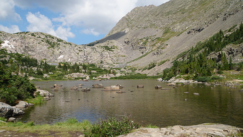
Mileage: 8.4 miles | Elevation Gain: 2,106’ | Route: Out and Back
For an unforgettable hiking experience near Breckenridge, the Mohawk Lakes trail requires some planning. The parking situation is limited, so getting there early is essential if you want a spot. If the lot is full, it’s best to move on, as parking along the streets is prohibited. That said, we’ve seen dozens of cars parked without any visible signs of tickets, though it’s always safer to follow the rules.
We first tackled this hike years ago when our kids were small, and our 60-year-old grandmother joined us. Aside from a small mishap with a bush (no injuries), the hike was fantastic. Melody carried our youngest in a backpack the whole way—she was only around 2 years old at the time. We’ve returned every summer since 2022, making it a staple of our Breckenridge trips.
On summer weekdays, it’s possible to start the hike around 8 am and enjoy some solitude. We’ve noticed that parking near the trailhead is generally quiet in the early hours, but expect crowds when you return around midday.
Mayflower Lake, located along the way, is a great spot to take a break. It’s a short, peaceful hike, perfect for a quick photo op, a snack, or even a short nap before continuing on to Mohawk Lakes.
The snowpack between the Upper and Lower Lakes was almost entirely melted when we visited. However, there were still patches of snow, making trekking poles and good hiking shoes crucial to avoid slipping.
For the best experience, make the extra effort to reach the Upper Lake. The alpine blue-green water, with icebergs floating in portions of the lake, is a sight to behold. Wildflowers were already beginning to bloom, adding a splash of color to the landscape. It’s a perfect spot to pause and take it all in.
While heading back, we met a few hikers who were frustrated by the trail’s lack of clear markings. They had taken unnecessary extra steps, so we shared the correct path with them. This is a good reminder that downloading maps ahead of time can prevent confusion and make your hike more enjoyable.
I also tested out our new backpacking water filters on this hike—the Epic Water Filter and the Katadyn BeFree. Both worked great, and the water was cold, fresh, and pure.
Starting from the parking lot, take the Spruce Creek Trail, following the creek. The trail is a steady uphill climb, so make sure to wear sturdy hiking shoes, take regular breaks, and pack some fun snacks to fuel up.
At about 1.5 miles, you’ll come to a junction for the Wheeler Trail, which leads to McCullough Gulch Road. Keep going straight to continue on the Mohawk Lakes Trail.
Look for the Continental Falls about halfway through the hike. There’s a steep trail leading up alongside the falls, but if you’re hiking with children or wearing running shoes, it’s better to stick to the main Mohawk Lakes Trail.
The trail ends at Lower Mohawk Lake, where you’ll get views of Mount Helen. At an elevation of 11,810 feet, it’s a great spot to relax before heading back down.
Hiking Tip for Breckenridge Trails: Most of the elevation gain happens after the falls, so make sure to hydrate and enjoy a snack before tackling the more difficult stretch.
How to Get There: Head south on Highway 9, then turn right onto Spruce Creek Road (Landmark: Grand Moose Lodge). Follow Spruce Creek Road to the end where you’ll find the trailhead.
10. Mayflower Lake and Continental Falls
Mileage: 7.9 miles | Elevation Gain: 1,922’ | Route: Out and Back
The most well-known hike from this trailhead leads to Mayflower Lake, offering a beautiful view of the lake before connecting to Spruce Creek Trail just before reaching Continental Falls. This 5-mile out-and-back route is perfect for a shorter adventure, especially if the complaints start piling up (I can’t be the only one who experiences that!).
Continental Falls is a two-tiered waterfall fed by a stream flowing from Mohawk Lakes. It’s located 2.6 miles from the Spruce Creek Trailhead, and you can follow the path alongside the falls for as long as you like. If you continue for another half-mile, you’ll reach the stunning Mohawk Lakes.
Both of these trails are popular year-round and are ranked as some of the best snowshoeing routes in Breckenridge, attracting plenty of visitors no matter the season.
For those looking for more adventure, camping and fishing are permitted in the area, offering an opportunity to enjoy the surroundings .
Read More : 26 Top Hikes in Colorado: Explore the Best Nature Trails
11. Peak’s Trail: A Beautiful Hike Between Breckenridge and Frisco
Mileage: 6.9 miles | Elevation Gain: 1,735 feet | Route: Point to Point
This hike stretches from Breckenridge to Frisco, making it a fantastic choice for exploring both towns. We typically hike toward Frisco and take the free shuttle back to Breckenridge.
One of the perks of this trail is that dogs can be off-leash, allowing them to roam freely. However, be aware that this trail is shared with mountain bikers. While bikers are supposed to yield to hikers, there are times when it’s easier for hikers to step aside. Following proper trail etiquette is essential to maintain a safe and respectful hiking experience.
Peak’s Trail is mostly a single track that follows along Miner’s Creek, offering views of Rainbow Lake. This section can be busy with families making their way to and from the lake. If you’re hiking in the fall, the two-mile stretch around Rainbow Lake is a prime spot for leaf peeping and enjoying the golden aspen leaves.
When you reach the junction of Peaks Trail and Miners Creek Road, stay on the Peaks Trail. Phone service can be unreliable in this area, so it’s a good idea to download your map beforehand to ensure you stay on track.
During July and August, the open meadows are filled with wildflowers, adding extra beauty to the hike. The end of the trail is close once you cross over Cucumber Creek Road, an unmarked jeep road.
Note: About a third of this hike follows the Colorado Trail, providing excellent views of Peaks 1-4 through scattered trees. The uphill portion from Frisco to Breckenridge is gradual, and the hike from Breckenridge to Frisco offers great views towards Frisco.
Insider Tip for this Breckenridge Hike:
For a longer adventure, consider hiking all the way to Breckenridge, then taking the free gondola from the summit to town. Have lunch, then ride the gondola back up to continue your 15-mile trek back to Frisco. If you prefer, you can start from Frisco and enjoy a similar experience, as Frisco is home to some great restaurants too.
How to Get There: The trailhead is located just off Ski Hill Road in Breckenridge, CO. Use the AllTrails link for the exact location.
12. Ptarmigan Trail: A Beautiful Breckenridge Hike with Scenic Views
Mileage: 5 miles | Elevation Gain: 1,141’ | Route: Out and Back
One of our top hikes in Breckenridge, Ptarmigan Trail offers a mix of everything—wildflowers, lakes, mountain views, and a well-marked path that’s great for families. While you’ll pass through some burn scar areas, the trail winds through aspen and conifer forests, offering stunning vistas along the way.
The first 20-30 minutes (around 3/4 mile) involve a steep climb. Starting at over 9,000 feet, be sure to wear sunscreen and a hat as most of the trail is exposed to the sun.
Take your time and enjoy the panoramic views of Dillon Reservoir. The second section of the trail is shaded by aspens and pines, with the terrain becoming a more gradual climb after the initial steep stretch.
At about 2.5 miles in, plan for a snack or lunch break. This is the perfect spot to pause and take in the incredible mountain vistas. If you’re following the AllTrails map, this marks your turnaround point.
How to Get There: From CO-9N/Blue River Parkway in Silverthorne, take exit 205 from I-70 West. Follow the road and turn right onto Ptarmigan Trail.
Note: Parking fills up quickly, so it’s a good idea to get there early to secure a spot. Street parking is available if the lot is full.
13. Wheeler Lakes: A Scenic and Peaceful Hike in Eagles Nest Wilderness
Mileage: 6.6 miles | Elevation Gain: 1,486’ | Route: Out and Back
Located in the Eagles Nest Wilderness, Wheeler Lakes offers a perfect balance of scenic views, quiet solitude, and summer wildflower beauty, all with some shade along the way. Be prepared to share the trail with a few flies, so don’t forget to pack your bug spray.
The first mile of the hike runs parallel to I-70, which may not be ideal, but the real beauty begins once you turn off into the woods. From there, the trail meanders through aspen groves and meadows, eventually leading you to the alpine lakes.
After entering the forest, you’ll be greeted with a steady uphill climb for about 2 miles, but the effort is worth it. You’ll be rewarded with stunning mountain views from a couple of clearings. Compared to nearby Mount Royal, this trail is less steep, making it a more manageable hike.
We particularly enjoyed the spurs off the main trail that loop around the lakes. Keep an eye out for fallen trees and signs of beaver activity, which add a bit of charm to the hike.
How to Get There: Take I-70, and park at the scenic area located between exits 195 and 198 before the trailhead. This adds about 1.5 miles to your hike. Use the AllTrails app for the exact trailhead location.
14. Upper and Lower Crystal Lake: A Challenging Yet Rewarding Hike
Mileage: 4.6 miles | Elevation Gain: 1,601’ | Route: Out and Back
A favorite for the Monberg family, this hike demands a solid snack pack and plenty of water. While the mileage may seem short, don’t let that fool you—by the time you reach Upper Crystal Lake, you’ll have climbed nearly 2,000 feet. Breckenridge’s hiking trails can be tough, especially for beginners, so be prepared for a workout.
Starting late on a summer day in Colorado typically means encountering a rainstorm. Melody and her husband learned this firsthand when they got caught in a monsoon. The rain came fast, followed by thunder and lightning, forcing them to seek shelter under scrub oak while assuming the lightning safety position.
Secret Tip: If you find yourself caught outdoors during a lightning storm, crouch down low onto the balls of your feet, keeping your feet close together. This will minimize the risk of being struck.
Once the storm cleared, the sun emerged, offering stunning views of Mount Helen, Crystal Peak, and Father Dyer Peak. These alpine lakes sit in the Tenmile Range, nestled between the east ridgelines of Crystal Peak and Peak 10, just south of Breckenridge.
The trail begins on a 4×4 road, and you’ll find yourself above treeline at around 12,000 feet. From there, the trailhead lies to the north of Lower Crystal Lake, with switchbacks leading across alpine tundra and meadows. As you climb through the pine forest, you’ll soon pass above the tree line.
Upper Crystal Lake sits 900 feet higher than its lower counterpart. Make sure to eat a good snack and then take the time to head up to the Upper Lake. The panoramic views of the surrounding peaks are worth every breath of the thin mountain air. Upper Crystal Lake rests just below Crystal Peak, which rises to an elevation of 13,852 feet.
Secret Tip for Breckenridge Hiking Trails: If you want to avoid the parking issues at the trailhead, start at Burro Trail. The Crystal Lake Trail connects with Burro, and there are plenty of signs to guide you along the way.
How to Get There: Take Hwy 9 southbound, then turn right onto Spruce Creek Road. Follow the road to the end, where you’ll find the trailhead.
Parking: The parking area is located near the ruins of an old cabin. If you have a 4WD vehicle, you can drive up to the Spruce Creek-Wheeler junction, which shortens the trail by nearly 2 miles. of old cabins; 4WD to Spruce Creek Wheeler junction, thereby shortening the hike.
Read More : 6 Hidden Risks at Breckenridge Municipality: What to Watch Out For
15. Willow Lakes via Gore Range Trail: A Memorable Hike in Eagles Nest Wilderness
Mileage: 11.9 miles | Elevation Gain: 2,716’ | Route: Out and Back
This hike is a true standout for us—one that’s earned a spot as a favorite. Still not convinced? Ask any of the kids who’ve hiked it with us, even our youngest at the time, who was just 6 years old. They’ll tell you just how special it is.
Willow Lakes is an excellent spot for both day hikes and backpacking. The trail offers fantastic views, alpine lakes, wildflowers, and a jaw-dropping mountain backdrop around the final lake. It’s the kind of hike that checks all the boxes for a perfect outdoor adventure.
The trail is well-maintained with clear signs along the way, making it accessible even for those who aren’t experts with directions. Melody, despite her occasional struggles with navigation, managed just fine here, proving this trail’s user-friendly nature.
Located in the Eagles Nest Wilderness, this hike near Breckenridge is definitely worth the drive. To make sure you get a good parking spot, aim to start early, arriving at the trailhead between 7 and 8 am. If you arrive later, there’s a bonus overflow lot, but keep in mind that parking there adds an extra 2 miles to your hike.
The first few miles are lined with aspen trees, making it a perfect fall destination for leaf peeping. There are numerous rest spots along the trail, so take your time to enjoy the views, especially after the uphill stretch between miles 2 and 4.
If you’re up for it, add a one-mile round trip detour to Salmon Lake. It’s not far, and the effort is worth the stunning views.
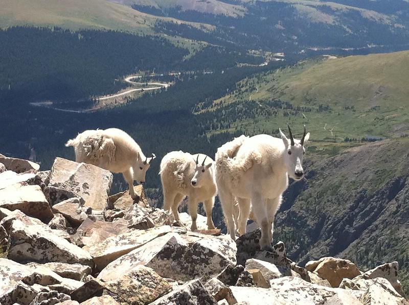
Depending on the season, you might spot mountain goats along the trail. Remember, you’re in their territory, so stay a respectful distance away, take a picture, and move along without disturbing them.
Insider Fall Hiking Tip! For an even more spectacular fall experience, take South Willow Trail to Mesa, then connect to North Willow for a loop between 5 and 6 miles. It’s a little longer, but the views of the aspen trees are absolutely worth it.
How to Get There: Take CO-9N to Blue River Parkway, then drive to Willowbrook Road. The main parking lot only holds around 12 cars, so be sure to get there early!
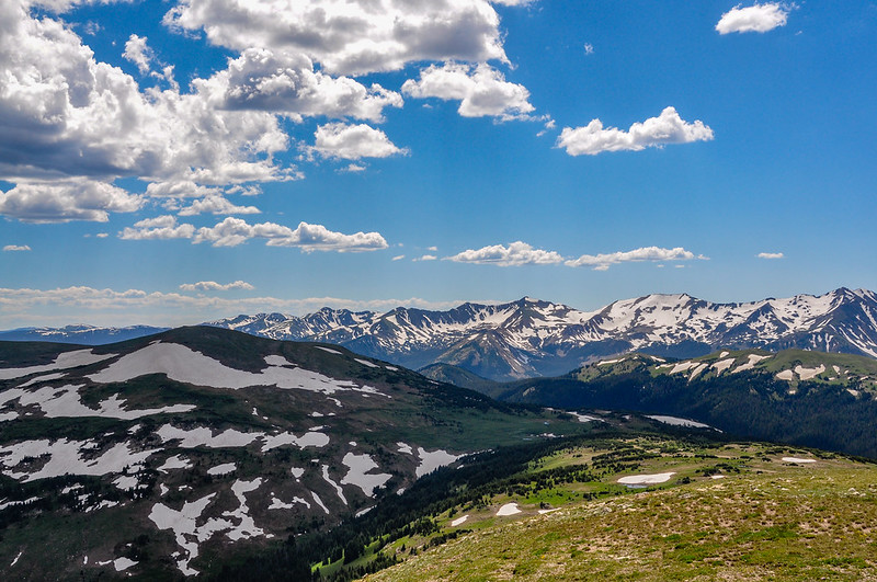
Difficult Hikes in Breckenridge: Prepare for the Challenge
Breckenridge and the surrounding areas offer some of the most rewarding hikes, but be ready to work for those stunning views. These trails will test your endurance, requiring both physical effort and careful planning. Make sure to pack a daypack with the essentials—think extra layers, first-aid items, and plenty of water.
Summer weather in Breckenridge can be unpredictable, so don’t forget your sunscreen and layers. While the weather can change in an instant, thunderstorms and lightning are a common part of Colorado hiking. It’s best to start early to minimize the risk of being caught in these storms. Always stay prepared and approach these hikes with caution, and you’ll be rewarded with some of the most incredible scenery in the area.
16. Bald Mountain Trail: A Family Tradition and Stunning Views
Mileage: 10.3 miles | Elevation Gain: 3,123’ | Route: Out and Back
In Melody’s family, each child has the chance to do a special “Hike with Dad” just before entering middle school. Her husband, Matt, does the research and presents a few options, allowing the kids to pick their adventure. For her son, the choice was clear: the famous 13,690-foot Mount Baldy. Known for its panoramic views of Breckenridge and the surrounding mountains, it’s a perfect spot for making lasting memories.
The hike begins by winding through neighborhoods, and you might wonder if you’re on the right track (you are!). To get a parking spot at the relatively small trailhead, it’s best to arrive early. It’s about half a mile past the residential area. While a 4WD vehicle isn’t required, be cautious about the road condition as regular cars may risk damaging their undercarriage.
The Summit Daily provides excellent directions for driving to the trailhead, as parts of the route can be tricky. Once on the trail, look out for a cabin on the right within the first half mile. After about another mile, you’ll pass the Iowa Mill, built in 1935.
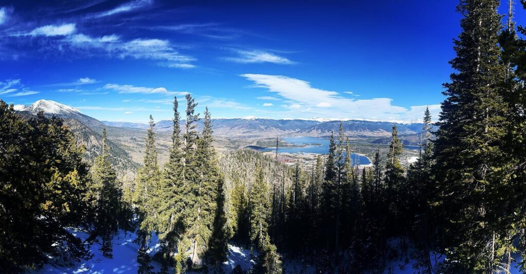
At the summit, take in the incredible views of the Tenmile Range and Breckenridge to the northwest, with Swan Mountain and Dillon Reservoir to the north. You’ll also have great views of Mount Guyot and Boreas Mountain, making it a perfect spot to relax and soak in the scenery.
As with many Breckenridge hikes, this trail begins as a road through a forest, offering an immersive natural experience.
How to Get There: Head to Mount Baldy Road, past Gold Point Resort. The trailhead will be on your left, near the intersection of Baldy Road and Goldenview Drive, close to the Summit State bus stop.
Trail Note: The end of the trail has been closed due to private property claims, but the transition between public and private land isn’t well-marked.
Insider Tip: Turn this hike into a family tradition. As your children grow, return to the trail to relive the memories. Walking the same path over the years brings those moments back and creates new ones to cherish.sit this trail over the years for reminiscing and shared memories.
17. Quandary Peak: A Challenging 14er with Breathtaking Views
Summit Elevation: 14,271 feet
Mileage: 6.6 miles | Elevation Gain: 3,326 feet | Route: Out and Back
NOTE: An advanced permit reservation is required to hike Quandary Peak.
As the 13th highest peak in Colorado’s renowned 53 fourteener club, Quandary Peak stands out not only for its elevation but also as the only 14er in the Tenmile Range. This hike offers spectacular views of Mount Democrat, Cameron, Lincoln, and Bross. To the north, you can spot Crystal Peak and Pacific Peak, with the distant Gore Range rounding out the horizon.
Although the mileage may seem manageable, don’t be deceived by the “Difficult” rating. The trail involves a significant elevation gain of 3,500 feet over just 3 miles, most of which is spent scrambling up exposed rock. This trail near Breckenridge is a true test for hikers looking for a challenge.
The hike begins north of Hoosier Pass in White River National Forest, taking you through shaded pine forests. The trail is well-marked, making navigation straightforward. Given its popularity, you’ll have plenty of company along the way, making it easy to follow the crowd up this beloved 14er.
As you make your way up, you’ll likely encounter large groups of mountain goats, so keep an eye out for these fascinating creatures. Be sure to stick to the trail to avoid disturbing them.
How to Get There: From Hwy 9 southbound, drive approximately 8.5 miles and turn right onto McCullough Gulch Road. The trailhead will be on the left side of the street. The parking lot fills up quickly during the summer months, so arrive early to secure a spot.
18. McCullough Gulch Trail: A Stunning Hike in White River National Forest
Trail Length: 6.4 miles | Elevation Gain: 1,607’ | Route: Out and Back
NOTE: A parking reservation is REQUIRED.
McCullough Gulch, located near the Quandary Peak trailhead in White River National Forest, offers a challenging yet rewarding hike near Breckenridge. Before heading out, make sure to secure your parking reservation, pack your essentials, put on sturdy hiking shoes, and grab your trekking poles.
While the preparation might seem a lot, the payoff is immense. The hike rewards you with beautiful lakes, waterfalls, wildflowers, mountain goats, and breathtaking mountain views throughout the journey.
The trail begins on an old mining road and splits off toward White Falls and Upper Blue Reservoir. If you’d like, you can take a 1-mile detour to White Falls for some extra scenic beauty.
The terrain on this trail varies from rocky sections to dirt-covered paths. While the entire hike has an uphill climb, the stretch between the first and second lakes is particularly difficult and narrow. Watch out for the large boulder field between the lakes—some paths are pure scree, which can be treacherous. It’s important to choose your route carefully to avoid a dangerous slip.
Once you pass the final ridge, you’ll be greeted by Pacific Tarn, a stunning high alpine lake sitting at 13,868 feet. This lake holds the title of the highest named lake in the United States. Hike to the left of the lake for spectacular views of Leadville and Copper Mountain.
Note! The trail through the alpine meadows can be tricky, as it’s not well-marked. Make sure to have a map or a map app on hand to help you stay on track.
Insider Tip: If you enjoy fishing, bring your fishing license and poles with you. The trail leads to Upper Blue Reservoir, where you can spend the day fishing or exploring the six additional alpine lakes in the upper valley. The trail is located on the north side of Quandary Peak and ends near the backside of Mayflower Gulch, another popular hike that offers similar views with fewer crowds.
How to Get There: From Hwy 9 southbound, drive for about 8.5 miles and turn right onto McCullough Gulch Road. Alternatively, take the shuttle to the Quandary lot and then take a short shuttle to the McCullough Gulch trailhead. It’s a half-mile walk from the shuttle to the official trailhead.