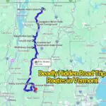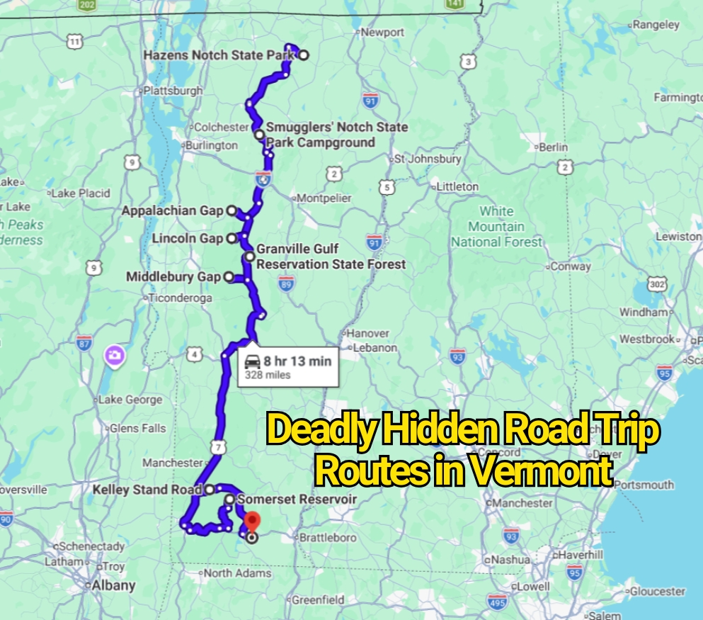
Vermont’s most intimidating roads rarely look threatening in travel photos. They appear as quiet ribbons of pavement winding through forests, mountain gaps, and small villages. That soft image can persuade visitors to drive faster than the road, weather, or vehicle can safely handle.
The contrarian truth is that Vermont does not publish an official ranking called the “most deadly hidden road trip routes.” Calling any road the deadliest without comparable crash data would be misleading. The roads below belong here because official documents describe steep grades, sharp bends, winter closures, flooding, landslides, repeated crashes, vehicle restrictions, or limited emergency access.
These routes should not be treated as thrill drives. Several become far less forgiving after dark, during leaf-peeping traffic, in heavy rain, or when temperatures fall around freezing. Seasonal barriers, closure signs, and length restrictions are safety measures rather than optional suggestions.
Smugglers’ Notch Road: Vermont Route 108

Smugglers’ Notch Road is Vermont’s best-known example of a scenic drive that behaves more like a narrow mountain passage. The section between Stowe and Cambridge squeezes between enormous boulders near Mount Mansfield. Tight bends leave little space for corrections, while traffic often includes hikers, cyclists, sightseers, and drivers watching the landscape instead of the pavement.
The danger is clearest in Vermont law. Single-frame vehicles longer than 40 feet are prohibited from using this section, while tractor units with trailers cannot exceed 45 feet in total length. The state may also close the Notch during winter weather. Those restrictions were created because large vehicles have repeatedly become trapped while attempting bends that their turning radius cannot handle.
Passenger cars can still encounter trouble. The road narrows sharply around rock formations, sight distance shrinks, and opposing traffic may appear immediately beyond a bend. Snow, ice, fallen leaves, and wet pavement amplify the risk. Vermont Tourism reports that this portion of Route 108 generally closes from November through May, though exact dates depend on conditions.
Smugglers’ Notch is not a road to rush before sunset or squeeze into a busy itinerary. Drivers should use low speeds, stay within their lane, avoid roadside distractions, and never follow GPS instructions past a closed gate.
Appalachian Gap: Vermont Route 17
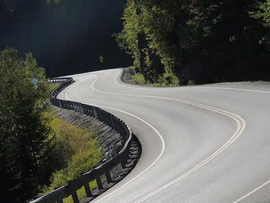
Appalachian Gap looks broad and manageable on a digital map. The real road tells a harsher story. Route 17 climbs from the Bristol and Starksboro side before crossing the Green Mountains and descending into Fayston and the Mad River Valley.
Fayston’s town plan describes the upper section as having very sharp curves and steep grades as it climbs to the gap. A regional corridor plan also refers to hazardous winter driving conditions and a history of accidents along the mountain crossing. The summit sits at roughly 2,375 feet, exposing the road to weather that may differ greatly from conditions in the valleys.
Unlike several smaller Vermont gap roads, Route 17 generally remains open during winter. That can create false confidence. An open road is not the same as an easy road. Shaded pavement may remain icy after surrounding roads have dried, and drivers descending the grade can gain speed before meeting another sharp bend. Vermont Tourism specifically cautions that the crossing can be difficult during winter.
The western descent deserves particular care. Drivers should reduce speed before each curve rather than braking hard in the middle of it. Motorcyclists also face changing pavement temperatures, leaf debris, sand, and limited escape space near the shoulders.
Lincoln Gap Road: Warren to Lincoln
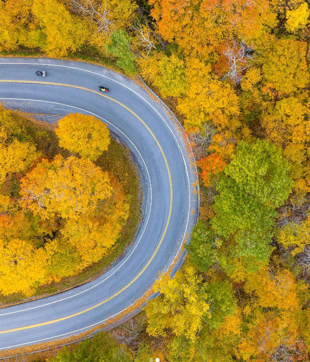
Lincoln Gap Road is frequently described as a scenic shortcut between Warren and Lincoln. “Shortcut” is the misleading word. This is a high, steep mountain crossing where the road changes character as it climbs.
The U.S. Forest Service describes Lincoln Gap Road as steep and winding and does not recommend it for trailers. The road closes for winter access. On the Warren side, the climbing pavement includes an exceptionally severe grade, while the Lincoln side contains gravel sections where traction and braking feel different.
Its seasonal schedule should be taken seriously. The Town of Lincoln reported that the road reopened on May 14, 2026, with a tentative winter closure date of October 15. Opening and closing dates can shift because of snow, ice, mud, road damage, or maintenance work.
A driver who reaches the road in October may find dry pavement in the valley and ice near the summit. Spring brings another problem: soft shoulders, mud, frost damage, and loose gravel. Vehicles pulling trailers should use another crossing, while drivers in ordinary cars should avoid relying on Lincoln Gap as a guaranteed connection.
Hazen’s Notch Road: Vermont Route 58
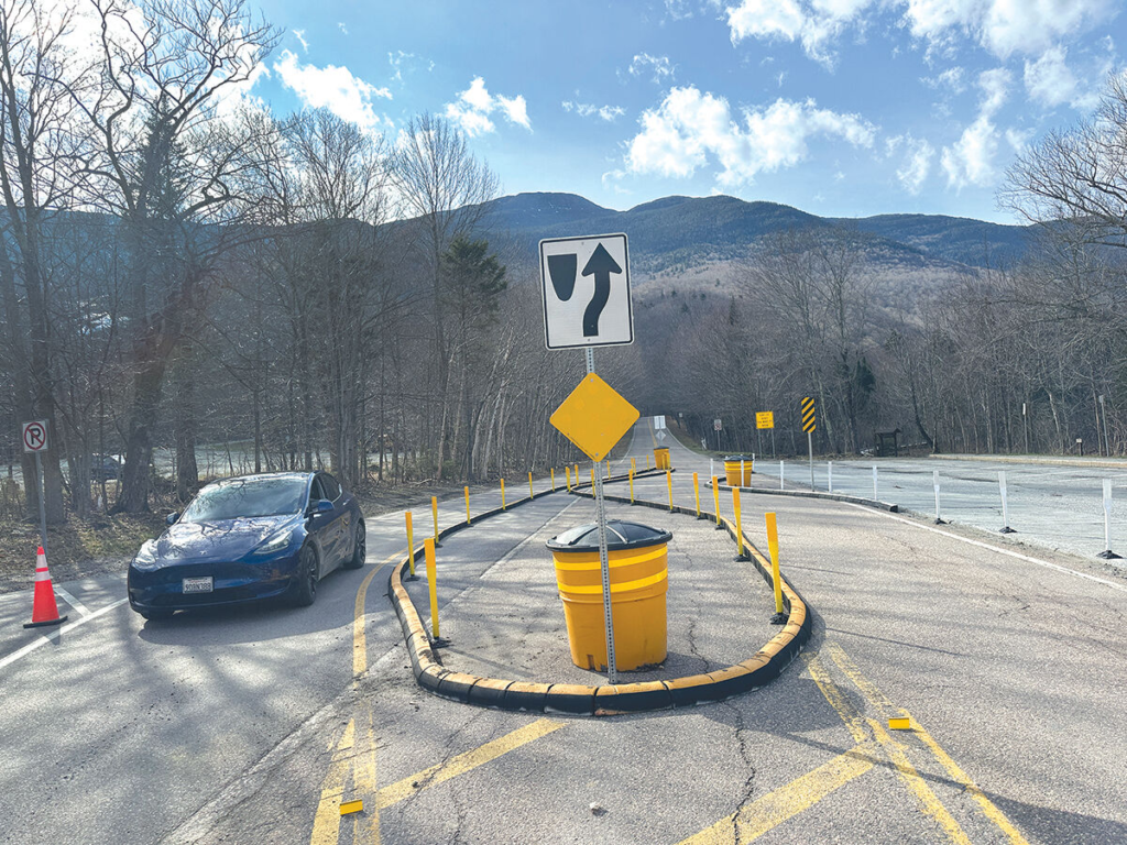
Hazen’s Notch Road crosses a secluded portion of northern Vermont between Montgomery and Westfield. Its distance is not the main concern. The combination of an unfinished surface, isolation, seasonal closure, and rapidly changing mountain conditions creates the problem.
Vermont Tourism states that Hazen’s Notch Road is not paved throughout and can be bumpy. The crossing normally closes from December through April. The road passes an undeveloped state park and a natural area, so commercial services and immediate assistance are scarce compared with busier state highways.
Rain can turn a manageable dirt section into a rough drive marked by ruts, loose stones, puddles, and hidden washouts. Dust during dry weather can reduce visibility behind another vehicle. Cell coverage may also be unreliable in rural mountain country, making a small mechanical problem harder to solve.
This road belongs on a warm-season itinerary only after checking local conditions. Drivers should turn around at barriers or badly damaged surfaces rather than trusting a map application that still displays the road as passable.
Kelley Stand Road: Arlington to West Wardsboro
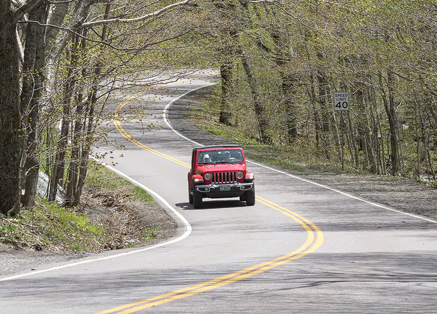
Kelley Stand Road cuts across the southern Green Mountains between the Arlington area and West Wardsboro. Much of its appeal comes from the absence of heavy development. That same remoteness explains why poor weather can turn a pleasant drive into a serious delay.
The western portion passes through Green Mountain National Forest and includes unpaved roadway. The road follows forested terrain near the Roaring Branch and links with recreation areas around Grout Pond and Stratton Pond. Local travel reporting describes the western stretch as a winter-closed road rather than a dependable year-round connection.
The U.S. Forest Service states that most roads in Green Mountain National Forest close from December 15 through May 1, with exceptions based on their individual designations. It also warns that closures can occur because of severe weather, construction, or conditions that make a road unsafe or impassable.
Kelley Stand demands patience after prolonged rain. Forest roads may develop erosion channels, soft edges, standing water, and loose gravel. A navigation app may suggest the crossing because it appears shorter, yet travel time can increase sharply when vehicles must crawl over rough surfaces.
Molly Stark Highway: Vermont Route 9
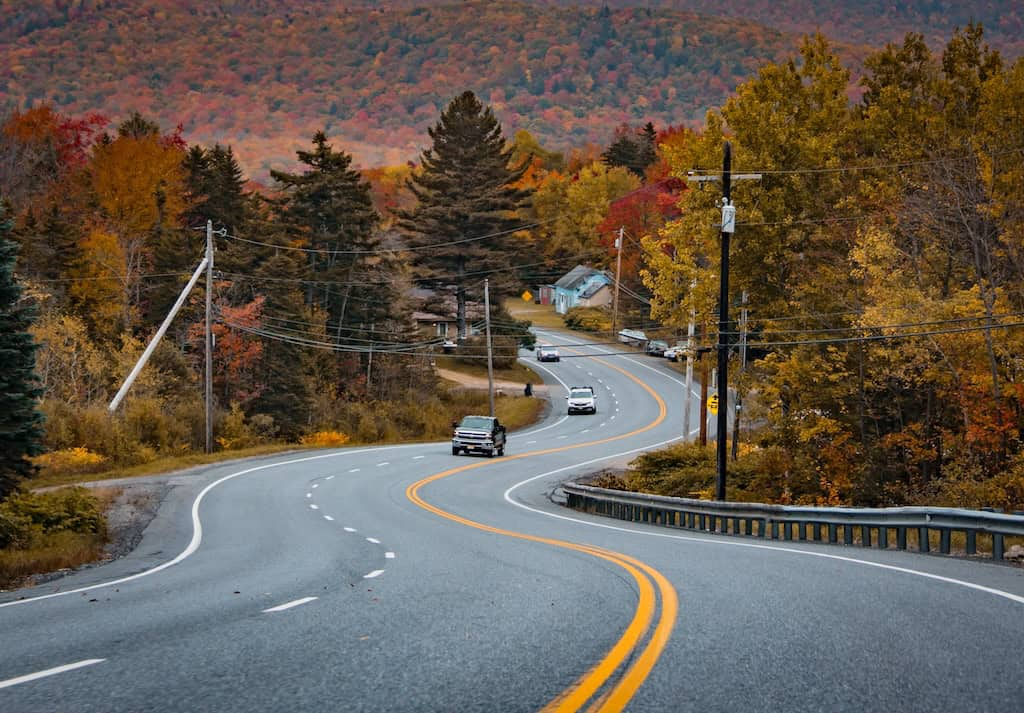
Route 9 between Bennington and Brattleboro is wider and busier than Vermont’s smaller gap roads. That does not make it harmless. The mountain section around Woodford, Searsburg, and Marlboro carries passenger vehicles, motorcycles, delivery trucks, and interstate traffic across southern Vermont.
Marlboro’s official town plan states that changing weather patterns have increased icy conditions on Route 9. The document says those conditions cause frequent traffic accidents and occasional road closures. It also notes that transitions between improved and unimproved sections can produce dangerous driving conditions.
The road can feel deceptively open after drivers leave the tighter streets of Bennington or Brattleboro. Speed builds on downhill sections, yet the next bend may contain slow traffic, ice, fog, an animal, or a vehicle entering from a side road. Winter storms can also strike the higher sections before nearby towns receive significant snow.
The Molly Stark Highway is safest when treated as a mountain corridor, not a rural expressway. Drivers should create more stopping space, expect reduced visibility around Hogback Mountain, and watch for sudden changes in pavement condition.
Middlebury Gap: Vermont Route 125
Route 125 climbs from East Middlebury through Ripton, crosses Middlebury Gap, and descends to Route 100 near Hancock. The road stays close to the Middlebury River for much of its mountain section. That relationship creates impressive scenery, but it also exposes the corridor to flooding, bank erosion, washouts, and slope failure.
A regional benefit-cost study considered the possibility of a complete Route 125 washout and examined an old right-of-way as a potential emergency connection for Ripton residents. Middlebury’s town plan has also discussed alternate access in case Route 125 is washed out again.
The concern is not theoretical. During the July 2023 flooding, a mudslide beside Route 125 destroyed a home and caused evacuations in Ripton. Flood damage was also reported along the road.
Heavy rain is the warning sign that matters most here. Water may carry soil, branches, gravel, or rocks onto the pavement before a formal closure appears online. Drivers should never enter moving water or pass emergency barriers, even when Route 125 is the most direct connection across the mountains.
Granville Gulf: Vermont Route 100
Granville Gulf is a narrow mountain corridor along Route 100 between Granville and Warren. Drivers often approach it as part of Vermont’s famous Route 100 journey, where the state’s postcard reputation can overshadow the road’s exposure to water, ice, and falling debris.
Granville’s hazard mitigation plan identifies flooding, flash flooding, and fluvial erosion as leading local threats. Route 100 appears among the locations vulnerable to those hazards. The plan explains that intense rain, snowmelt, ice, and debris can damage culverts, bridges, riverbanks, and other infrastructure.
That matters because Route 100 serves as the main north-south road through this steep valley. A blocked lane or damaged shoulder can leave few immediate alternatives. During winter, the gulf’s shaded sections may hold packed snow or ice longer than open roads nearby.
Drivers should look beyond the weather displayed for a distant city. Conditions in Granville Gulf may be colder, wetter, or foggier. After major storms, checking Vermont 511 before departure is more reliable than assuming the road remains unchanged.
Somerset Road: Forest Road 71
Somerset Road begins near Route 9 and runs north through Green Mountain National Forest. It provides access to Somerset Reservoir and follows the Deerfield River before connecting with Kelley Stand Road. The scenery feels remote because the route genuinely is remote.
The U.S. Forest Service identifies Somerset Road as Forest Road 71. Its official recreation page notes that potable water is unavailable and that the road passes through forest and wildlife habitat. That lack of roadside infrastructure matters during a breakdown, medical problem, or sudden storm.
Most Green Mountain National Forest roads close during winter, generally from December 15 through May 1, although road-specific exceptions apply. The Forest Service also advises visitors to know current conditions, carry a backup plan, and turn back when circumstances deteriorate.
Somerset Road should not be used as an improvised night shortcut. Fuel, tire condition, daylight, and weather should be checked before entering the forest. Heavy rain and spring thaw can create mud, erosion, fallen branches, or soft shoulders that are difficult to see from inside a low-clearance car.
Why Vermont’s Most Beautiful Roads Catch Drivers Off Guard
The larger risk is not that Vermont secretly maintains a collection of death roads. It is that attractive scenery lowers a driver’s sense of threat. A forest canopy feels calm, a narrow road feels old-fashioned, and a mountain bend looks harmless until another vehicle enters it from the opposite direction.

Many of these roads were built through terrain that leaves little room for modern shoulders, gentle bends, broad sightlines, or alternate access. Weather adds another layer. Rain affects dirt roads, rivers threaten low corridors, and ice forms earlier at higher elevations.
A safe Vermont road trip is less about fear and more about refusing to underestimate the landscape. Slow down before bends, check closures before leaving, keep extra distance, and accept that turning around can be the smartest decision of the day. Vermont Tourism recommends using Vermont 511 for state-road closures while remembering that local roads may not appear on the state map.