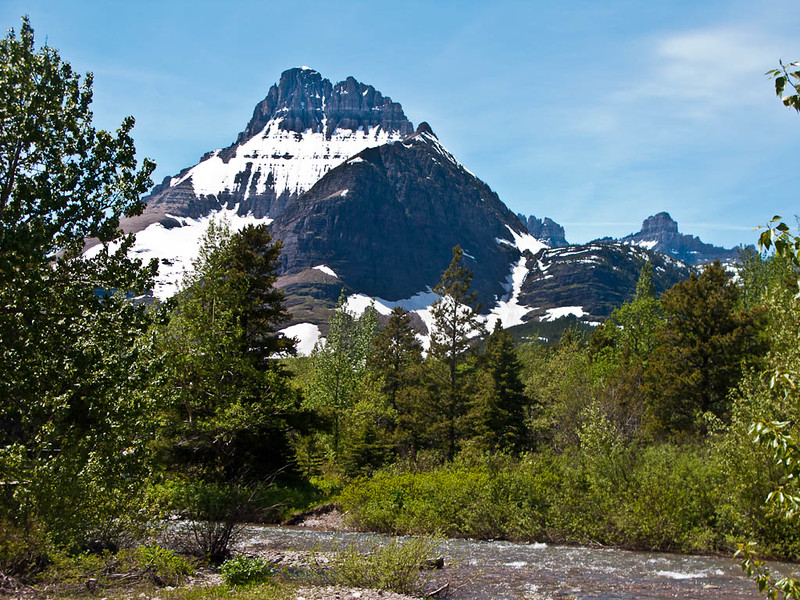
Glacier National Park features more than 700 miles of trails and over 50 day hikes, giving it one of the largest trail systems in the U.S. With only a few days to spend here, choosing where to go can feel overwhelming. Some routes lead past ancient ice fields, while others wind through alpine lakes, dense forests, and open valleys filled with wildlife.
This guide simplifies the decision. It highlights 23 standout hikes that deliver the most rewarding views and experiences across the park. From short scenic walks to challenging full-day treks, each option brings something different, whether that’s dramatic mountain backdrops or quiet lakeside paths.
You’ll find trail picks across key areas like West Glacier, Lake McDonald, Logan Pass, St. Mary, Many Glacier, and Two Medicine. Each region has its own character, so mixing locations helps you get a broader feel for the park without wasting time.
Keep reading to learn the best time of year to hit the trails, practical hiking tips, and where to stay near major trailheads so you can make the most of your trip.
Best Time for Hiking Glacier National Park
The ideal window for hiking in Glacier National Park runs from July through mid-September. During this period, key areas across the park are accessible, including the famous Going-to-the-Sun Road. Most trails are clear of snow, making hikes safer and far more enjoyable for all skill levels.
Outside of this window, lingering snow can block higher elevations and limit access to popular routes. Summer brings longer daylight hours, giving you more time to explore without rushing through the experience.
That said, this is also the busiest stretch of the year. Parking fills up quickly, and popular trailheads can get crowded. Starting your day early—preferably before 8 AM—can make a noticeable difference, offering quieter trails and easier access.
Early September, just after Labor Day, is often a smart choice. Visitor numbers begin to drop, yet the weather remains pleasant enough for hiking, giving you a better balance between comfort and fewer crowds.
When to Go Hiking in Glacier National Park
The ideal window for hiking in Glacier National Park runs from July through mid-September. During this period, key areas across the park are accessible, including the famous Going-to-the-Sun Road. Most trails are clear of snow, making hikes safer and far more enjoyable for all skill levels.
Outside of this window, lingering snow can block higher elevations and limit access to popular routes. Summer brings longer daylight hours, giving you more time to explore without rushing through the experience.
That said, this is also the busiest stretch of the year. Parking fills up quickly, and popular trailheads can get crowded. Starting your day early—preferably before 8 AM—can make a noticeable difference, offering quieter trails and easier access.
Early September, just after Labor Day, is often a smart choice. Visitor numbers begin to drop, yet the weather remains pleasant enough for hiking, giving you a better balance between comfort and fewer crowds.
Read more : 15 Unforgettable Adventures in Glacier National Park, Montana
Top Hikes in West Glacier & Lake McDonald
West Glacier is the main entry for many visitors arriving via Kalispell, with easy access to popular trailheads. Lake McDonald offers a mix of lakeside walks and higher trails with wide views. These hikes are best for time spent on the park’s western side, where distances between stops are short.
1. Avalanche Lake Trail
Distance: 4.6 miles
Elevation Gain: 500 feet
Difficulty: Moderate
Time to Hike: 3 hours
Trailhead: Avalanche Picnic Area
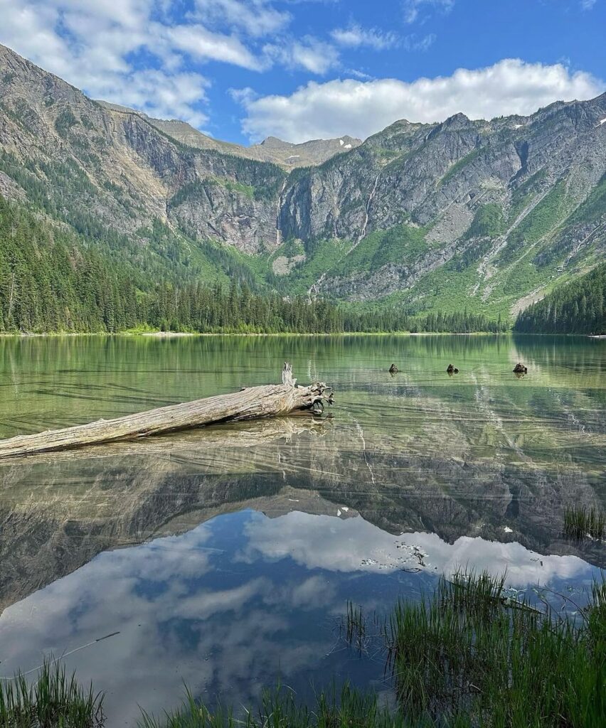
Avalanche Lake Trail is one of the most visited hikes on the west side of Glacier National Park, yet it feels different from many other routes in the park. Instead of wide-open alpine exposure, much of this trail moves through thick forest, giving it a cooler and greener atmosphere that feels almost like a different region entirely.
The hike begins along the Trail of the Cedars, where tall cedar and hemlock trees surround the path. Sections of boardwalk and packed earth lead you through this old forest, creating a calm and steady start. Light filters softly through the canopy, and the setting feels quiet despite the trail’s popularity.
At Avalanche Gorge, the route splits and begins to follow Avalanche Creek. Here, the scenery shifts as bright, milky-blue water rushes past rocky edges and gentle slopes. The trail rolls slightly up and down, staying close to the creek, with the sound of flowing water guiding you forward.
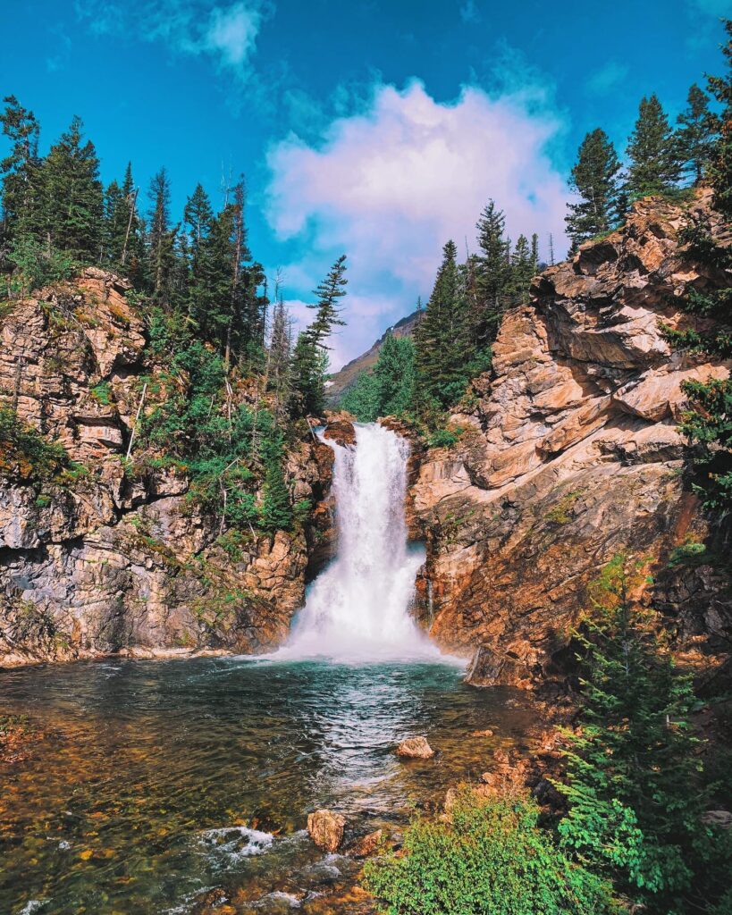
When you arrive at the lake, the landscape opens dramatically. Sheer mountains rise above, cut with long avalanche chutes, while thin waterfalls spill into the water below. Driftwood gathers along the shoreline, adding texture to the scene. If you continue toward the far end of the lake, you’ll usually find fewer people, making it a great place to sit, relax, and enjoy a peaceful break.
2. Trail of the Cedars
Distance: 1.4 miles
Elevation Gain: None
Difficulty: Easy
Time to Hike: 30 minutes
Trailhead: Avalanche Picnic Area
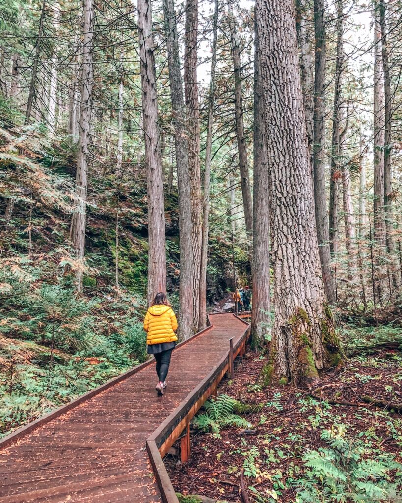
Trail of the Cedars is one of the most accessible walks in Glacier National Park, offering a smooth experience for visitors of all abilities. Located just across the road from the Avalanche Creek Picnic Area, the route follows a raised boardwalk that allows easy movement for wheelchairs, strollers, and anyone looking for a short, relaxed outing.
The path winds through an old-growth forest filled with towering cedar and hemlock trees that feel noticeably different from other areas in the park. The air stays cool and slightly damp, and the dense canopy keeps the trail shaded even during warmer parts of the day. It’s a quiet setting where the pace naturally slows down.
Along the way, interpretive signs provide simple insights into the forest’s geology, plant life, and long history. These stops add context without interrupting the gentle flow of the walk, making the trail both easy to follow and informative.
3. Sperry Chalet Trail
- Distance: 12.6 miles
- Elevation Gain: 3,432 feet
- Difficulty: Strenuous
- Time to Hike: 8-10 hours
- Trailhead: Sperry Trailhead
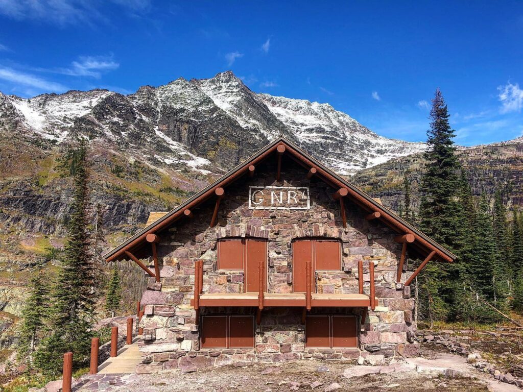
Spending the night at Sperry Chalet is one of the more limited-access experiences inside Glacier National Park. This backcountry lodge, listed on the National Register of Historic Places, sits over six miles from the nearest road, reached only by hiking through rugged terrain from Going-to-the-Sun Road.
Securing a reservation can be difficult, but those who manage it are rewarded with a comfortable place to rest deep in the wilderness. Guests are provided with hearty meals and private rooms, offering a rare mix of backcountry setting and simple comfort that feels far removed from the usual park crowds.
The chalet itself carries a long history. After being heavily damaged during the 2017 wildfire, it underwent major restoration work and reopened in 2021. Today, it stands again as a reminder of Glacier’s early lodging traditions, rebuilt while keeping its original character intact.
For hikers looking to extend the experience, the route continues beyond the chalet toward Sperry Glacier. This added trek is more demanding, but those who push farther are met with a striking high-alpine scene that few visitors take the time to reach.
4. Johns Lake Loop
- Distance: 6 miles
- Elevation Gain: 160 feet
- Difficulty: Easy
- Time to Hike: 1 hour
- Trailhead: Johns Lake Trailhead
The Johns Lake Loop will provide visitors with an enjoyable walk around a loop trail that is relatively flat and easy, perfect for hikers of any age or ability looking to stretch their legs without having to climb many hills.
The 6-mile track with views of Lake McDonald Creek, you will be able to spot two pretty waterfalls, McDonald Falls and Sacred Dancing Cascade in the meantime.
The walk starts at the Johns Lake Trailhead, but you can take shortcuts from either waterfall vista for a shorter hike. This trail passes through a serene old-growth forest of giant cedar and hemlock trees, then leads to Johns Lake.
The surrounding of the lake is mainly covered with Marsh grasses and water lilies making it enormously peaceful. Keep a lookout for Moose, Seen around the lake . Continue on to Sacred Dancing Cascade and McDonald Falls, where the loop meets up again at the trailhead.
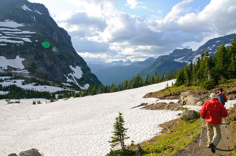
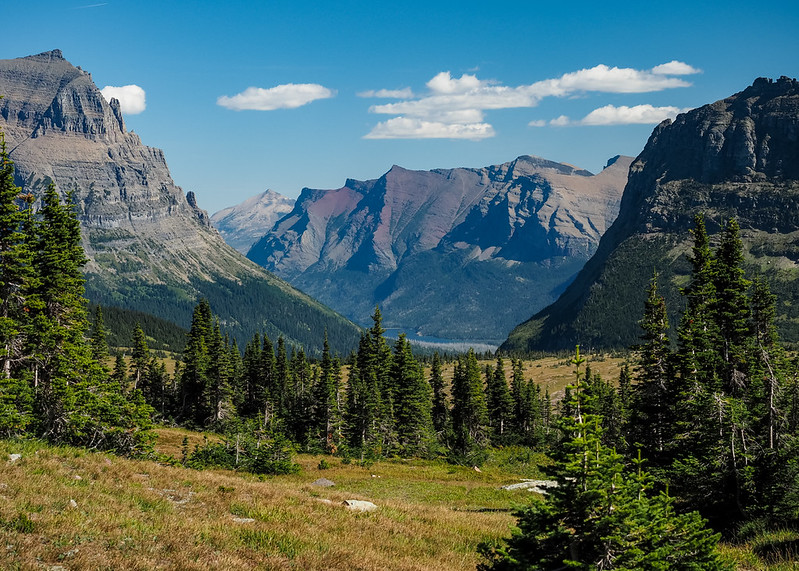
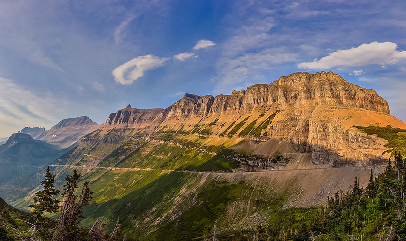
Top Hikes Around Logan Pass & St. Mary in Glacier National Park
Compared to the park’s western side, the Logan Pass and St. Mary areas feel more open and high-elevation, with sweeping mountain views and exposed alpine terrain. These sections are also some of the best places to spot wildlife, including marmots, mountain goats, bighorn sheep, and even bears moving across the slopes.
5. Highline Trail
- Distance: 11.8 miles
- Elevation Gain: 800 feet
- Difficulty: Strenuous
- Time to Hike: 6 to 8 hours
- Trailhead: Logan Pass Visitor Center
The Highline Trail is one of the most famous hikes within Glacier National Park and starts at the high point along Going to the Sun Road where you will enjoy easy access to amazing views. Panorama Ridge has the best of everything that Garibaldi Park is famous for: unimpeded views, abundant wildlife and a pathway through alpine meadows to scenic but rough ridgetops.
For most hikers, it is point to point from Logan Pass Visitor Center to The Loop, relying on free Glacier shuttles for a ride back. Those wanting a shorter hike can make reasonable arrangements, trekking across from Logan Pass to Haystack Pass and heading back the way you came.
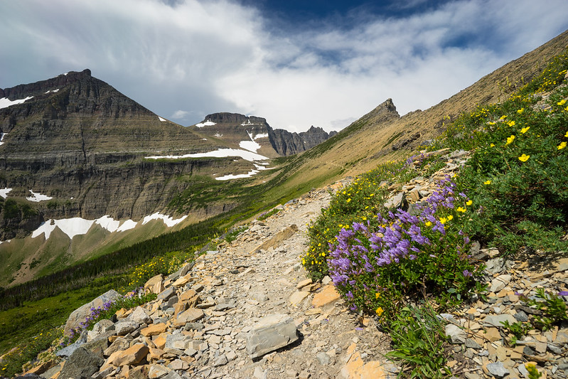
This path starts on an adrenaline filled route clumped to a cliff wall, the hillclimb security cords pierced into solid rock for hikers. Where the trail opens up and you go into a very big meadow with flowers all over, this is maybe one of the most beautiful views over Lake McDonald Valley.
Enjoy watching the marmots and mountain goats that share this hike with you.
Halfway along the Highline Trail, a spur trail to The Garden Wall called Grinnell Glacier Overlook. This bypass ascends to the Continental Divide (then avoids Crest House and Shelter Island), adding about 2 extra miles roundtrip.
You’ll look out towards Grinnell Glacier, McDonald Valley and Many Glacier Valley as well at over five different lakes below you.
Continue on the trail, and you will soon arrive at a remote backcountry lodge called Granite Park Chalet. The trail continues downhill through trees burnt in old wildfires until arriving down at The Loop.
Logan Pass to The Garden Wall – This 7.6KM stretch is widely regarded as the best part of the hike!! The track is quite lengthy, the ascent over a large total distance but this should be easy going for experienced walkers.
Remember, Logan Pass is one of the busiest trailheads in Glacier National Park – try to get there prior to 8am if you can so that way you do not have any trouble finding parking at visitor center.
Read more : Planning 3 Days in Glacier National Park? Here’s the Perfect Itinerary
6. Hidden Lake Overlook Trail
- Distance: 2.8 miles
- Elevation Gain: 460 feet
- Difficulty: Moderate
- Time to Hike: 1.5 to 2 hours
- Trailhead: Logan Pass Visitor Center
Just beyond Logan Pass Visitor Center, the Hidden Lake Overlook Trail is a popular trek with many Glacier visitors. This picturesque highway passes through some rugged terrain and opportunities to see wildlife like mountain goats or bighorn sheep are abundant throughout the drive.
A paved trail begins to the rear of the visitor center and leads through a series of boardwalks in addition with gravel trails that meander across Hanging Gardens. This section offers impressive views of Clements Mountain to the Southeast, a high rock peak that towers above you along the route.
Wildflowers are abundant in the meadows, which also provide a high probability of seeing mountain goats. Approximately 1.5 miles in you reach the overlook where you become instantly gratified by sighting Hidden Lake itself. It is the perfect place to watch either sunrise or sunset and also escape from crowds during midday.
Adventurers who wish a bit more of an effort can hike all the way down to lake level that will tack on another 2.5 miles out and back in total. Please be aware though that this part of the trail is at risk for being closed later in the summer due to bear activity.
Parking at Logan Pass Visitor Center is limited; getting there by 8 AM or after 4 PM may be your best bet.
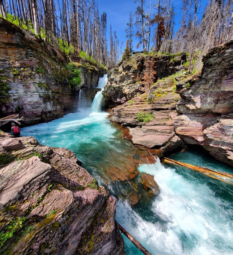
7. St. Mary and Virginia Falls Trail
- Distance: 3.6 miles
- Elevation Gain: 285 feet
- Difficulty: Moderate
- Time to Hike: 1.5 to 2 hours
- Trailhead: St. Mary Falls Trailhead
Calling all waterfalls lovers – if the churning waters of mountain vistas capture your imagination less than cascading falls, then you must set foot on St. Mary and Virginia Falls Trail at some point in time! A moderate hike that will take you past some of Glacier National Park’s most famous falls: St. Mary and Virginia Falls
The trip starts at the St. Mary Falls Trailhead off Going-to-the-Sun Road, a regular stop for the park’s shuttle service. If you start at Sunrift Gorge or the very popular parking area midway on Going-to-Sun Road, Sun Point (the latter hosts lots of late morning visitors),
St Mary Falls (in approx 2.6 miles): Descend quickly through a forest with remains of past fires to reach St Mary Falls This bountiful, sapphire-colored water is coming from above as waterfall in two levels of cascade. On a few hot summer days, you might push yourself to jump into the falls or the creek.
A little over a mile past St. Mary Falls, the train takes you to Virginia Falls. Standing next to a single-drop waterfall that falls over 50 feet, this fall sends glacial waters spraying through the area in droves. Virginia Falls is usually refered to as the more impressive of the two but it receives much fewer visitors.
8. Siyeh Pass Trail
- Distance: 9.2 miles
- Elevation Gain: 2,240 feet
- Difficulty: Strenuous
- Time to Hike: 6 to 8 hours
- Trailhead: Piegan Pass Trailhead
A challenging and rewarding hike that takes you through by some of the most beautiful (and wild) landscapes in Logan Pass. Speaking of one-way trail heads and alpine meadows, this singletrack offers nearly nonstop views of the high mountains.
Getting there: Starting at the Piegan Pass Trailhead, ending near Sunrift Gorge along Going-to-the Sun Road. After hiking up one of the best maintained trails in the park, you’ll arrive at Mount Siyeh’s saddle and view expansive views into both Logan Pass to your south and St. Mary area to the north.
In route, you will travel through Sexton and Many Glacier Pass until arriving at Logan Bonnet where the Highline Trail trails off to a more busy trail. If you want to avoid climbing any, starting at Piegan Pass works best. To reduce the hassle of dealing with logistics, we parked at one end and used the free park shuttle plus a bit of hitching.
For a longer hike, you can make this an out-and-back route and retrace your footsteps instead of taking the shuttle to return.
9. Piegan Pass Trail
- Distance: 9.0 miles
- Elevation Gain: 1,750 feet
- Difficulty: Strenuous
- Time to Hike: 6 to 8 hours
- Trailhead: Piegan Pass Trailhead
Piegan Pass Trail For those seeking a less crowded trail head to the Piegan Pass Trail. Challenging trek with sweeping panoramic vistas of the Logan Pass area and views over three glaciers: Jackson Glacier, Blackfoot Glacier & Piegan Creek.
There is no need for a shuttle, as the Piegan Pass Trail shares its trailhead with the Siyeh Pass Trail. When you have traveled 2.6 miles down this same path, there will be a junction; Then take a left to go up Piegan Pass. The trail leads to the saddle between Piegan Mountain and Mount Pollock with some fantastic views.
The hike takes you through Preston Park, which features seasonal alpine wildflowers adding a splash of color to the landscape.
10. Baring Falls Trail
- Distance: 0.6 miles
- Elevation Gain: 250 feet
- Difficulty: Easy
- Time to Hike: 30 minutes
- Trailhead: Sunrift Gorge Pullout
This is a great option for an easy and short hike in the St. Mary area, as well Frequently ignored in favour of the neighbouring St. Mary and Virginia Falls, Baring Falls is a peaceful spot to relax by your camping tent with an impressive glacial waterfall as a claim to fame.
One of the most easily accessible trails at the park (only a quarter-mile walk from parking to an overlook near Sunrift Gorge) This, in turn, links to Baring Falls from Sun Point for a slightly longer but still fairly easy walk.
Located near busier areas, this trail is surprisingly serene and offers a pleasant but easy change of scenery.
11. Gunsight Lake Trail
- Distance: 13.2 miles
- Elevation Gain: 1,750 feet
- Difficulty: Strenuous
- Time to Hike: 6 to 8 hours
- Trailhead: Gunsight Pass Trailhead / Jackson Glacier Overlook
The Gunsight Lake Trail is a great option for lodging guests looking to hit the trails and avoid crowds (but only if you’re into that sort of thing). The trail sets out from the Jackson Glacier Overlook just around Siyeh Bend off of Going to the Sun Road and into a remote, alpine wonderland.
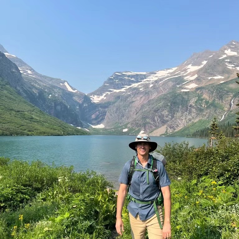
The trail started with a descent from the overlook and then was open slightly to approach St. Mary River and Reynolds Creek in a beautiful valley. At the end, you come to Gunsight Lake… a blue hole set under the peaks of towering mountains. If you have a backcountry camping permit, get ready to camp on the lake itself for some of the most remote wilderness ever.
This also an area that has a lot of Wildlife, you are in grizzly and black bear country here, with lots of moose as well so keep your eyes peeled.
Top Hikes in Many Glacier – Glacier National Park
Many Glacier stands out as one of the park’s prime areas for hiking, known for its dramatic scenery and well-known trails. Routes like Grinnell Glacier and Iceberg Lake start here, drawing hikers looking for classic backcountry views.
If your main reason for visiting Glacier is to hit the trails, this region offers some of the strongest options, with routes that highlight the park’s rugged peaks, glacial lakes, and wildlife-rich valleys.
12. Grinnell Glacier Trail
Distance: 10.6 miles (7.2 miles with boat tour)
Elevation Gain: 1,600 feet
Difficulty: Strenuous
Time to Hike: 6 to 8 hours
Trailhead: Many Glacier Hotel near the Many Glacier Ranger Station
The Grinnell Glacier Trail ranks among the most rewarding hikes in Glacier National Park, leading hikers past a chain of glacial lakes and up to one of the park’s most striking glacier views. Throughout the route, shifting scenery keeps the experience engaging, with each section offering a different perspective of the surrounding peaks.
There are two main ways to complete this hike. You can start directly from the trailhead and follow the shoreline of Swiftcurrent Lake and Lake Josephine, covering the full 10.6 miles. Alternatively, many hikers choose the boat option from the Many Glacier Hotel, which shortens the distance by about 3.4 miles roundtrip. While the boat doesn’t reduce the elevation gain, it adds a guided experience with insights from local operators along the way.
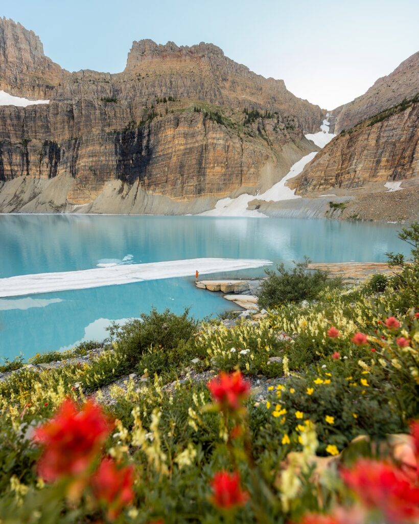
Beyond Lake Josephine, the trail begins its steady climb. The route transitions from shaded forest into a more open alpine setting, where wide views stretch across meadows dotted with seasonal wildflowers. Looking back, the bright teal waters of Lower Grinnell Lake appear far below, creating a strong contrast against the surrounding terrain.
The final stretch leads to Upper Grinnell Lake, where the trail comes to an end at a cold, blue-green body of water often filled with floating ice. Surrounding it are Grinnell Glacier, Salamander Glacier, and the steep ridges of the Garden Wall rising above. Wildlife sightings are common here as well, with chances to spot grizzly bears, mountain goats, bighorn sheep, and even moose along the route.
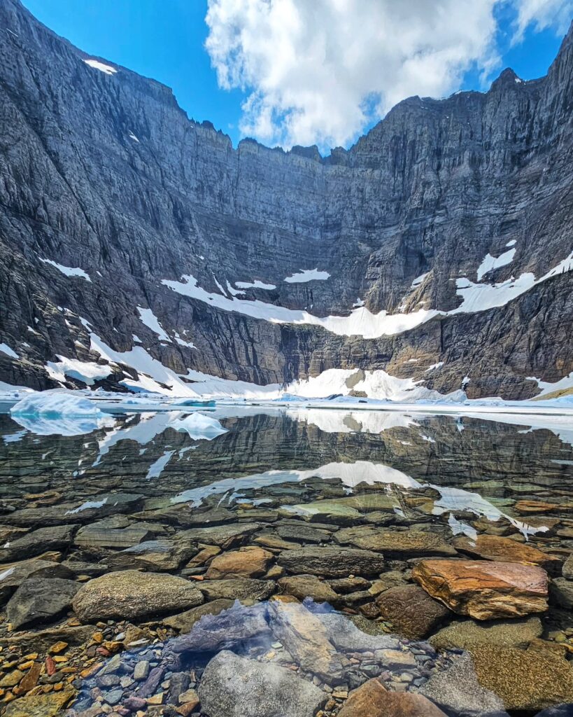
13. Iceberg Lake Trail
- Distance: 9.6 miles
- Elevation Gain: 1,200 feet
- Difficulty: Moderate
- Time to Hike: 4 to 6 hours
- Trailhead: Iceberg Ptarmigan Trailhead
Another great Many Glacier area hike is the Iceberg Lake Trail. This is a relatively easy hike that starts behind the Swiftcurrent Motor Inn and ends at an iceberg filled glacial lake (seriously). It stays cold enough that the icebergs can last all year long.
The trail for the first few miles is shared with Ptarmigan Tunnel, an area famous as grizzly habitat and a tasty spot if near huckleberries. At Ptarmigan Falls, the trail diverges to the left towards Iceberg Lake.
At the lake brilliant blue water is bordered by snowy peaks and adds a fantastic view at the end of this hike. A great place to stop for a picnic lunch, followed by your return hike along the same path back to the trailhead.
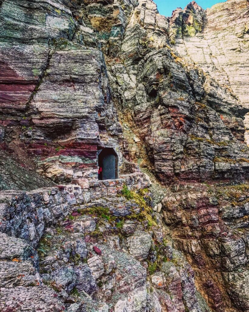
14. Ptarmigan Tunnel Trail
- Distance: 10.6 miles
- Elevation Gain: 2,300 feet
- Difficulty: Strenuous
- Time to Hike: 6 to 8 hours
- Trailhead: Iceberg Ptarmigan Trailhead
Given our imaging needs, we opted to enter America the night before and on Day 1 of this adventure hike one of Glacier National Park’s more unique treks -The Ptarmigan Tunnel Trail. This difficult path edges towards a nearly century old, historic 250-foot tunnel through the side of mountain.
Built in 1930 by the Civilian Conservation Corps for horseback sightseeing trips, it links Many Glacier Valley with the isolated Belly River Valley via a tunnel bored through towering Ptarmigan Wall.
The tunnel is usually open from late July through September but because of heavy snowfall this year, it has not yet opened. If you visit earlier in the summer, then this hike may be worth saving for later as much of the appeal is lost if you’re unable to actually go through the tunnel.
The Iceberg Lake Trail shares its first 2.7 miles with the villages Creek Highlands trail. When the trail splits at Ptarmigan Falls, stay right on the path to Ptarmigan Lake. The road has a small textile ascent of 500 feet in under a mile, so it’s best seen when moving down the other side.
Once you have crossed over the Ptarmigan Tunnel, You will be reintroduced to a new section of Glacier National Park.
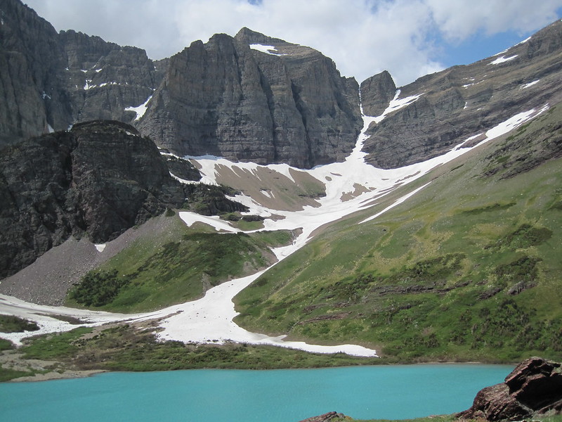
15. Cracker Lake Trail
- Distance: 12.8 miles
- Elevation Gain: 1,400 feet
- Difficulty: Moderate
- Time to Hike: 5 to 7 hours
- Trailhead: South end of Many Glacier Hotel parking lot
With all their bright blue alpine lakes, Many Glacier is a well-known spot for it’s scenic beauty and if you have already tackled Grinnell Glacier or Iceberg Lake then Cracker Lake should be your next stop on your trail list.
The hike, a steady climb that starts on the Many Glacier Hotel lot and passes Sherburne Lake before eventually ending with Ptarmingan Falls, in no way meant to be difficult. The trail winds through forested patches before opening up to the incredible Cracker Lake. This alpine treasure is encircled by flower-filled meadows and towering mountain peaks.
Like most hikes in the area, bear sightings are prevalent so make sure to pack some bear spray and be on your guard all through this hike.
16. Swiftcurrent Pass Trail
- Distance: 13.6 miles
- Elevation Gain: 2,300 feet
- Difficulty: Strenuous
- Time to Hike: 8 to 10 hours
- Trailhead: Swiftcurrent Trailhead by Swiftcurrent Motor Inn parking area
The Swiftcurrent Pass Trail is an excellent choice for advanced hikers looking to experience a challenging backcountry hike. This is a sharp climb through Iowa Lake, and over the Swiftcurrent Valley rim (Anthony Mountain), with magnificent views from above the Continental Divide. A popular side trip, Swiftcurrent Fire Lookout offers fantastic views along the park’s highest maintained trail.
We started hiking from Swiftcurrent Trailhead behind the Swiftcurrent Motor Inn. The first port of the trail is quite flat and you will be walking through Fishercap Lake, Redrock Lake, Redrocks Falls and Bullhead lake; which are all great spots to see a moose.
Heading up into the Swiftcurrent Valley you are rewarded with panoramic vistas of isolated summits such as Heavens Peak, Granite Park Mountain (again), and myriad lakes.
Note that snow may persist at higher elevations into July or even August, so count on some areas of the trail to be snowy.
17. Redrock Falls Trail
- Distance: 3.6 miles
- Elevation Gain: 100 feet
- Difficulty: Easy
- Time to Hike: 1 to 2 hours
- Trailhead: Swiftcurrent Trailhead by Swiftcurrent Motor Inn parking area
Many Glacier is one of the best places in the entire park to spot a moose, and although this particular hike isn’t overly strenuous or difficult it is very pretty.
The trailhead starts at the Swiftcurrent Trailhead, which is surpassed where you will find the lodging and establishments of the same name as well. This mostly level trail winds around Fishercap Lake and Redrock Lake. Make sure you take the side roads to get close and personal with mooses feeding in the water.
The path ends at Redrock Falls, a lovely waterfall tumbling down the base of Swiftcurrent Mountain. Relatively easy hike with panoramic vista views and numerous wildlife viewing possibilities.
With the boat tour, this is an easy 2.2-mile trail that is perfect for families or those looking for a low-impact trail. Glacier Park Boat Company also offers a guided hike and boat tour option.
18. Grinnell Lake Trail
- Distance: 6.8 miles (2.2 miles with boat tour)
- Elevation Gain: 60 feet
- Difficulty: Easy
- Time to Hike: 2 to 3 hours
- Trailhead: Many Glacier Hotel near the Many Glacier Ranger Station
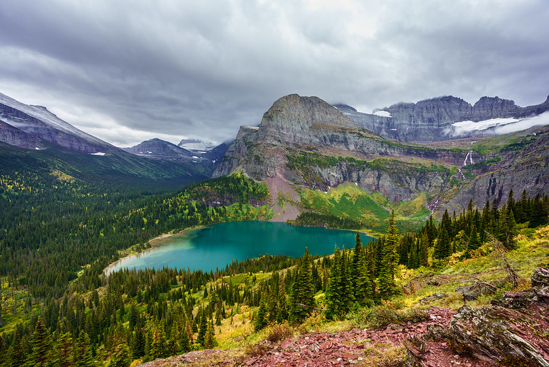
A good more moderate hike to the Grinnell Glacier trails is the hike to Grinnell Lake. With similar yet less, elevation gain panoramas of meadows and mountains this is a great alternative to the more challenging hikes.
Lower Grinnell Lake, nestled between dramatic peaks as an alternative to climbing up to Upper Grinnell Lake.
You can hike the whole 6.8 miles from Many Glacier Hotel, skirting Swiftcurrent Lake and Lake Josephine or you may take one of two boat tours cutting out 4.6 miles each down to Grinnell Point In any case, you get a scenic route with more rolling hills and less exertion than the Grinnell Glacier hike.
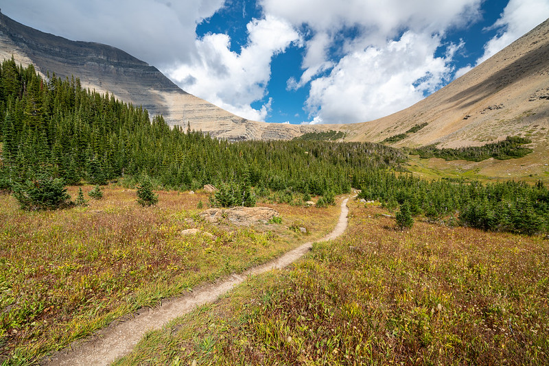
Top Hikes in Two Medicine – Glacier National Park
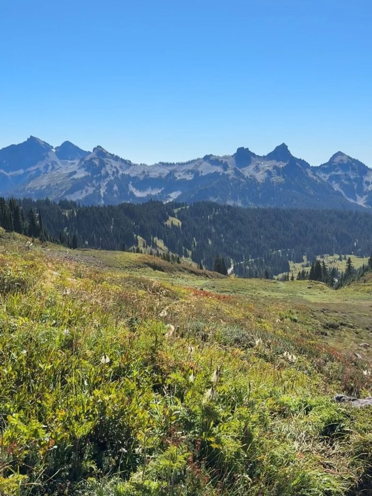
Two Medicine sees fewer visitors than many other areas of the park, mainly due to its more remote location. Reaching it requires about an hour’s drive south of St. Mary, which naturally keeps the crowds lower.
Those who make the trip are met with quieter trails and some of the park’s finest sunrise views, where the early light hits the peaks and lakes in a calm, open setting.
19. Pitamakan Pass & Dawson Pass Loop
- Distance: 17.5 miles
- Elevation Gain: 2,700 feet
- Difficulty: Strenuous
- Time to Hike: 10 to 12 hours
- Trailhead: North Shore Trailhead
It is intended for very experienced hikers and should only be attempted if you are in fantastic shape. Because the fire look out is remote and secluded, it boasts some of the best sights in Glacier National Park.
The trail can be traveled in either direction, but it’s most commonly accessed from the North Shore Trailhead on Two Medicine Lake. Then its a bit of an ascent to Dawson Pass, so if you want the easier climb go counterclockwise starting with Pitamakan pass.
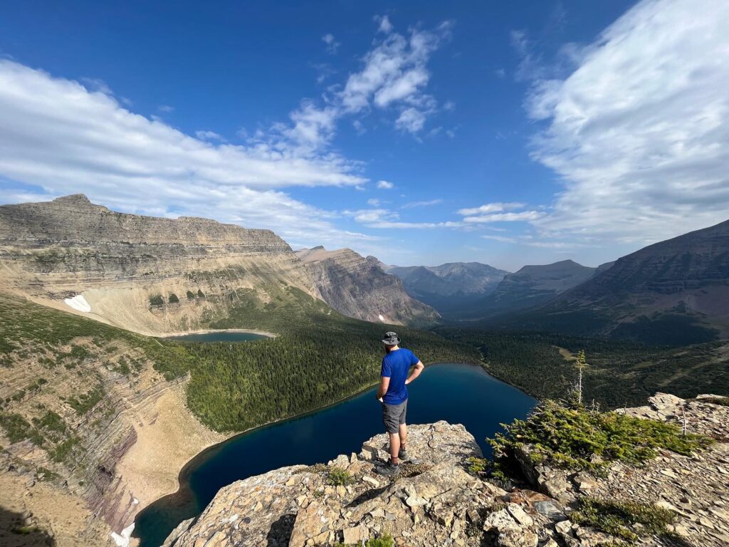
The loop traverses a mix of alpine lakes and meadows, avalanche chutes and towering peaks. Pitamakan Pass has a panoramic view that includes five high country lakes, and the 2.9 miles between Dawson/Pitamakan Passes is one of Glacier’s prettiest stretches.
Want to come in for an overnight experience, backcountry permits are available that enable you turn it into a multi-day excursion with stays at Oldman Lake or No Name Lake campsite. Three miles of that trail can also be bypassed by taking the Two Medicine boat tour.
High in the mountains snow may be encountered, even during the summer and crampons could be required. In August or September For the best conditions tackle this trail.
20. Paradise Point Trail
Distance: 1.4 miles
Elevation Gain: 100 feet
Difficulty: Easy
Time to Hike: 30 minutes
Trailhead: South Shore Trailhead
Paradise Point Trail offers a relaxed way to experience the Two Medicine area of Glacier National Park without taking on a demanding route. While this region is known for longer and more challenging hikes, this short loop provides a lighter option that still captures the setting.
The trail begins near the Two Medicine Lake parking area and follows the shoreline at an easy pace. The path stays mostly level, making it suitable for a wide range of hikers. Along the way, you might spot wildlife near the water, including beavers quietly moving along the edges.
Early morning is the best time to walk this trail. When the lake is calm, the surrounding mountains reflect clearly on the surface, creating a still and striking scene that feels calm and unhurried.
21. Running Eagle Falls Trail
Why you should go: A distinctive waterfall with a perfect spot for a family picnic, just a short walk from the road.
- Distance: 0.6 miles
- Elevation Gain: 26 feet
- Difficulty: Easy
Running Eagle Falls Set in an idyllic little meadow near the entrance to Two Medicine Lake, just outside East Glacier Park Village (which is located on U.S. Route 2), Running Eagle Falls provide a perfectly pleasant way to stretch your legs after driving into the park. It’s also the perfect place to stop for a snack and let your little one get some energy out.
The trail is groomed, flat and very easy for all ages.
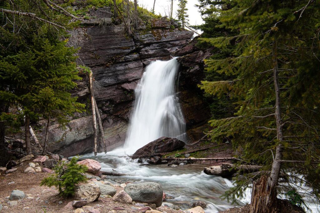
The running eagle falls is a beautiful display. It appears to come directly from the cliff, giving an impressive visual impact. At the bottom, a shallow pool at base (along with smooth gravel-studded creek) makes play ground for kids An ideal location to relax in and enjoy a picnic with plenty of room.
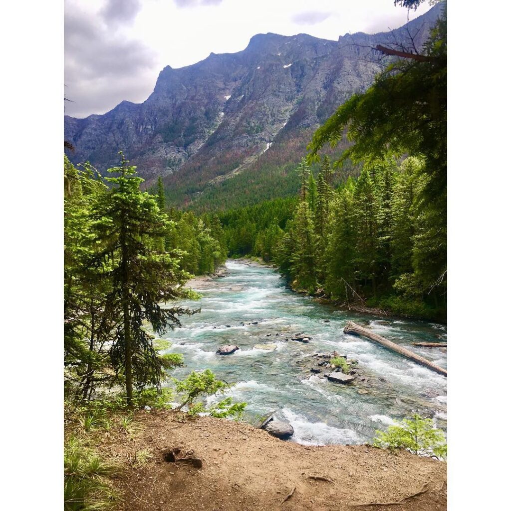
22. McDonald Creek
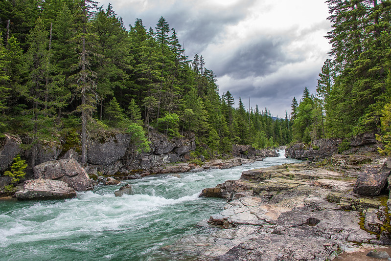
Why you should go: A serene escape from the crowds, offering a quiet, easily accessible trail with plenty of charm.
- Distance: 5.0 miles
- Elevation Gain: 213 feet
- Difficulty: Easy
McDonald Creek is perfect for folks looking to get away from the crowds in one of Glacier’s busier areas. It is an easy hike and since in the summer time it doesn’t get as much traffic than other trails on Hurricane Hill.
The clear glacial waters of the creek rush and splash over large boulders by rapids, cascade down small waterfalls. Though not as dramatic of a hike compared to others, McDonald Creek provides tranquil backcountry atmosphere and so offers the perfect antidote for stepping out from some of busier sections in the park.
At the end of the hike, there are bigger falls for that with fewer views than previous trails giving a peaceful serenity in general. Watch out for wildlife such as moose and bears, which are easier to find here than in busier sections of the park.
23. The Garden Wall
Why you should go: Reach new heights atop the Continental Divide, where expansive views make the challenging climb worthwhile.
- Distance: 14.7 miles
- Elevation Gain: 3,507 feet
- Difficulty: Challenging
Hiking to The Garden Wall is a worthy adventure for those looking for an inspiring day on the trail. One of the most emblematic rock formations in all Tetons, with an elevation well over 13k feet seen here towering on The Continental Divide and providing a panoramic view that will even take experienced explorers’ breath way!
The trail is tough, no bones about it. It has steep uphill sections as well as rocky scrambling portions. The hike is difficult but the views both along the way and from above make it one of a kind. The Garden Wall summit will deliver panoramic views in all directions, as if you have finally made it to the top of the world.
The Garden Wall is itself a national park iconic, with grinnell glacier below and adding scope to the scene.
Essential Information for the Best Day Hikes in Glacier National Park
- Park Entry Pass Required: All visitors must purchase an entry pass. The America the Beautiful Pass is a cost-effective option if you plan to visit multiple parks, offering 12 months of access to 400+ sites.
- Vehicle Reservations Needed: Separate reservations are required for high-traffic areas, including Going-to-the-Sun Road, North Fork, Many Glacier, and Two Medicine. These are limited and should be booked in advance.
- Start Early for Parking: Trailheads at Logan Pass and Many Glacier fill up fast. Arriving by around 8 AM helps you secure a spot and avoid heavy foot traffic.
- Limited Hiking Season: Most trails are accessible from July to September. Snow and road closures, especially along Going-to-the-Sun Road, restrict access during other months.
- Check Trail Conditions: Always review current trail status before heading out. Closures can happen due to weather, construction, or wildlife activity. Park rangers are also a reliable source for updates.
- Keep Distance from Wildlife: Maintain at least 100 yards from bears and wolves, and 25 yards from other animals. Respecting this space is critical for safety.
- Carry Bear Spray: Recommended on every hike, regardless of length. Bear spray is widely available for purchase or rent at nearby outdoor stores.
- Dress in Layers: Weather can shift quickly, especially at higher elevations like Logan Pass. Bring a warm layer and a rain jacket to stay prepared.
Where to Stay Near the Best Trails in Glacier National Park
Finding a place to stay close to the main trail areas can save time and make early starts much easier. Lodging options range from historic lodges to simple cabins, with choices spread across different park regions. Each area offers its own advantages depending on which trails you plan to hike.
West Glacier
- Lake McDonald Lodge – A classic Swiss-style lodge set along the lake, offering wide views and several dining options.
- Village Inn at Apgar – A simple, motel-style stay with both standard rooms and units that include full kitchens.
- Belton Chalet – A 3-star property near the Flathead River, within walking distance of shops and local spots.
- Glacier Guides Lodge – A small lodge close to the main West Glacier area, convenient for nearby services.
- Glacier Outdoor Center – A mountain-style stay with private cabins, located a short drive from the park entrance.
- Great Northern Resort – Cabin accommodations near the historic railway line, just minutes from the West Entrance.
Going-to-the-Sun Road & St. Mary
- Rising Sun Motor Inn – A rustic option near St. Mary Lake, with a restaurant and small shop on-site.
- St. Mary Village – A 3-star resort located close to the St. Mary Entrance, making it easy to access eastern trails.
- Cottages at Glacier – Comfortable two-bedroom cabins just outside the park boundary.
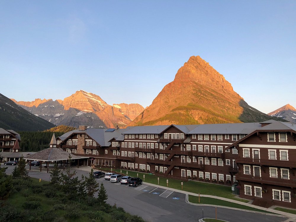
Many Glacier
- Many Glacier Hotel – A well-known Swiss-style lodge with strong views and an on-site dining room.
- Swiftcurrent Motor Inn – A more basic stay with a camp store and quick access to nearby trailheads.
Choosing the right base depends on your hiking plans. West Glacier works well for lake and forest trails, St. Mary gives access to higher elevations, and Many Glacier places you close to some of the park’s most demanding routes.
Read more : Looking for the Best Stays in Glacier National Park? Here Are 18 Picks
Final Thoughts on the Best Hikes in Glacier National Park
Exploring Glacier on foot remains one of the most direct ways to experience its landscapes. Trails lead you through forests, along lakes, and up into higher terrain where the views shift with every mile. Walking these routes gives you a closer connection to the park than simply driving through it.
Another strong point is the range of options available. Whether you prefer a short, easy path or a longer climb with more elevation, there’s something here that fits different energy levels and time limits. This mix allows visitors to plan their days without feeling restricted to one type of hike.
Overall, the trails highlighted in this guide cover a wide spread of what the park offers—from gentle walks to more demanding routes. No matter which you choose, each hike brings a different angle of Glacier’s terrain, making every outing feel worthwhile.