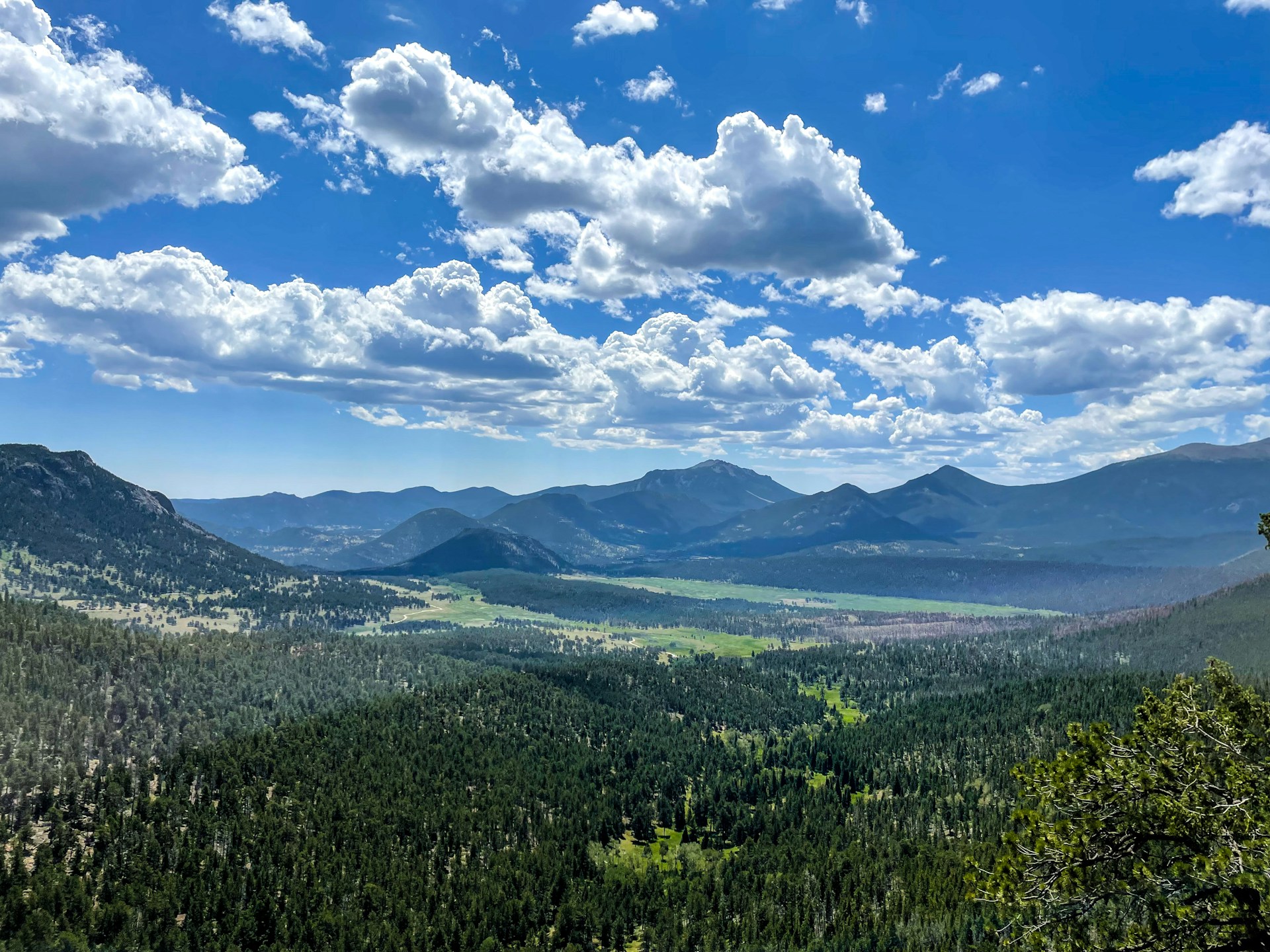
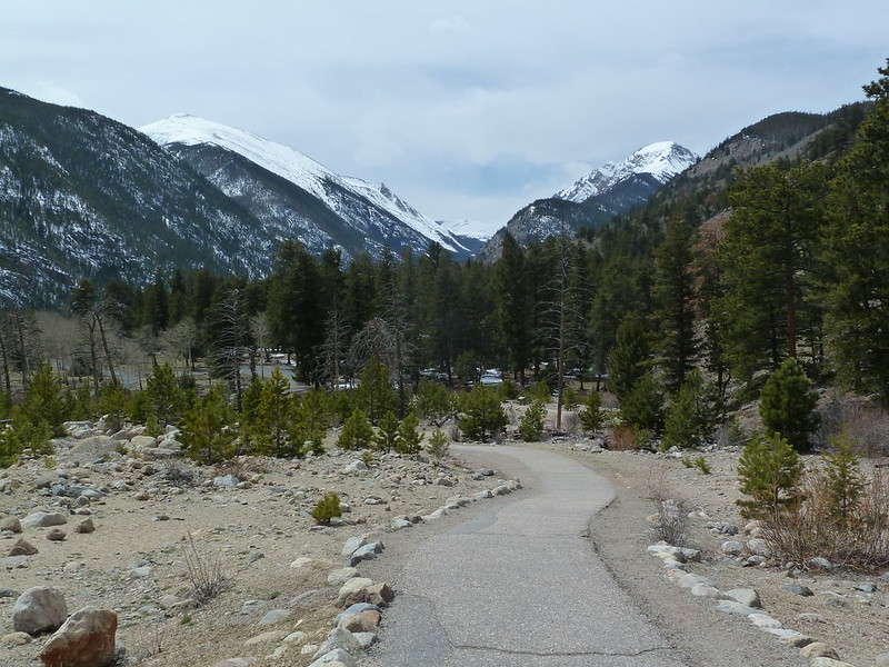
Exploring Rocky Mountain National Park on foot reveals its real character. Trails move past still lakes, climb through forested slopes, and stretch upward to ridgelines where the views feel endless. Some paths are short and easy, ideal for a calm outing, while others demand effort and reward you with high-elevation scenery.
One of the park’s strengths is how well it fits different hiking styles. Families can enjoy simple lakeside loops without much elevation gain. Casual hikers can reach scenic viewpoints without committing to long distances. For those wanting a challenge, routes that push toward peaks like Longs Peak offer a tougher, more intense experience.
The variety keeps things interesting from start to finish. You might begin your day on a smooth path circling water, then move into a steeper trail that opens into wide alpine terrain. Each section feels different, giving you a fresh perspective without leaving the park.
Before stepping onto any trail, follow the seven principles of Leave No Trace. Plan ahead and stay prepared for shifting conditions. Stick to marked routes to protect the environment. Carry out everything you bring and leave areas as they were. Keep campfire impact low, respect others on the trail, and always keep a safe distance from wildlife without feeding or approaching them.
Top Hikes in Rocky Mountain National Park
Before going into the full breakdown, here’s a quick look at five standout hikes in Rocky Mountain National Park. These routes cover a wide range, from short and easy walks to longer efforts that demand more time and energy. It’s a helpful starting point if you want a simple snapshot before choosing your trail.
Our Favorite Hikes in Rocky Mountain National Park
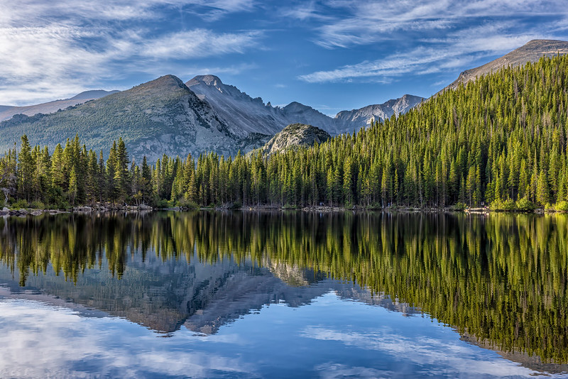
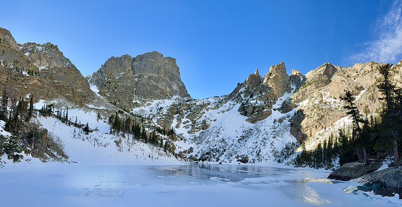
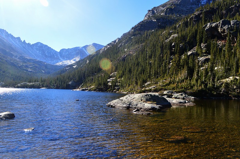
Nymph, Dream & Emerald Lake
This short and easy route is a great starting point for first-time visitors. The trail connects a series of lakes, each with its own character, and can be extended to include Bear Lake or Lake Haiyaha. It’s also a smart choice for your first day, helping your body adjust to the higher elevation without too much strain.
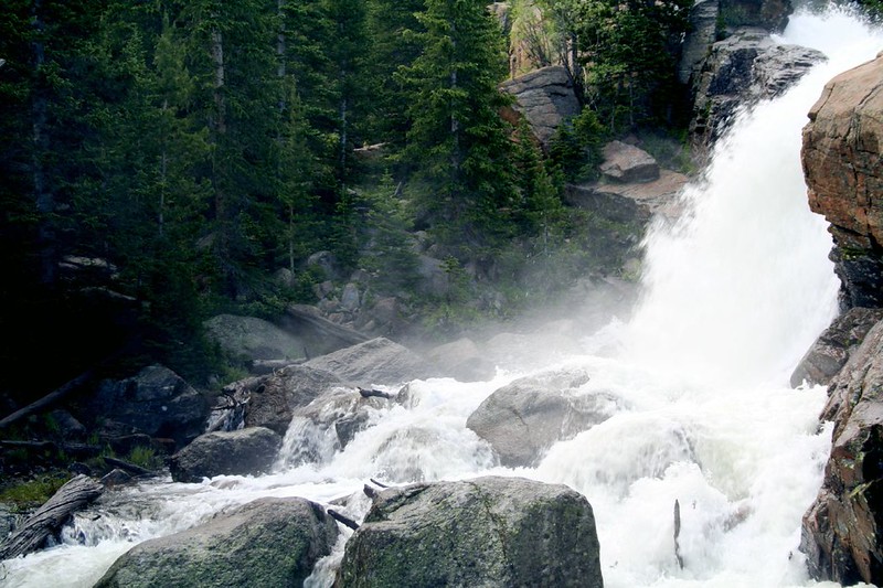
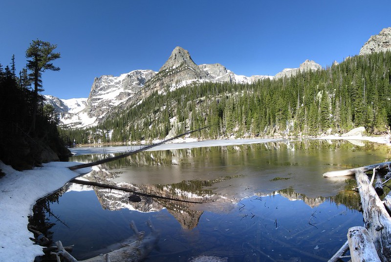
Sky Pond
One of the most popular hikes in the park, and for good reason. The trail keeps things interesting with waterfalls, changing terrain, and a steady climb that leads to a striking alpine lake. The final view at Sky Pond makes the effort feel well worth it.
Tombstone Ridge
If you want big views without a long commitment, this is a solid option. The trail is short and fairly easy, yet it delivers wide mountain scenery almost the entire way. It also pairs well with a drive along Trail Ridge Road, making it an easy add-on to your day.
Continental Divide Trail to Mt. Ida
This is a longer and more demanding hike, but it offers something different from the lake-focused routes. Much of the trail stays above the tree line, giving you open, sweeping views for most of the journey. It’s a great pick if you prefer wide landscapes over forested paths.
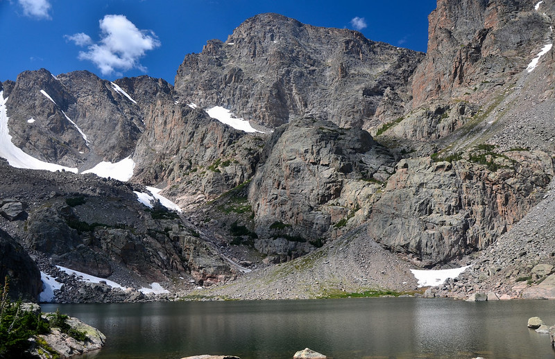
Chasm Lake
This hike shares some similarities with Sky Pond, with a longer distance and steady elevation gain. The reward is a striking lake set beneath towering rock faces, along with close views of Longs Peak. It’s a strong choice if you’re ready for a more challenging day on the trail.
The list is arranged from the most accessible paths to those that require more endurance. You can begin with gentle, low-effort routes and gradually move up to trails that climb higher and stretch farther into the mountains. This structure makes it easier to match a hike with your comfort level.
Each option here is a day hike, meaning you can complete it without overnight gear or extended planning. Whether you have just a few hours or a full day to spare, these trails fit into a single outing. Keep in mind that all distances mentioned are round-trip, so plan your time and energy accordingly.
1. Bear Lake Trail: The Easiest and Most Popular Walk in Rocky Mountain National Park
One of the shortest and most visited hikes in Rocky Mountain National Park, Bear Lake offers a relaxed way to enjoy the scenery. The path circles a calm lake and stays mostly level, making it feel more like a peaceful stroll than a demanding hike.
The full loop is under a mile, so it works well for all ages and fitness levels. While the surface is mainly gravel rather than pavement, it is still considered accessible for visitors with mobility needs. The gentle terrain makes it an easy option if you want something light without giving up good views.
This trail also doubles as a simple learning route. At the trailhead, you can pick up an interpretive guide for a small fee. It highlights 30 marked points along the path, sharing details about the surrounding landscape and the Bear Lake area as you walk.
Bear Lake Hiking Stats
- Distance: 0.6 miles round-trip
- Time: About 30 minutes
- Difficulty: Easy
- Location: Begins at the Bear Lake Trailhead, at the end of Bear Lake Road
Parking is available at the trailhead, but the lot fills up quickly, often by early morning. Arriving early helps you secure a spot and enjoy a quieter walk before the crowds build.
Many other well-known hikes begin nearby, including routes to Emerald Lake, Sky Pond, and Flattop Mountain. If you’re already heading out on one of those trails, adding Bear Lake takes very little extra time and fits easily into your day.
2. Alberta Falls: A Short Hike to One of the Park’s Most Loved Waterfalls
Alberta Falls is among the most visited waterfalls in Rocky Mountain National Park, and it’s easy to see why. The trail to reach it is fairly simple, making it a great option if you want a quick outing with a strong reward at the end.
Starting from the Glacier Gorge parking area, the route climbs gently uphill. The incline is steady but manageable, so most hikers can handle it without much trouble. As you approach the falls, the sound of rushing water builds, adding to the experience before the view even opens up.
Once there, you can move along short paths beside Glacier Creek to find different angles of the waterfall. Each spot offers a slightly different look, so it’s worth taking a few minutes to walk around. Early morning is especially nice, as the light hits the water and fewer people are around.
Alberta Falls Hiking Stats
- Distance: 1.7 miles
- Difficulty: Easy
- Time: 1 to 1.5 hours
- Location: Starts at the Glacier Gorge parking lot on Bear Lake Road
Parking fills up quickly here, often before sunrise. Arriving early gives you a better chance at a spot and a quieter trail. If the lot is full, you can park at the larger area near the Bear Lake Trailhead and follow the signs to Alberta Falls. This adds about 0.4 miles to the total distance.ome peace and quiet while sitting upon one of these lookouts watching sunrise over the mesa landscape.
3. Alpine Ridge Trail: A Short Climb with Big Views
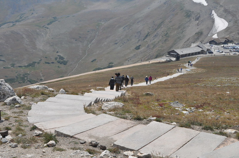
The Alpine Ridge Trail in Rocky Mountain National Park may be just over half a mile round trip, but it feels more demanding than the distance suggests. Even hikers in good shape can find themselves catching their breath along the way.
The route begins at the Alpine Visitor Center, the highest visitor center in the United States. From there, it’s a steady climb up a long staircase leading to a viewpoint. There’s no complicated route to follow—just a direct push upward.
What makes this hike feel tough is the elevation. You’re starting just below 12,000 feet, where the air is thinner and every step takes more effort. If it’s your first day in the park or one of your first days at high altitude, taking breaks is completely normal. Moving slowly helps you adjust and makes the climb more manageable.
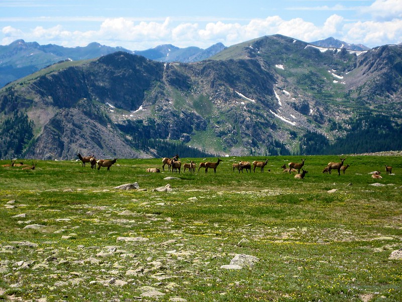
At the top, you reach 12,005 feet, where wide views stretch across the park. On clear days, you can see far beyond the surrounding peaks, and wildlife sightings are common. Elk are often spotted in the area, including large males with impressive antlers.
This trail is short but memorable. The climb may push you a bit, but the payoff at the top makes it worth it.
Alpine Ridge Trail Hiking Stats
- Location: Alpine Visitor Center on Trail Ridge Road
- Distance: 0.6 miles
- Difficulty: Easy
- Time: About 30 minutes
4. Gem Lake Trail: A Short Climb with Rewarding Views
Gem Lake is one of the easier lake hikes in Rocky Mountain National Park, though it still brings a bit of effort along the way. The trail is not very long, but the steady uphill sections and stone steps can make it feel more demanding than expected.
As you make your way up, the landscape opens to wide views over Estes Park, with Longs Peak rising in the distance. The lake itself sits tucked among rock formations, giving the area a quiet, slightly rugged feel that stands out from other trails in the park.
This hike works well for families or anyone wanting a shorter outing with a bit of challenge mixed in. The climb may slow you down at times, but the distance is manageable, and there are plenty of spots to pause and take in the surroundings.
Gem Lake Hiking Stats
- Location: Lumpy Ridge Trailhead, just north of Estes Park (via Devils Gulch Road to Lumpy Ridge Road)
- Distance: 3.4 miles
- Difficulty: Moderate
- Time: 2 to 3 hours
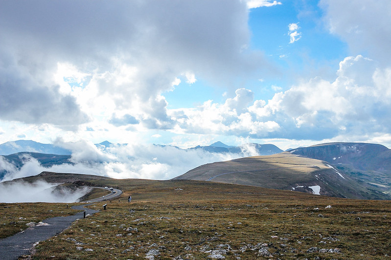
5. Ute Trail to Tombstone Ridge: Big Views with Minimal Effort
If you want a short hike with wide, open views in Rocky Mountain National Park, this one deserves a top spot on your list. It’s one of the easiest ways to experience high-elevation scenery without committing to a long or tiring route.
The Ute Trail to Tombstone Ridge follows the alpine tundra for nearly the entire stretch. With no trees blocking the view, you get clear sightlines of Longs Peak, Forest Canyon, and the Continental Divide. The landscape feels open from the very first steps, so you don’t have to go far to enjoy what the trail offers.
This is a great choice for families or anyone wanting flexibility. You don’t have to complete the full distance—simply walk as far as you like and turn back when you’re ready. The scenery starts immediately, so even a short walk delivers a rewarding experience.
It also fits nicely into a day spent driving along Trail Ridge Road. The trailhead sits about 15 minutes from the Alpine Visitor Center, making it an easy stop along the way.
Tombstone Ridge Hiking Stats
- Location: Ute Trailhead on Trail Ridge Road, about 7 miles east of the Alpine Visitor Centeraway from the Alpine Visitor Center by car, starting at the trailhead.
- Distance: 4 miles
- Difficulty: Easy to moderate
- Time: 1.5 to 3 hours
6. Emerald Lake Trail: A Classic Multi-Lake Hike in Rocky Mountain National Park
The Emerald Lake hike is one of the most popular routes in Rocky Mountain National Park, and it packs a lot into a relatively short distance. Along the way, you pass four alpine lakes—Bear Lake, Nymph Lake, Dream Lake, and finally Emerald Lake—each with its own look and setting.
This trail works well for a wide range of hikers. The distance is manageable, and the elevation gain is steady without being overwhelming. It’s a solid first hike if you’re getting used to higher elevations or visiting the park for the first time.
You don’t have to go all the way to Emerald Lake to enjoy the experience. Many hikers choose to stop at Dream Lake, which already offers impressive scenery. If you want to extend your outing, you can add a side trip to Lake Haiyaha, turning the hike into a longer and more varied route.
For trails that begin along Bear Lake Road, timing matters. Arriving early in the morning helps you avoid crowded parking areas, or you can take the park’s shuttle system. During peak months, a timed entry permit is required to access this part of the park, so plan ahead before heading out.
Dream & Emerald Lake Hiking Stats
- Location: Bear Lake Trailhead, at the end of Bear Lake Road
- Distance: 3.6 miles
- Difficulty: Easy to moderate
- Time: 2 to 3 hours
7. Deer Mountain Trail: A Steady Climb to a Scenic Summit
The Deer Mountain hike in Rocky Mountain National Park is one of the more approachable ways to reach higher ground and take in wide mountain views. It offers a steady climb without the technical challenges found on some of the park’s tougher routes.
The trail rises gradually through evergreen forest, with a near-constant uphill grade. Early in the hike, you’ll catch brief glimpses of Longs Peak, but most of the scenery stays hidden until you near the top. The forest setting can feel repetitive at times, though it keeps the path shaded and calm.
At the summit, the view opens up across Moraine Valley, with Longs Peak and nearby ranges stretching into the distance. It’s a satisfying payoff after the climb, especially for those aiming to reach a summit without taking on a more demanding route.
This trail is a good pick for beginners who want to experience a mountain summit for the first time. It also works well as a warm-up hike if you’ve just arrived at elevation and want to get your legs ready before attempting longer or steeper trails.
Deer Mountain Hiking Stats
- Location: Deer Mountain Trailhead on Trail Ridge Road, about 3 miles west of the Beaver Meadows entrance (around a 20-minute drive from Estes Park)
- Distance: 6.2 miles
- Difficulty: Moderate
- Time: 3 to 4 hours
8. Twin Sisters Peaks: A Quiet Trail with a Strong Summit View
Located along the eastern edge of Rocky Mountain National Park, the Twin Sisters Peaks hike leads to a summit with wide views over Estes Park and a clear look at Longs Peak. It’s a solid option if you want a quieter trail without giving up a rewarding finish.
This route isn’t the most exciting from start to end, but it serves a purpose. Many hikers use it as a warm-up before attempting bigger climbs like Hallett Peak or Longs Peak. It also attracts those who prefer less crowded paths while still aiming for a scenic payoff.
For much of the hike, you’ll move through a pine forest with limited views. The climb is steady, and the scenery doesn’t change much until you approach the top. Once you reach the summit, the landscape opens up, and the effort starts to feel worthwhile.
You’ll likely notice a mix of experienced hikers and locals on this trail, including runners who use it for training. It has a quieter feel compared to some of the busier routes in the park, which can be a nice change if you’ve already explored the more popular hikes.
Twin Sisters Hiking Stats
- Location: Eastern side of the park, near Lily Lakey locals & (trail) runners and those that seem like they have already hiked a handfull of all other hikes in CLP.
- Distance: 7.4 miles
- Difficulty: Moderate
- Time: 4 to 5 hours
9. Odessa & Fern Lake Trail: A Quieter Multi-Lake Hike
The hike to Odessa Lake and Fern Lake in Rocky Mountain National Park is a solid choice if you want fewer crowds while still visiting several alpine lakes. Nearby trails like Bear Lake and Emerald Lake tend to draw more people, so this route offers a calmer alternative with a similar setting.
The trail itself is scenic, passing through forested sections before opening up near the lakes. While it’s a rewarding hike, there are other lake routes in the park that many hikers prefer first, such as Sky Pond or Chasm Lake. Even so, this trail stands out for its quieter feel and steady pace.
You have a few ways to approach this hike. It can be done as a point-to-point route between Bear Lake and Moraine Park, or as an out-and-back from either starting point. Each option changes the total distance and time, so you can adjust the hike to fit your plan.
An out-and-back route from Bear Lake is a common choice, allowing you to visit both Odessa Lake and Fern Lake before returning the same way. It’s a longer outing, but manageable for those comfortable with moderate distances.
Odessa & Fern Lakes Hiking Stats
- Location: Bear Lake Trailhead or Moraine Parko Odessa and Fern Lakes Check out our post on Fern Lake for an in-depth guide to this hike.
- Distance: 7.5 to 10 miles (depending on route)
- Difficulty: Moderate
- Time: 4 to 7 hours
10. Mills Lake & Black Lake: A Scenic Journey to Two Alpine Lakes
Mills Lake and Black Lake are often considered among the most striking lakes in Rocky Mountain National Park. This hike combines waterfalls, forest paths, and high mountain views, making it a rewarding choice for those willing to go a bit farther.
The trail begins at the Glacier Gorge Trailhead and quickly leads you past Alberta Falls, one of the park’s most visited waterfalls. From there, follow the route toward Mills Lake. At around three miles, you’ll reach the first lake, where many hikers choose to stop and head back for a shorter outing.
If you continue beyond Mills Lake, the trail becomes more varied. You’ll pass through damp, marshy sections, move across forested stretches, and walk by Ribbon Falls. Along the way, views of the Keyboard of the Winds begin to stand out, adding a dramatic touch to the landscape.
The final stretch leads to Black Lake, set beneath steep, rugged peaks. Its setting has a similar feel to Chasm Lake, with sharp rock formations rising above the water. Reaching this point feels like a strong finish after a steady, full-day hike.
Mills & Black Lakes Hiking Stats
- Distance: 10 miles
- Difficulty: Moderate
- Time: 5 to 7 hours
- Location: Glacier Gorge Trailhead on Bear Lake Road
11. Sky Pond Trail: A Challenging Hike with One of the Best Payoffs
Sky Pond stands out as one of the top hikes in Rocky Mountain National Park, offering a mix of scenery and terrain that keeps things engaging from start to finish. Along the way, you’ll pass waterfalls, alpine lakes, and open mountain views, with several stream crossings adding a bit of variety.
One of the more memorable sections is the climb beside a waterfall, where you’ll need to scramble over rocks to continue. In warm weather, the spray can feel refreshing, while colder days make this section more intense. It’s a short stretch, but it adds a bit of adventure to the route.
The highlight, of course, is reaching Sky Pond itself. Set beneath steep cliffs, the lake creates a dramatic setting that makes the effort worthwhile. The final view feels like a strong reward after a steady climb through changing terrain.
This trail rarely feels repetitive. The scenery shifts often, keeping your attention as you move higher into the mountains. While the distance and elevation gain can be demanding, many hikers consider this one of the most rewarding routes in the park.
Sky Pond Hiking Stats
- Location: Glacier Gorge Trailhead on Bear Lake Road.
- Distance: 9.5 miles
- Difficulty: Strenuous
- Time: 4 to 6 hours
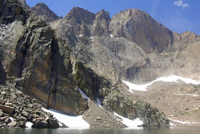
12. Chasm Lake Trail: A Dramatic Alpine Destination Beneath Longs Peak
Chasm Lake is one of the standout hikes in Rocky Mountain National Park, offering a rugged route with a strong finish. It combines steady climbing with striking scenery, making it a favorite for those ready to take on a more demanding trail.
The hike begins along the same path used by climbers heading toward Longs Peak, the highest peak in the park. Early sections move through forest, but as you continue, the terrain opens up and the surroundings begin to feel more dramatic.
During the final mile, the views really come together. You’ll pass landmarks like Columbine Falls and Peacock Pond, with Longs Peak rising above it all. The setting feels bold and raw, with steep rock faces and open terrain shaping the experience.
At Chasm Lake, the scenery reaches its peak. The lake sits beneath towering cliffs, creating a powerful backdrop that feels similar to landscapes found in Glacier National Park. Water, rock, and elevation combine to create a memorable end point after a challenging hike.
Chasm Lake Hiking Stats
- Distance: 9 miles
- Difficulty: Strenuous
- Time: 4 to 6 hours
- Location: Longs Peak Trailhead, at the end of Longs Peak Road on the east side of the park
13. Mt. Ida via Continental Divide: High Elevation Views from Start to Finish
The hike to Mt. Ida in Rocky Mountain National Park gives you a sense of being high above everything. For much of the route, you follow the Continental Divide, with wide, open views stretching across the park in nearly every direction.
As you gain elevation, the scenery stays consistent—open terrain, distant peaks, and long sightlines that don’t fade in and out like forested trails. Reaching the summit at 12,899 feet takes that experience even further, with the park spreading out below in a way few hikes can match.
This trail stands apart from many others in the park. You spend very little time below the tree line, so the views are present for most of the journey. It’s also less crowded than many well-known routes, giving it a quieter, more remote feel.
That said, the hike is demanding. Starting around 10,800 feet, the altitude is noticeable right away, and it only increases as you climb higher. Wind and colder temperatures are common, even in summer, so preparation matters.
For those ready to handle the elevation and distance, this hike offers one of the strongest high-alpine experiences in the park.
Mt. Ida Hiking Stats
- Location: Milner Pass Trailhead on Trail Ridge Road
- Distance: 9.5 miles
- Difficulty: Strenuous
- Time: 4 to 6 hours
14. Hallett Peak via Flattop Mountain: A Demanding Climb with Expansive Views
This hike begins at Bear Lake in Rocky Mountain National Park and quickly gains elevation along the Flattop Mountain Trail. Early on, the views begin to open, with clear sightlines of Longs Peak and the striking ridges of Keyboard of the Winds.
As you climb higher, the forest thins out and eventually fades, giving way to open terrain. From this point, the landscape stretches wide in multiple directions. Overlooks along the route provide great views down toward Dream Lake and Emerald Lake, adding depth to the experience as you continue upward.
Reaching the top of Flattop Mountain feels like a milestone, but the hike doesn’t end there. To continue to Hallett Peak, you’ll follow a rocky and less-defined path. This section is more demanding, with uneven ground and a slower pace as you move across rugged terrain.
At the summit of Hallett Peak, standing at 12,718 feet, the effort pays off with full 360-degree views. It’s one of the most rewarding viewpoints in the park and a solid step for those preparing to take on bigger climbs like Longs Peak.
Hallett Peak Hiking Stats
- Location: Bear Lake Trailhead
- Distance: 10.4 miles
- Difficulty: Strenuous
- Time: 6 to 8 hours
15. Longs Peak via the Keyhole Route: The Ultimate Challenge in Rocky Mountain National Park
At 14,259 feet, Longs Peak is the only fourteener on this list and one of the most demanding hikes in Rocky Mountain National Park. Reaching the summit requires endurance, preparation, and a clear understanding of the risks involved.
Over the course of more than 15 miles, hikers gain over 5,000 feet in elevation. The Keyhole Route includes sections of rock scrambling and exposed terrain, where footing and focus are critical. This is not just a long hike—it’s a serious mountain climb, and conditions can change quickly.
Many who attempt this route do not reach the summit. Weather plays a major role, with sudden storms and strong winds forcing hikers to turn back. The mountain has a history of accidents, which highlights the importance of caution and proper planning.
If you’re considering this climb, preparation is key. Spend a few days in the park hiking shorter trails to adjust to the altitude. Choose a day with a stable weather forecast and start very early—often before sunrise—to reduce the risk of afternoon storms.
This is a demanding goal, but for those who reach the top, it’s an unforgettable experience that stands apart from any other hike in the park.
Longs Peak Hiking Stats
- Location: Longs Peak Trailhead, at the end of Longs Peak Road (via Highway 7 south of Estes Park)
- Distance: 15 miles
- Difficulty: Extremely difficult
- Time: 10 to 15 hours
16. Sprague Lake Loop: An Easy Walk with Wide Mountain Views
If you’re looking for an accessible trail to a scenic lake in the Bear Lake Corridor of Rocky Mountain National Park, Sprague Lake is a great choice. Located just east of Bear Lake, it offers clear views of the surrounding peaks and a calm setting that feels just as appealing as some of the park’s more famous spots.
The trail forms a gentle loop around the lake, covering only 0.8 miles. The path is smooth and easy to follow, making it suitable for all ages and mobility levels. The far side of the lake often provides some of the best angles, with reflections of the mountains stretching across the water.
You’ll likely see people fishing along the shoreline, and the small pier is sometimes used for quiet ceremonies. The setting feels relaxed and welcoming, making it a nice stop whether you’re beginning your day or winding down after a longer hike.
Sprague Lake Hiking Stats
- Elevation Gain: Minimal
- Distance: 0.8 miles
17. Lily Lake Loop: A Quiet and Easy Escape Near Estes Park
If you want a peaceful lake walk with fewer people, Lily Lake is a great option in Rocky Mountain National Park. Located just south of Estes Park, this spot offers calm surroundings and open views without the busy feel found at some of the park’s more visited lakes.
The trail forms a short loop around the water, stretching about 0.8 miles. The path is flat and easy to follow, making it suitable for families, casual walkers, and anyone looking for a relaxed outing. Even though it’s less visited, the mountain views here still stand out and make the walk worthwhile.
This is a great place to slow down and enjoy the setting without rushing. Whether you’re starting your day or taking a break from longer hikes, Lily Lake provides a simple way to enjoy the park at an easier pace.
Lily Lake Hiking Stats
- Elevation Gain: Minimal
- Distance: 0.8 miles
18. Toll Memorial Trail: Easy Access to 360-Degree Mountain Views
Toll Memorial Trail is a short and rewarding hike in Rocky Mountain National Park, offering wide views without a long or demanding climb. Starting near Rock Cut along Trail Ridge Road, the trail begins at one of the higher points in the park, so the scenery opens up right away.
The path is about 1.1 miles and easy to follow, making it a good option for a quick stop during a scenic drive. Along the way, there’s a short side trail leading to unusual rock formations that resemble large mushrooms. It’s a fun detour that adds a bit of character to the hike.
Toward the end, the trail climbs a short but steep rocky section. From the top, you get wide views in every direction, with mountain ranges stretching far into the distance. The Toll Memorial marker sits here as well, pointing out surrounding peaks and adding a bit of context to what you’re seeing.
This hike is a great way to enjoy high-elevation scenery without committing to a longer route. It’s quick, simple, and delivers strong views with minimal effort.
Toll Memorial Trail Hiking Stats
- Elevation Gain: 150 feet
- Distance: 1.1 miles
19. Marmot Point Trail: A Short Climb with Wide, Open Views

Marmot Point Trail is a lesser-known hike in Rocky Mountain National Park, located along Old Fall River Road. This historic road connects Estes Park with the Alpine Visitor Center and usually opens in mid-summer, making it a scenic route with several worthwhile stops.
The trail itself is short at just 0.8 miles, but it climbs steadily toward the viewpoint. The elevation gain is noticeable, especially near the top, where the slope becomes a bit steeper. It’s a quick hike, though, and the effort doesn’t last long.
At the summit, the landscape opens in all directions, offering wide views across the park. From this vantage point, you can see layers of mountains stretching far into the distance, making it a rewarding stop despite the short distance.
Another advantage of this trail is the lower foot traffic. Compared to more popular routes, Marmot Point feels quieter, giving you more space to enjoy the surroundings without crowds.
Marmot Point Trail Hiking Stats
- Elevation Gain: 330 feet
- Distance: 0.8 miles
20. Alluvial Fan Trail: A Short Walk to a Powerful Waterfall
Alluvial Fan Trail is another great stop along Old Fall River Road in Rocky Mountain National Park. Located near the start of the road close to Estes Park, this short trail leads to a wide, rocky cascade that spreads across a fan-shaped slope.
The walk is just 0.7 miles and easy to manage, making it a quick outing that still offers a rewarding view. Early summer is the best time to visit, when snowmelt feeds the waterfall and the flow is at its strongest. During this period, the sound of rushing water adds energy to the entire area.
Later in the day, the trail tends to quiet down, which can make the experience more relaxed. The nearby meadows are also a good place to spot wildlife. It’s not uncommon to see animals like moose or elk in the area, especially in the evening hours.
This trail is short, simple, and easy to fit into your day, whether you’re driving Old Fall River Road or looking for a quick stop near the park entrance.
Alluvial Fan Trail Hiking Stats
- Elevation Gain: Minimal
- Distance: 0.7 miles
Map of the Best Hikes in RMNP
Tap any icon on the map to view details about that location. Each point includes helpful information to guide your visit.
To save the map, click the star next to its title. This adds it to your Google account for easy access later. When you open the Google Maps app, go to Saved, then select Maps. You’ll find this map listed there, ready to use during your trip.
How to Pick the Best Hikes in Rocky Mountain National Park
Choosing the right hikes in Rocky Mountain National Park depends on your time, fitness level, and what kind of scenery you want to experience. Some trails focus on alpine lakes, others on summit views, and a few combine a bit of everything into one route.
If you’re looking for standout options, Sky Pond, Mt. Ida, and Chasm Lake are strong picks. Sky Pond offers a mix of terrain and a rewarding lake at the end. Mt. Ida delivers wide views for most of the hike, especially along the Continental Divide. Chasm Lake stands out for its dramatic setting beneath Longs Peak.
For first-time visitors, the Bear Lake and Emerald Lake combination is a classic introduction. It’s manageable in distance and gives you a good sense of the park’s landscape. If you only have time for one hike and don’t mind a longer route, Sky Pond is a strong choice.
If you’re spending a few days in the park, starting with easier hikes can help you adjust to the elevation. Trails like Emerald Lake, Deer Mountain, and Twin Sisters work well as early outings before moving on to more demanding routes.
Short hikes are easy to fit into a busy schedule. Tombstone Ridge pairs well with a drive along Trail Ridge Road, while the Nymph, Dream, and Emerald Lakes route offers a compact but scenic experience.
For quieter trails with fewer people, consider Twin Sisters, Mt. Ida, or Tombstone Ridge. These routes still offer great views but tend to feel less crowded than some of the more popular hikes.
If you’re planning a short trip, a simple outline could include a scenic drive along Trail Ridge Road with a short hike on day one, Sky Pond on day two, and a longer hike like Chasm Lake, Hallett Peak, or Mt. Ida on day three.
For those aiming for a major challenge, Longs Peak stands at the top of the list. It requires preparation, time, and good weather, but it offers one of the most demanding and rewarding experiences in the park.
Before heading out, check current trail conditions through the National Park Service. During the busy season, you’ll also need to reserve a timed entry permit in advance.
Read More Hike Related Articles :