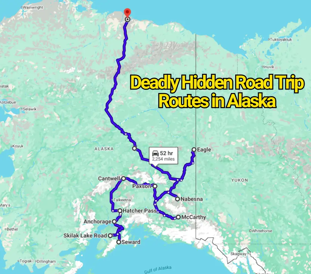
Alaska’s most alarming roads rarely look threatening in travel photographs. Snow-covered peaks, empty valleys, and long ribbons of gravel create the impression of a peaceful wilderness drive. The trouble begins when that beautiful emptiness leaves a traveler hours from fuel, phone service, repairs, or medical help.
There is no official government ranking naming these Alaska routes the “most deadly.” That label oversimplifies the issue. Many are dangerous because several problems can arrive together: loose gravel, damaged tires, sudden snow, flooding, avalanches, commercial trucks, wildlife, and long gaps between services. A small mistake that would be inconvenient near a city can become a serious emergency in remote Alaska. State agencies repeatedly direct motorists to Alaska 511 before departure because road conditions and closures can change quickly.
Dalton Highway and Atigun Pass
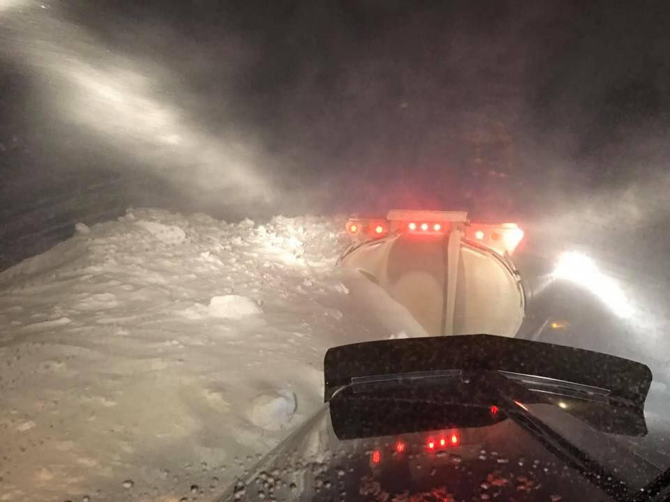
The Dalton Highway runs from the Interior to Deadhorse on Alaska’s North Slope. Although it has become famous through television and social media, it remains a working industrial corridor built to support the Trans-Alaska Pipeline and northern oil fields. Heavy commercial trucks use the highway throughout the year, and recreational drivers must share narrow, dusty, or icy sections with vehicles that cannot stop quickly.
Atigun Pass is the highest point on the Dalton Highway at 4,653 feet. The pass cuts through the Brooks Range, where snow, fog, wind, steep grades, and avalanche exposure can appear during periods when southern Alaska is still experiencing mild weather. The Bureau of Land Management describes the Dalton as rough, remote, and demanding rather than an ordinary sightseeing road.
The hidden danger is distance. Fairbanks to Coldfoot can take six to eight hours depending on weather and road conditions. Phone coverage is absent across many sections, fuel stops are widely separated, and sharp gravel can damage tires or windshields. The road is open to the public, but that does not mean every rental agreement permits travel on it. Drivers must confirm vehicle restrictions before leaving Fairbanks.
McCarthy Road

McCarthy Road stretches about 59 miles from Chitina to the Kennicott River area. Its origin as part of an old railroad corridor adds to its reputation, but the greater concern today is its narrow gravel surface, isolated setting, soft shoulders, and changing maintenance conditions. The journey often takes much longer than the mileage suggests.
The road can develop potholes, washboard sections, mud, and wet edges after heavy rain or spring thaw. In May 2026, Alaska DOT reported fair-to-difficult conditions shortly after seasonal opening work, including soft shoulders and a wet, rough roadway. Regular maintenance was scheduled through October 1, showing why visitors should never assume that a summer date guarantees a smooth drive.
Drivers are sometimes frightened by stories about railroad spikes puncturing tires. While that detail receives plenty of attention, speeding over loose gravel poses the more immediate problem. A damaged tire becomes far more serious when towing help and repair facilities are distant. The sensible pace on McCarthy Road is set by the surface, visibility, and vehicle—not by the posted maximum.
Nabesna Road
Nabesna Road begins near Slana and reaches approximately 42 miles into the northern side of Wrangell–St. Elias National Park and Preserve. The unpaved road follows a route first built during Alaska’s mining era. Today, it provides access to trailheads, historic locations, hunting areas, and broad sections of backcountry.
The first miles are often passable in an ordinary two-wheel-drive vehicle during favorable weather. That fact can create false confidence. Conditions farther along the road can change after rainfall, snowmelt, flooding, or maintenance work. Creek crossings that seem shallow in the morning may become much stronger after heavy rain upstream.
This is less a road for chasing mileage than one for making careful decisions. Turning around before a questionable crossing is not a failed trip. It is often the choice that prevents a flooded engine, stranded vehicle, or long wait for assistance. The National Park Service advises checking current conditions before committing to the full road.
Denali Highway
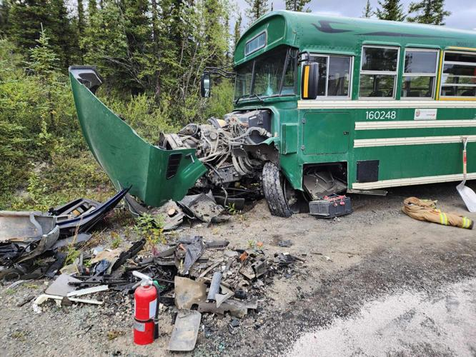
The Denali Highway connects Paxson on the Richardson Highway with Cantwell on the Parks Highway. It covers roughly 135 miles across open tundra, mountain country, river valleys, and glacial terrain. Its reputation as one of Alaska’s grand road trips can hide an important truth: much of the route is remote, unpaved, and seasonally maintained.
Drivers may face washboard surfaces, loose stones, dust, muddy edges, construction equipment, and long gaps between dependable services. Sharp gravel can damage tires, while roadside pullouts may be softer than they appear. Weather moving across the open country can reduce visibility quickly because there are few buildings or sheltered stopping points.
Alaska DOT announced the highway’s 2026 seasonal opening in May after crews removed snow and thawed culverts. That yearly reopening process matters. The road should never be treated as a guaranteed year-round connection merely because it appears on a digital map.
Taylor Highway to Eagle
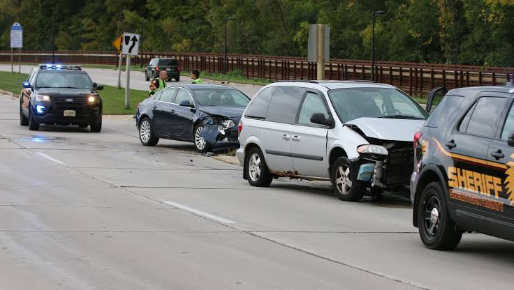
The Taylor Highway leaves the Alaska Highway near Tetlin Junction and runs through Interior Alaska to Chicken and Eagle. Sections are paved, while other portions are gravel or chip-sealed. Drivers entering from the Canadian Top of the World Highway may be surprised by how quickly road quality and available services change.
In April 2026, Alaska DOT reported that the reopened route had soft shoulders and wet, rough, patchy sections. The agency advised a reduced speed and warned travelers about scarce fuel, weak phone coverage, and limited roadside facilities. Regular seasonal maintenance was expected to continue through October 15.
The route’s risk is easy to underestimate because Chicken attracts summer visitors and Eagle feels like a defined destination. Yet the stretches between settlements remain exposed. Dust can hide approaching traffic, rain can soften road edges, and a vehicle drifting too far from the firm center may lose traction.
Hatcher Pass Road
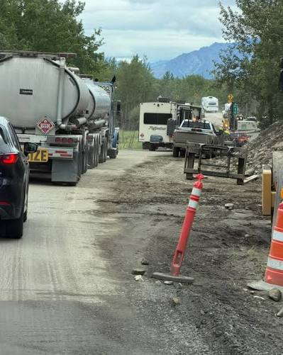
Hatcher Pass Road is close enough to Palmer and Wasilla that many travelers treat it as an easy side trip. The western summit section tells a different story. Alaska State Parks describes the road between Miles 17.5 and 32.5 as rough, gravel, narrow, and steep. It is not maintained or open during winter.
Hairpin turns, blind bends, narrow passing areas, and loose edges demand low speeds. Large recreational vehicles are discouraged on the summit section because their size makes meeting opposing traffic much harder. The seasonal road generally opens during summer, often from July through late September, depending on snow depth and road work.
The road does not need hundreds of isolated miles to become hazardous. Its threat comes from compact mountain terrain where one rushed corner can place a tire on loose gravel beside a steep slope. Rain, low cloud, and lingering snow can make the drive feel entirely different from conditions in Palmer below.
Richardson Highway Through Thompson Pass
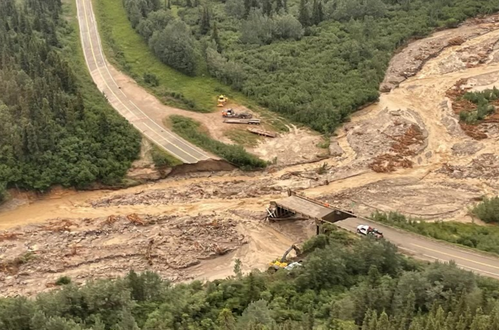
The Richardson Highway is a major paved route rather than a hidden backroad. Still, the section between Valdez, Keystone Canyon, and Thompson Pass carries hazards that many summer-focused itineraries barely mention. Alaska DOT calls Thompson Pass one of the state’s most notoriously snowy mountain passes.
Avalanches have repeatedly closed the highway. In January 2014, a series of slides blocked ground access to Valdez for days after heavy rain and unusually warm temperatures destabilized the snowpack. The event became known locally as the “Damalanche.” No one was injured in the first slides, but the blockage showed how quickly Valdez’s sole highway connection can be cut.
Summer does not remove every concern. Heavy rain, rockfall, sharp curves, low clouds, and strong winds can affect Keystone Canyon and the pass. Drivers who see clear pavement in Valdez should not assume the same conditions exist at higher elevation.
Seward Highway Along Turnagain Arm
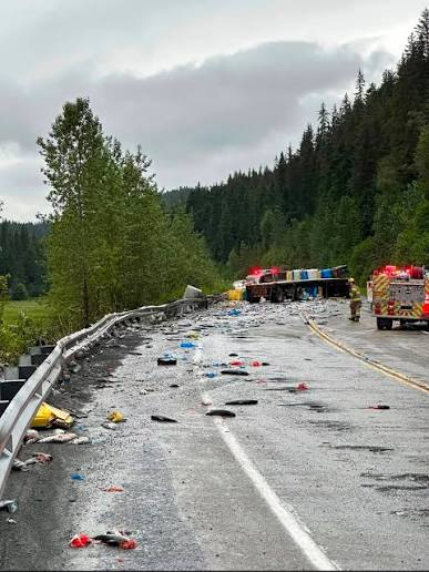
The Seward Highway south of Anchorage is one of Alaska’s most photographed drives. It is also a busy road squeezed between Turnagain Arm and steep mountain slopes. Traffic, wildlife, curves, limited passing opportunities, falling rock, snow slides, and distracted sightseeing combine in a narrow corridor.
Alaska DOT operates an avalanche program that includes the Seward Highway. Historical records show vehicles affected by avalanche debris or air blasts, while transportation studies have also examined icefall concerns along parts of the route. These are managed hazards, but management does not make them disappear.
The most ordinary risk may be the view itself. Drivers slow unexpectedly, drift near the centerline, or look across the water for whales while traffic continues moving. Turnouts exist for a reason. Photographs belong at a safe stopping area, not through a windshield while rounding a bend.
Steese Highway Beyond Central
The Steese Highway begins in Fairbanks and continues northeast to Circle on the Yukon River. Early sections feel connected to the city, which can disguise how remote the northern half becomes. The road passes between sections of the Steese National Conservation Area before ending in a small river community.
Pavement gives way to longer gravel stretches, while traffic and services thin out. Summer construction, smoke from wildfires, rain, dust, wildlife, and tire damage can slow progress. A driver may cover many miles without meeting another vehicle, especially outside peak travel periods.
This road is less sensational than the Dalton, and that may make it more deceptive. People prepare heavily for famous Arctic routes but approach the Steese as a casual Fairbanks outing. Beyond Central, the road deserves the same respect given to other remote Alaska corridors.
Copper River Highway
The Copper River Highway begins in Cordova and was intended to extend for 56 miles to the Million Dollar Bridge. It cannot currently be driven as a complete highway. A failed bridge near Mile 36 remains impassable, and Alaska DOT states that the road is closed at that point.
This route belongs in the conversation because digital maps, older travel guides, and historic accounts can create the impression that visitors may drive through to the bridge or continue farther along the old corridor. They cannot. The closure is caused by major structural and river-channel problems rather than a minor washout that an adventurous driver can cross.
Attempting to bypass the closure in a road vehicle would be reckless and may lead onto damaged infrastructure, private areas, unstable ground, or terrain intended for other forms of access. On this highway, the warning is refreshingly simple: treat the closure as the end of the drivable road.
Road to Tanana
The Road to Tanana extends through remote Interior Alaska to the Yukon River community of Tanana. Alaska DOT opens and maintains it seasonally, with conditions shaped by snow removal, frozen ground, spring thaw, rain, and culvert performance.
For the 2026 opening, officials warned that services along the route were extremely limited. The corridor had no gas stations, no dependable phone coverage, and no developed campgrounds. Travelers were advised to carry food, water, first-aid supplies, warm clothing, and spare tires.
The road’s primary threat is not a dramatic cliff or famous pass. It is the absence of backup. A flat tire, empty fuel tank, mechanical fault, or unexpected delay can leave occupants waiting far longer than they would on Alaska’s major highways.
Skilak Lake Road
Skilak Lake Road is an 18.5-mile gravel loop branching from the Sterling Highway through the Kenai National Wildlife Refuge. It passes forests, lakes, campgrounds, trailheads, and wildlife-viewing areas. Compared with the Dalton or McCarthy Road, it looks harmless.
That calm appearance can encourage drivers to move too quickly. Gravel reduces braking grip, while dust and forested bends shorten sight distance. Moose, bears, and smaller animals may enter the road without warning. Stopped vehicles near trailheads or wildlife sightings can create additional surprises around curves.
Calling Skilak Lake Road one of Alaska’s “deadliest” routes would be an exaggeration without crash data supporting that label. Its inclusion makes a broader point: short recreational roads can still punish distraction, excessive speed, and poor wildlife awareness.
What Locals Understand About Driving in Alaska

The most dangerous Alaska road is often whichever road a traveler has underestimated. Pavement does not cancel avalanche exposure. A gravel road is not automatically impassable. A sunny forecast in Anchorage says little about Atigun Pass, Thompson Pass, or the Denali Highway.
Road condition checks should happen immediately before departure rather than several days earlier. Alaska 511 publishes current closures, construction reports, weather-related warnings, cameras, and surface conditions. Fuel, vehicle suitability, rental restrictions, daylight, weather, and the distance to the next service should shape the schedule.
Alaska rewards patient drivers. It punishes schedules built around maximum speed, perfect weather, and uninterrupted progress. The real local warning is rarely “never go.” It is “do not drive farther than your preparation can carry you.”