If you’re thinking about a good old-fashioned American road trip, you’re in the right spot. People sometimes ask whether I’ve driven through a certain scenic stretch of the United States, and it always brings to mind that famous lyric about traveling every road across the land. After years on the highways, backroads, deserts, and mountain passes, the list of miles covered is long — though a few routes still wait their turn.
That wide driving history gives real, hands-on insight instead of guesswork. These recommendations come from time behind the wheel, roadside stops, missed turns, and surprise highlights that never show up on simple maps. Gas stations, diners, overlooks, and small towns all add character to the journey, not just the headline attractions.
A cross-country drive remains one of the strongest ways to experience the scale and variety of the USA. You can watch landscapes shift hour by hour — coastlines, forests, red rock, plains, and snowy peaks — all in one extended trip. Windows down, music on, snacks in the seat beside you — it turns travel into a moving story.
Below you’ll find 21 epic USA road trip ideas to spark your next long drive. Some routes are famous, others less talked about, but each one offers memorable views, local flavor, and plenty of reasons to keep going just a little farther.
The 21 Best U.S. Road Trips for Your Next Adventure
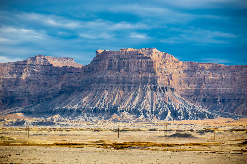
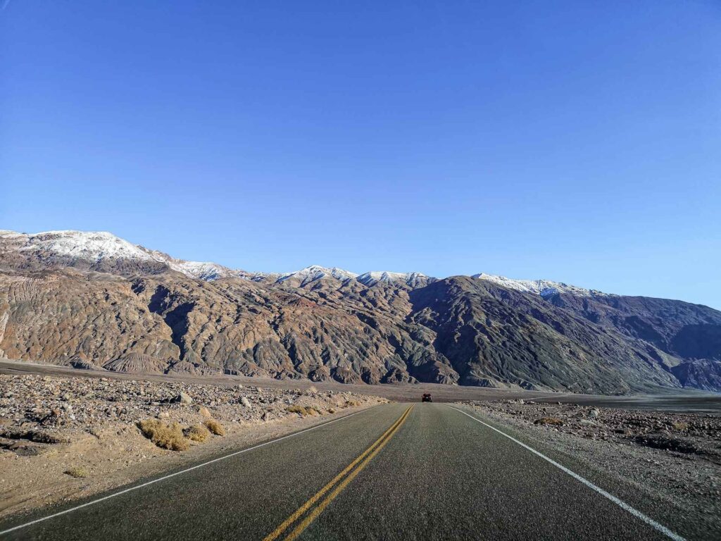
1. Utah Mighty 5 Road Trip Guide
Location: Utah, USA
Distance: Approximately 1200 miles (1931 km)
Suggested Time: 7 days
Minimum Time: 3 days
Best Time of Year: March – October
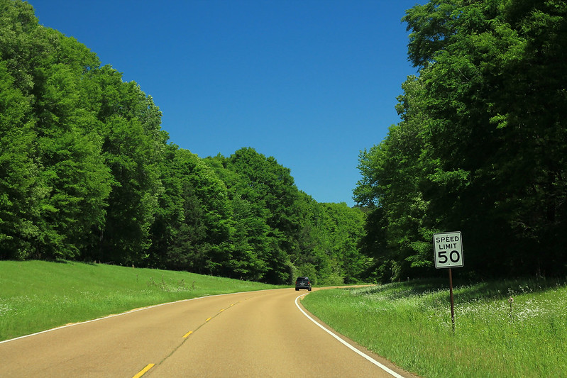
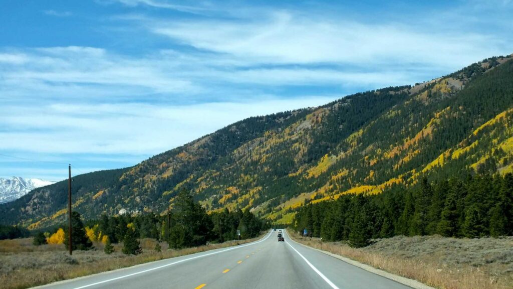
The Utah Mighty 5 road trip runs across a wide stretch of desert highways and park roads, linking five major national parks in one extended loop. This route passes through massive sandstone walls, deep canyons, natural arches, and open dry country that feels almost unreal at first glance. Each segment of the drive looks different from the last, so the scenery keeps shifting hour by hour.
Expect bold color changes across the terrain, from deep red rock to pale stone and wide blue sky. Long empty sections of road give space to slow down and take in the scale of the Southwest. Photo stops appear often, sometimes right off the roadside, sometimes after a short walk. Conditions stay fairly friendly for drivers across most months of the year.
This park-to-park drive works in every season. Summer brings heat and heavy visitor numbers, while winter days can turn crisp but still manageable for travel. Spring and fall often give the most balanced weather. Services are spread out, so plan fuel and food stops ahead of time.
There are many side parks, state lands, and trail systems connected to this route. During peak summer weeks, lines build quickly at popular entrances. Some travelers choose to reduce time in the busiest parks and focus more on the quieter areas nearby. A full route guide helps map daily drive times, stop ideas, and overnight bases before you go.
2. Historic Route 66 Road Trip Guide

Location: Illinois to California
Distance: 2,400 miles
Suggested Time: 3 weeks
Minimum Time: 2 weeks
Best Time of Year: May – October
Route 66 stands as one of the most recognized long-distance drives in the United States. Known as the road where travelers “get their kicks,” it has shaped road culture for decades and still draws drivers who want a classic cross-country run. The route carries a strong sense of nostalgia, with old signage, retro diners, and roadside stops that feel frozen in another era.
My first drive along Route 66 happened right after high school graduation. The dry summer wind, open highway, and long horizon gave a feeling of total freedom. No strict schedule, no pressure — just motion, music, and miles rolling past the windshield. That first trip set the tone for many future drives.
The official line begins in Illinois and finishes near Santa Monica in California. Still, many travelers focus on the western legs instead of the full span, since completing every segment takes serious time. Broken sections and bypassed alignments mean you often shift between the historic path and modern highways.
Arizona and New Mexico remain standout portions of the trip. Expect wide desert views, old trading posts, faded motels, and long empty stretches where the road runs straight for miles. These areas carry the strongest old-route atmosphere and often leave the deepest impression on drivers.
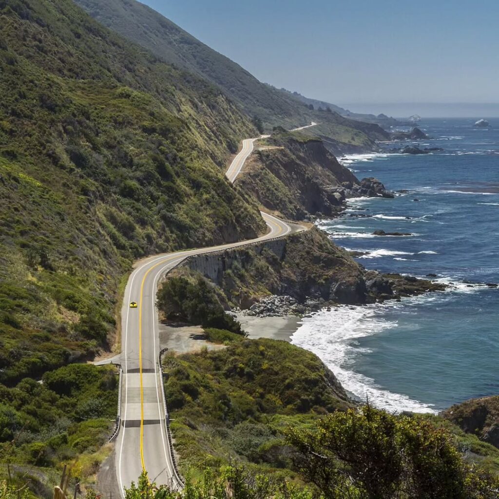
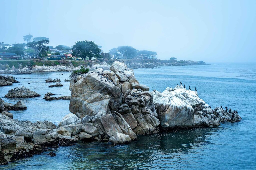
3. California Highway 1 Coastal Road Trip
Location: California, USA
Distance: 655 miles (1,055 km)
Suggested Time: 7 days
Minimum Time: 1 day
Best Time of Year: April – October
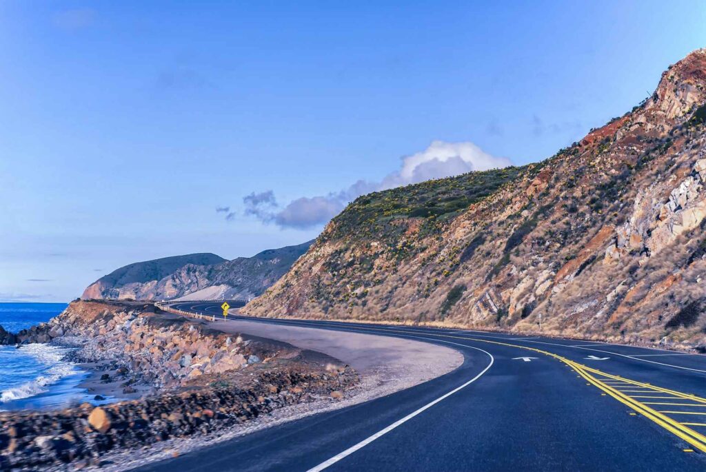
California’s Highway 1, also called the Pacific Coast Highway, ranks among the most dramatic coastal drives on the planet. The road tracks the edge of the continent for long stretches, with waves crashing below and rolling hills rising inland. Every hour brings a different coastal mood, from foggy bluffs to bright open shoreline.
The route officially begins just south of Los Angeles and runs north to just above San Francisco, stopping short of the tallest redwood zones farther up the state. Drivers can complete it in a long single push, but that turns a rich drive into a rushed one. A slower pace allows time for beach stops, cliff overlooks, and small coastal towns.
Road conditions shift often. Some parts feel smooth and fast, while others twist and climb with tight curves and steep drop-offs. That variation keeps the drive engaging and calls for steady attention behind the wheel. Pullouts appear frequently, giving safe spots to pause and take in the ocean views.
Spring through early fall usually brings the most comfortable weather and clearer skies. Morning fog can still roll in along certain sections, then lift by midday. With flexible timing and a loose plan for overnight stops, this coastal run becomes one of the most rewarding drives in the country.
Read More: 15 Budget-Friendly Places to Visit in California
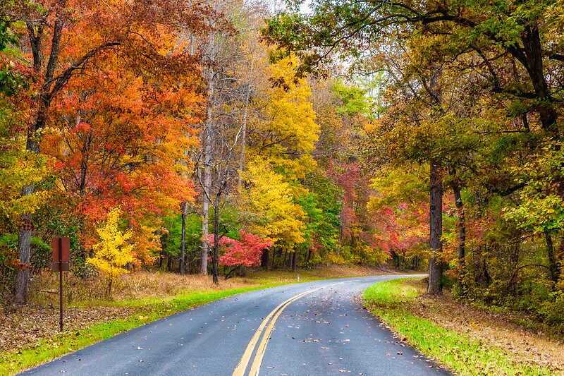
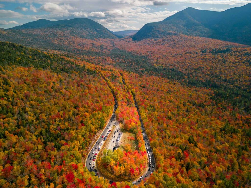
4. Blue Ridge Parkway Fall Road Trip Guide
Location: Virginia to North Carolina, USA
Distance: 469 miles
Suggested Time: 5 days
Minimum Time: 1 day
Best Time of Year: October (fall color season)
The Blue Ridge Parkway often gets called the top American road trip for autumn color, and that claim holds up well. A drive here in October brings long bands of red, gold, and burnt orange spread across the mountain slopes. Overlooks appear one after another, each with wide-angle views that shift with the light and elevation.
This road isn’t about speed. It’s about pacing. Traffic moves slower than on major highways, which suits the setting. You roll from ridge to ridge, stopping often, stepping out, and taking in the layered mountain lines that seem to go on forever. Morning mist and late-day glow both change how the landscape reads.
Spring trips show a different side of the parkway. Hillsides fill with blooming flowers, and many trailheads lead to short waterfall hikes close to the road. Summer brings long daylight hours and warm evenings, with sunset colors stretching across the sky at the higher viewpoints.
The parkway passes through protected mountain land and connects with Great Smoky Mountains National Park along the route. Its status as both a National Parkway and an All-American Road marks it as a drive worth adding to any serious road trip list.
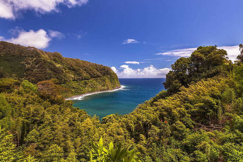
5. Road to Hana Coastal Drive Guide
Location: Maui, USA
Distance: 64 miles (103 km)
Suggested Time: 2 days
Minimum Time: 1 day
Best Time of Year: May – October (when roadside fruit stands are open)
This road trip shifts the list into tropical terrain. The Road to Hana runs along Maui’s northeastern shoreline and links jungle, cliffs, streams, and small coastal stops in one winding stretch. It is widely known for tight curves, narrow bridges, and constant scenery changes packed into a short distance.
The drive feels slow and intense in a good way. One minute you pass thick green forest, the next you’re looking out over open ocean. Waterfalls appear beside the road after rainfall, and roadside stands sell fresh fruit and baked goods during the warmer months. The route delivers motion, color, and sound all at once.
Large sections are one lane or close to it, with blind bends and limited shoulder space. Rockfalls and water runoff sometimes affect conditions. Summer brings heavy visitor traffic, and backups happen when drivers meet head-on at narrow crossings. Patience and steady control matter more than speed here.
Those who complete the drive reach a series of natural highlights along Maui’s southeast side, including ʻOheʻo Gulch, the Pools of ʻOheʻo, Waimoku Falls, the Pīpīwai Trail, and the Kīpahulu coastal area. Plan extra time for stops, short hikes, and weather delays — the road sets the schedule, not the clock.
6. Going-to-the-Sun Road Drive Guide
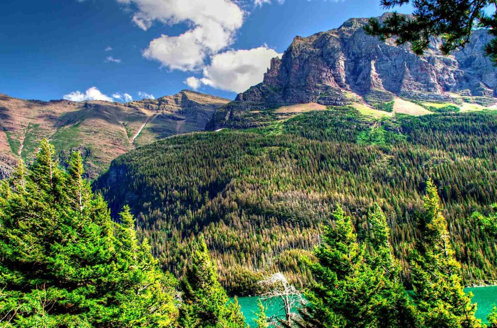
Location: Montana, USA
Distance: 50 miles (80 km)
Suggested Time: 2 days
Minimum Time: 1 day
Best Time of Year: July – October
Going-to-the-Sun Road stands as the headline drive through Glacier National Park. When a single road becomes the main draw inside such a dramatic park, expectations run high — and this route meets them. The road crosses the park from end to end, climbing from forest floor to alpine heights with steep grades and sharp turns. For those wanting to stretch their legs, don’t miss the Best Hikes in Glacier National Park to experience these landscapes up close.
The full stretch measures about 50 miles and can take roughly two hours without long stops, though most drivers take far longer. Pullouts, trailheads, and high passes invite frequent breaks. The changing elevation brings quick shifts in temperature and views, moving from dense trees to open rock and snow patches even in warmer months.
Many travelers prefer hiking over driving inside national parks, yet this road flips that habit. Sitting behind the wheel here still feels like part of the main experience. Each bend opens a new angle — glacial valleys, hanging waterfalls, and distant peaks stacked layer behind layer.
Summer traffic grows heavy since demand is high and lanes stay narrow. Wildlife crossings and tight edges add extra tension, so slow speeds are the norm. The route also earns praise as a major engineering feat, cut across steep mountain faces. Film fans may also recognize its look from the opening drive sequence of The Shining.
7. Olympic Peninsula Loop Road Trip Guide
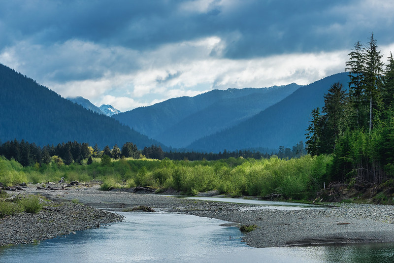
Location: Washington, USA
Distance: 329 miles (531 km)
Suggested Time: 5 days
Minimum Time: 1 day
Best Time of Year: July – September
The Olympic Peninsula Loop Drive ranks among the most overlooked scenic routes in the United States. Visitor numbers inside Olympic National Park stay high, yet the full ring road around the park often gets treated as simple access instead of a highlight on its own. That’s a mistake. The loop delivers steady variety mile after mile. For a deeper experience beyond the drive, check out the Best Hikes in Olympic National Park to explore its diverse landscapes on foot.
This drive circles a park with striking range in terrain. You pass deep forests, glacier-cut peaks, cold lakes, fast rivers, and long stretches of raw Pacific shoreline. Weather and landscape can shift within a short span of road. One section may sit under gray mist while another opens to blue sky.
The peninsula rewards slow travel. Side roads lead to trailheads, beaches, and river valleys that feel far removed from city pace. Wildlife sightings happen often, especially in quieter morning and evening hours. Small towns around the loop offer simple stops for food and fuel between longer scenic legs.
From rainforest valleys to wave-battered coast, the entire circuit can be seen from this single connected route. A detailed park guide helps with timing, overnight bases, and which spurs are worth the extra miles before you go.
Read More: 15 Must-Visit Hidden Gems in Washington’s Small Towns
8. Nevada Route 50 — The Loneliest Road Drive Guide
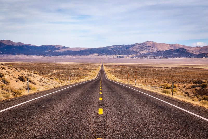
Location: Nevada, USA
Distance: 408 miles (657 km)
Suggested Time: 2 days
Minimum Time: 1 day
Best Time of Year: October – May
Nevada Route 50 carries the nickname “The Loneliest Road in America,” and the label fits. Long, empty pavement runs across the Great Basin with barely a town in sight for extended stretches. You crest one hill, see miles of straight highway ahead, then repeat the pattern again and again. The mood feels quiet, dry, and slightly surreal.
This road forms part of the historic Lincoln Highway, first mapped in 1913 as an early coast-to-coast route. That original corridor linked Times Square in New York with the San Francisco area and helped shape early cross-country car travel. Its success later influenced the creation of the U.S. Interstate system used today.
Parts of Nevada’s Route 50 follow even older paths. Segments overlap with the Pony Express National Historic Trail. Drivers can stop at restored or partial station sites where riders once changed horses while carrying mail across the country at high speed.
Many travelers reach this highway while heading for Great Basin National Park, though others drive it purely for the isolation factor. Services remain limited, so fuel planning matters. The reward is open space, wide sky, and a rare sense of distance from city noise — a road trip stripped down to asphalt and horizon.
9. Avenue of the Giants Redwood Drive Guide
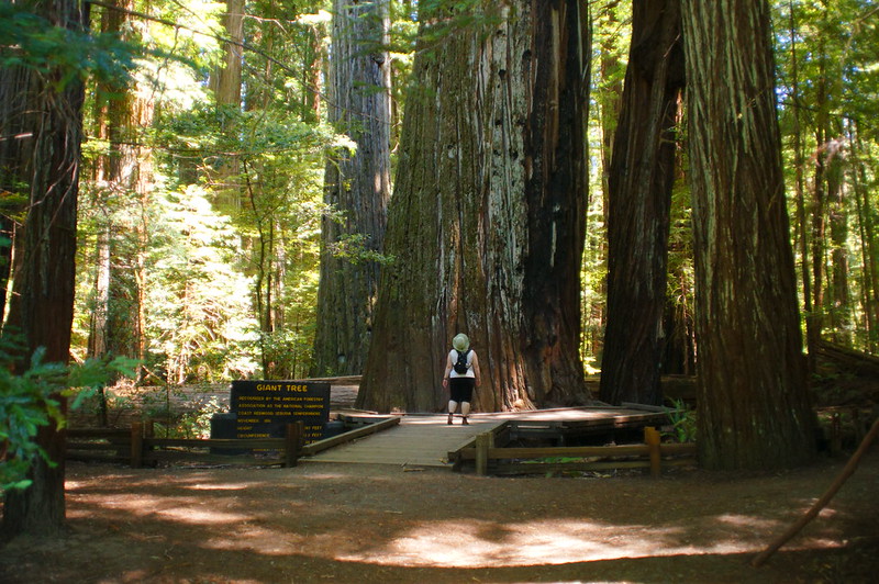
Location: California, USA
Distance: 31.5 miles
Suggested Time: 3 days
Minimum Time: 1 day
Best Time of Year: May – September
The Avenue of the Giants runs for 31.5 miles through Humboldt Redwoods State Park, about an hour south of Eureka. This forest road passes between towering redwoods that have stood for over a thousand years. The scale feels hard to judge until you step out of the car and stand at the base of one.
Driving here feels slow by default. Traffic moves lightly, and frequent pullouts invite short walks and photo stops. Many marked points lead to groves, river access spots, and short loop trails. Taking time between segments makes the drive far more rewarding than treating it as a straight pass-through.
Trail rules matter in this forest. Foot traffic outside marked paths can damage the shallow root systems that keep these giants standing. Staying on signed routes helps protect the ground layer that supports the trees.
In side-by-side comparison, the redwoods in this park often show deeper color than those closer to the immediate coastline. Light filters differently through this inland section, giving trunks a darker, richer tone. Pairing this drive with a broader Redwood National Park visit makes a strong north-coast road trip combo.
10. Kancamagus Highway Fall Drive Guide
Location: New Hampshire, USA
Distance: 34.5 miles (90 km)
Suggested Time: 2 days
Minimum Time: 3 hours
Best Time of Year: October (fall color season)
The Kancamagus Highway ranks among the top fall-color drives in the northeastern United States. Nearly a million visitors travel this 34-mile mountain road each year to watch the hills turn red, orange, and gold. Timing shifts slightly year to year, but the strongest color usually appears in the first half of October.
If your schedule forces a choice, going a bit early works better than going late. Trees with partial color still create a strong visual effect, while bare branches change the entire mood of the drive. Elevation changes along the route also mean color stages vary from one section to the next.
This road is no secret. Each autumn, travelers from across the country — especially from nearby states — arrive in large numbers. Traffic slows, parking areas fill, and hotel rates climb. Booking rooms ahead of time helps avoid last-minute stress.
Early morning offers the clearest views and lighter traffic. Low-angle light adds depth to the mountain slopes and river valleys beside the road. If you have extra time, crossing into nearby Vermont to see parts of the Green Mountains adds another strong foliage drive to your trip.
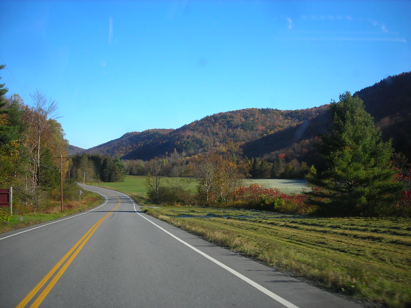
11. Vermont Route 100 Fall Road Trip Guide
Location: Vermont, USA
Distance: 216 miles (348.7 km)
Suggested Time: 5 days
Minimum Time: 1 day
Best Time of Year: October
Vermont’s Route 100 cuts north to south through the Green Mountains and ranks as one of the strongest fall drives in the eastern United States. Each year, travelers wait for the hardwood forests to shift color, then head here for long stretches of orange, red, and yellow across the hills. The road links small towns, farm valleys, and mountain passes in one continuous line.
Several scenic routes cross the Green Mountain National Forest, yet Route 100 often stands above the rest for leaf season viewing. Elevation changes keep the scenery active. One bend shows thick forest, the next opens to fields and distant ridges. The pattern keeps repeating, which makes the drive feel longer than the map suggests. For a step-by-step plan, check out the Detailed Route 100 Vermont Itinerary to map your stops and timing.
Mountains rise on both sides for much of the trip. Old barns, covered bridges, and village centers appear at steady intervals. Pull off often — short stops add more to the trip than trying to cover the full distance in one push.
Key stops along the way include the well-known Vermont Country Store in Weston, plus the towns of Stowe and Waterbury. Cafés, local shops, and roadside markets give easy break points between mountain segments, especially during peak October color weeks.
Read More: 21 Amazing Things to Do in Woodstock, Vermont in Autumn
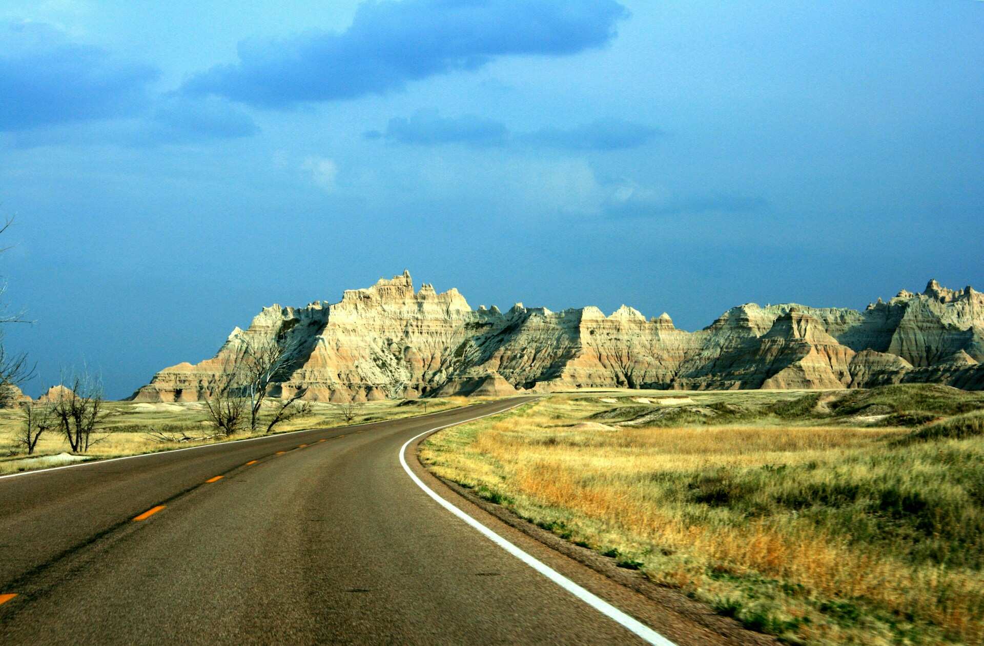
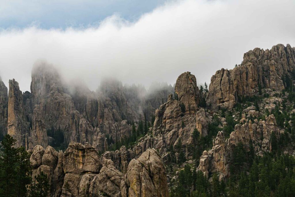
12. Peter Norbeck National Scenic Byway Drive Guide
Location: South Dakota, USA
Distance: 70 miles (112 km)
Suggested Time: 3 days
Minimum Time: 1 day
Best Time of Year: June & October
The Peter Norbeck National Scenic Byway cuts through the Black Hills and delivers one of the most dramatic short drives in the Midwest. This route links narrow tunnels, tight switchbacks, and stone spires with long stretches of pine forest. The road layout itself becomes part of the attraction, not just the views around it.
Several side roads connect within this byway system, including Iron Mountain Road and Needles Highway. Together they form a looping network of curves, rock corridors, and elevated viewpoints. Granite towers rise close to the pavement in some sections, giving the drive a canyon-like feel even at low speeds.
Wildlife appears often along this route. Bison, deer, and mountain goats are regular sightings, especially in the early and late hours of the day. Light near sunset throws deep shadows across the rock formations and adds strong contrast across the hills.
The Black Hills hold deep cultural meaning for the Sioux and Cheyenne nations, who regard this area as sacred ground. Key stops along the drive include Black Hills National Forest and the well-known Mount Rushmore National Memorial. Take it slow, use the pullouts, and treat the road as a series of short experiences rather than one continuous push.
Read More: 15 Charming Small Towns in South Dakota Worth Visiting
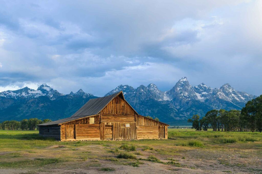
13. John D. Rockefeller Jr. Memorial Parkway Drive Guide
Location: Wyoming, USA
Distance: 27 miles (43 km)
Suggested Time: 7 days (including visits to Yellowstone & Grand Teton)
Minimum Time: 30 minutes
Best Time of Year: June, July, & September
The John D. Rockefeller Jr. Memorial Parkway is a short connector road with a big role. Though it runs for only 27 miles, it links two heavyweight national parks — Yellowstone and Grand Teton. Many travelers pass through quickly, but the corridor itself offers quiet forest stretches, river views, and lighter traffic than the parks on either end.
Using this parkway as a base route works well for a longer park-focused trip. A balanced plan gives several days to Yellowstone for geysers, wildlife areas, and geothermal zones, plus extra days in Grand Teton for mountain views and lake country. Even with close distance between them, the terrain and atmosphere feel clearly different.
Grand Teton often feels calmer, with more open sightlines and fewer traffic jams outside peak hours. Yellowstone draws larger crowds but delivers constant geothermal action and wide wildlife ranges. Driving between the two adds a calm transition instead of a rushed transfer.
Even a short pass along this road can be worthwhile. Longer visits allow time for river pullouts, short walks, and photography stops between the two park entrances. It turns a simple connector into part of the overall journey rather than just a link on the map.
Read More: 15 Must-Visit Small Town Gems Across Wyoming
14. Natchez Trace Parkway Road Trip Guide
Location: Mississippi, Alabama, Tennessee, USA
Distance: 444 miles (715 km)
Suggested Time: 5 days
Minimum Time: 1 day
Best Time of Year: October – November
The Natchez Trace Parkway runs for 444 miles across the southern states, following a historic travel corridor used long before modern highways. The road moves through wooded hills, open fields, and quiet river crossings. Traffic stays light compared with major routes, which gives the drive a calm, steady rhythm.
This parkway favors slow travel over speed. Commercial trucks are restricted, and roadside development stays limited, so the atmosphere feels clean and uninterrupted. You move from one natural stretch to another, broken up by heritage stops and walking paths rather than busy towns.
Travelers with extra time can spread the drive across several days and visit key landmarks along the way. Popular stops include the Meriwether Lewis site, Emerald Mound, Chickasaw Village areas, Jackson Falls, and multiple short trail systems. Each stop adds context and depth to the overall trip.
The route is overseen by the National Park Service and carries an All-American Road designation from the Federal Highway Administration. That status reflects both its historical value and its visual appeal, making it a strong choice for drivers who prefer culture and landscape over fast mileage.
15. Trail Ridge Road High-Altitude Drive Guide
Location: Colorado, USA
Distance: 48 miles (77 km)
Suggested Time: 1 day
Minimum Time: 2 hours
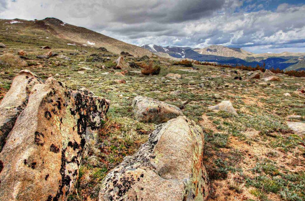
Trail Ridge Road climbs to 12,183 feet, making it the highest paved road in Colorado and one of the highest in the United States. The mileage looks short on paper, yet the elevation gain and open exposure give the drive real impact. Thin air, wide horizons, and sharp temperature shifts turn it into more than a simple park road.
As the route rises above 12,000 feet, tree cover drops away and alpine tundra takes over. Long views stretch across jagged peaks and high meadows. Weather can change quickly at this height, so blue sky at the entrance may turn to wind or cloud near the top.
Wildlife sightings happen often along this corridor. Elk, marmots, and bighorn sheep appear near pullouts and grassy slopes. Drivers tend to move slowly, which makes safe spotting and photo stops easier than on faster highways.
The road curves through forest, then crosses exposed high ground with frequent overlooks. Each stop gives a different angle across the Rocky Mountains below. Pairing this drive with extra time inside Rocky Mountain National Park adds hikes, lakes, and valley stops to round out the day.
Read More: 26 Incredible Colorado Hiking Trails You Need to Try
16. Northern Arizona Canyons Road Trip Loop Guide
Location: Northern Arizona, USA
Distance: ~230 miles (370 km) loop from Flagstaff
Suggested Time: 3–4 days
Minimum Time: 1 day
Southwest desert terrain takes center stage on this Northern Arizona Canyons road trip loop. The drive links high desert, volcanic fields, and deep canyon views in one connected route. Starting from Flagstaff, the road moves through changing elevation and color, with each segment showing a different side of the region.
Sedona brings towering red rock walls and winding approach roads with frequent overlook pullouts. Farther along, the Grand Canyon rim delivers long sightlines across layered stone and shadowed depth. Light conditions shift the canyon’s appearance hour by hour, so timing your stops adds value to the visit.
The loop also passes ancient settlement sites and geologic landmarks. Wupatki preserves old pueblo structures across open desert ground, while Sunset Crater shows hardened lava flows and cinder slopes from past eruptions. Short walks at these stops break up the drive and add historical and geological context.
This route works as a fast one-day circuit, yet adding extra days allows time for rim walks, side hikes, and slower pacing between segments. Fuel and food stops are spread out, so plan intervals ahead and treat each section as its own short drive rather than one continuous push.
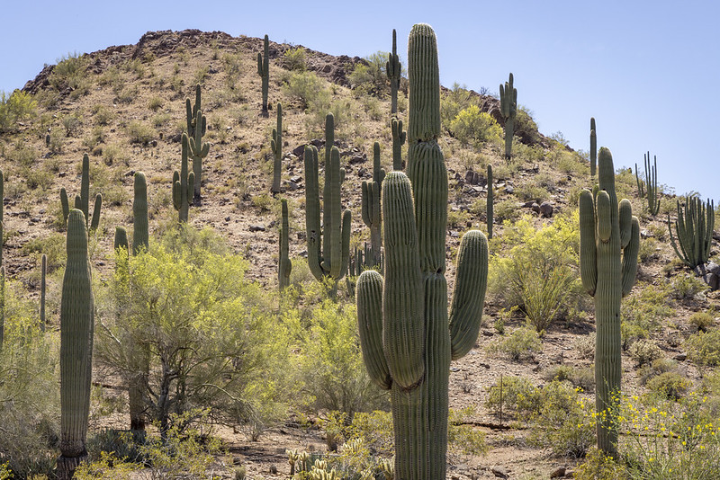
17. Southern Arizona Desert & Wild West Road Trip
Location: Southern Arizona, USA
Distance: ~300 miles (480 km) depending on route
Suggested Time: 3–5 days
Minimum Time: 1 day
This southern Arizona drive runs from saguaro-filled desert to old frontier towns, mixing open land with cultural stops. The Sonoran Desert sets the tone early, with tall cacti, dry ridges, and wide skies stretching across the horizon. Road segments feel open and sun-washed, with frequent scenic pullouts.
Tombstone adds a Wild West chapter to the route. Wooden boardwalks, historic saloons, and preserved streets recall its mining-era past. It’s an easy place to park, walk, and spend a few hours between longer driving legs.
The trip also connects larger city stops like Tucson and Scottsdale. Tucson offers strong regional food and museum options, while Scottsdale brings gallery districts, desert trails, and high-end resort areas. You can balance simple roadside stops with more comfortable overnight stays.
Travelers who want extra activity near Scottsdale can add local hiking routes and well-known dining spots to the plan. Splitting the drive across several days allows time for desert walks, town visits, and relaxed evening stops instead of rushing straight through.
Read More: 15 Surprising Small Towns in Arizona Worth Visiting
18. Southern California Coast & Desert Road Trip
Location: Southern California, USA
Distance: ~350 miles (560 km) depending on route choices
Suggested Time: 3–4 days
Minimum Time: 1 day
This Southern California road trip links coastline, wine country, and desert terrain in one extended drive. The route runs from Los Angeles toward Temecula and the San Diego area, mixing beach stretches with inland canyon and dry valley segments. Expect steady sunshine, open skies, and strong landscape contrast across relatively short distances.
Early legs of the drive feature palm-lined beaches and bluff-top roads above the Pacific. Farther inland, vineyard hills and tasting rooms mark the Temecula Valley stop. This section slows the pace, with short detours and relaxed afternoon breaks built into the route.
San Diego adds an urban-coastal chapter with harbor views, food districts, and waterfront parks. Beyond the city, rugged desert canyons and heat-shaped rock formations take over. Temperatures in hotter months often climb past 100°F in interior zones, which is why spring and fall work better for this trip window.
Travelers looking for more drives out of Los Angeles can extend plans with a run toward Death Valley or a broader California desert circuit, linking extra park and canyon stops into the schedule.
19. Northern California & Southern Oregon Coast Road Trip
Location: Northern California & Southern Oregon, USA
Distance: ~450 miles (725 km) depending on entry point
Suggested Time: 4–6 days
Minimum Time: 2 days
This Northern California and Southern Oregon coast road trip delivers long stretches of shoreline, forest roads, and small seaside towns. The drive usually begins inland in California’s Central Valley, then climbs west and north to meet the Pacific. From there, the route follows coastal highways with steady ocean presence beside the road.
The California portion features tall redwood groves, river mouths, and quiet beach communities. Farther north, the Oregon section brings sea stacks, dune fields, and cliffside viewpoints above crashing surf. The scenery changes often, so short driving segments with frequent stops work better than one long push.
U.S. Highway 101 carries much of the coastal leg, with turnouts and park access points spaced along the way. Walking trails, lighthouse areas, and beach access roads break up the mileage and add variety to each day’s plan.
A regional map helps visualize inland connectors and shoreline curves before departure. Electric vehicle drivers will also find charging stations placed at regular intervals across larger towns along the corridor, making multi-day pacing practical.
20. Grand Pacific Northwest Road Trip
Location: Oregon & Washington, USA
Distance: ~550 miles (885 km)
Suggested Time: 5–7 days
Minimum Time: 2 days
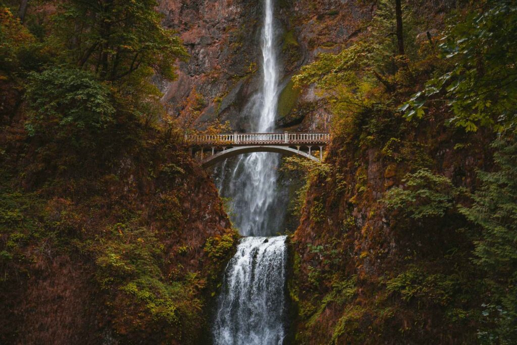
This Grand Pacific Northwest road trip crosses roughly 550 miles through Oregon and Washington, linking river gorges, mountain parks, and forest highways. The route combines well-known landmarks with long natural stretches, making it a strong pick for travelers who prefer outdoor stops over city hopping.
One major segment follows the Historic Columbia River Highway, where a chain of waterfalls sits close to the road. Short walks lead to viewing platforms and trail loops, so the drive naturally breaks into smaller scenic pauses instead of one continuous run.
Farther north, Mount Rainier National Park adds high-elevation terrain and seasonal flower fields during summer months. Clear days bring wide mountain views, while misty weather gives the slopes a heavier, dramatic tone. Road elevation and conditions can shift quickly, so daily timing matters.
This trip can stand on its own or connect with several other Northwest routes. Drivers who want more mileage can extend into additional Oregon or Washington backcountry highways and coastal spurs across the upper-left corner of the U.S. map.
21. Utah National Parks Scenic Road Trip
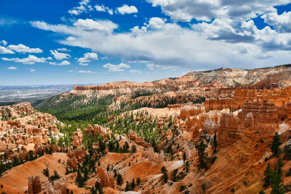
Location: Utah, USA
Distance: ~1,050 miles (1,690 km)
Suggested Time: 7–10 days
Minimum Time: 3 days
Utah draws road trippers with its strong food culture and striking landforms. This multi-park driving route links several of the state’s national parks in one extended circuit. Expect long desert highways, stone arches, canyon walls, and high plateaus spread across the route.
The drive places you close to several headline park areas, with repeated chances to stop, walk short trails, and take in wide-angle terrain. Rock layers shift in color and texture from park to park, so the visual experience keeps changing even over short distances. Sunrise and late afternoon light add extra depth across cliffs and carved formations.
Between park visits, small towns provide food breaks and local flavor. Moab stands out as a key base, with well-known dining spots such as Sunset Grill offering elevated views along with regional dishes. These town stops help balance hiking time with relaxed evenings.
This route often ranks near the top of U.S. driving trips thanks to its steady mix of park access, road quality, and stop variety. With enough days, you can split the journey into short segments and avoid rushing from gate to gate.
How to Plan Your USA Road Trip: Routes, Maps & Timing
Deciding Where to Go & What to See
The first step in planning a USA road trip is choosing your main direction and key sights. Think about landscape first. Do you want desert highways and red rock plateaus, or cooler forests and coastal air? A Utah or Southwest drive gives dry terrain and canyon country, while a Pacific Northwest route brings mountains, trees, and shoreline.
It helps to anchor your trip around one priority stop or one scenery type. Maybe it’s a landmark park like Yellowstone, or a terrain style like red rock country. One clear focus point makes the rest of the route easier to shape.
Before locking plans, check road and site status. Seasonal closures and construction happen often. A quick check ahead of time prevents wasted detours and last-minute frustration.
Mapping Out Your USA Road Trip
Plotting the route on a map is where the trip starts to feel real. Seeing your stops lined up across states gives scale and structure to the plan. Pins on a map turn ideas into a path you can follow.
Digital maps make edits simple. You can shift stops, add alternates, and test different route shapes in minutes. When you finally reach each marked point, that earlier map work pays off in a very direct way.
Best Road Trip Map Tool
Many travelers use Google Maps because it’s simple and widely available. The standard planner has a stop limit, which can feel tight on longer trips. Google My Maps removes that cap and lets you save layered custom maps to your account.
Other road trip planners also exist, with features like fuel estimates and attraction overlays. Testing one or two tools before finalizing your route can help match the planner to your travel style.
Tips for Creating a Road Trip Map
Try rearranging stop order instead of locking your first draft. Routes that look logical at first glance often improve after reordering points. Small changes can cut several hours of drive time between stops.
Be selective with map pins. It’s easy to overload the route with “while we’re there” additions. Extra stops sound harmless but can stack into long, tiring days. Trimming low-priority detours often improves the overall trip.
Check estimated drive times and arrival windows. If a sunrise or sunset view matters, count backward and set that segment first. Timing details may feel tedious, yet they prevent missed moments later.
How Long the Road Trip Should Be
Next comes the time budget. Compare how many days you have with how many major stops you want. A practical baseline is one to two days per major destination. That gives room for weather changes and rest.
If you have a week available, limiting the plan to about five main stops keeps the pace reasonable. Fewer stops with more time at each usually feels better than rushing through a long checklist.
Choosing a Starting Point
Picking the start city can be tricky, especially if you’re flying in and renting a car. In that case, compare total cost instead of looking at flights and rentals separately. The combined price often tells a different story than either one alone.
Airport size, rental car supply, and one-way drop fees also affect the decision. Running a few start-city price checks can shift the route in a smart way and lower total trip cost.
Saving Money on Flights, Cars, Lodging & Food for a USA Road Trip
Getting the Best Combined Price for Rental Car + Airfare
When booking a road trip, flight cost alone should not decide your arrival city. Compare airfare and rental car prices together before choosing. The cheapest ticket sometimes pairs with the most expensive car rates, which cancels out the deal.
Take a Utah Mighty 5 parks trip as an example. Salt Lake City and Las Vegas both work as entry points. A low airfare to Salt Lake City might look perfect at first glance, but if car rentals there are priced far higher than in Las Vegas, the total trip cost shifts quickly.
Run both numbers side by side for each airport option. A slightly higher plane ticket with a much lower car rate often wins overall.
Choosing the Right Lodging Options
Late-night arrivals without reservations often end badly. Campgrounds fill. Hotels sell out. Prices jump fast in popular park regions. Many travelers learn this the hard way after long no-signal drives into busy gateway towns.
Major parks can have surprisingly high room rates during peak periods. That’s why checking lodging early matters. Scan prices for your travel month and note how fast availability drops. This gives a realistic view of budget needs.
Match your stay type to your spending limit — hotel, motel, cabin, or campsite. Early checks reduce stress and prevent last-minute scrambling.
Camping on a USA Road Trip
Campers should look at Recreation.gov for advance site reservations. Many popular campgrounds open booking windows months ahead. Spots can disappear within minutes for peak dates.
Nearby national forests are strong backup options. Sites there often cost less and fill more slowly than park campgrounds. Some areas even allow dispersed camping under posted rules.
Always carry a second-choice overnight plan in case your first option falls through. Flexibility keeps the trip moving without panic.
Road Trip Food Planning

Food planning matters more than most people expect. Hunger turns a good drive into a tense one quickly. Gas station snacks help in a pinch, but relying on them all day wears people down.
A balanced approach works best — mix local diners with cooler-stored food. Fresh items and simple packed meals offset heavy fast food and keep energy steadier across long days.
A soft cooler works well for flights and car trips. Pack it with clothing during travel, then switch to ice and groceries on arrival. It saves space and adds flexibility.
Road Trip Groceries & Simple Cooking
Many road trippers make a grocery stop right after leaving the airport. Stocking up early covers gaps where towns are small or restaurant hours are limited. Having food in the car also prevents schedule pressure when trying to reach a sunset or timed entry.
A small one-burner camp stove adds another level of freedom for those who camp or car-camp. Hot meals after a long park day improve morale fast and cost less than repeated restaurant stops.
Coffee deserves its own mention. Portable water heaters and simple pour-over gear make it easy to prepare a solid cup almost anywhere, which for many travelers feels close to essential fuel for the road.
Fuel, Budget & Flexibility: Final USA Road Trip Planning Guide
Fueling Up on a Long Drive
Running out of gas on a remote highway is the kind of mistake most drivers make once — then never forget. Desert routes and mountain corridors often have long gaps between stations. Heat, distance, and weak cell signal can turn a small oversight into a major delay.
Fuel planning works best when treated as routine, not optional. Check the gauge often and refill earlier than you think necessary when crossing sparsely populated areas. Half a tank is a safer trigger point than “almost empty.”
Make a habit of topping off before entering park roads and rural stretches. A five-minute stop beats a one-hour rescue wait.
Planning Your USA Road Trip Budget
Setting a trip budget early keeps decisions grounded. It also makes it easier to trim low-value stops and manage group expectations. Numbers do not remove fun — they support it.
A sample per-trip budget might look like this:
Sample 7-Day Road Trip Budget for Two People
- Food — $50 per person / day
- Lodging — $150 per day (hotel, double occupancy)
- Gas — $30 per day (varies by vehicle and distance)
- Rental Car — $70 per day
- Flights — $300 round trip per person
- Fees & Park Passes — $100 total
- Miscellaneous — $300 total
Estimated Total: ~$3,300
Actual totals move up or down based on hotel nights, flight deals, car type, and dining choices. Grocery stops and camping nights can cut costs quickly.
Flexibility Leads to a Better Trip
Road trips work best with structure plus breathing room. Tight schedules often create tension when traffic, weather, or fatigue shift the day’s plan. A lighter framework keeps moods steadier.
Leave open blocks in the schedule. Stay longer where the experience feels good. Leave earlier when a stop doesn’t hold your interest. The road allows adjustment — use that advantage.
Missing a sunset or skipping a minor stop is fine. Hydration, snacks, and rest breaks matter more than perfect timing. Focus on the present stretch of road instead of the next checkpoint.
Weather Planning Matters
Weather remains the least controllable part of any road trip. Rain, smoke, wind, or heat waves can change plans fast. Backup options help reduce disappointment when conditions turn.
Check monthly averages for temperature and rainfall before locking dates. Also prepare alternate stops or shorter routes in case key viewpoints or roads close temporarily. A flexible route absorbs weather surprises far better than a rigid one.