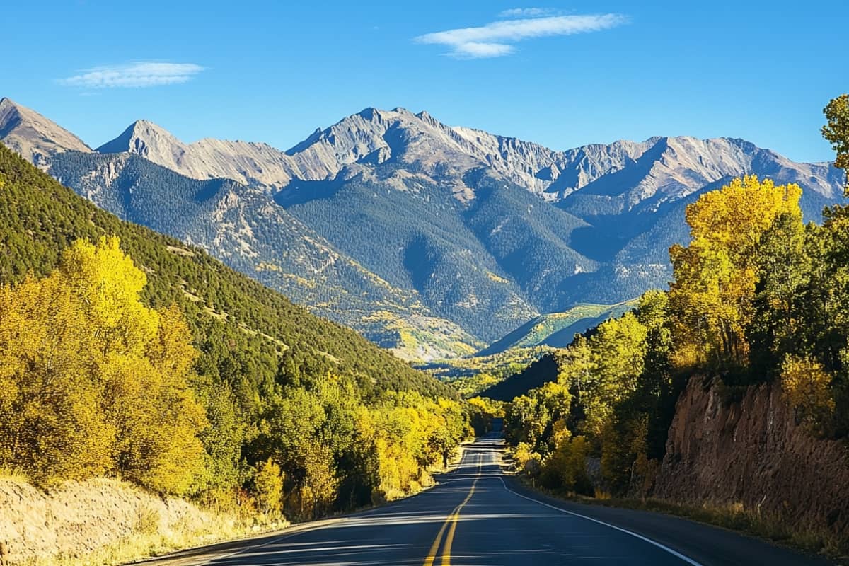
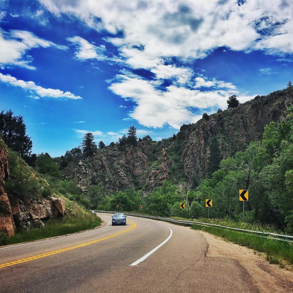
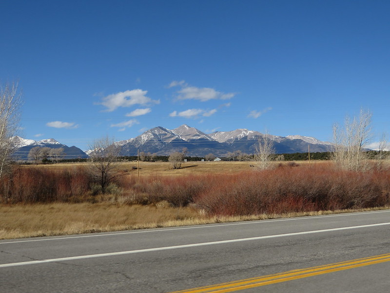
Colorado stands out as a road trip destination where every mile feels alive with contrast. The Rocky Mountains rise sharply across the state, connecting national parks, state parks, old mining towns, and wide-open terrain through roads that feel as memorable as the places themselves.
Some of these routes climb to remarkable elevations, placing you above the tree line with sweeping views that stretch for miles. Others wind through green valleys and deep canyons, where the road bends and shifts with the landscape, keeping the drive engaging at every turn.
There’s a steady rhythm to traveling here. One moment feels bold and exposed, the next calm and grounded. That contrast is what makes these drives stand apart, offering a mix of high-altitude drama and quieter stretches where you can slow down and take it all in.
If you’re ready to experience it for yourself, here are 21 of the best scenic drives in Colorado that bring together the state’s most striking roads and unforgettable views.
About This Collection of Scenic Drives
This list is incomplete. Scenic Drives in Colorado are abundant and heritage-rich. A basic guide to 10 This is not a full list. Colorado has a wide range of scenic drives, more than most travelers can fit into one itinerary. The routes featured here are some of the most recognized, known for bold views and that instant sense of scale the moment you hit the road.
Many of these drives are through-routes—highways and byways that connect several towns, parks, and viewpoints along the way. Others take a more direct path, climbing steadily to higher elevations where the landscape opens in every direction. Each route offers a different rhythm, but all keep the drive interesting from start to finish.
Here is a little road trip terminology:
Scenic Byway: A designated route created for travelers, passing through areas known for natural beauty or cultural value.
Mountain Pass: A drivable route that crosses over a mountain range, often involving elevation gain, curves, and shifting conditions.
Note: All of these roads are paved, so a standard vehicle works just fine. You can see these scenic drives on a map at the end of this post.
Colorado’s Scenic Drives
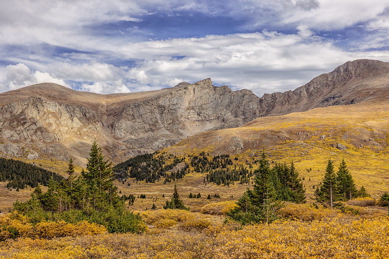
1. Peak to Peak Scenic Byway
Distance: 55 miles | Duration: 2 Hours | Open: All Year
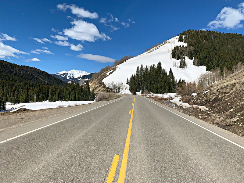
The Peak to Peak Scenic Byway links Estes Park with Central City, tracing the eastern edge of Rocky Mountain National Park and the Front Range. It moves across high terrain, passing through forested stretches and several old mining towns before reaching its final stop.
Along the way, the road brings clear views of Longs Peak, the tallest summit in the park, rising sharply above the skyline. Mount Meeker, standing at 13,911 feet, also comes into view, adding to the dramatic mountain backdrop that follows much of the drive.
Nederland makes a great midway stop, with its small-town feel and a few laid-back spots to grab a meal or take a short break. As the route continues into Central City, the atmosphere shifts slightly, where historic streets meet a cluster of casinos that add a different kind of energy to the end of the drive.
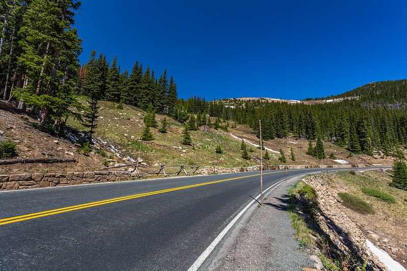
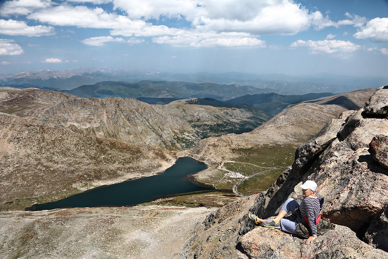
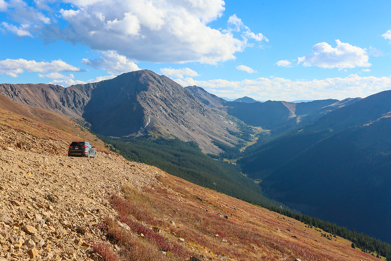
2. Mount Evans Scenic Byway
Distance: 50 miles round-trip | Duration: 2 hours | Open: Summer
The road is the highest asphalted track in all of North America.
At 14,271 feet Mount Evans is towering member of the Front Range in Rocky Mountains. Mount Evans Scenic Byway provides access to be drive right up the mountainy peak.
Rising more than 7,000 feet across its length of 28 miles – topping out at an altitude of 14,130 itself – the Pikes Peak Hill Climb reigns as the second oldest race in American performance driving history behind only Indianapolis. At the top, you will be rewarded with panoramic vistas of the Rocky Mountains and Continental Divide as well as perhaps glimpses mountain goats or bighorn sheep.
Directions: The Mount Evans Scenic Byway is usually open from Memorial Day to Labor Day, weather permitting. Make sure to check local resources for updates! Take I-70, exit 240 at Idaho Springs, follow Highway 103 south to Echo Lake and then HWY5 up all the way to the top. Or, from Bergen Park take Squaw Pass Road/Highway 103 to Echo Lake and Highway 5 at the top.
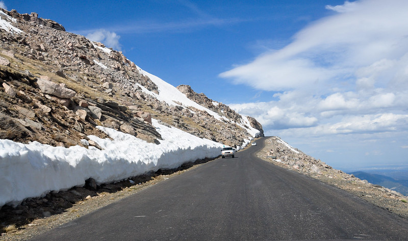
3. Trail Ridge Road
Distance: 48 miles | Duration: Half to Full Day | Open: Summer and Early Fall
As we headed towards Trail Ridge Road, the highest paved through road in Rocky Mountain National Park—and indeed all of Colorado—we knew today would prove to be a little challenging not just for us but also our Honda Civic hatchback Chinese. It covers 11 miles and runs from Estes Park in the east to Grand Lake on the west, with part of those 48 stretching across alpine tundra well above treeline. The road reaches a maximum elevation of 12,183 feet and travels through Milner Pass on the Continental Divide.
This is a journey that provides an experience of your life. You will definitely see bighorn sheep (and Elk) and the views are stunning from big lookouts along the way. In Rocky Mountain National Park, Trail Ridge Road is also the gateway to some wonderful hiking opportunities. Pay a visit to one of their other unforgettable visitors’ centers, especially the Alpine Visitor Center which is the highest in America.
PLEASE NOTE: Trail Ridge Road is generally open from Memorial Day to mid-October. In the between then, this road remains packed with snow. Visit the National Park Service website for current road conditions and Timed Entry System details.
4. Top of the Rockies National Scenic Byway
Distance: 130 miles | Duration: 4 to 5 hours | Open: Year-Round (Independence Pass is seasonal)
This scenic byway is a wonderful trip, and it’s one with multiple sections that includes three mountain passes as well as several historically significant towns.
From Aspen head east on Highway 82 toward Granite. Along the way you will head over Independence Pass, one of the highest paved state highways that traverses the Continental Divide at 12,095 feet. Take note some of this road is narrow and twisted with limited places that only one car can pass at a time.
Memorial Day and late October mind, that Indiana Pass despite the fact is often Blizzard restrained. Be sure to check conditions for current road status updates.
At Highway 24, take a left heading north to remain on the Top of the Rockies Scenic Byway.
Leadville: As the highest incorporated town in america at 10,152 ft and This historic community was a silver boomtown in the late 1880s and attracted such notable figures like Doc Holliday, Susan B. Anthony, Buffalo Bill Cody and Horace “Silver Dollar” Tabor.
Leadville, the scenic byway branches Therefore in two directions. If you take Highway 91 north, it will eventually rise to more than two miles above sea level as one crosses the Continental Divide on Fremont Pass (11,318 feet) before descending toward Copper Mountain and I-70. Turn left to take Highway 24 over the Continental Divide at Tennessee Pass (Elevation: 10,424 feet) and Minturn/I-70.
Highway 24 and Highway 91 are usually both open throughout the year, but they might be temporarily closed after serious snowstorms.
Pro Travel Tip: In summer, Mountain passes such as Mount Evans, Pikes Peak, Alpine Ridge Road and Loveland Pass can be 20-30 degrees cooler than the low lands. Dress warmly and layer it up so that you can peel off garments as the day warms!
5. Pikes Peak
Distance: 40 miles round trip | Duration: 2 to 3 hours | Open: Year-Round
The road to the top of Pikes Peak is one of Colorado’s most iconic drives.
Pikes Peak is one of Colorado’s highest fourteeners, at 14,115 feet. Just outside of Colorado Springs, the summit provides sweeping panoramas over those lovely purple mountain majesties. On a really clear day you can even see Kansas, New Mexico, Utah and Arizona.
There is an entrance fee to Pikes Peak, which you will pay at the base of the mountain before driving up. From late May through the end of September, a reservation is required if you plan to enter.
The summit is home to restaurants, washrooms and a giftshop. Ranger-led programs offer information about the history, geology and wildlife of Pikes Peak. We definitely recommend grabbing some hot and fresh donuts at the Summit House!
Since Pikes Peak is open year-round, temporarily closing in winter months for snow redistribution.
6. Skyline Drive in Canon City
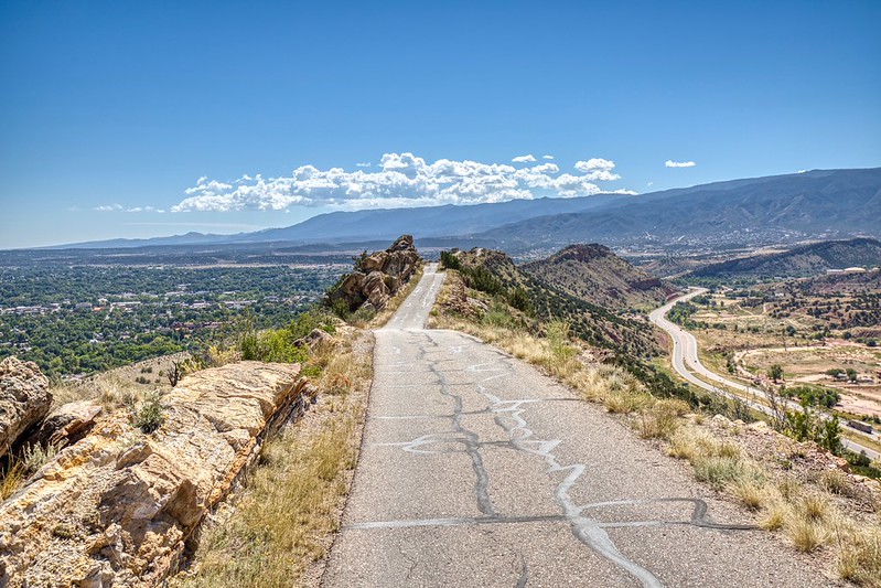
Distance: 2.6 miles | Duration: 15 minutes | Open: Year-Round
Even though this is a short drive it’s definitely one of the most iconic and scenic drives through Colorado. The narrow, one-way road sits atop the razorback ridge with a very thin pavement and drop-offs of several hundred feet on both sides.
Built in 1905, Skyline Drive was constructed by inmates from an Aztec prison who received sentence reductions for their efforts. Once a horse-drawn carriage, pedestrian and bicycle route when it first opened then later cars adding views to the surrounding mountains that up until the tunnel only pilots saw from their viewpoint above.
Getting There: Go northeast on Hwy 50 in Canon City and right onto Skyline Drive. On all maps, the entrance is well indicated. This 2.6-mile one-way road goes south and returns to town at the bottom. Drivers face a thrilling ride with the road’s precipitous 450-foot no-guardrail drop-offs. Along the way, there are wider sections that accommodate passing vehicles more safely. With my sticks I step aside one or two steps and allow for safe passage of other travelers who may be using cars, busses to those home stations upstream from where I began earlier this morning at Waverly Beach near Toronto.
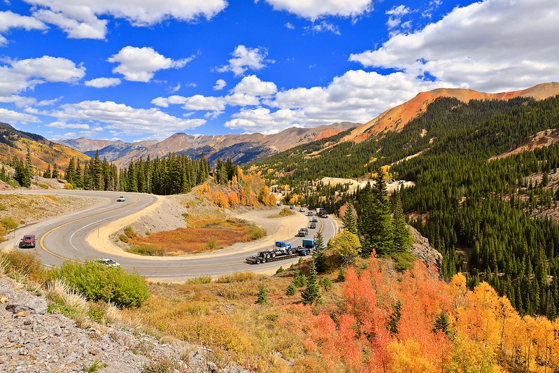
7. San Juan Skyway and the Million Dollar Highway
Distance: 230 miles | Duration: 1 day | Open: Year-Round
This drive is one of the most stunningly beautiful scenic routes in Colorado. A large loop through the San Juan Mountains, part of it on a dirt road; links historic towns and two national parks.
On the southwest corner of the loop is Cortez, your access point to Mesa Verde National Park.
Start off in Durango, once a bustling mining town during the boom years of the 1880s and then head east on Highway 160 toward San Juan.
Durango Take Highway 550 north along the Hermosa Cliffs and through San Juan National Forest. The remainder on the road between Silverton and Ouray is known as The Million Dollar Highway (because, according to legend, it cost one million dollars per mile.) Legend also has it that the road was built over millions of dollars in gold and other minerals.
This section of the drive is incredible, full or hairpin turns and panoramic views of the surrounding mountains. Ouray Is a Lovely Historic Town Where You Can Relax in Hot Springs, Shop and See the Box Canyon Waterfalls.
From Ouray, the loop goes through Telluride on Highway 145 (“To Hell You Ride”), yet another of these old towns with a more recent ski economy and back again to Cortez.
Road Trip Tip: If you’re taking in Colorado’s national parks, use this scenic route to get from Mesa Verde National Park over to Black Canyon of the Gunnison. Take the San Juan Skyway from Cortez through Durango, Silverton and Ouray north to Montrose.
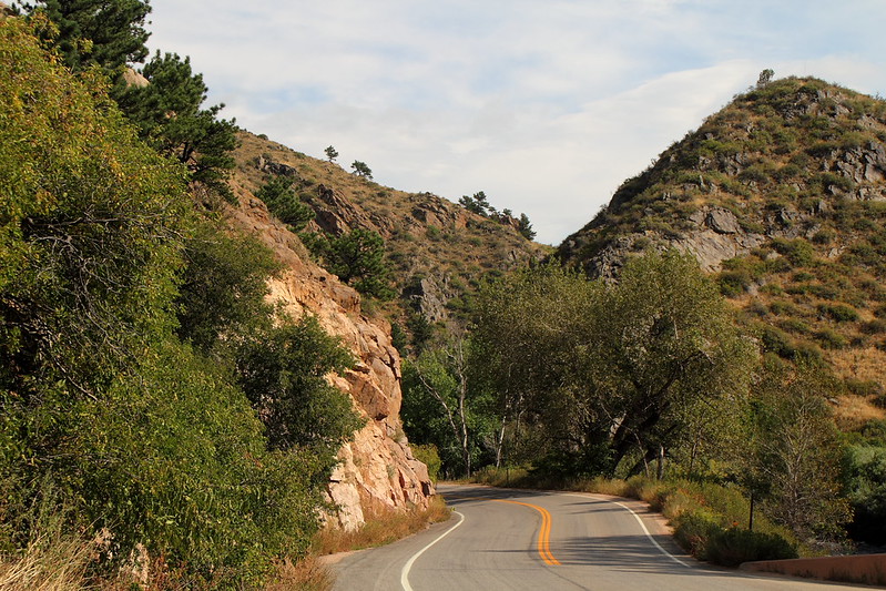
8. Loveland Pass
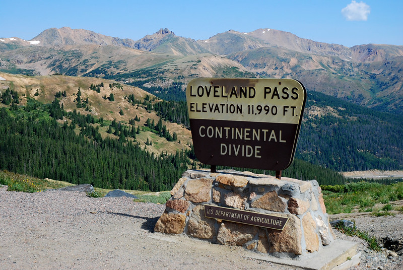
Distance: 8 miles round-trip | Duration: 1 hour | Open: Year-Round
Loveland Pass is a high mountain pass in the Rocky Mountains of north central Colorado, at an elevation of 11,990 feet between I-70 just west of Arapahoe Basin near Keystone and U.S. Highway 6 junction with Hwy40. On outbound from Denver to a number ski resorts around Summit County.
The pass itself is only a few miles long but very steep, with an average gradient of 6.7% and several tight hairpin bends to negotiate on the ascent. Although it is a difficult climb, the view at top makes the hike worthy.
Despite the challenging conditions, Loveland Pass is considered to be Colorado’s highest pass that remains open in wintertime. But closures can still occur if there’s a lot of snow. 2WD vehicles must carry chains in the winter months.
9. Rim Rock Drive, Colorado National Monument
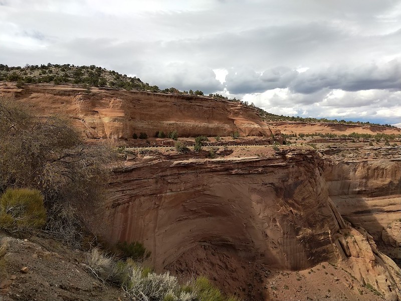
Distance: 23 miles | Duration: 1 hour | Open: All Year
This scenic drive is still on our to-do list, but it stands out for its striking desert-style landscape and dramatic canyon views.
Colorado National Monument feels very different from the mountain scenery most people expect in Colorado. With its red sandstone formations and wide mesas, the setting resembles parts of Utah or Arizona more than the alpine terrain found elsewhere in the state.
Rim Rock Drive follows the edge of the Uncompahgre Plateau, with the road curving along cliffs that overlook deep canyons and open valleys. The views shift constantly, giving you something new around nearly every bend.
There is a $25 entrance fee per vehicle to access Colorado National Monument.
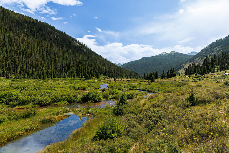
10. The Poudre Canyon Near Fort Collins
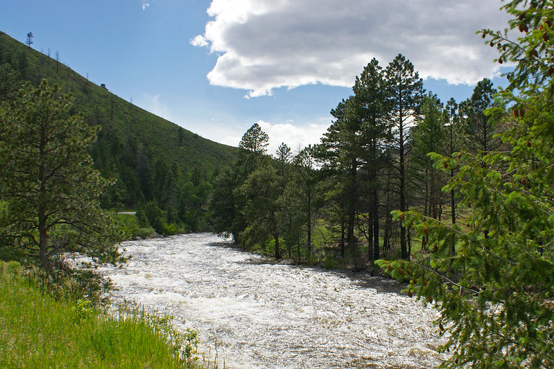
Distance: 101 miles (one way) | Duration: 3 hours (one way) | Open: Year-Round
Cache la Poudre Scenic Byway (101 Miles, Fort Collins to the northern Rockies) This winding road offers stunning views of some of Colorado’s wildest landscapes. Whether you drive in a bit to stretch your legs, or on all the way into the Never Summer Mountains, this one is sure to be an adventure.
Raft the Poudre River, rock climb in the walls of poudre canyon, campground out under the stars or hike through trails there.
11. Guanella Pass
Distance: 22 miles (one way) | Duration: 1 hour (one way) | Open: Late Spring to Early Fall (Closed in Winter)
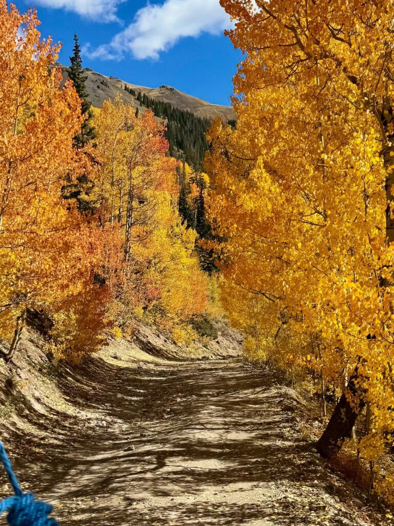
And it was here that we made our way to Guanella Pass, one of the best fall drives in Colorado and a vibrant show filled with golden aspens swaying next to tranquil brooks all of which culminated at an overlook showcasing stunning views towards Mt. Bierstadt–one Denver’s most iconic 14ers.
It runs from Georgetown to Grant, connecting Interstate 70 with Highway 285. No toboggan, limited winter maintenance; park closes in heavy snow
Things To Do: Dispersed camping off the road, summit one of Colorado’s more straightforward and lower 14ers, wildlife viewing opportunities at times in season, picnic sites or scenic pullouts for views on point.
12. Jones Pass
Distance: 13 miles (one way) | Duration: 1 hour if the pass is closed, 2 hours if it’s open | Open: Summer through September
While it might be less-visited than other alternatives, Jones Pass is still among my all time favorite scenic drive in Colorado. A crossover SUV or equivalent is suggested for the steep, unpaved route that leads to a splendid view at the highest point. Covered with snow (mostly a block of ice during the year), it is accsible from July repril until Septemer. This mean his it isn’t onn – more ike Narnia, bur phenomenal views make up for any hassles .
Cross the Continental Divide and you will reach Bobtail Creek. Now, a popular Jones Pass out-and back route (9.5 miles) rises 1,750 feet to link with the CDT before descending back over gentle terrain with views into Vasquez Cirque. Equal Opportunity Note: Many would opt for an easy pass on this part of the Continental Divide Trail.Credits: Kari Medig You will enjoy more of a journey if you step out and hike up the closest hill, especially when there is snow on the road so that way you can observe fantastic alpine landscapes.
Highlights: Dispersed camping, section of the Continental Divide Trail for hiking; ATVing (or skiing in winter), sunset views and alpine vistas-careful with those wild flowers!
13. Lariat Loop Scenic Byway
Distance: 40 miles | Duration: 1 to 2 hours (depending on stops) | Open: Year-Round
Chances are if you live in Denver, a portion of this route has never been more than 40 minutes away. The loop starts in Golden, where it ascends Lookout Mountain for vistas of the town beneath – especially beautiful when late spring turns Colorado’s hillsides as lush and green as Ireland.
After Brighton, you merge onto I-70 in Genesee and take the rest of the route through to Evergreen Parkway before hitting Bear Creek Road south back toward town. During the drive, you will have lots of trails into hiking near Denver little towns and parks to explore.
Local Tip: Elk, bighorn sheep and wild country oxen are frequently seen in the mornings when you head out early.
Details/Activities of Interest: Hike in Evergreen, sunrise or sunset on Lookout Mountain and lunch at one near you – Evergreen or Golden.
14. The Gold Belt Loop
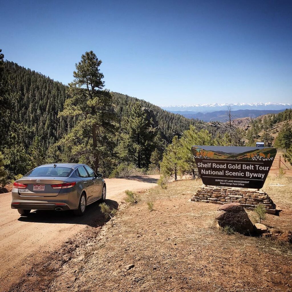
Distance: 131 miles | Duration: 5.5 hours | Open: Year-Round
The Gold Belt Scenic Loop Exploring the past and beauty of history buffs. A mix of asphalt and rugged 4WD road that doubles as a Canyon CityCripple Creek cattle drive based on the route early settlers used to migrate, this exciting southern Colorado trek calls for lunch in Cripple Creek with enough time left over to find creative Internet sites dedicated user forums encouraging you.
Stop at the Florissant Fossil Beds National Monument to see petrified redwood and 34-million-year-old insects. Head to Cripple Creek, named after the golden prospectors of yore (which has been replaced with casinos for some).
Finally, for those wanting a more off-road adventure, Shelf Road and Phantom Canyon offer lots of backcountry shenanigans.
Things to Do: Try 4-wheel driving, rock climbing along Shelf Road, and explore the towns of Victor, Cripple Creek, and Canon City.
15. Collegiate Peaks Scenic Byway in the Sawatch
Distance: 57 miles (one way) | Duration: 1 hour 30 minutes (one way) | Open: Year-Round
Collegiate Peaks Scenic Byway makes you feel like ants as you drive beside towering peaks. The paved road continues to parallel the Sawatch Range, where 14 of our nation’s highest peaks begin— all over 14,000 feet.
Enjoy the dramatic views of mountains as you travel along this quintessential Colorado roadway.
Things to Do: Tour charming Buena Vista, Leadville and Salara Whitewater rafting, hiking and mountain biking will be on offer to keep you well entertained. The region is also home to some of Colorado’s top Free Camping.
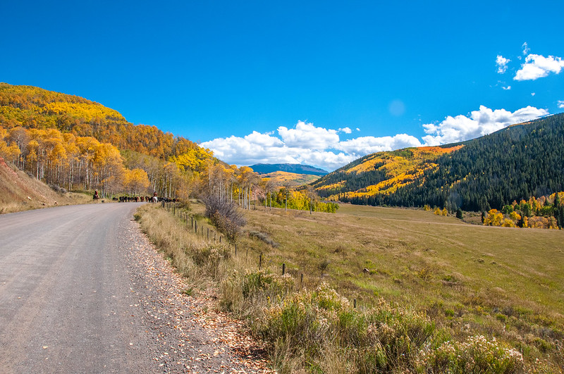
16. West Elk Loop
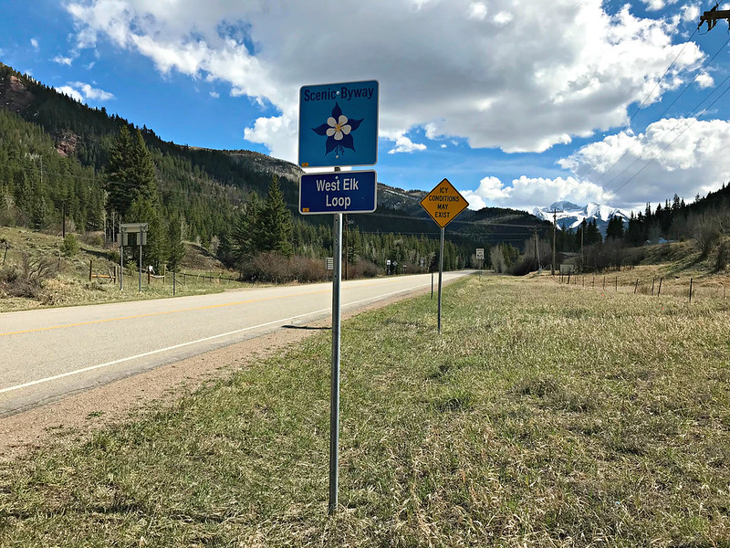
Distance: 205 miles (one way) | Duration: 7 hours (one way) | Open: Year-Round
The West Elk Loop is more than just a beautiful scenic byway, it’s an entire vacation unto itself! This route winds riders through quaint mountain communities such as Carbondale (near Aspen), Paonia, Crawford, Gunnison and Crested Butte.
While you can cover this in a day, it’s really best over the weekend, allowing for stops at some of these amazing views and things to do along the way.
Things to Do: Gunnison National Park, Aspen and the Maroon Bells for insane beauty, Crested Butte to hit some biking trails. This route offers some of the best alpine fishing, hiking, mountaineering and camping in the world.
17. Kebler Pass near Crested Butte
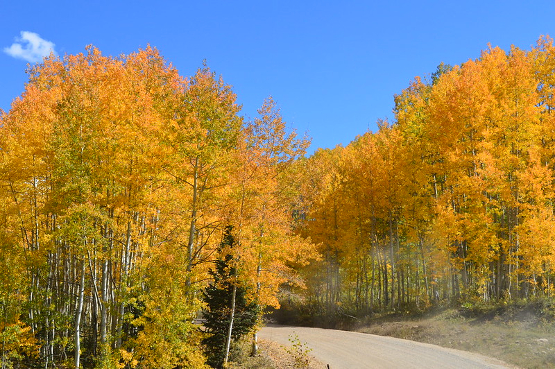
Distance: 31 miles (one way) | Duration: 1 hour 30 minutes (one way) | Open: Summer and Early Fall
Those looking for a bit of shutdown after all the city scapes might want to take the long way between Aspen and Crested Butte, through miles of aspen groves along this scenic by way. Good for a summer or early fall drive, as they say this byway is insane in the membrane. via Charter Smokehouse & Tavern Buzzkill: you want to see Vermont? you are taking months off from school and your parents have no idea where ¢25 million goes every day in Iraq because Halliburton has already made them forget that, The road, part of which isn’t paved and impassable in winter months. So make sure the park is open before heading out to this unique spot. While you’re in Aspen, make your way over to the famous Maroon Bells hikes.
Things to Do: Glance at colorful autumn leaves, find wild flowers, discover great camping location or have a hike and ride an ATV through the pass.
18. The Million Dollar Highway near Ouray
Distance: 25 miles (one way) | Duration: 1 hour (one way) | Open: Year-Round (may close in winter due to avalanche risk)
Part of the San Juan Skyway, this winding and steep road between Ouray and Silverton provides some incredible Colorado views.
For most, it will be the Million Dollar Highway with its stunning scenery capped by red peaks and memories of early mining days that rises to the top. This is one of the best things to do in Ouray —and a truly memorable ride through some beautiful rugged Colorado.
Things to Do: Camping, hiking Ice Lake Basin; nearby Ouray and Silverton.
19. The Alpine Loop in Silverton
Distance: 65 miles | Time: 5 hours | Open: Summer
For a true off-road experience, the Alpine Loop crosses the San Juan Mountains, linking Lake City, Ouray, and Silverton. The route climbs through high terrain, passing old mining areas, narrow paths, and wide mountain views that shift as you move from one section to the next.
A 4WD, high-clearance vehicle with a short wheelbase is recommended for the full loop. However, parts of the route can still be driven with a standard 2-wheel-drive vehicle, allowing you to experience a large portion without tackling the most difficult sections.
Local Tip: A proper off-road vehicle is required for Engineer Pass, Cinnamon Pass, and Mineral Creek.
This route is popular for ATV rides, mountain biking, hiking, camping, and exploring small mountain towns that carry a strong sense of Colorado’s mining history.
20. Trail of the Ancients
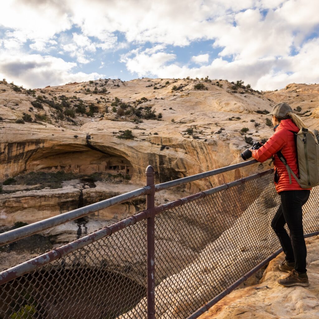
Distance: 114 miles | Time: 3 Hours (one way) | Open: Year-round (fall through spring is ideal)
Located in the southwest part of Colorado near the Four Corners region, this scenic drive stands out for its deep historical roots and wide desert landscapes. The route passes through areas where traces of ancient civilizations are still visible today.
Along the way, you can stop at Lowry Pueblo, explore Canyons of the Ancients National Monument, and visit Mesa Verde National Park, where cliff dwellings offer a closer look at life from centuries ago.
This drive also gives you the chance to experience desert hiking, quiet camping spots, and a stronger connection to Native American heritage, all set within a landscape that feels very different from the rest of the state.
21. Flat Tops Trail
Distance: 82 miles | Time: 5 hours (with side trips) | Open: Year-round
The Flat Tops Trail runs from Yampa to Meeker, crossing the northwestern part of the state with long stretches of mountain views and open space. This route passes through river valleys and high terrain within the Flat Tops Wilderness, offering a drive that feels calm and removed from busier routes.
This landscape played a role in shaping early wilderness protection in the United States, as its vast, untouched character influenced the idea of preserving large natural areas. Even today, it carries that same sense of scale and quiet.
Traffic is usually light here, so it’s common to go long distances without seeing many other vehicles. That slower pace gives you time to take in the surroundings without distraction.
Things to Do: Ripple Creek Pass, Trappers Lake, and Milk Creek.
Map of Scenic Drives in Colorado
How to Use This Map : Click the tab in the top-left corner of the map to open the full list of points of interest and switch layers on or off. You can also tap any icon on the map to view more details about that location.
To save this map for later, click the star next to the map title to add it to your Google account. Then open your Google Maps app, go to “Saved,” and select “Maps.” You’ll find the map listed there, ready to use whenever you need it.
More Related Articles :