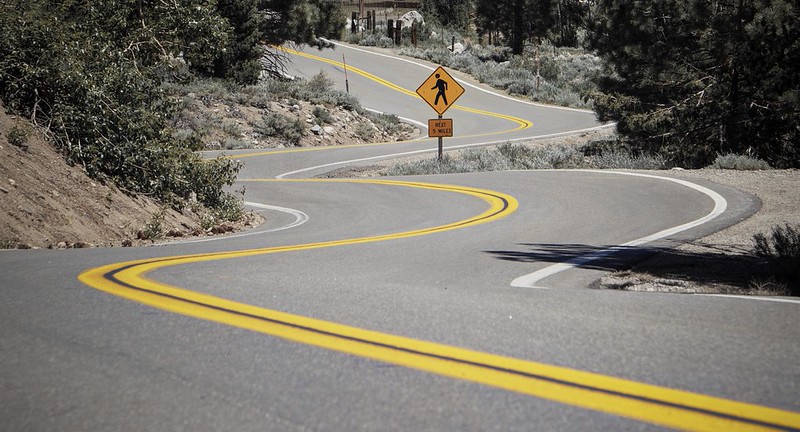
California sells the dream of open-road freedom better than almost anywhere in America. A highway curls above the Pacific, a desert road runs into empty heat, a mountain pass climbs into snow country, and every turn feels ready for a postcard.
That is the part most travel guides love to repeat.
The quieter truth is sharper. Some California road trip routes are beautiful because they are exposed, remote, steep, narrow, or hard to repair. Locals do not warn visitors away from them because they hate tourists. They warn them because they have seen fog swallow curves, rockfall block lanes, brakes overheat on grades, and summer heat turn a small car problem into a serious emergency.
These roads are not always the busiest. Some look harmless on a map. That is exactly why they catch road trippers off guard.
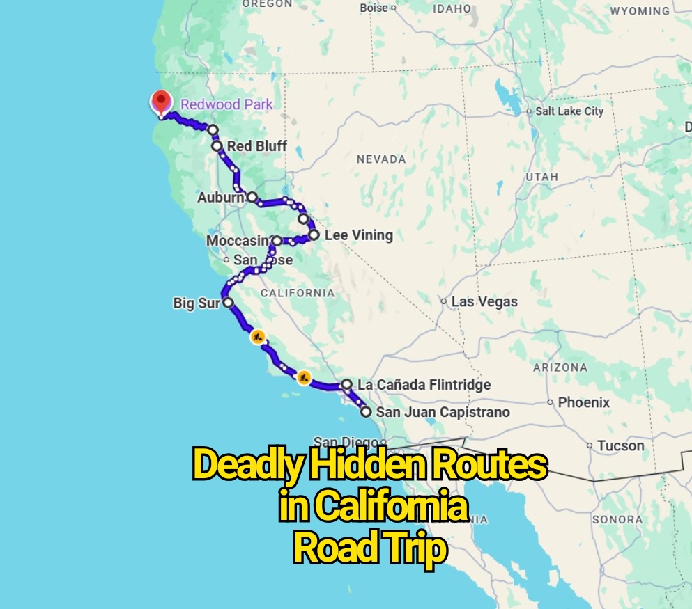
Highway 1 Through Big Sur
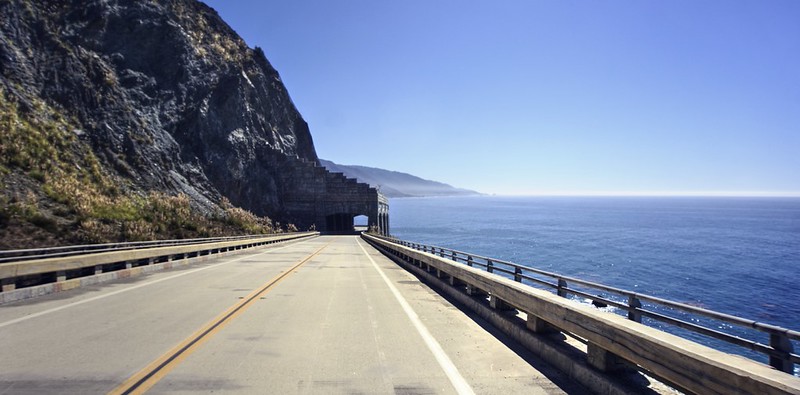
Highway 1 through Big Sur may be California’s most romantic road trip, but it is also one of the state’s most fragile coastal drives. The danger is not just the cliff edge. It is the mix of fog, narrow curves, distracted sightseeing, soft shoulders, rockfall, and landslides that can change the route without much warning.
The Regent’s Slide closure became a reminder that this road is never fully tame. California officials announced the reopening of the closed Big Sur section in January 2026 after major slide repair work, but the same coast remains shaped by unstable slopes and storm damage risk. A road can reopen and still deserve respect. That is the part casual visitors often miss.
Locals know that Highway 1 is best driven slowly, with both hands on the wheel and no hurry to beat the sunset. The view is the reward, but the road does not forgive careless driving.
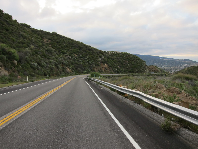
Angeles Crest Highway
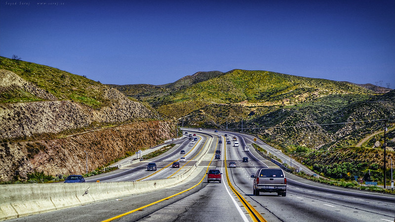
Angeles Crest Highway looks like an escape hatch from Los Angeles. In a short drive, the city drops away, and the San Gabriel Mountains take over. That sudden change is part of the problem. Drivers move from urban roads into sharp curves, elevation gain, rockfall zones, and fast-changing weather before they fully adjust.
Caltrans describes emergency repair work along State Route 2 as focused on storm damage, including washouts, rockfalls, landslides, debris flows, roadway erosion, and damaged shoulders. That is not just routine road work. It shows how often the mountain itself pushes back against the pavement.
This is the kind of route where overconfidence becomes the real hazard. A sunny day at the bottom can turn into fog, ice, debris, or closed gates higher up.
Ortega Highway
Ortega Highway, or State Route 74, connects Orange County with the Lake Elsinore side of Riverside County. On a map, it looks like a handy shortcut. On the road, it becomes a winding mountain corridor with blind curves, commuter pressure, motorcycles, trucks, and limited room for mistakes.
Older Caltrans safety material for Ortega Highway pointed to narrow lanes, limited turnout areas, high accident rates, and the need to improve drainage and roadway safety. More recent Caltrans work on SR 74 includes a major lane-widening and safety-features project near Lake Elsinore.
The contrarian truth is that this road is not scary because it feels remote. It is risky because it feels familiar to so many drivers. Familiar roads often make people drive faster than the curves allow.
Old Priest Grade Road
Old Priest Grade Road is short, steep, and famous for saving time near the Yosemite gateway area. That is exactly why locals warn visitors about it. The road climbs hard, turns tightly, and gives little comfort to anyone towing a trailer or driving a large camper.
Tuolumne County’s own emergency material says Old Priest Grade is not recommended as an exit route, is not suitable for trailers or campers, and has a very steep grade with tight turns. That is unusually plain language for a public document, and it says plenty.
This road is a classic trap for travelers who trust GPS more than local judgment. The shorter route is not always the smarter route, especially near mountain parks where grades matter more than mileage.
Highway 190 Through Death Valley
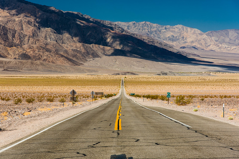
Highway 190 through Death Valley does not need hairpin cliffs to be dangerous. Its threat is harsher and less dramatic at first glance. Heat, distance, steep grades, limited services, and mechanical stress can turn a normal road trip into a survival situation.
The National Park Service tells summer visitors to stay on paved roads, remain with the vehicle if it breaks down, and carry extra drinking water. It also says people should drink at least one gallon of water per day in summer conditions. That advice exists because help can be far away and the desert does not wait kindly.
This road is especially misleading because the pavement can look easy. The danger is not always the curve ahead. Sometimes it is the temperature, the grade, the brake smell, and the empty miles between services.
Tioga Pass Road
Tioga Pass Road feels like a dream route across Yosemite’s high country, but it is ruled by snow more than tourism. It crosses high elevation terrain where closures can last deep into spring, and even after opening, services can be limited.
The National Park Service says Tioga Road is closed to vehicles in winter, and plowing covers 45.5 miles from Crane Flat to Tioga Pass. Caltrans’ current road condition pages also direct travelers to check highway status before heading into the Sierra.
The mistake visitors make is treating Tioga like a normal scenic road. It is not. It is a seasonal mountain crossing where the calendar matters less than the snowpack, storms, and park operations.
Sonora Pass
Sonora Pass on State Route 108 is one of California’s most intense mountain drives. It can be gorgeous, quiet, and wide open in good weather. It can also be steep, narrow, and closed by snow when the Sierra decides the season is not finished.
Caltrans announced the formal reopening of Sonora Pass for April 30, 2026, after seasonal snow-clearing work. That annual ritual says a lot about the road. This is not a route to treat as a simple line across the map.
The real warning here is for travelers who dislike slow driving. Sonora Pass rewards patience and punishes rushing. Grades, curves, and changing mountain conditions all demand a calmer pace.
Highway 36
State Route 36 between Red Bluff and Fortuna has a reputation among locals and motorcyclists for being wild, winding, and mentally tiring. It is remote enough to feel quiet, but that quiet can become a problem if weather, fatigue, or a breakdown enters the picture.
A Caltrans transportation report notes that SR 36 has multiple curves with advisory speeds of 25 mph or less, sections too narrow for a centerline stripe, shoulder areas that vary from paved to unpaved, places with no shoulder, and limited turnout or passing options along the route.
That is the kind of road where distance can lie. A route may not look extreme by mileage, but the constant curves and limited escape space make it feel far more demanding from behind the wheel.
Highway 299
Highway 299 links inland Northern California with the coast, but it crosses rugged country where slides, rockfall, winter weather, and wildfire-scarred slopes have all left their mark. This is not a smooth cruise from Redding to Arcata. It is a working mountain-and-canyon highway with real natural hazards.
Caltrans has documented work on the Monument Slide along SR 299 in Trinity County after the Monument Fire, and a 2026 Pit One Grade project includes rock fence installation, boulder removal, drainage replacement, and guardrail work to reduce rockfall risk.
Locals tend to watch the weather before taking this road. Visitors should do the same. Rain, snow, fire damage, and loose slopes can all change the mood of the drive fast.
Highway 49 Through Gold Country
Highway 49 has old mining towns, foothill scenery, and a slower historic feel in places. That softer image can hide the real traffic risk. Parts of the corridor carry fast vehicles, local commuters, tourists, trucks, curves, and narrow shoulders through hilly terrain.
Caltrans safety work near Auburn aimed to realign reversing curves, improve sight distance, reduce sideswipe and head-on crash potential, and address trailer off-tracking on tight-radius curves. A separate Placer County SR 49 project added a concrete median barrier to reduce cross-centerline crashes.
This road is not dangerous because every mile feels dramatic. It is dangerous because ordinary-looking stretches can still carry serious crash patterns.
Why Locals Warn About These California Roads
The most dangerous California road trip routes are not always the ones with the scariest names. Some are famous scenic drives. Some are shortcuts. Some are historic corridors. Some are desert crossings where the road itself looks calm until the heat, grade, or isolation becomes the problem.
That is the lesson locals understand. California’s beauty often comes with exposure. Coastlines slide. Mountains freeze. Desert roads overheat vehicles. Foothill curves punish speed. Remote highways leave little room for casual mistakes.
So yes, these roads can belong on a California road trip. But they should never be treated like background scenery. Check road conditions before leaving, respect closures, avoid rushing, and remember that the best California drive is the one you finish safely. Caltrans points travelers to current highway conditions and QuickMap for real-time travel updates before they go.