Louisiana road trips can look soft from a distance. The map shows bayous, old river towns, Gulf roads, swamp bridges, and quiet forest drives. That is the part travelers like to save, pin, and dream about.
But locals know another side of these routes.
The danger is usually not dramatic in the way people expect. It is not always a sharp mountain road or a cliffside highway. In Louisiana, the risk often comes from fog that appears too fast, marsh smoke, long bridges with no easy exit, low coastal roads that flood, wildlife near the pavement, hurricane evacuation pressure, and rural stretches where help may feel far away.
That is what makes the most deadly hidden road trip routes in Louisiana so unsettling. Many of them look calm until the weather changes, traffic stops, or water starts creeping across the road. These are real routes, and the warnings around them are based on real conditions, official safety concerns, and documented incidents.
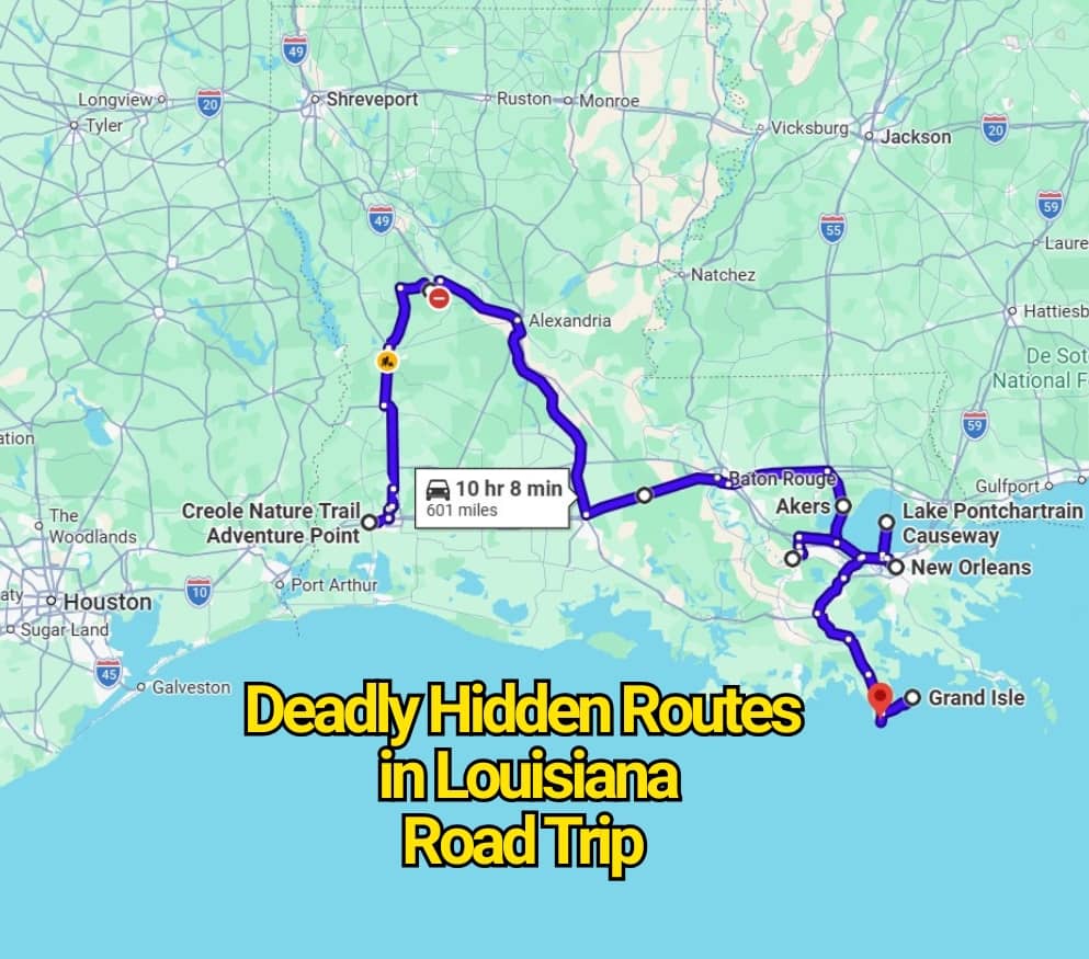
LA-1 to Grand Isle and Port Fourchon
LA-1 is one of Louisiana’s most striking coastal drives, but it also carries one of the state’s clearest warning labels. The road runs through lower Lafourche Parish toward Port Fourchon and Grand Isle, where open marsh, Gulf weather, and storm risk shape the drive more than the scenery does.
This is not just a beach road. Louisiana DOTD has described the existing low-lying roadway as a stretch that has been overtopped and damaged during storm events. The ongoing LA-1 Phase 2 project is meant to replace part of that vulnerable road with more elevated highway, improving hurricane and flooding access for residents, port traffic, tourism, and emergency movement.
The part locals worry about is simple. Once you get farther down the coast, there are fewer options if conditions go bad. A sunny drive to Grand Isle can feel easy, but storm surge, heavy rain, wind, and evacuation traffic can change the mood fast. LA-1 is beautiful, but it is not a casual road during tropical weather.
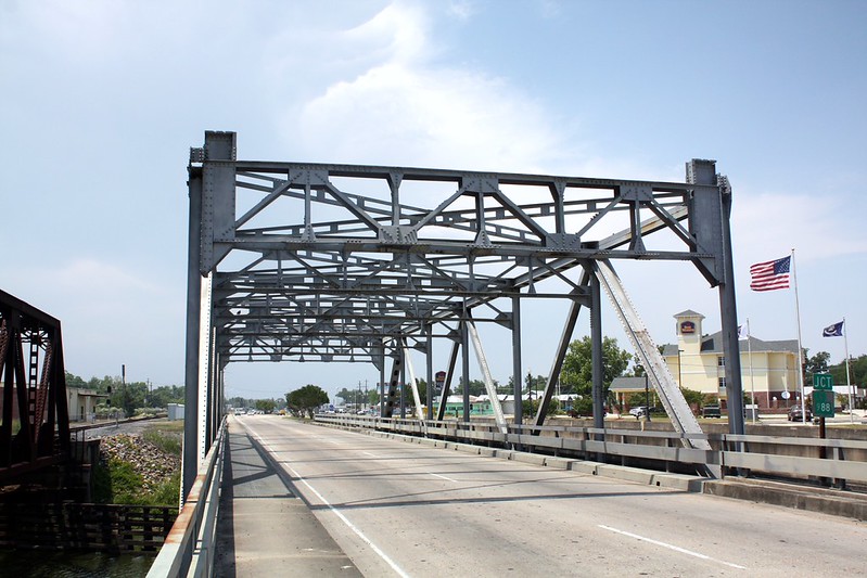
I-10 Atchafalaya Basin Bridge
The Atchafalaya Basin Bridge is one of those drives that tricks people. It feels straight, wide, and familiar because it is part of I-10. Then the miles stretch on, the swamp stays on both sides, and a single crash can turn the bridge into a long trap of stopped vehicles.
Louisiana DOTD has treated this bridge as a serious safety corridor. In 2024, the agency said improvements along the Atchafalaya Basin Bridge Highway Safety Corridor were focused on reducing fatal and injury crashes, which can keep the bridge closed for hours. DOTD also noted that the project aims to keep vehicles moving at more consistent speeds to improve reaction time and stopping distance.
That is why locals warn visitors not to treat the bridge like an ordinary interstate segment. Tailgating, speeding, sudden braking, and distracted driving are more dangerous here because there is no simple shoulder escape and no quick side-road detour. The swamp view may feel peaceful, but the traffic pattern can become unforgiving.
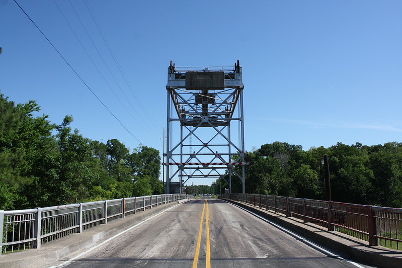
I-55 Through Manchac Swamp
I-55 near Manchac is one of Louisiana’s clearest examples of how a normal drive can turn deadly with almost no warning. The area is surrounded by marsh and water, and under the wrong conditions, dense fog can mix with smoke from marsh fires.
That mix became national news in October 2023. A massive pileup on I-55 near Manchac involved more than 160 vehicles, killing eight people and injuring dozens more. Officials and reports tied the crash to “super fog,” where fog and smoke combined to cut visibility to dangerous levels.
The contrarian truth is that I-55 does not need to look scary to be dangerous. In fact, that is the problem. Drivers may enter the route expecting a routine interstate ride, then hit a sudden blanket of fog where traffic speeds no longer match what the eye can see. Around Manchac, locals take visibility warnings seriously because history has shown what can happen when people do not slow down in time.
Lake Pontchartrain Causeway
The Lake Pontchartrain Causeway is iconic, but familiar does not mean harmless. A 24-mile bridge over open water gives drivers a long, exposed crossing where fog, wind, rain, and traffic can create problems far from the nearest exit.
In December 2024, fog-related crashes on the Causeway sent 33 people to hospitals and closed the bridge for hours. Local reports described multiple crash clusters across both spans during the morning commute.
For road trippers, the warning is less about fear and more about respect. The Causeway can feel almost hypnotic because the view changes slowly, and the road keeps going. But if fog drops across the lake, depth perception and stopping distance become harder to judge. Locals know that the safest Causeway drive is the one where you leave extra space, keep both hands ready, and do not race the weather.
LA-27 and LA-82 on the Creole Nature Trail
The Creole Nature Trail is marketed as one of Louisiana’s great scenic drives, and it deserves that reputation. It moves through marshes, prairie, wildlife habitat, coastal towns, and Gulf-side stretches that feel far removed from busy city travel.
Still, the same things that make the route memorable also make it risky. Louisiana Byways notes that along the marshy stretch where Highway 27 meets Highway 82, drivers may see cranes, pelicans, and even an occasional alligator in warm weather.
This is where the road trip fantasy needs a reality check. Wildlife, water, low shoulders, rural spacing, and coastal weather all matter here. A traveler who is watching the marsh instead of the lane can drift too easily. A driver who assumes the road is empty may come up fast on a slow vehicle, animal, or flooded spot. The Creole Nature Trail is worth driving, but it asks for patience.
LA-23 to Venice
LA-23 runs deep through Plaquemines Parish, carrying travelers closer to the end of the road at Venice. It has that last-stop feeling that road trippers love, especially people chasing fishing towns, delta scenery, and a sense of Louisiana’s edge.
The caution comes from geography. This is a low, storm-sensitive corridor where weather systems, floodgates, and emergency closures can affect travel. During major weather events, DOTD has listed closures involving the LA-23 Venice floodgate, which shows how quickly movement in this area can depend on flood protection decisions.
Locals do not treat this drive like a random afternoon route during rough weather. They check alerts, watch the forecast, and understand that being far downriver can limit choices. LA-23 can be fascinating, but it is not a place to ignore tropical systems, high water, or road closure notices.
LA-18 and LA-44 on the Great River Road
The Great River Road between Baton Rouge and New Orleans is often described as a classic Louisiana drive. It follows river country, plantation corridors, levee roads, small communities, and long bends shaped by the Mississippi River.
Louisiana Byways calls the Baton Rouge to New Orleans stretch the most popular drive along the state’s Great River Road. That popularity can make travelers underestimate the road. It is scenic, yes, but it is also local. People live, work, turn, park, pull out, and move farm or service vehicles along these roads.
This is not the kind of route where speed helps you see more. The safer approach is to slow down and read the road like a local. Watch driveways, levee access points, narrow shoulders, sharp curves, and sudden stops near small towns. The danger is rarely dramatic at first glance. It appears in the quiet details.
Longleaf Trail Byway
Longleaf Trail Byway in Kisatchie National Forest does not match the flat Louisiana stereotype. The U.S. Forest Service describes it as a 17-mile route that follows a high ridge through the rugged Kisatchie Hills and connects Louisiana Highways 117 and 119.
That higher, rougher setting is part of the draw. It also means drivers should expect a different rhythm from the swamp and coastal roads. Curves, forest shade, limited lighting, wildlife movement, and recreational traffic can surprise people who assume all Louisiana drives are flat and simple.
This road is best treated as a slow scenic run, not a shortcut. The forest can make visibility uneven, especially near dusk or after rain. Longleaf Trail may be short, but locals know that a short road can still create trouble when drivers relax too much.
Why Locals Warn About These Louisiana Routes
The warning behind these roads is not that travelers should avoid Louisiana. It is that Louisiana road trips require a different kind of attention. The state’s danger points are often low, wet, foggy, remote, or exposed. That makes them easy to underestimate.
A mountain road announces its risk. Louisiana often whispers it.
Before driving these routes, check 511LA for current road conditions, closures, construction, weather issues, ferry information, and traffic alerts. Louisiana DOTD describes 511 as the state’s official traveler information service, with updates for weather-related road conditions, road work, commercial vehicle restrictions, closures, and other travel details.
The smartest Louisiana road trip is not the one that avoids every risky route. It is the one that respects water, fog, bridges, storms, and distance before they become a problem.