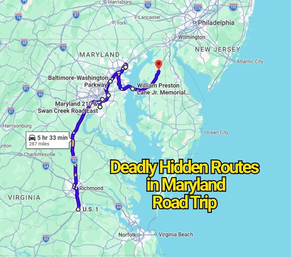
Maryland looks small on a map, which is exactly why some drivers underestimate it. The risky routes here are not remote desert highways or cliffside lanes with movie-trailer drama. They are commuter roads, bridge approaches, beltway loops, and fast suburban corridors where a weekend road trip can suddenly feel too tense.
That is the contrarian truth behind Maryland’s most deadly hidden road trip routes: the danger is often ordinary. A wide road near a shopping center. A bridge everyone wants to cross before beach traffic thickens. A beltway lane where one impatient move changes the whole mood. Locals warn about these drives because they know the warning signs are easy to miss until the traffic tightens, the speed rises, or visibility drops.
MD 210 Indian Head Highway
Indian Head Highway has one of the strongest warning reputations in Maryland, especially through Prince George’s County and into Southern Maryland. The route links the D.C. line with Forest Heights, Oxon Hill, Fort Washington, Accokeek, and Indian Head, but it does not feel like a relaxed scenic connector for long.
The risk here comes from the road’s split personality. It can feel open and fast, then suddenly turn into a corridor with intersections, turning vehicles, pedestrians, buses, and drivers trying to make up time. MDOT has lowered the speed limit on part of MD 210 from Livingston Road to Sachem Lane and the Washington, D.C. line, a clear sign that this is a corridor transportation officials have been trying to calm.
Locals do not warn visitors away from MD 210 because there is nothing to see. They warn them because the road tricks people. It looks simple, but it punishes distraction.
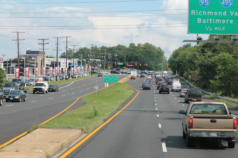
I-695 Baltimore Beltway
The Baltimore Beltway is not hidden in the usual sense. Everyone knows it. The hidden part is how quickly routine driving can become serious. Around Woodlawn, Catonsville, Towson, Essex, and the broader Baltimore suburbs, I-695 carries commuters, freight, work zones, short merges, and drivers who think they know every inch of it.
The 2023 I-695 work-zone tragedy near Woodlawn is one reason this road remains part of Maryland’s safety conversation. The NTSB said six highway workers were struck in a work zone on northbound I-695, and its final reporting connected the crash to excessive speed and an unsafe lane change.
That is why the Beltway belongs in this article. It is familiar, busy, and easy to underestimate. Familiar roads often breed the most careless confidence.
US 50 and US 301 Bay Bridge Route
The drive from Annapolis across the Chesapeake Bay Bridge can feel like the gateway to a beach weekend. That is why it catches people off guard. The scenery pulls your eyes, the bridge narrows your options, and traffic can swing from smooth to stopped in minutes.
In January 2024, more than 40 vehicles were involved in crashes on the Chesapeake Bay Bridge, with 13 people injured and long closures that backed up travel between Annapolis and Kent Island. Dense fog and limited visibility were part of the concern reported around that event.
This route is not scary because it looks ugly. It is scary because it looks like vacation. The Bay Bridge asks for full attention even when the view is doing everything it can to steal it.
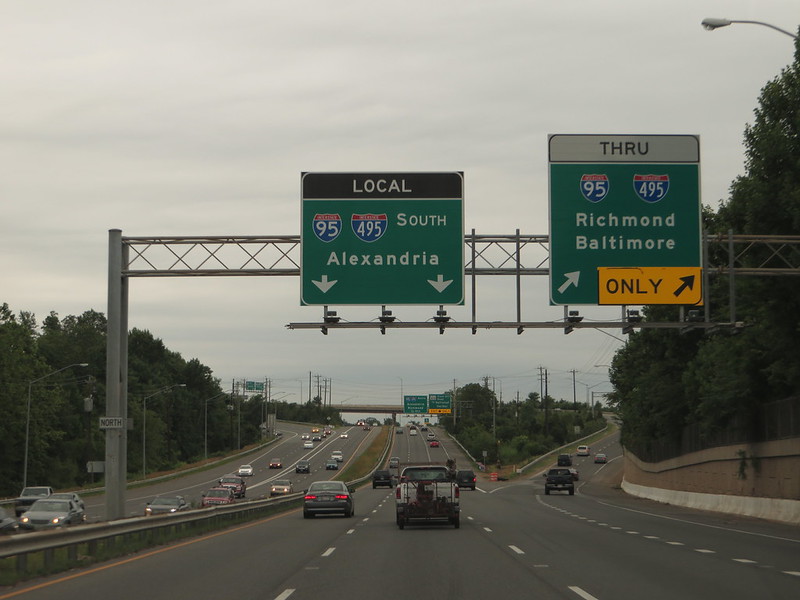
I-95 Through Central Maryland
I-95 through Maryland is a road-trip shortcut, a commuter artery, and a freight corridor all at once. Around Laurel, Elkridge, Baltimore, White Marsh, and Aberdeen, it can feel like everyone is traveling for a different reason at the same time.
That mix matters. A January 2026 Maryland State Police report described a fatal crash on southbound I-95 before Route 100 in Howard County after a refuse collection truck struck the rear of a tractor-trailer parked on the right shoulder.
The lesson is plain. On I-95, the danger is not always the curve or the weather. Sometimes it is the shoulder, the merge, the truck ahead, or the driver behind you who sees the road as a race.
US 301 on the Eastern Shore
US 301 across the Eastern Shore can feel calmer than the highways near Baltimore and Washington. That calm is exactly why locals stay alert. Long open pieces, higher speeds, farm access, trucks, and sudden intersections can make this route harsher than it appears.
Maryland State Police reported a fatal crash on US 301 north of MD 544 near Millington in March 2026 while also investigating another fatal Eastern Shore crash that same period.
This is the kind of Maryland road that can make a driver relax too much. The land opens up, the noise drops, and the road starts to feel forgiving. It is not.
Baltimore-Washington Parkway
The Baltimore-Washington Parkway has an old park-road feel in places, but the traffic using it is very modern. Drivers use it to move between Baltimore, Laurel, Greenbelt, Bladensburg, and Washington, D.C., often during tight commute windows.
A fatal April 2025 crash near Maryland Route 197 in Laurel led to serious law enforcement action later that year, with U.S. Park Police reporting an arrest tied to the incident.
This road can feel narrower and less forgiving than newer interstates. Trees, curves, short ramps, and commuter pressure create a route where the posted speed is not the only thing that matters. Patience matters more.
MD 5 Branch Avenue
Branch Avenue is one of those Maryland routes that can look like a straight shot out of the D.C. area. In reality, MD 5 carries a heavy mix of local traffic, pedestrians, buses, shopping access, and commuters moving between the city line, Suitland, Clinton, and Waldorf.
MDOT reduced the speed limit from MD 458 to the Washington, D.C. line from 35 mph to 30 mph as part of pedestrian safety work.
That small number tells a larger story. A road does not need mountain cliffs to become risky. It only needs speed, foot traffic, turning cars, and people who assume they have more time than they do.
MD 214 Central Avenue
Central Avenue runs through a part of Prince George’s County where everyday traffic can become unpredictable fast. The road moves people past neighborhoods, shopping areas, transit access, and major highway connections.
Prince George’s County Police identified Route 214 among the county’s common fatal crash sites, along with other major corridors such as Route 202 and Route 210. MDOT also reduced the speed limit on part of MD 214 from Pepper Mill Drive to I-95/I-495, placing it within a wider pedestrian safety push.
The problem is not one dramatic curve. It is the constant friction of cars, crossings, signals, buses, and drivers trying to thread through a packed corridor.
MD 202 Landover Road
Landover Road is easy to treat as a pass-through. That is part of the issue. MD 202 connects drivers across Prince George’s County, serving areas around Upper Marlboro, Largo, and Landover, where local access and faster movement often share the same pavement.
Local reporting in 2025 noted that Prince George’s County Police listed Route 202 as one of the county’s common fatal crash sites. A separate 2025 report covered a seven-vehicle crash on Route 202 at St. Joseph’s Drive in Largo that killed two people and injured others.
This is why MD 202 belongs here. It is not a hidden backroad. It is hidden in plain sight, disguised as a normal connector until the traffic pattern breaks.
US 1 Between College Park and Laurel
US 1 between College Park, Beltsville, and Laurel has a different kind of risk. It is not just a through-road. It is a college corridor, a business strip, a bus route, a pedestrian zone in places, and a commuter path.
That blend can make the drive feel restless. One mile may feel like city traffic, the next like a faster suburban route. Drivers who fail to adjust can create trouble for everyone else.
This is where road-trip thinking can be dangerous. A visitor may see US 1 as a simple line on a map. Locals see the crosswalks, sudden turns, delivery vehicles, students, buses, and lights that rarely leave room for lazy driving.
Why These Maryland Roads Feel More Dangerous Than They Look
The routes locals warn about are not always the wildest-looking ones. That is the point. Maryland’s most deadly hidden road trip routes often look useful, ordinary, and familiar. They connect beaches, suburbs, campuses, shopping zones, work sites, and county lines.
A driver expecting danger on a mountain road may sit up straighter. A driver on Branch Avenue, Central Avenue, US 1, or I-695 may relax because the road feels routine. That confidence is exactly where the risk starts.
Final Takeaway
The most dangerous Maryland road trip routes are not all tucked away in forests or along lonely water crossings. Some run past gas stations, campuses, beltway exits, shopping centers, and commuter lots. They are part of daily life, which makes them easier to misjudge.
So the better way to read this title is not as a reason to avoid Maryland. It is a reminder to respect it. Slow down before the bridge, give space on the Beltway, stay sharp on rural US 301, and do not treat Prince George’s County corridors like shortcuts without consequences. Locals warn about these roads because they have seen how fast an ordinary drive can turn serious.